Grubbins
Grubbins
Once part of the great medieval East Field of Kingston Manor
The southern part of today's Lyde Road was originally known as Meadway, Mead Way or Medway and is noted as such in the Terrier of 1589 ".... from Meadway Gate, the lower part of the way, unto Reckless Gate...." and ".... from Reckless Lake in the outpart of the Meadway unto the River before Compton Mill....". In 1754 it was referred to in a document as "Master George Prowse's Mead-Way" - George Prowse being the Lord of Kingston Manor at that time.
Grubbins was a small field that lay alongside Meadway (today's Lyde Road) roughly opposite today's Sandringham Road. The name Grubbins is most likely a corruption of the surname Grobham or Grubham - both of which were used in field names in other parts of Yeovil.
In 1813, Edward Bullock Watts produced a map of "Peckford's Lyde" - as Little Lyde Farm was known at the time - that showed that Grubbins was part of Peckford's Lyde. It seems to have been sold off shortly after this date.
The 1846 Tithe Apportionment noted that Grubbins (Parcel 874) was owned by John Tanner Whiteley Pitcher ('natural' son of William Row) and the tenant was John Brook the Younger. The Apportionment noted that it was used as pasture for grazing livestock and measured 3a 2r 0p.
Grubbins was bounded on the northwest by Meadway (today's Lyde Road), on the southwest by East Beachams Close (Parcel 872), on the southeast by Thistlemoor (Parcel 870) and on the northeast by Drang (Parcel 871).
By the time of the 1927 Ordnance Survey, shown below, Grubbins was still a field but was divided up into allotments. Today the former Grubbins is filled with empty factory/office buildings at its western end facing Sandringham Road, and buildings of the trading estate to the east.
For details on historic land measurement (ie acres, roods and perches) click here.
maps

This map, based on the descriptions in the 1589 Terrier and the 1846 Tithe Map of Yeovil shows the approximate boundaries of the Manors of Kingston and Hendford as well as the manorial three-field system used in Kingston.

A map of the great medieval East Field of Kingston Manor showing conjectured locations of several fields based on descriptions in the 1589 Terrier.
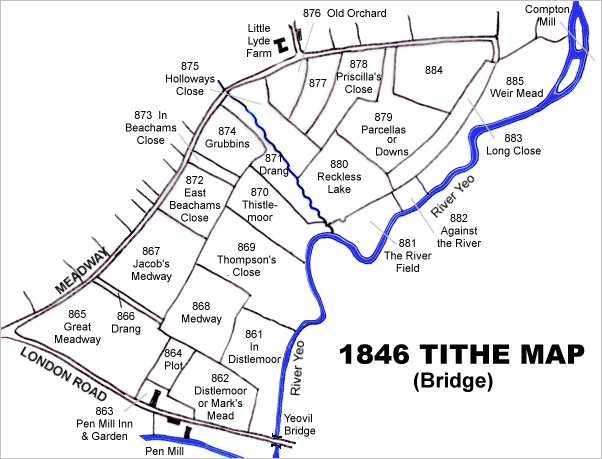
This map is based on the 1842 Tithe Map with field names chiefly added from the 1846 Tithe Apportionment.
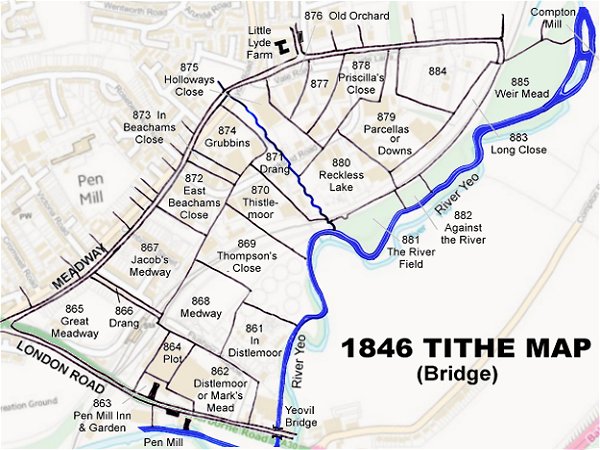
The 1842 Tithe Map superimposed (roughly) over a modern street map. Bearing in mind the relatively primitive surveying equipment of the 1840s they weren't all that far out.