Higher Cowleaze
higher cowleaze
One of Yeovil's last fields has just disappeared forever
Shown as the Middle South Field on Philip Byles' map of 1653, Higher Cowleaze was 14a 1r 19p in area. The 1846 Tithe Award noted that it was used as pasture to graze livestock and, indeed, the name 'cowleaze' simply means pasture land on which cows were grazed.
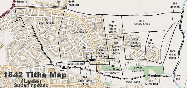
Higher Cowleaze (905) was bounded to the north by Twenty Acres (895), to the west by Lower Eight Acres (904), to the south by Lower Cowleaze (907) and to the east by Nine Acres (906). In its northwestern corner was gate giving access to Higher Eight Acres (896).
Today (2014) Higher Cowleaze has completely disappeared, being recently built on as part of the ever-expanding Wyndham Park and now has part of Collingwood Road as well as Scott Road, Shackleton Road and Hood Road.
maps
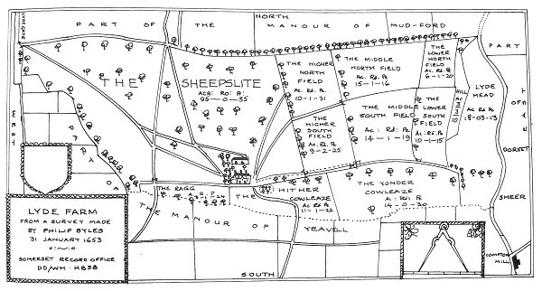
Philip Byles' map of Lyde Farm dated 31 January 1653. Higher Cowleaze is shown as the Middle South Field, at right centre.
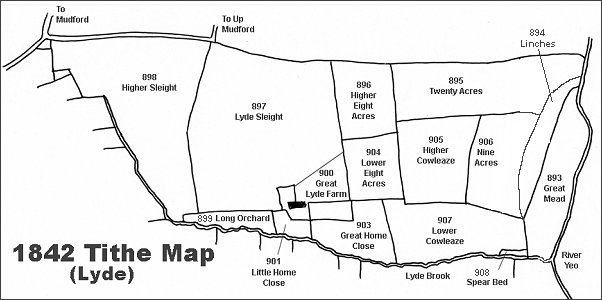
The Lyde area reproduced from the 1842 Tithe Map.
Courtesy of
Steve Wills
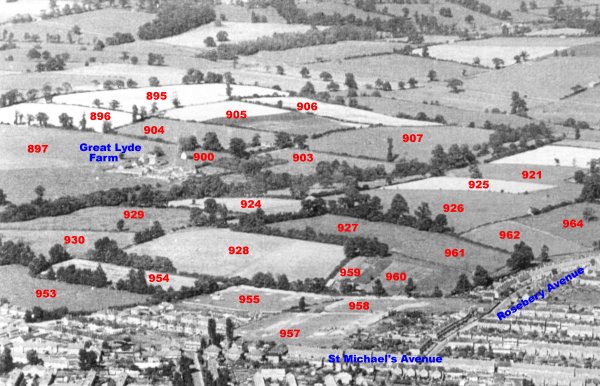
An aerial photograph of the Great Lyde area taken around 1953, with Parcel Numbers superimposed from the 1842 Tithe map.
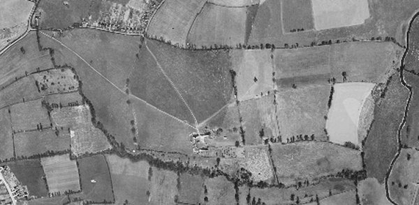
The 1946 aerial photograph of Great Lyde Farm
The same area today 'borrowed' from Google maps and taken around 2010 when the groundworks for Wyndham Park were being started.
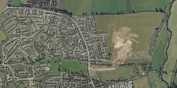
The 1842 Tithe Map superimposed over a modern map.
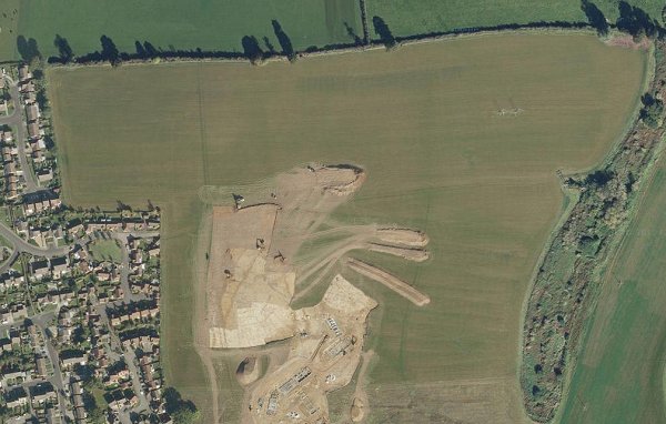
A closer Google Maps image of Higher Cowleaze at centre, all but obliterated with the early groundworks phase of the Wyndham Park development.
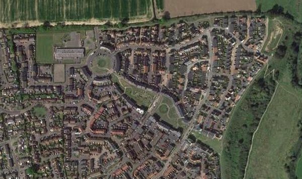
... and a more recent (2018) aerial view (courtesy of Mr Google) showing Higher Cowleaze completely built on.