lower eight acres
lower eight acres
Now covered in housing
Shown as the Higher South Field on Philip Byles' map of 1653, Lower Eight Acres was 9a 2r 25p in area. The 1846 Tithe Award noted that it was used as pasture to graze livestock.
Lower Eight Acres (904) was bounded to the north by Higher Eight Acres (896), to the west by Great Lyde Farm (900), to the south by Lower Cowleaze (907) and Great Home Close ( 903) and to the east by Higher Cowleaze (905).
Today (2014) Lower Cowleaze has completely disappeared, and is now covered with the eastern end of Sandalwood Close, Ashwood Drive, Raleigh Road and part of Collingwood Road.
maps
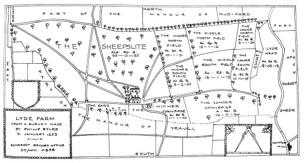
Philip Byles' map of Lyde Farm dated 31 January 1653. Lower Eight Acres is shown as the Higher South Field, at right of centre.
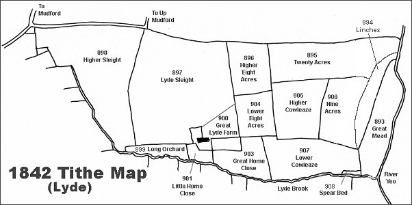
The Lyde area reproduced from the 1842 Tithe Map.
Courtesy of
Steve Wills
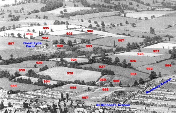
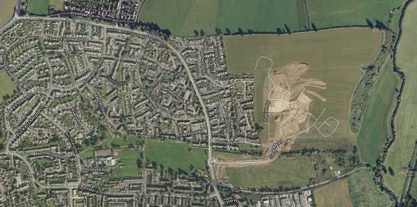
An aerial photograph of the Great Lyde area taken around 1953, with Parcel Numbers superimposed from the 1842 Tithe map.
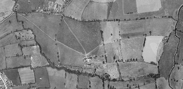
The 1946 aerial photograph of Great Lyde Farm
The same area today 'borrowed' from Google maps and taken around 2010 when the groundworks for Wyndham Park were being started.
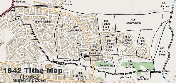
The 1842 Tithe Map superimposed over a modern map.
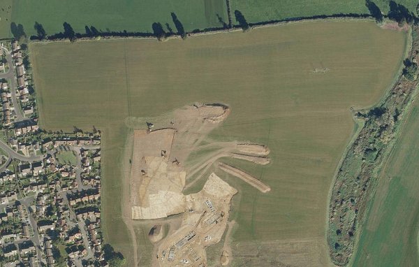
A closer Google Maps image showing the early groundworks phase of the Wyndham Park development (c2012). Even at this time the western half of Lower Eight Acres, at bottom left, was already built on with the eastern end of Sandalwood Close and Ashwood Drive. The roads Raleigh Road and part of Collingwood Road now cover the rest.