Hop Yard
Hop Yard
A field within the great manorial East Field
Hop Yard (Parcel 979) was a four-acre field, rising steadily from south to north, originally within the great East Field of the Manor of Kingston. It is unlikely there was a connection with the growing of hops.
In her will of 1754, spinster Anne Markes in referring to her land holdings, wrote "... two Acres called the Hop Yard... ".
At the time of the 1846 Tithe Apportionment Hop Yard was owned by Elizabeth Duffett and let to Benjamin Watts. Elizabeth was the widow of glove manufacturer Samuel Duffett. Hop Yard was used as pasture for grazing livestock and measured 4a 1r 30p.
Hop Yard was bounded on the west by Brickyard Lane (today's St Michael's Avenue), on the north by Sydling's Lane (originally called Selling's Lane in the 1589 Terrier, but around 1895 it was extended and named Rosebery Avenue), on the east by Sydlings (Parcel 978) and on the south by Goar Knap (Parcel 980).
Today the former Hop Yard is occupied by the houses and gardens of St Michael's Avenue from Rosebery Avenue as far as Glenville Road as well as the whole of the L-shaped Glenville Road itself.
For details on historic land measurement (ie acres, roods and perches) click here.
maps

This map, based on the descriptions in the 1589 Terrier and the 1846 Tithe Map of Yeovil shows the approximate boundaries of the Manors of Kingston and Hendford as well as the manorial three-field system used in Kingston.

A map of the great medieval East Field of Kingston Manor showing conjectured locations of several fields based on descriptions in the 1589 Terrier.
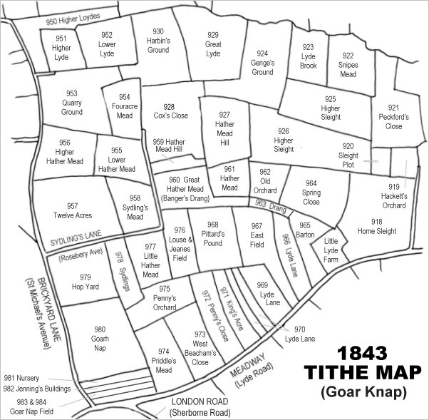
Drawn from the 1846 Tithe Map with field names added from the 1846 Tithe Apportionment, with Hop Yard (Parcel 979) in the lower left quadrant.
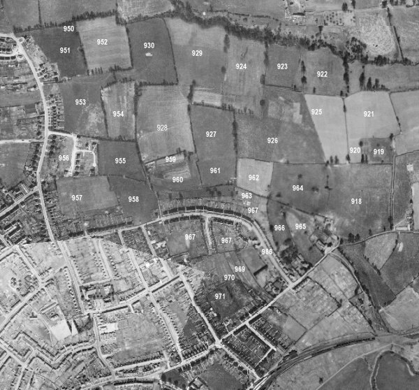
The 1946 aerial survey photograph (somewhat mis-aligned at bottom left) with parcel numbers of 1846 plotted on. By this time, however, Hop Yard has been built on and contained the houses and gardens of St Michael's Avenue and the whole of Glenville Road (mostly built around 1912).
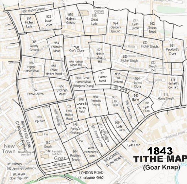
The 1843 Tithe Map overlaid onto a modern map of the area.
gallery
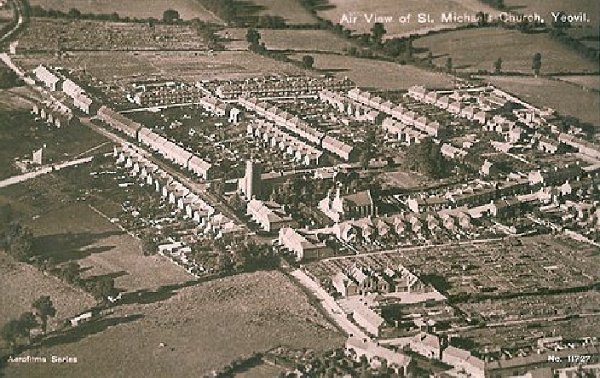
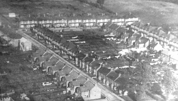
An aerial postcard of the very early 1920s with St Michael's church at centre. This photograph demonstrates remarkably well how isolated this part of Yeovil was at the time; St Michael's Avenue runs diagonally across the image from bottom right to top left, the first road off to its right is St Michael's Road, the last road off to the right towards the top of the photo is the partly-built Rosebery Avenue and the three roads between are, from left to right, Glenville Road, Percy Road and Alexandra Road.
The former Hop Yard was that part bounded by Rosebery Avenue at the top, and included the L-shaped Glenville Road (St Michael's church was to the immediate south).
Courtesy of the
Western Gazette
This aerial photograph dates to 1928 and shows Rosebery Avenue running across the top of the photograph with Glenville Road running from top left to bottom centre and Percy Road at right.
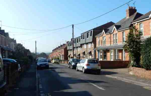
Occupying the bulk of the former Hop Yard, this is the northern end of Glenville Road. Photographed in 2016.
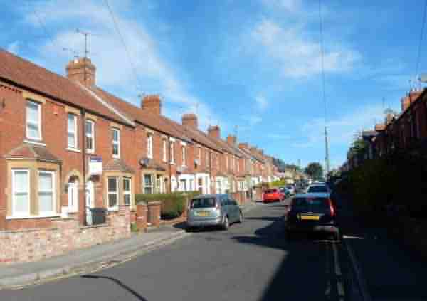
... and this is the southern end of Glenville Road (mostly built around 1912), looking north.