The Island
The Island
A descriptively-named field
The large field known as 'The Island' is just that - an island formed by the River Yeo and the leat, or mill stream, of Pen Mill.
The 1846 Tithe Apportionment noted that the Island (Parcel 857) was owned by George Harbin of Newton Surmaville and the tenant was William Pope, the tenant farmer of Newton Farm. The Apportionment noted it measured 19a 2r 0p and was used as meadow. Before grass seeds were obtainable meadows were the only hay land of the community. It usually consisted of land near streams since that was the only kind of land on which hay grew in any quantity.
Today the Island is part of Yeovil Golf Course. Although the golf course was built in 1923 the aerial photograph of 1946 shows that the golf course was not extended onto the Island until after this date.
For details on historic land measurement (ie acres, roods and perches) click here.
maps & Aerial Photographs
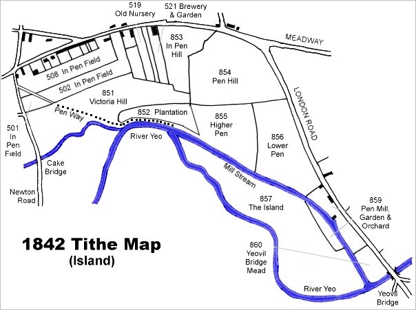
This map is based on the 1842 Tithe Map with field names chiefly added from the 1846 Tithe Apportionment.
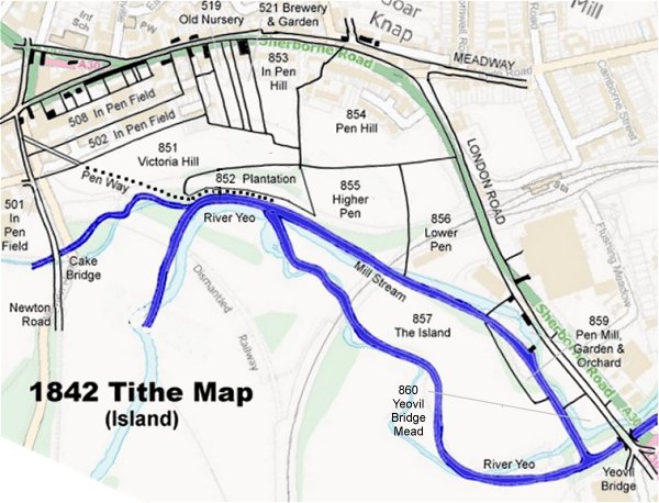
The 1842 Tithe Map superimposed (roughly) over a modern street map. Bearing in mind the relatively primitive surveying equipment of the 1840s they weren't all that far out.
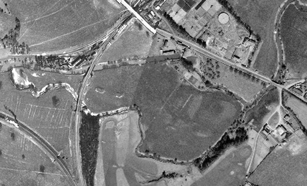
The 1946 aerial photograph shows the island bisected by the railway. There are very few tress apart from one or two along the river banks and the mill leat. Although the Yeovil Golf Course was built in 1923 (seen at the bottom of the photograph on the Dorset side of the River Yeo), it doesn't appear to have been extended onto the Island at this time.
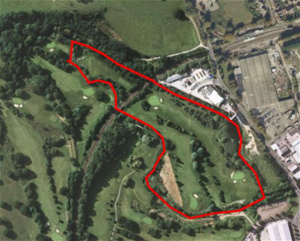
The current aerial view shows how the field has been re-landscaped by the golf course with much additional tree planting over the years.
Gallery
From my
collection
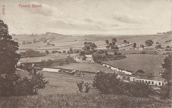
A postcard of about 1910 looking southeast and showing Pen Mill at centre. At bottom right is the Pen Mill Station engine shed and the signal box just below and to the left of the mill at centre. Between the engine shed and the mill is the leat, or mill stream, and the Sherborne Road runs from just above centre left to the mill. Pen Mill Station is off image to the left. The large field at centre right is the Island.