Lockyer's Mead
Lockyer's Mead
A former part of the great West Field of Kingston Manor
Originally a part of the great medieval West Field of Kingston Manor, Lockyer's Mead was a field off the north of Preston Lane (today's Preston Road) halfway between Larkhill Lane and the Union Workhouse.
The 1846 Tithe Apportionment noted Lockyer's Mead (Parcel 1454) measured 6a 1r 0p and was used as a meadow. It was owned by Elizabeth Duffett and occupied by William Rodber.
Lockyer's Mead was bounded on the north by Lower Perrythorne (Parcels 1449 and 1450), to the west by Shore's Close (Parcel 1453), to the south by Preston Lane (the road) and to the east by Preston Lane (the field - Parcel 1455).
As will be seen from the aerial photographs below, by 1941 the eastern side of Lockyer's Mead had been built on and the southern half of Cedar Grove occupied the field. Cedar Grove then continued into Lower Perrythorne (Parcel 1450) which, because it was offset to Lockyer's Mead caused the dog-leg bend in Cedar Grove. In more recent times the western half of Lockyer's Mead was built on and now contains the southern half of Burroughes Avenue.
For details on historic land measurement (ie acres, roods and perches) click here.
maps & Aerial Photographs

This map, based on the descriptions in the 1589 Terrier and the 1846 Tithe Map of Yeovil shows the approximate boundaries of the Manors of Kingston and Hendford as well as the manorial three-field system used in Kingston.
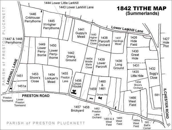
The Larkhill area reproduced from the 1842 Tithe Map. Lockyer's Mead is centre left.
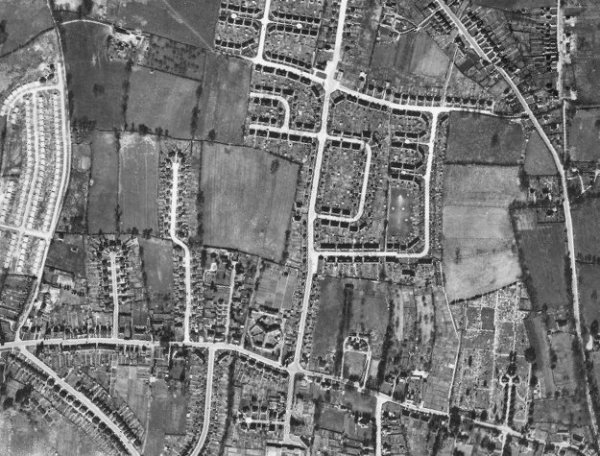
The 1946 aerial photograph. At this time it is seen that the western half of Lockyer's Mead remained as a field and the eastern part contained the southern end of Cedar Grove.
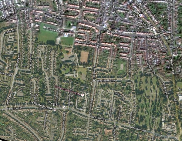
The same area today 'borrowed' from Google maps.
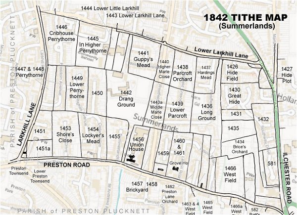
The 1842 Tithe Map superimposed (only very slightly out at the bottom) over a modern map.
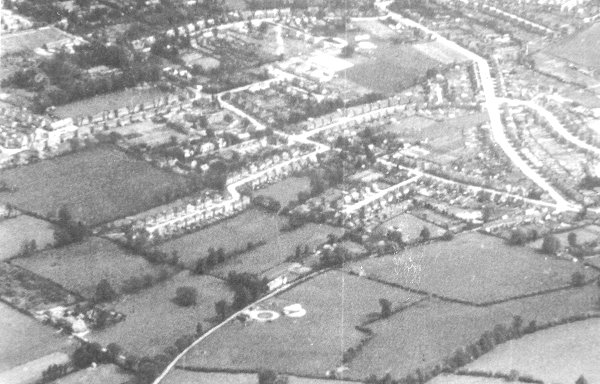
An aerial photograph of 1941 showing Larkhill Lane running from its junction with Preston Road at centre right, down past Larkhill Farm at bottom left. At centre the eastern half of Lockyer's Mead contains the southern end of Cedar Grove while the eastern half remains as a field. At centre bottom, the circular object is Yeovil's Barrage Balloon Site No 19, "Larkhill Lane".