Long Mead
Long Mead
A part of Preston Lower farm
Long Mead (Parcel 136) was a large, but long and narrow, field of Preston Lower Farm. The word 'mead' comes from the Old English 'maed'. Before grass seeds were obtainable this was the only hay land of the community. It usually consisted of land near streams since that was the only kind of land on which hay grew in any quantity, and Long Mead lay between the Old Mill Leat and the brook that ultimately fed Dodham Brook.
The 1848 Preston Tithe Apportionment described Long Mead as meadow owned by Robert Tucker and occupied by Joseph Roberts. It measured 10a 2r 25p.
John Brook the Younger became the tenant farmer, replacing Joseph Roberts, in 1857. He was the tenant farmer until his retirement around 1878.
The aerial photograph of 1927 shows that Long Mead was completely undeveloped but by 1946 the aerial photograph shows that The western end of Long Mead was allotments at this time and at the eastern end the Westland Sports complex was taking shape with a sports field, including a football pitch marked out in the central section of the field (the sports club buildings would be constructed later the other side of the brook, on fields to the south).
For details on historic land measurement (ie acres, roods and perches) click here.
MAPS & Aerial Photographs
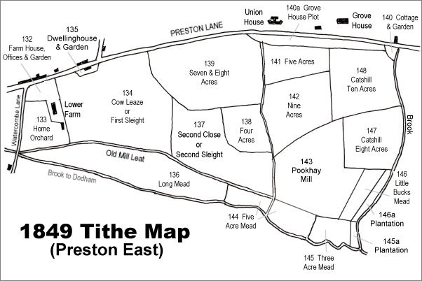
The 1849 Preston Tithe Map. Long Mead is at bottom left.
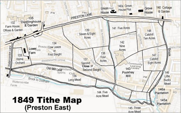
The 1849 Preston Tithe Map overlaid on a modern map.
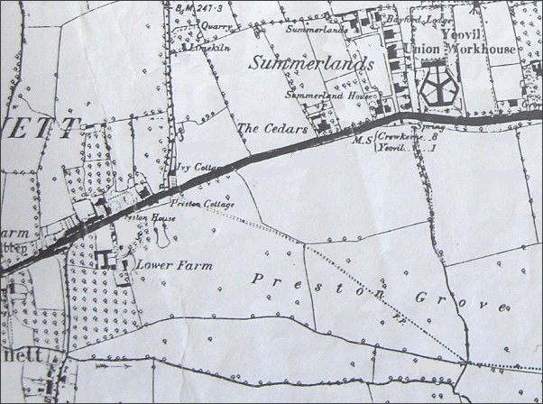
The 1889 Ordnance Survey shows Lower Farm at lower left with extensive fields labelled 'Preston Grove' stretching eastwards. The dotted line across the fields, indicating a footpath, was the line of the later road, also called Preston Grove. Running across the bottom of the map is Long Mead.
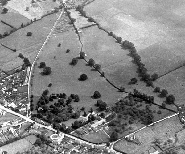
An aerial photograph of 1927, looking southeast. Preston Road runs across lower left and Watercombe Lane is at lower right while Westland's airfield is at top right and relatively newly-built Preston Grove runs up the left of the photograph. Preston Lower Farm is at centre bottom with the two streams containing Long Mead (as far as the hedge cutting across near the top of the photograph) running from lower right to top centre.
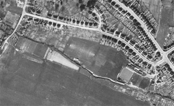
An aerial photograph of 1946 showing Long Mead running from top left to bottom right of the photograph. The brook on the southern side is clearly discernible, the old mill leat to the north is delineated by the southern ends of the gardens of Westbourne Grove. The western end of Long Mead was allotments at this time and at the eastern end the Westland Sports complex is taking shape with a sports field, including a football pitch marked out in the central section of the field.
Gallery
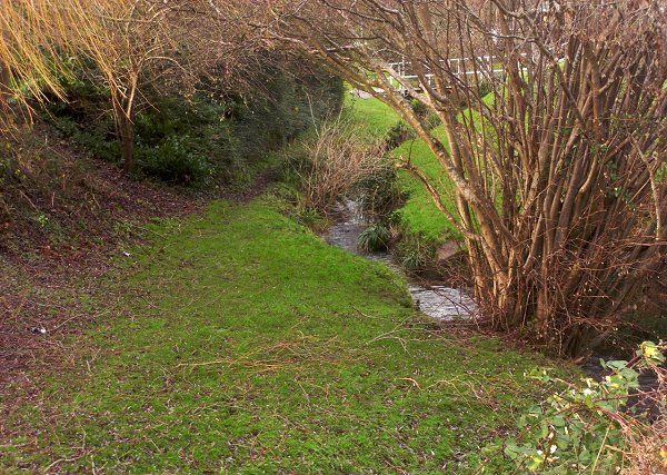
The brook, as it passes along the north of Westlands Sports and Social Club is now little more than a trickle. Long Mead would have been on the right bank here. Photographed in 2014.