Long Close
Long Close
Once part of the great medieval East Field of Kingston Manor
Of the five fields in Yeovil called Long Close, this must have been the longest and thinnest of them all. A very long, thin field that had once been part of the great medieval East Field of Kingston Manor, it followed the contours of the hillside in the valley of the River Yeo.
The 1846 Tithe Apportionment noted that Long Close (Parcel 883) was owned by William Jones Prowse (Lord of Kingston Manor at that time) and the tenant was Thomas Frost. The Apportionment noted that it was used as pasture for grazing and measured 3a 0r 0p.
Long Close was bounded on the northwest by Parcellas (Parcel 879) and un-named Parcel 884. On the southeast it was bounded for most of its length by Weir Mead (Parcel 885) and Against the River (Parcel 882)
Long Close was purchased by the Great Western Railway in the early 1850s and was completely filled with their railway tracks east of Pen Mill Station - as it remains today.
For details on historic land measurement (ie acres, roods and perches) click here.
maps & Aerial photographs

This map, based on the descriptions in the 1589 Terrier and the 1846 Tithe Map of Yeovil shows the approximate boundaries of the Manors of Kingston and Hendford as well as the manorial three-field system used in Kingston.

A map of the great medieval East Field of Kingston Manor showing conjectured locations of several fields based on descriptions in the 1589 Terrier.
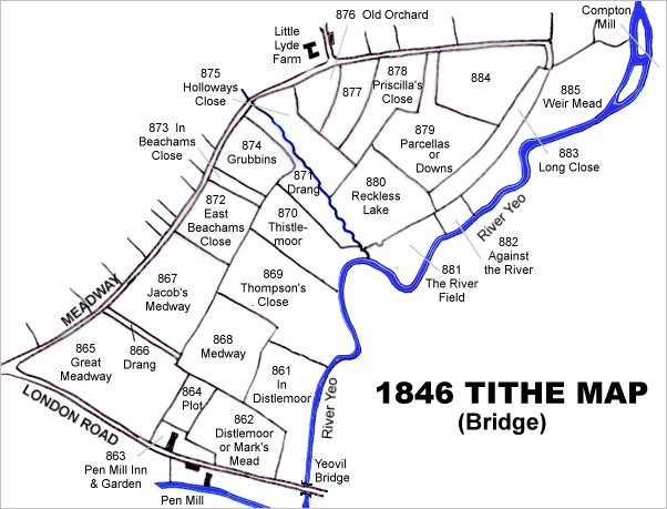
This map is based on the 1842 Tithe Map with field names chiefly added from the 1846 Tithe Apportionment.
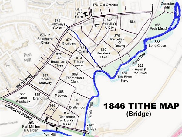
The 1842 Tithe Map superimposed (roughly) over a modern street map. Bearing in mind the relatively primitive surveying equipment of the 1840s they weren't all that far out.
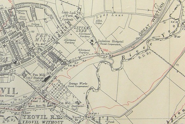
The 1927 Ordnance Survey showing the whole of the Pen Mill - Lyde Lane area with the railway completely filling Long Close beneath the words 'Great Western'.