Lyde Lane
LYDE LANE
A field, later divided, within the great manorial East Field
Lyde Lane (Parcels 966, 969 and 970) was originally a large field within the great East Field of the Manor of Kingston.
By the time of the 1846 Tithe Apportionment Lyde Lane had been split into several smaller parcels, all still called Lyde Lane..
In 1846 the largest of these, Parcel 966, was owned by William Callen and let to George Frost. It was used as arable for growing crops and measured 3a 0r 0p. This long, narrow field was bounded on the south by Lyde Lane (today's Lyde Road), on the west by the extension of East Field (Parcel 967) that would eventually be occupied by the eastern end of Rosebery Avenue, on the north by Drang (Parcel 963) and on the west by Barton (Parcel 965) - the most southwesterly field of Little Lyde Farm. Today, Parcel 966 is entirely occupied by the houses and gardens of Sandringham Road.
The other parcels of Lyde Lane were separated from Parcel 966 by an extension of East Field (Parcel 967) which was an access strip from Lyde Lane.
In 1846, Parcel 969 was owned by George Mayo and let to Thomas Frost. It was used as arable for growing crops and measured 3a 0r 35p. Today, parcel 969 is entirely occupied by the houses and gardens of Herblay Close in its southern half and Clifton Close in the northern half.
Parcel 970 was a long, thin field divided longitudinally into two halves. It was owned by George Harbin and let to Robert Allen. It was an orchard and measured 0a 3r 20p. Today a house and garden occupy the end facing Lyde Road while the rest of the former Parcel 970 is occupied by the eastern portion of the Fiveways School playing field.
Part of King's Acre (Parcel 971), Parcel 971a was labelled Lyde Lane in the Tithe Apportionment and was owned by Ann Tell and let to George Frost. It was an orchard and measured 1a 0r 6p. Again, today a garden occupies the end facing Lyde Road while the rest of the former Parcel 970 is occupied by the eastern portion of the Fiveways School playing field.
For details on historic land measurement (ie acres, roods and perches) click here.
maps

This map, based on the descriptions in the 1589 Terrier and the 1846 Tithe Map of Yeovil shows the approximate boundaries of the Manors of Kingston and Hendford as well as the manorial three-field system used in Kingston.

A map of the great medieval East Field of Kingston Manor showing conjectured locations of several fields based on descriptions in the 1589 Terrier.
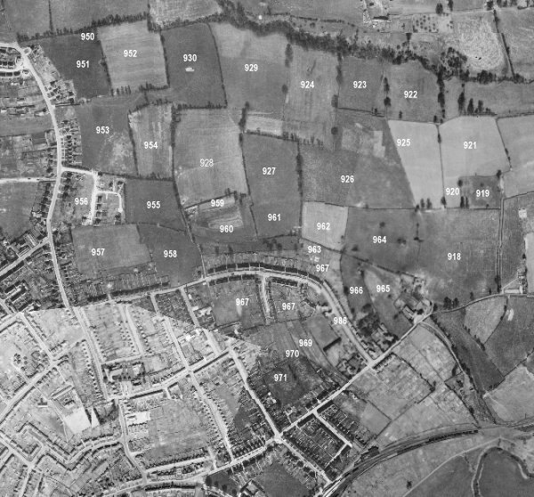
Drawn from the 1846 Tithe Map with field names added from the 1846 Tithe Apportionment, with King's Acre at centre bottom.
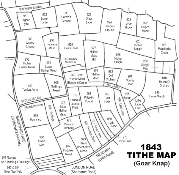
The 1946 aerial survey photograph (somewhat mis-aligned at bottom left) with parcel numbers of 1846 plotted on.
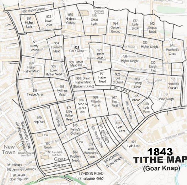
The 1843 Tithe Map overlaid onto a modern map of the area.
Gallery
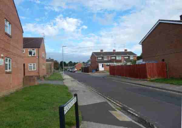
Sandringham Road, photographed in 2016 from Lyde Road.