Mount Pleasant (1)
Mount Pleasant (1)
Now the site of Arnewood Gardens
Mount Pleasant was originally a much larger field spanning both sides of West Coker Road but that part south of West Coker Road later split into three parcels (here called Mount Pleasant 1, 2 and 3) under separate ownership.
The Turnpike Minutes of 12 June 1753 record ".... meeting adjourned to Mount Pleasant in the parish of Yeovil" and that the "Turnpike Road belonging to Yeovil.... from Crossways at Bowling Green to to Mount Pleasant 4f 10p"
Mount Pleasant (1) was bounded on the north by West Coker Road, on the east by Daniell's Higher Field (Parcel 724), on the south by a field access track that would later become Arnewood Gardens and on the west by the future Wraxhill Road - with Mount Pleasant (2) and (3) further on.
The
1846 Tithe
Apportionment
described
Mount Pleasant
(1) (Parcel
723) as
arable and
the total
acreage 5a 0r
30p. It noted
that Eleanor
Upton
was the owner
and it was
occupied by
Edward Pierce.
As seen in the aerial photograph of 1946 below, by this time the former Mount Pleasant (1) had just houses and gardens of West Coker Road houses along its northern end. Today the former track at the southern boundary of the former Mount Pleasant (1) has become Arnewood Gardens and today its houses and gardens fill the rest of the former field.
MAPs & Aerial Photographs
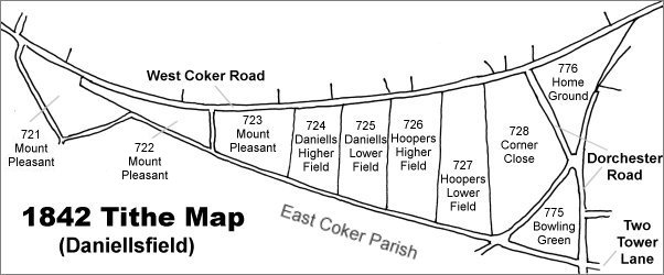
Map based on the 1842 Tithe Map with field names added from the 1846 Tithe Award. The three parts of Mount Pleasant are at left.
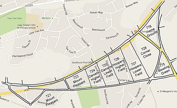
The 1842 Tithe Map superimposed over a modern map of the area. Although the field boundaries do not align precisely, remember that the 1849 survey was undertaken by hand using primitive surveying equipment.
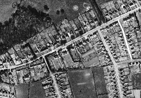
The 1946 aerial photograph with West Coker Road running from centre left to top right and Turners Barn Lane coming in at centre right and continuing as no more than a track (today's Arnewood Gardens) at centre before meeting Wraxhill Road. The former Mount Pleasant (1) is at centre with just houses and gardens of West Coker Road houses along its northern end.
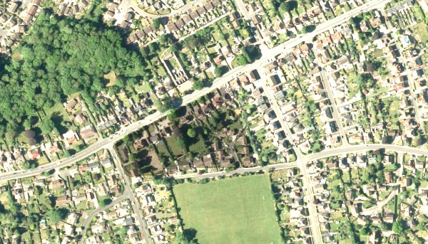
The modern satellite image shows the former track now made up to become Arnewood Gardens, the houses and gardens of which fill the former Mount Pleasant (1).