Preston Grove
Preston Grove
Originally in Preston Plucknett
Preston Grove runs southeast from Preston Road, at the junction with Larkhill Road, to the junction of Huish and Grove Avenue.
Preston Grove was originally the name of an area of open fields - Cow Leaze, Second Close, Four Acres and Pookhay Mill - north of the Preston Lower Farm's mill leat and running from Preston Lower Farm itself in the west to the brook that denoted the parish boundary between Preston Plucknett and Yeovil in the east (see maps below).
The road known today as Preston Grove was not constructed until the 1920s, and the early 1920's map below shows the road with just a small terrace of houses towards its northern end. Also at this time, St Andrews' Road and Park Avenue had been constructed (or at least laid out).
By the time of the 1928 Ordnance Survey Preston Grove, St Andrews' Road and Park Avenue (by now re-named Westbourne Grove) were fully populated with houses.
Maps & Aerial photograph
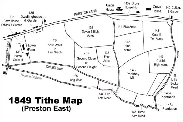
The 1849 Tithe Map - most of the fields shown formed part of Preston Lower Farm. All (except 140a) were owned by Robert Tucker. The brook at extreme right was the boundary between Preston Plucknett and Yeovil. Grove Avenue would be built on the Preston side of the brook during the 1890s.
Much of this area - Cow Leaze, Second Close, Four Acres and Pookhay Mill - formed the area known as Preston Grove (named as such on the following map).
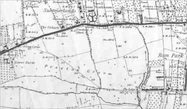
This map is based on the 1889 Ordnance Survey and shows the area known as Preston Grove
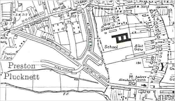
This early 1920's Ordnance Survey shows that by this time Preston Grove, together with St Andrews' Road to its north and Park Avenue to its south had been constructed (or at least laid out). Just a short run of terraced houses (shown in the second photograph of the Gallery) were the only houses constructed at this time.
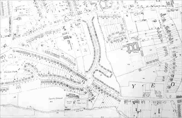
An extract of the 1928 Ordnance Survey map showing that with ten years Preston Grove, St Andrews' Road and Park Avenue had been fully populated with houses. Park Avenue had been extended and re-named Westbourne Grove.
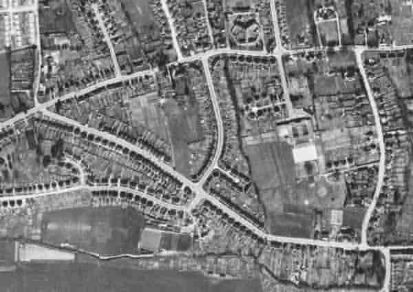
The 1946 aerial survey showing Preston Grove and the surrounding area.
gallery
Courtesy of South Somerset Heritage Collection
(colourised)
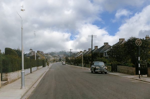
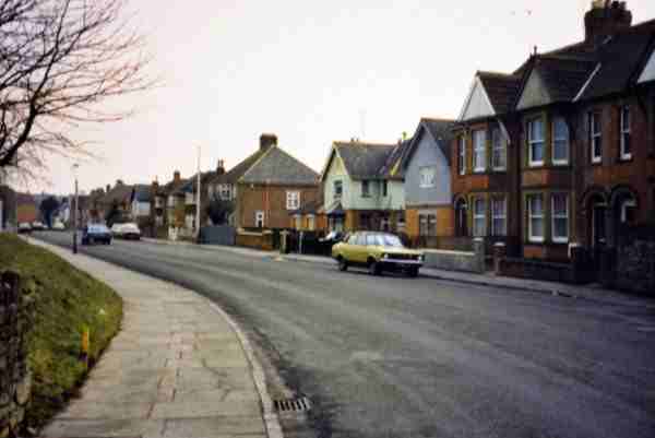
Looking southeast along Preston Grove in the 1950s.
Courtesy of South Somerset Heritage Collection
(colourised)
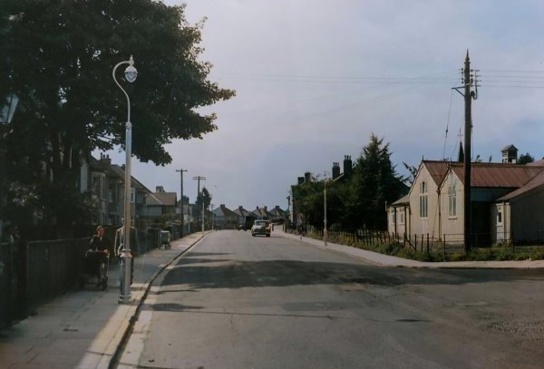
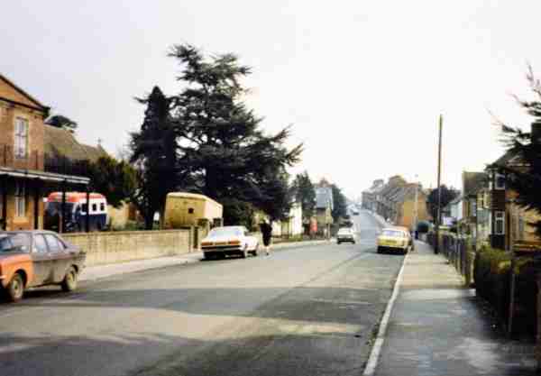
Preston Grove photographed in 1957, with St Andrew's Mission Hall at the right.
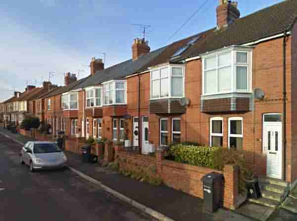
The first terrace of houses built in Preston Grove and seen on the early 1920's map above. Photographed in 2008.
At extreme left is Dorcas House and the old Mission Room is just seen at centre, behind the tree, in the wider setting of Preston Grove with Huish Hill in the distance. Photographed in 1987.
The 'bend' in Preston Grove, looking toward Huish. The Preston Grove Medical Centre is off-photo at left. Photographed in 1987.
From the Cave
Collection
(colourised),
Courtesy of South Somerset Heritage Collection
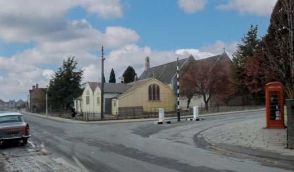
The southern end of Preston Grove, at far left, continuing on from Huish at the junction with Grove Avenue (running off to the centre right), photographed in the mid-1960's. This was as far as Huish ever went and from this point onwards was fields until Preston Grove was built in the 1920's. At centre is the old 'wriggly tin' Mission Room.