Preston Townsend
Preston Townsend
A former part of the great West Field of Kingston Manor
Until the Municipal Boundary changes of 1928 Larkhill Lane (today's Larkhill Road) marked Yeovil's north-western boundary and Preston Townsend, nestled in the junction between Larkhill Lane and Preston Lane (today's Preston Road), was the first (or last, depending on your direction of travel) field at the town's end next to the hamlet of Preston Plucknett - hence the name of the field.
One of the earliest references to Preston Townsend occurred in the 1589 Terrier which, in describing the great West Field of Kingston Manor, noted ".... from Jacob's Door being the Townsend of Kingston to Preston Townsend".
By the time of the 1846 Tithe Apportionment Preston Townsend had been subdivided into two smaller fields; Preston Townsend (Parcel 1451) and Lower Preston Townsend (Parcel 1451a). Both parcels were noted as pasture for grazing livestock and Preston Townsend was recorded as being 3a 0r 0p while Lower Preston Townsend measured 2a 3r 0p. Both parcels were owned by John Newman and the tenant of both parcels was Emanuel Pilton. Even at this time a small portion of Lower Preston Townsend had been partitioned off and Ivy Cottage (see Gallery below) had been built - the only cottage in the area at this time.
Preston Townsend / Lower Preston Townsend were bounded to the north by Perrythorne (Parcel 1447), to the west by Larkhill Lane (with a small portion in the southwestern corner given over to Ivy Cottage and its garden), to the south by Preston Lane and to the east by Shore's Close (Parcel 1453).
Today the former Preston Townsend / Lower Preston Townsend are occupied by houses and gardens of Larkhill Road and Preston Road.
For details on historic land measurement (ie acres, roods and perches) click here.
maps & Aerial Photographs

This map, based on the descriptions in the 1589 Terrier and the 1846 Tithe Map of Yeovil shows the approximate boundaries of the Manors of Kingston and Hendford as well as the manorial three-field system used in Kingston.
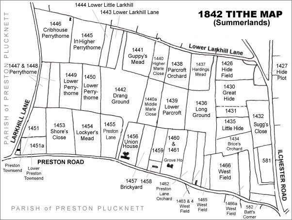
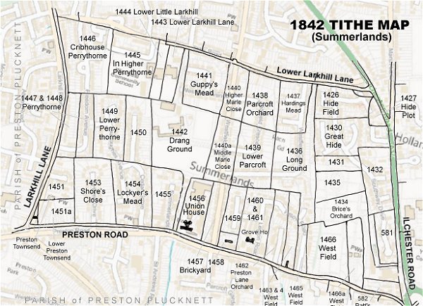
The Larkhill area reproduced from the 1842 Tithe Map. Preston Townsend / Lower Preston Townsend are at bottom left.
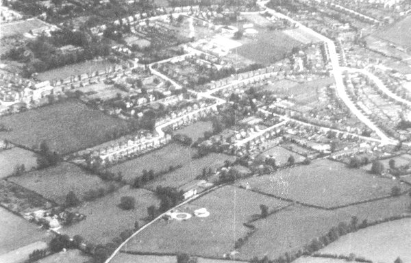
An aerial photograph of 1941 showing Larkhill Lane running from its junction with Preston Road at centre right, down past Larkhill Farm at bottom left. At centre, the circular object is Yeovil's Barrage Balloon Site No 19, "Larkhill Lane". At centre right Lower Preston Townsend has been built on with the houses and gardens of Larkhill Road and Preston Road but Preston Townsend remains an open field, albeit apparently divided into two.
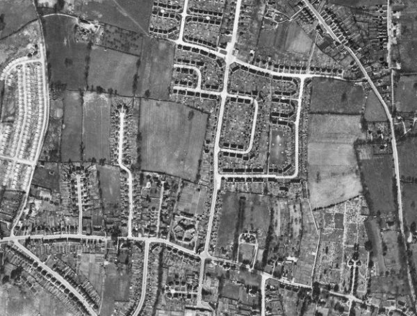
The 1946 aerial photograph - Preston Townsend appears to be partially free from buildings but Lower Preston Townsend is completely filled with houses and gardens of Larkhill Road and Preston Road.
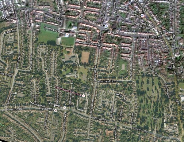
The same area today 'borrowed' from Google maps.
The 1842 Tithe Map superimposed (only very slightly out at the bottom) over a modern map.
gallery
This
colourised photograph
features in my
book 'Yeovil From Old Photographs'.
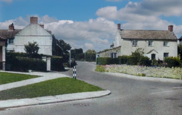
The southern end of Larkhill Road seen from Preston Road, probably photographed in the 1930s. At right is Ivy Cottage which is shown on the 1842 Tithe Map as the only house in the area - its parcel had been partitioned from Lower Preston Townsend. It was demolished in the 1960s. The Larkhill Road houses at left (built after 1903) were actually in the parish of Preston Plucknett until the 1928 boundary changes.