Queensway
Queensway
Opened in the Jubilee Year of 1977
Queensway was a dual carriageway laid out as Stage Two of a ring road for Yeovil (albeit passing through the town rather than around it) that opened in the Queen's Silver Jubilee year of 1977, hence its name.
Queensway runs from the hospital roundabout at the junction of Reckleford and Kingston to the police station roundabout at the bottom of Hendford Hill. At the same time the road was built the hospital roundabout was enlarged and the Horsey Lane roundabout realigned. Underpasses were constructed around the hospital roundabout and in West Hendford and two footbridges were constructed across the new road.
As part of the project Queen Street was completely obliterated as were parts of Park Road, Everton Road, The Crescent and much of lower Kingston.
maps & Aerial Photographs
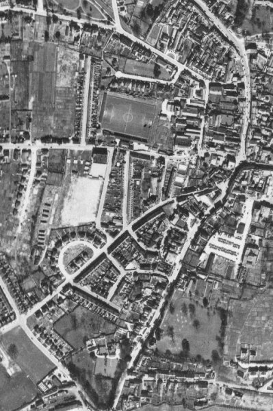
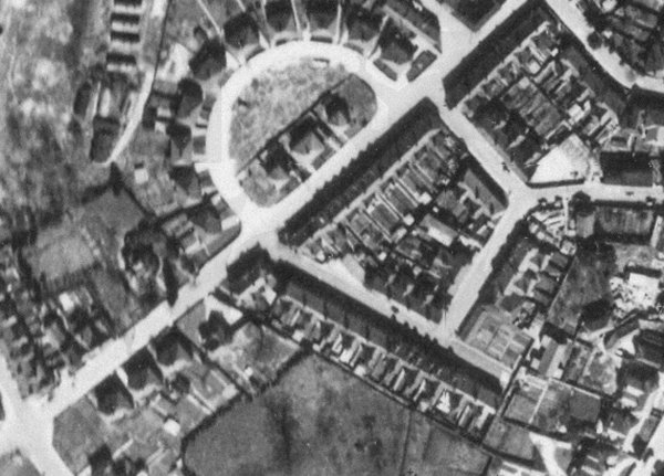
The 1946 aerial survey photograph shown for comparison with the following modern aerial photograph. Huish runs across the centre of the photo with the YTFC ground clearly visible and Queen Street to its immediate left. Kingston runs into Princes Street at top right, continuing down to where it splits into West Hendford (with the Crescent clearly seen) and Hendford.
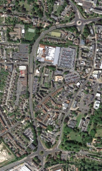
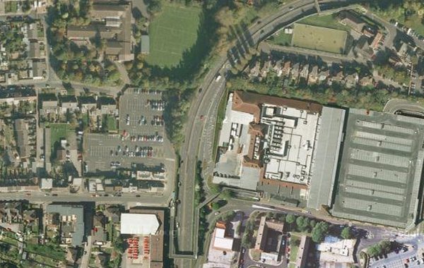
The current aerial view 'borrowed' from Google showing Queensway snaking down from the hospital roundabout at top right to the police station roundabout at bottom centre.
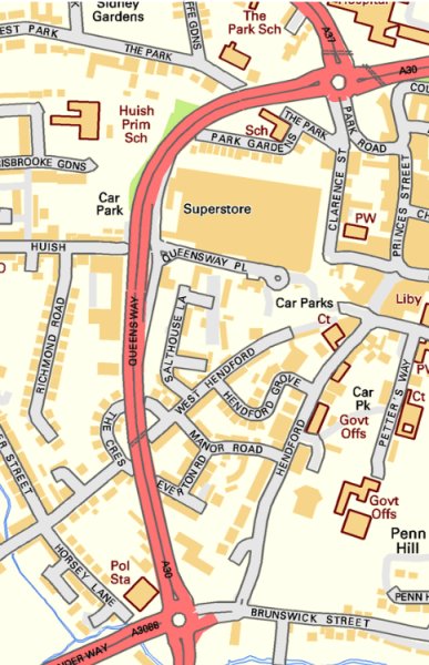
The modern map to give names to the adjoining roads.
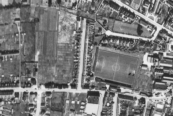
An enlargement of the 1946 aerial photograph shows Huish running across the bottom with the famous sloping pitch of Yeovil Town FC at right centre. Queen Street runs vertically at centre.
....and then came Queensway. The same view today and Queen Street has completely disappeared.
An enlargement of the aerial photograph of 1946 showing West Hendford running from lower left to upper right and The Crescent dominating top centre. Opposite the lower, western, junction of the Crescent and West Hendford is the eastern end of Everton Road. Opposite the upper, eastern, junction of the Crescent and West Hendford is Manor Road. The spur joining Manor Road and Everton Road is also Everton Road.
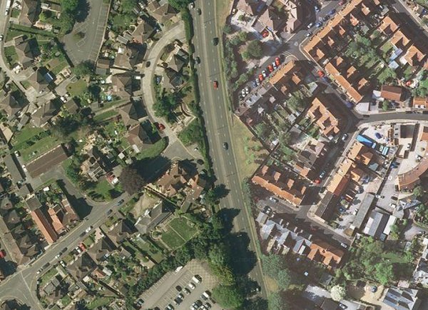
....and a modern aerial view of the same area showing the subtle effect the planners once again foisted on Yeovil.
Courtesy of
Steve Wills
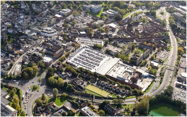
A 2013 aerial view of Yeovil showing Queensway running from the hospital roundabout at bottom left to the ploice station roundabout at top right.
Gallery
This
photograph
features in my
book "Lost Yeovil"
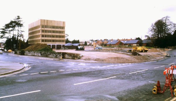
The old hospital roundabout seen from the hospital. At right buildings in Kingston, such as the Kingston Hotel, have been demolished ready for the Queensway groundworks to begin.
Looking across to Park Road running across the top of the photo with the Armoury at extreme top left and buildings of the Park School at centre top.
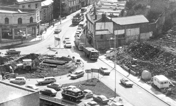
Queensway under construction - seen here from the junction of Hendford and Horsey Lane.
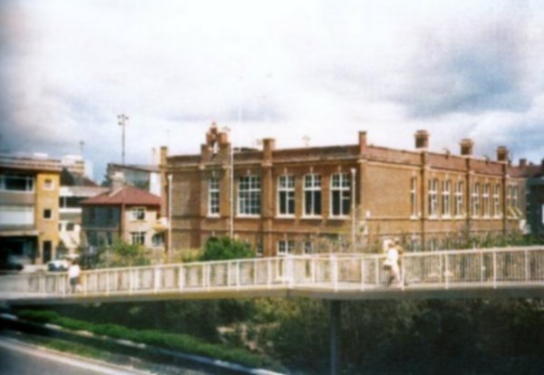
The infamous quarter-mile long Huish footbridge over Queensway, in a colourised photograph of around 1980.
![]()
Many thanks to Richard George for permission to use his series of photographs, shown below, taken during the construction of Queensway in 1976.
Courtesy of
Richard George
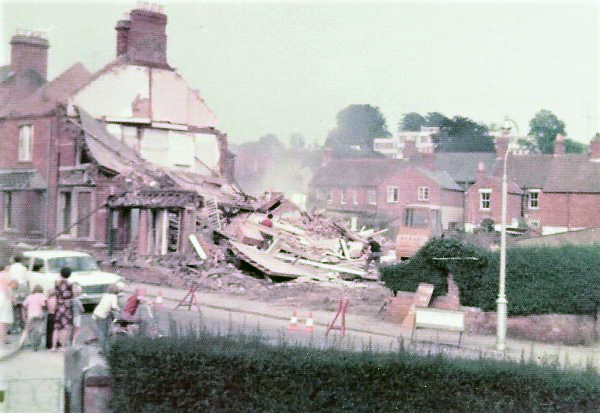
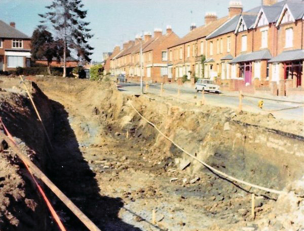
Demolition of houses in West Hendford, opposite the Crescent. I lived about 200 yards further down West Hendford at the time and remember the constant daily noise and dust being a real nuisance.
Courtesy of
Richard George
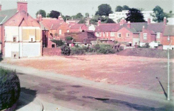
The same section of West Hendford as the previous photograph once the site had been cleared.
Courtesy of
Richard George
Demolition begins on the houses in West Hendford that sat inside the Crescent.
Courtesy of
Richard George
The view from Manor Road, looking across West Hendford towards the Crescent. Where the man is leaning on the wall is the approximate location of the steps which now lead down to the subway.
Courtesy of
Richard George
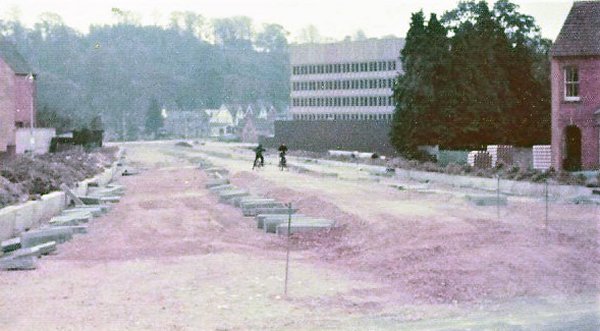
Queensway under construction and viewed from West Hendford looking to the police station roundabut.
Courtesy of
Richard George
The same stretch of Queensway as the previous photograph but taken a few weeks later.
Courtesy of
Richard George
The view from the Crescent looking north to Huish and Huish Primary School.
Courtesy of
Richard George
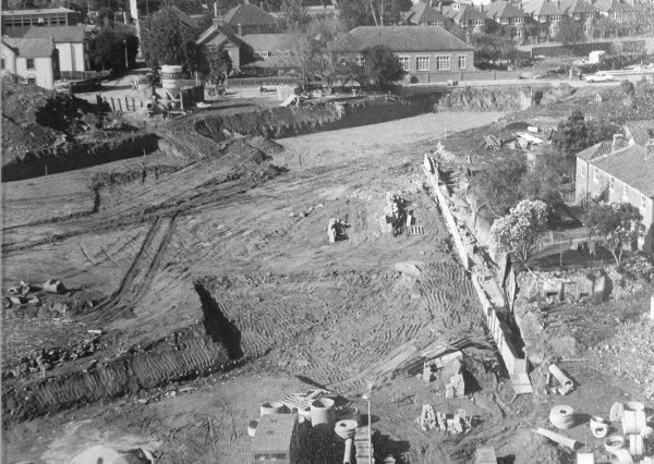
The West Hendford subway under construction.
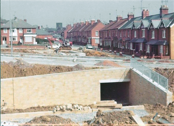
Courtesy of
Richard George
The West Hendford subway nearing completion.
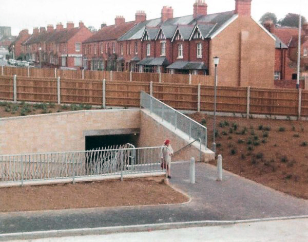
Courtesy of
Richard George
..... and completed.
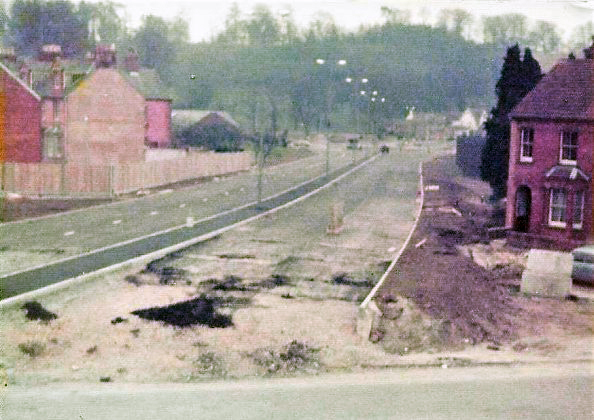
Queensway in recent years
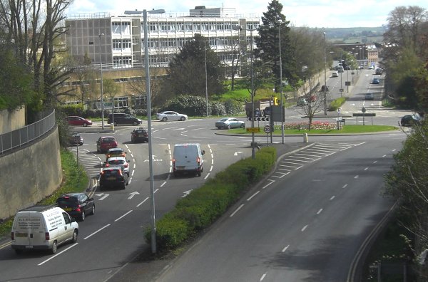
Queensway approaches the hospital roundabout. Photographed from the Park Road footbridge in 2016, before the roundabout approaches were redesigned.
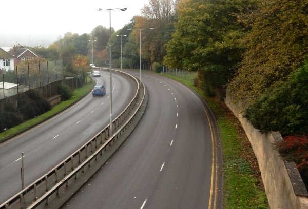
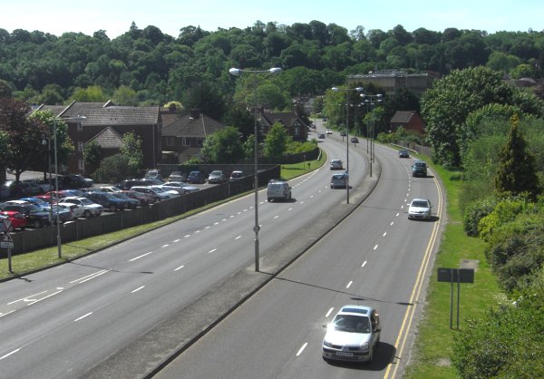
The central section of Queensway, looking south from the Park Road footbridge in 2016.
Looking south along Queensway to the police station roundabout from the Huish footbridge. Photographed in 2016.