kingston
kingston
One of the original 'main' roads into Yeovil
Kingston was, in Saxon times, a royal tun or manor, the King's Tun. It was owned by the Saxon King Aethelwulf who bequeathed it to his younger son who became known as Alfred the Great. He, in turn, bequeathed it to his youngest son Aethelweard. The road Kingston, being the main route through the old manor from the north, takes its name from the manor.
In earlier times it was known as Lower Kingston to distinguish it from Higher Kingston.
In March 1930 the Western Gazette published a contribution from a Yeovilian signing himself 'Ivel' in which he described parts of Kingston of the 1880s, in which he wrote "An interesting feature in Kingston fifty years ago was the existence of a fairly large plot of grass growing in the street opposite York Place. In the centre of the plot, or middle of the street, as at present, two large elm trees, also a pump and stone trough from which passing cattle quenched their thirst. On market days farmers visiting the town used to tether their horses to the trees and park their traps and waggons upon the grass plot. The road at this point was very narrow, only just enough room for one cart or waggon to pass by in single file up or down the street.
Memory also recalls the old turnpike gates stretching across the road at the junction of the three main roads leading into town near the old hospital. Three sets of double wooden gates spanned the road at this point. Wicket gates at each side of the road were provided for the use of pedestrians. A large bell was affixed to the gates enabling the drivers of vehicular traffic to draw attention of the toll-gate keeper to unlock the gates and, after paying their toll, to let them pass on. Many boyish pranks we played on dark nights with that old bell to the annoyance of the old gate-keeper. The toll house in which the keeper lived stood in the corner, where now stands a brick outhouse used by the occupants of the two cottages at the bottom of Mudford Road. Shortly after the passing of the Turnpike & Roads Act in 1878, the gates were abolished; the old toll-house pulled down and the stones used in building the house, 23 Kingston, in which Mr Burrows lives at present."
MAPs
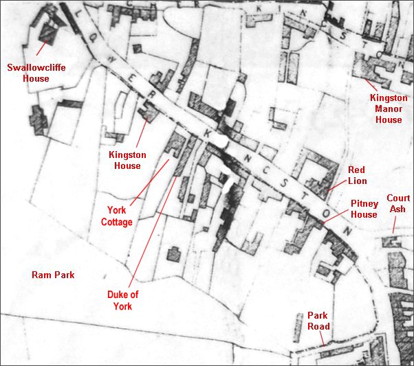
Day's map of 1831 showing Kingston (marked here as Lower Kingston) - I've annotated a few buildings of interest that were there at the time.
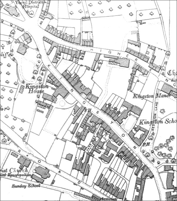
This map, based on the 1901 Ordnance Survey, shows the entire original length of Kingston from the Fiveways Crossroads at top left to Mansion House and North Lane at bottom right at which point Kingston becomes Princes Street.
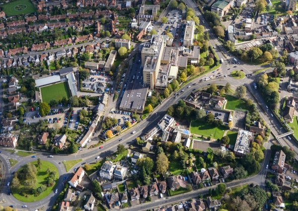
The entire length of Kingston photographed in 2005.
gallery
The following photographs run from north to south along Kingston, from Fiveways to Princes Street, although not necessarily in chronological order.

A plan, dated 1945, of the Kingston Cross Roads by the Borough Surveyor's Department of Yeovil Borough Council. (I worked in the Architect's section of this department some thirty years later).
This
colourised photograph
features in my
book 'Yeovil From Old Photographs'.
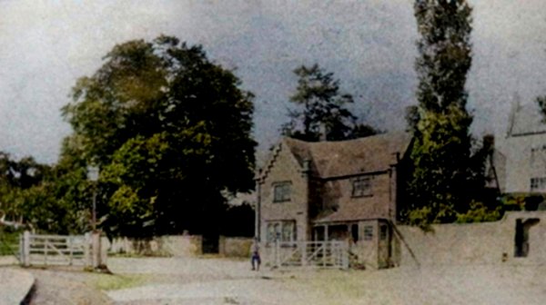
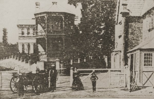
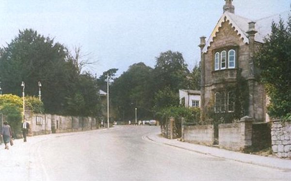
Kingston Turnpike House photographed about 1860 by Henry Goodfellow. Notice the gates which would close until tolls had been paid. The house was moved a hundred yards further down Kingston in 1875.
Photographed by Thomas Clarke between May and December 1874 from Kingston, and showing the new hospital at Fiveways and the Kingston Toll Gates. This is probably the earliest photograph of the new hospital that had opened just two years earlier, in January 1872.
This postcard of 1924 shows a narrow Preston Road running off to the left and Ilchester Road right of centre. The hospital, later the maternity unit, opened in 1872.
From the Cave
Collection
(colourised),
Courtesy of South Somerset Heritage Collection
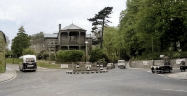
This photograph of the early 1960s shows the hospital facing the Fiveways Roundabout when it really did have five ways and before the roundabout grew out of all proportion. Kingston at bottom left, Preston Road at left with the bus, Ilchester Road at centre to the right of the hospital, Mudford Road with the car and motorbike exiting and Higher Kingston at bottom right. Note that the roundabout still had its black and white markings - painted on during the war so that it was easier to see in the blackout. At extreme left (with the flagpole) is the RAFA Club.
From my
collection.
This
image
features in my
book 'Yeovil
- The Postcard
Collection'.
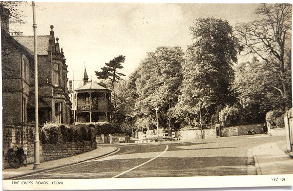
A postcard, of the 1950s, showing the hospital and the Five Crossroads roundabout as seen from Kingston.
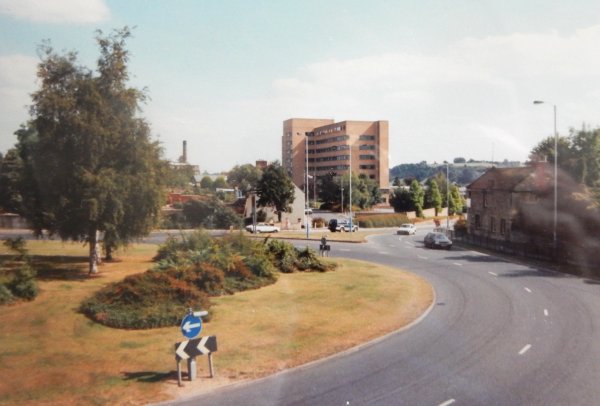
Photo by Jack
Sweet. Courtesy of South Somerset Heritage Collection
Fiveways Roundabout photographed in 1993 with the northern end of Kingston seen right of centre, between the District Hospital and the RAFA Club.
Courtesy of
Vivien and John
Cornelius
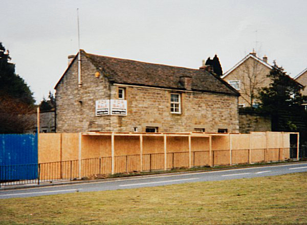
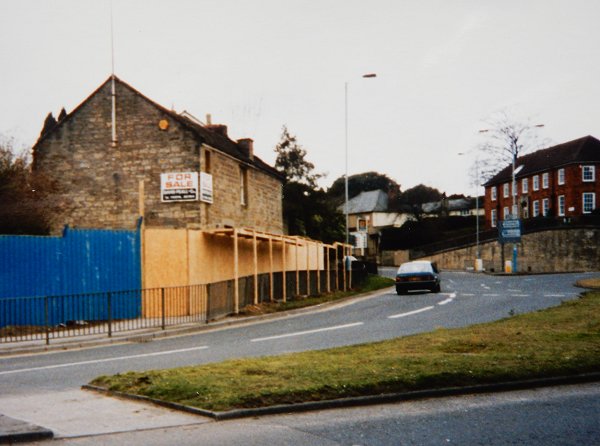
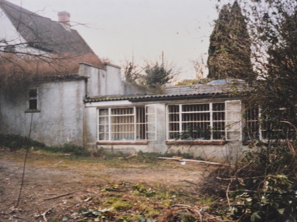
Photographed in 1995, the RAFA Club now closed and awaiting demolition. My home skittle alley when I played in Tony Robin's team during the 1970s and early 1980s.
Courtesy of
Vivien and John
Cornelius
The RAFA Club in its location at Fiveways between Kingston and Preston Road. Photographed in 1995.
Courtesy of
Vivien and John
Cornelius
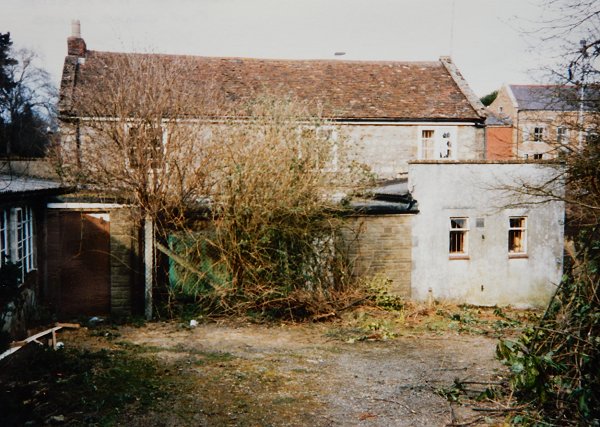
The rear of the RAFA Club as approached from Swallowcliffe Gardens. Photographed in 1995.
Courtesy of
Vivien and John
Cornelius
.... and for those who didn't know it, this is the skittle alley at the rear of the rear of the RAFA Club. Photographed in 1995.
Anyway, back to Kingston -
From the Cave
Collection
(colourised),
Courtesy of South Somerset Heritage Collection
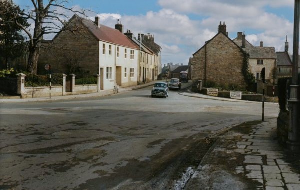
Taken from outside the RAFA Club, around 1965, and looking across Fiveways to Higher Kingston (straight across) and Kingston (at right).
From the Cave
Collection
(colourised),
Courtesy of South Somerset Heritage Collection
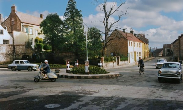
The same view, but taken a little further along Preston Road in order to get a view of the original tiny Fiveways roundabout.
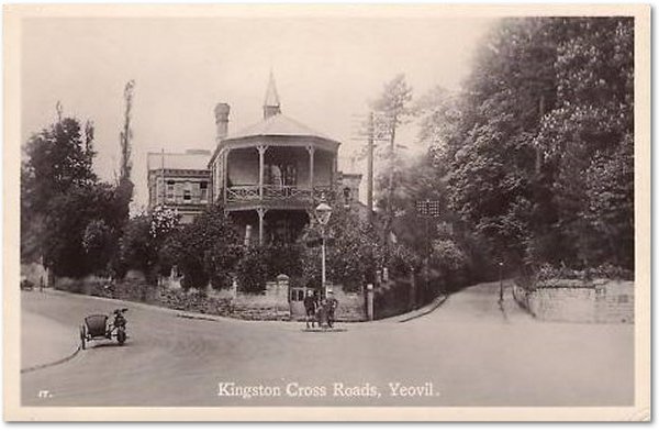
This colourised photograph looks along Kingston from the (mini) Fiveways Roundabout in 1967. Kingston Villas, at centre, are the only survivors from this photograph.
Kingston Turnpike House (east side) in its new location, in a colourised photographed of 1967. At centre is the Fiveways roundabout.
From the Cave
Collection
(colourised),
Courtesy of South Somerset Heritage Collection
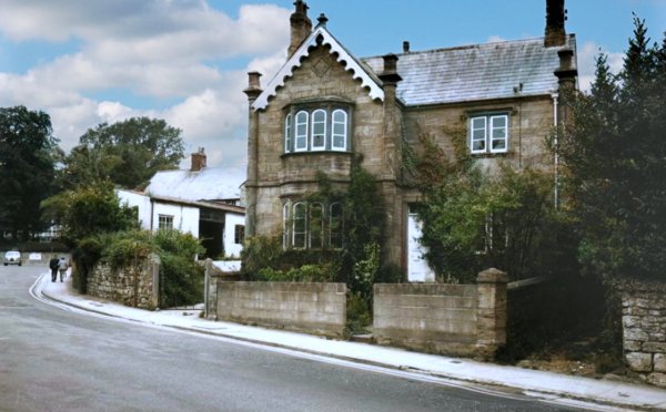
A more detailed view of Kingston Turnpike House after being removed from the Fiveways area..
This
photograph
features in my
book "Lost Yeovil"
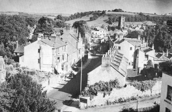
This almost-aerial view along Kingston, looking southeast from the roof of Swallowcliffe House, once a private residence. The photograph was taken in the 1950s when Swallowcliffe House was used as the Ministry of Labour Employment Exchange. In the foreground right of centre are Kingston Villas - rare survivors of the widening of Kingsway. The large white gable wall just beyond Kingston Villas belongs to Kingston House, now part of the Park School. At lower left is the entrance gateway in the garden wall of the Unitarian chapel.

This
colourised
image
features in my
book 'Yeovil
- The Postcard
Collection'.
A postcard dated 1906 looking along Kingston towards the town. The building at extreme left is the Kingston Turnpike House, then comes the entrance gateway in the garden wall of the Unitarian chapel before the three-storey villas. The Duke of York (before it was rebuilt) is seen at extreme right and is enlarged below.
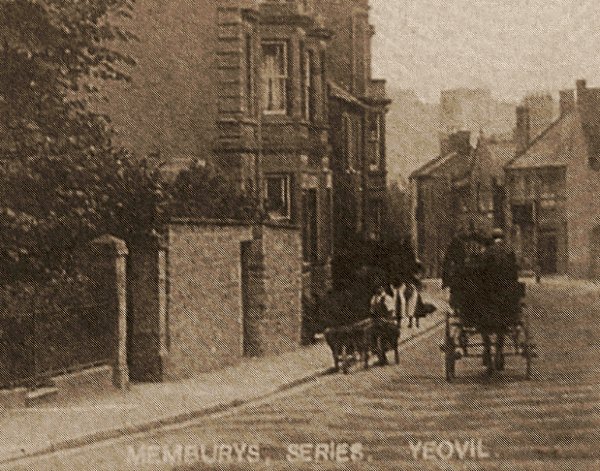
An enlargement of the previous postcard showing the old building of the Duke of York at right with its hanging sign appearing as a black square above and to the left of the door.
From the Cave
Collection
(colourised),
Courtesy of South Somerset Heritage Collection
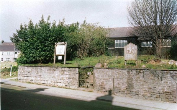
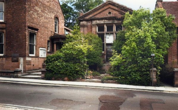
Photographed in the 1960s, this photograph shows the entrance gateway in the garden wall of the Unitarian chapel, with the chapel itself in the background.
In this colourised photograph of the mid-1960s, at left is the entrance gateway in the garden wall of the Unitarian chapel and then a series of houses along the eastern side of Kingston. The nearest of the three-storey buildings at centre was, during the late 1940s, the Green Lantern Restaurant.

The same terraces but photographed closer to town. In the distance is the white building that was Vincent's car showrooms, now Batten's solicitors. The three-storey building immediately behind the traffic sign, No 28 Kingston, was the Registry Office and the offices of Yeovil Rural District Council until the local government reorganisation of 1974.

This colourised photograph
features in my
book 'Yeovil
From Old
Photographs'
So, how narrow was Kingston! Still looking towards the town centre at left are the houses of the previous couple of photos. At right is the terrace known as Kingston Villas and the wall of Kingston House (later the Park School) - the only survivors from Kingston's early days.
.... and for those of you who like 'Before & After' shots - here it is today. BUT, before you go blithering on about the destruction of wonderful old Yeovil while wearing your rose-coloured specs, just think about the traffic that goes along the bottom photo all the time and imagine how long you'd have to sit in your car if the streetscape hadn't changed.
Kingston Villas (western side of Kingsway), rare survivors of the widening of Kingsway and glimpsed at extreme right of the photo above. The centre one was originally the beerhouse of Thomas Busby. Photographed in 2013.

No 28 Kingston, was the Registry Office and the offices of Yeovil Rural District Council until the local government reorganisation of 1974.
From the Cave
Collection
(colourised),
Courtesy of South Somerset Heritage Collection
The Wyndham Museum was originally the billiard room of No 28 Kingston. The museum was the gift of William Wyndham to the town and formed the origins of the later Yeovil Museum. The museum was later housed in the municipal offices in King George Street and then in the coach house of Hendford Manor. Today it is all locked up in Artillery Road and, although it is still accessible by appointment, how awful is that!

.... and the houses next to the Wyndham Museum (the top of its gable is just visible).
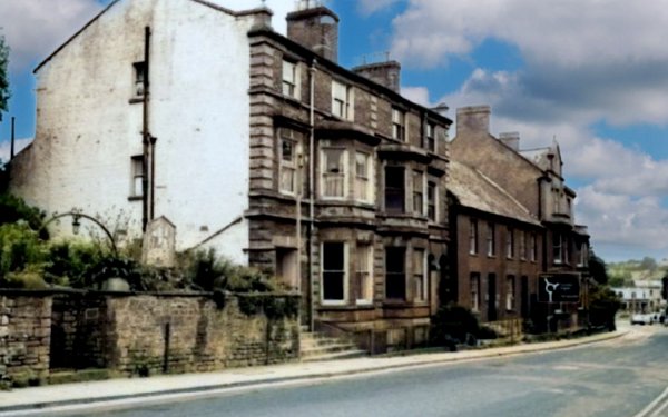
Now returning to the western side, the Duke of York photographed in its guise as the Conservative Club in 2012.

York Place, next to the Duke of York, seen from Kingston, photographed in the late 1960s.
From the Cave
Collection
(colourised),
courtesy of
South Somerset
Heritage
Collection
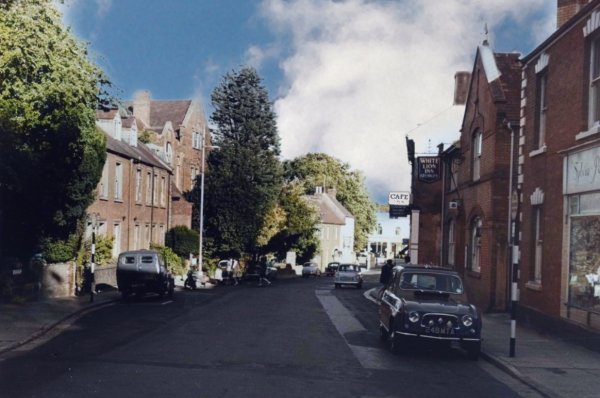
The photograph above, taken around 1965, looks south down Kingston towards Princes Street and is taken from just about outside the Duke of York. Just behind the car at right is the White Lion with its sign visible above the car and at the end of the street the Red Lion stands in front of the last tree. At extreme right is Sylvia Perrett's antique shop (on the corner of York Place), seen painted white in the previous photograph. The three-storey building to the left of the tree left of centre is the former Yeovil County School. The row of four houses, at left and behind the parked van, mark the site of the Quaker Meeting House, the caretaker's cottage and the row of small thatched cottages that were all pulled down in or around 1879.
Almost from the same position as the previous photograph, by the time of this 1974 photograph Kingston had been made into a dual carriageway and all the buildings on the left have gone. All the buildings on the right in this photograph will disappear with the building of Queensway within five years.
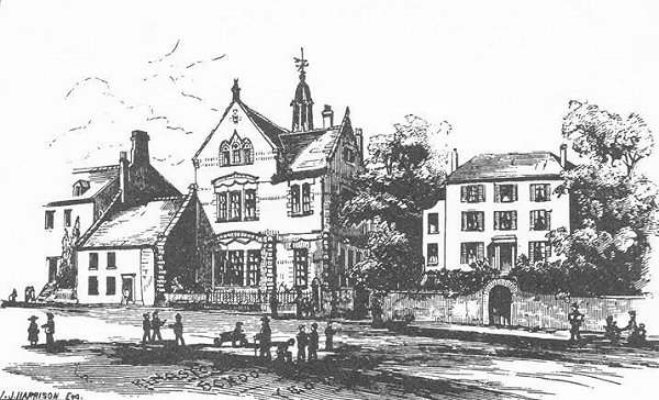
This sketch of Kingston School probably dates to the early 1850s, which was around the time that John Aldridge acquired the buildings for his school. The cottages at left were later acquired by John - he demolished them to allow his school to be enlarged.

This
colourised photograph
features in my
book "Lost Yeovil"
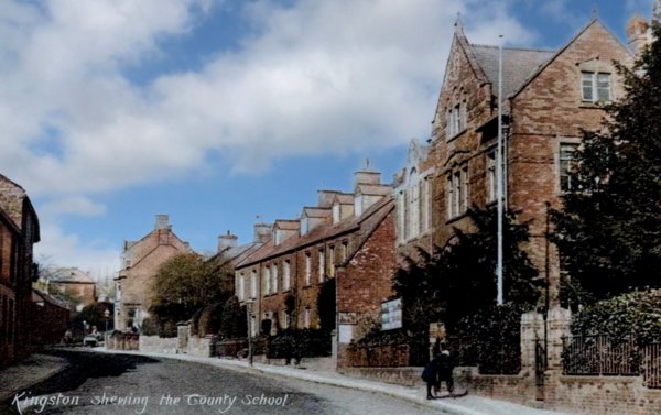
Looking back towards Fiveways, the Red Lion Inn is seen at right, partly hidden by the tree, in this photograph taken around 1905. Next door to the pub, identified by the flag pole, was the Yeovil County School.
From my
collection
-
This photograph
features in my
book 'Yeovil From Old Photographs'.
A postcard of about 1910 by which time Kingston School had been renamed the County School. Believe it or not, at the far end of Kingston is a man riding a horse down the road.

Flooding in Kingston was a common occurrence outside the Red Lion (at right, behind the bus).
From the
Cave
Collection
(colourised).
Courtesy of South Somerset Heritage Collection
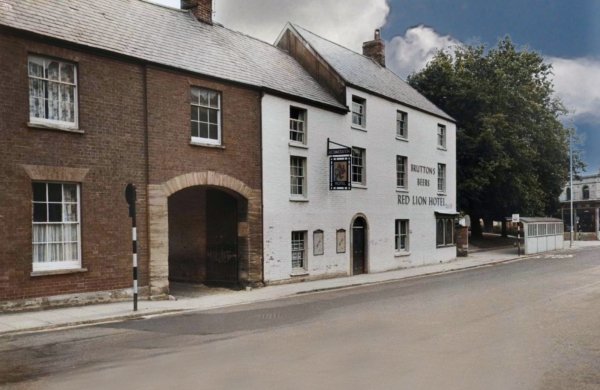
The Red Lion Inn, in this photograph taken in the 1960s, is seen to be a substantial three-storey building. The archway, or porte-cochere, was the entrance to extensive stabling at the rear of the premises.
From the
Cave
Collection
(colourised).
Courtesy of South Somerset Heritage Collection
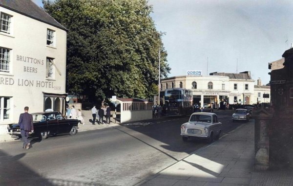
This photograph, taken during the 1960's, probably makes the location of the Red Lion much clearer with Vincent's showrooms, now Batten's offices, at the junction of Princes Street and Court Ash. Red Lion Lane started (or ended) between the Red Lion and the bus stop.
From the
Cave
Collection
(colourised).
Courtesy of South Somerset Heritage Collection
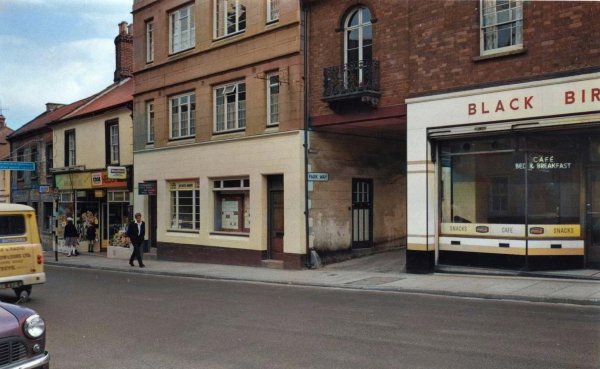
The opposite (west) side of Kingston photographed in the mid-1960s. At centre is the Kingston entrance to Park Way (it even has a street nameplate) - through the porte-cochere next to the Black Bird Café.

This colourised photograph
features in my
book 'Yeovil
From Old
Photographs'
This remarkable photograph was taken in November 1861 and looks north along Kingston as seen from just outside what would become Bide's Gardens. Towards the left is Pitney Villa with its impressive set of double steps. To its right is Pitney House. The small grocer's shop at left is that of JT Foole who had recently taken the shop over from Gerard Samson.
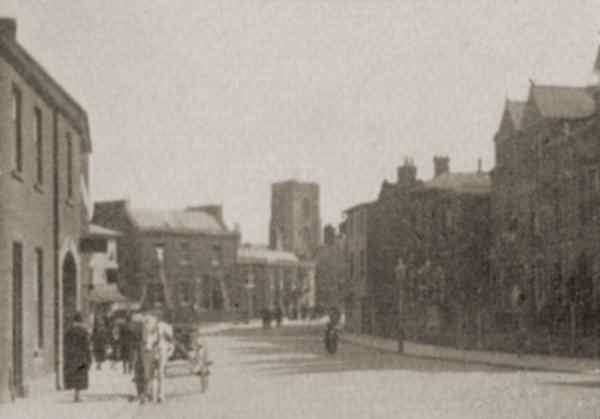
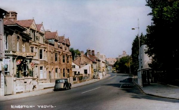
A photograph of Kingston looking towards Princes Street taken during the late 1920s. At extreme left is the Red Lion, directly ahead is the Mansion House and the tower of St John's church while at right is the Kingston Hotel.

It looks like the foreground is getting ready for the building of the new hospital so I'm guessing this colourised photograph dates to the late 1960s.
.... and viewed in this colourised photograph from just a little further on, so now we can see where Kingston met Princes Street.
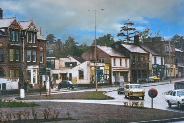
A view of the roundabout at the junction of Princes Street off to the left, Kingston at centre right and Reckleford at lower right. In the three-storey house at left with the white bay window is the premises of Yeovil DIY Services and the single storey white building is FR Bartlett Ltd's 'Kingston Works'. The last building at right is the Duke of York. A colourised photograph of 1973.
As a sidenote, during the Second World War, Bartlett's Yard was used as an Air Raid Rescue Party Depot.
Courtesy of Len
Copland.
This
photograph
features in my
book "Lost Yeovil"
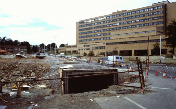
Looking north along Kingston during the late 1970s showing the building of the underpass for the new junction with Queensway.
Courtesy of the
Western Gazette
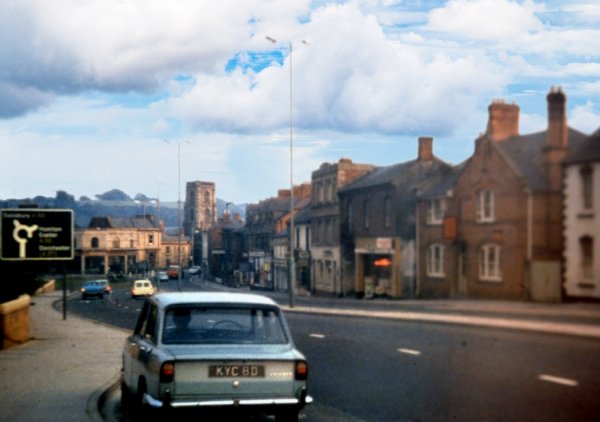
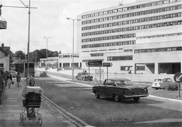
Looking northwest along the dual-carriageway Kingston in the 1970s. The photograph was taken from outside the Kingston Hotel.
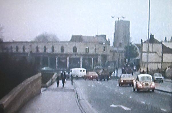
A still taken from a home movie of around 1976 showing the southern end of Kingsway as it joined Reckleford. At centre is Vincent's car showrooms and at right buildings seen in the previous photograph are being demolished for the construction of Queensway.
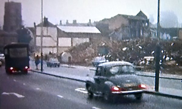
From the same home movie, the Kingston Hotel and other buildings have been demolished ready for the construction of Queensway.
This
colourised photograph
features in my
book "Lost Yeovil"
In this photograph of 1956 by HA 'Jack' Cooper, Pitney Villa in its guise as the Kingston Hotel remains, but Pitney House has been replaced by a short terrace of three-storey villas, later to be absorbed into the Kingston Hotel.

From the
Cave
Collection
(colourised).
Courtesy of South Somerset Heritage Collection
Looking the other way, towards Princes Street, is Pitney Villa, in its guise as the Kingston Hotel, in a colourised photograph of the mid-1960s. The bay windows are late-nineteenth or early-twentieth century additions, not present in early photographs.
This photograph
features in my
book 'Secret Yeovil'
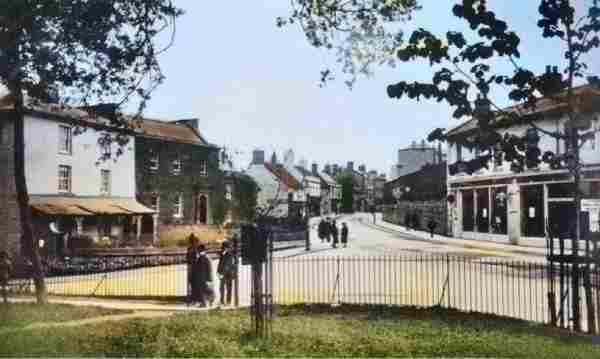
This photograph was taken from Bide's Gardens and shows the northern end of Princes Street / southern end of Kingston. Bide's Gardens, as seen from the map above, ran from the Red Lion to the corner of Court Ash. At this time, before Reckleford was made a dual carriageway and Yeovil lost Bide's Gardens (the photographer of this photograph would today be standing on the southern carriageway of Reckleford as it approaches the hospital roundabout), Princes Street ended at North Lane on the eastern side (between the white flank wall and the ivy-covered Magnolia House left of centre) while the western side of Princes Street ended at Park Road (indicated on this image by the flank of three-storey Old Sarum House visible just right of centre).
The photograph most likely dates to the early 1920s, yet is probably one of the earliest of this location as witnessed by the building at far left, next to Mansion House and enlarged below, which pre-dates the 1930's Vincent's (now Batten's) building of the previous photograph, on the corner of Court Ash (running off to the left), we are all so familiar with. At right is the shop-front of the sales rooms of Hill & Boll's carriage works.
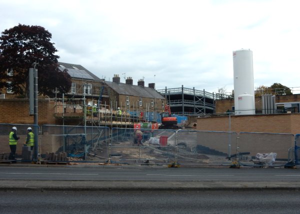
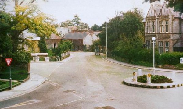
The latest change to be seen in Kingston is the construction of a new road linking Higher Kingston with Kingston. Photographed in October 2016.
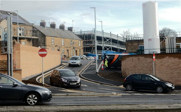
.... and completed by November 2016.
Kingston Crossroads / Fiveways roundabout - Then and Now

From my 2024
book "Yeovil,
Then and Now"
Above at left is an aerial photograph of Fiveways from the 1946 aerial survey of the whole country. At right, for comparison, is the modern equivalent from the 2006 aerial survey of Somerset (courtesy of Somerset Council). The triangular field between Ilchester and Mudford Roads was very much truncated and the position of the Fiveways Hospital would be approximately in the lower left quadrant of the grassed area at the centre of the roundabout.