Sydling's Lane
Sydling's Lane
An early field access track that survives today
'Sydling' may have been a personal name of a former owner, or the name may derive from the Old English 'sid', meaning broad, and 'hlinc' being a bank separating strips of arable land in medieval times.
Sydling's Lane was known by a variety of names through its existence as a field access track on the western edge of Kingston's great medieval East Field. As seen on the maps below, Sydling's Lane ran east from just under halfway up Brickyard Lane (today's St Michael's Avenue), before turning north after a hundred yards or so. This northern spur is now the southern end of today's Monmouth Road.
The 1589 Terrier referred to it as Selling's Lane, in the 1790s it was known as Sidlands Lane or Sydlands Lane. By 1805 it was known as Sydling's Lane, also called Sydland's Lane.
The east-west section is now the western end of today's Rosebery Avenue, while the northern spur is now the southern half of Monmouth Road.
Today's Sydling Road, off Rosebery Avenue, was clearly named in tribute despite being built further west in the former field Pittard's Pound (Parcel 968).
maps

This map, based on the descriptions in the 1589 Terrier and the 1846 Tithe Map of Yeovil shows the approximate boundaries of the Manors of Kingston and Hendford as well as the manorial three-field system used in Kingston.

A map of the great medieval East Field of Kingston Manor showing conjectured locations of several fields based on descriptions in the 1589 Terrier.
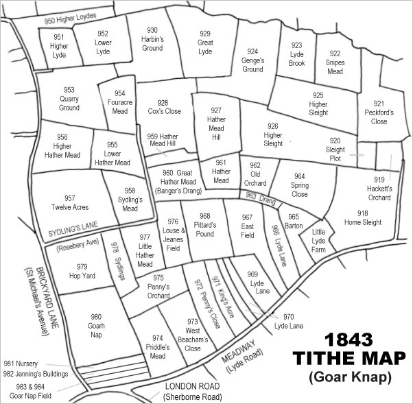
Drawn from the 1846 Tithe Map with field names added from the 1846 Tithe Apportionment, with Twelve Acres at centre left.
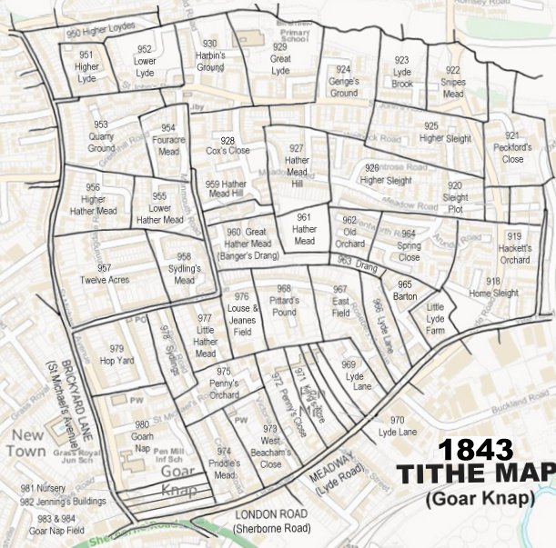
The 1843 Tithe Map overlaid onto a modern map of the area.
Gallery
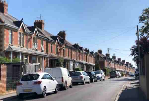
Rosebery Avenue, built on the original Sydling's Lane, seen from the corner of St Michael's Avenue. Photographed in 2021.