three corner ground
three corner ground
A former part of the great West Field of Kingston Manor
Originally part of the great medieval West Field of Kingston manor, Three Corner Ground, also known as Three Corner Close (Parcel 1425) was a triangular field (hence the name) in the junction of Ilchester Road and a field access track called Lower Larkhill Lane which today has become Stiby Road.
In his will of 1719, John Saunders the Elder left "threecorner Close" to his eldest son William. It is likely that William Sanders sold off Three Corner Close to John Game almost immediately since in his will dated 1725, Edward Boucher (1) bequeathed "... Closes of pasture which I formerly purchased of John Game called Marle Close and Three Corner Close..." to his nephew Edward Boucher (2).
In his will of 1827, glove manufacturer Henry Collins recorded "all that my close of pasture land called the Three Cornered Ground near Brimsmore Tree... late Caymess and situate lying and being in the parish of Yeovil aforesaid", which he bequeathed to his widowed daughter Mary Phelps.
The 1846 Tithe Apportionment noted Three Corner Ground as 4a 0r 30p and used as pasture for grazing animals. The Apportionment noted that the owner was John Glyde and the tenant was William Harrison. It was part of Marl Close Farm.
Three Corner Ground was bounded on the north by Ilchester Road, on the south by the field access track Lower Larkhill Lane and on the west by Marle Close (Parcel 1424).
Today the site of the former Three Corner Ground is occupied by the houses and gardens of Ilchester Road, Stiby Road and Thatcham Close.
For details on historic land measurement (ie acres, roods and perches) click here.
maps

This map, based on the descriptions in the 1589 Terrier and the 1846 Tithe Map of Yeovil shows the approximate boundaries of the Manors of Kingston and Hendford as well as the manorial three-field system used in Kingston.
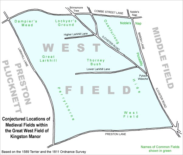
A conjectural map of the great West Field of Kingston Manor showing ancient sub-fields, most likely common fields, within the overall bounds of West Field.
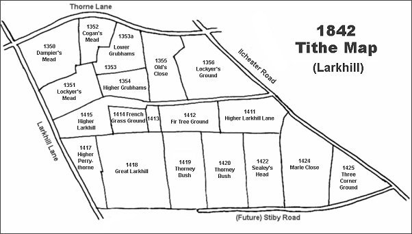
The Larkhill area reproduced from the 1842 Tithe Map. Three Corner Ground is at bottom right.
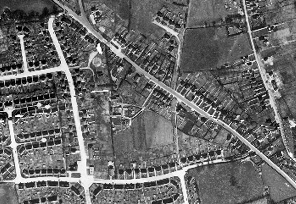
The 1946 aerial photograph - Three Corner Ground is in the lower right quadrant.
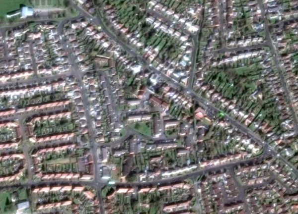
The same area today 'borrowed' from Google maps.
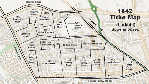
The 1842 Tithe Map superimposed (slightly out at the bottom) over a modern map.