Yeovil Bridge Mead
Yeovil Bridge Mead
The field name says it all
Yeovil Bridge Mead, also known simply as Bridge Mead or Bridge Close, got its name because it lies next to Yeovil Bridge and because it was a meadow. The word 'mead' comes from the Old English 'maed'. Before grass seeds were obtainable this was the only hay land of the community. It usually consisted of land near streams since that was the only kind of land on which hay grew in any quantity.
In his will dated 15 March 1725, John Jeanes wrote "... I give devise and bequeath the same to my Nephews Thomas Burford of [word illegible] Clerke Office in the County of Middlesex Gentleman and John Burford one of the Fellows of Kings Colledge in Cambridge Gentleman and their heires dureing the naturall life of my daughter Mary together with one ground called Milford and two acres in Gold Croft One acre in Goare feild and Yeovil Bridge Mead together with all those foure peices of ground called Ryalls in the parish of Yeovill aforesaid In trust to apply and dispose of the rents issues and profitts thereof to the proper hands of my said daughter or as she shall appoint ...".
In his will of 1795, Yeovil butcher Charles Francis of South Street left "unto my Son in Law Nathaniel Parker all that my Close of Meadow or Pasture Ground called Bridge Close situate lying and being at or near Yeovil Bridge".
In the 1820s Yeovil Bridge Mead, which lay next to Pen Mill, was owned by Thomas Tytherleigh, Gent, of Norton Fitzwarren, but the tenant was his younger brother Robert Tytherleigh who was the miller at Pen Mill (see his page for the complex land ownership issues of that time).
The 1846 Tithe Apportionment noted that Yeovil Bridge Mead (Parcel 860) was owned by George Harbin of Newton Surmaville and the tenant was Robert Allen, the miller of Pen Mill after Robert Tytherleigh's death in 1834. The Apportionment noted it was used as meadow and measure 1a 3r 32p. Yeovil Bridge Mead was bounded on the northeast by the London Road (today's Sherborne Road), on the northwest by Pen Mill, on the southwest by the mill stream and on the southeast by the River Yeo.
Today Yeovil Bridge Mead is all but waste ground.
For details on historic land measurement (ie acres, roods and perches) click here.
maps
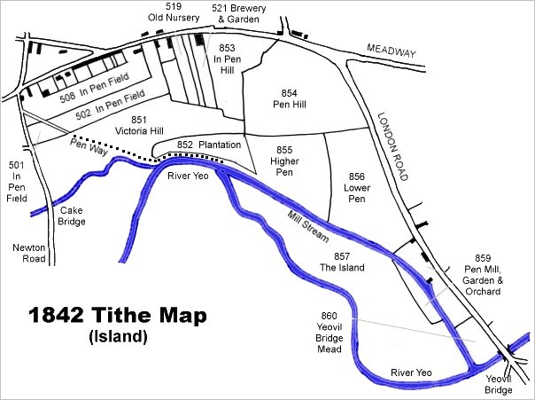
This map is based on the 1842 Tithe Map with field names chiefly added from the 1846 Tithe Apportionment.
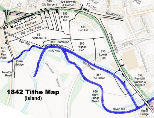
The 1842 Tithe Map superimposed (roughly) over a modern street map. Bearing in mind the relatively primitive surveying equipment of the 1840s they weren't all that far out.
Gallery
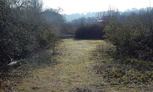
Yeovil Bridge Mead, photographed from Pen Mill in 2016.