Daniell's Close
Daniell's Close
A field within the great manorial East Field
Daniell's Close (Parcel 934), one of three fields with the same name in Yeovil, was originally part of the great medieval East Field of Kingston Manor.
The 1846 Tithe Apportionment noted that Daniell's Close was in the ownership of Ann Collins and let to James Marten. The Tithe Apportionment shows Daniell's Close was used as pasture for grazing livestock and measured 2a 1r 26p.
Daniell's Close (Parcel 934) was bounded on the west by Furzey Close (Parcel 933), on the north by Young Orchard (Parcel 935), on the west by Lyde Gurl and Higher Sleight (Parcel 898) and to the south by Lower Loydes (Parcel 931).
By the time of the 1946 aerial photograph, seen below, Daniell's Close was a small open field. The former Daniell's Close is now occupied by the shops, houses and gardens around the junction of Bucklers Mead Road and Runnymede Road.
For details on historic land measurement (ie acres, roods and perches) click here.
maps

This map, based on the descriptions in the 1589 Terrier and the 1846 Tithe Map of Yeovil shows the approximate boundaries of the Manors of Kingston and Hendford as well as the manorial three-field system used in Kingston.

A map of the great medieval East Field of Kingston Manor showing conjectured locations of several fields based on descriptions in the 1589 Terrier.
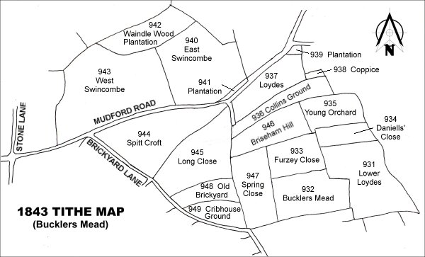
Drawn from the 1846 Tithe Map with field names added from the 1846 Tithe Apportionment, with Daniell's Close (Parcel 934) at centre right.
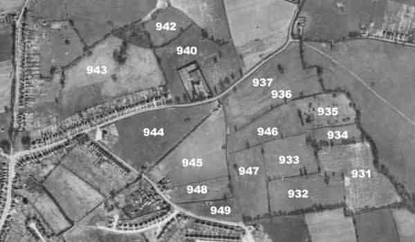
The 1946 aerial survey photograph with parcel numbers of 1846 plotted on.
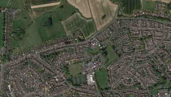
An aerial view (courtesy of Mr Google) of the area today.
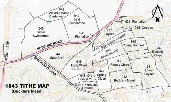
The 1843 Tithe Map overlaid onto a modern map of the area.