Gayley Mead
Gayley Mead
One of the most northerly fields in Preston Plucknett
Field's End was originally a large field along the north parish boundary of Preston Plucknett, lying to the immediate south of Thorne Lane and bounded by the parish boundary with Brympton in the west and Larkhill Lane in the east.
By the time of the 1763 survey of the Manor of Preston, the large field was subdivided and six fields were created running along the southern side of Thorne Lane. Gayley Mead was one of these six fields, close to the junction of Thorne Lane and Larkhill Lane..
The 1846 Preston Tithe Map shows Gayley Mead (Parcel 71), albeit shown on the map as Gazeley Mead, bounded to the north by Thorne Lane, to the west by Hacker's Close (Parcel 69), to the south by Higher Great Down (Parcel 76) and to the east by Lower Crossways (Parcel 72)..
The Preston Plucknett Tithe Apportionment of 1848 noted that Gayley Mead was owned by Henry Halsey and the tenant was Edward Harris. The field measured 6 acres, 0 roods and 24 perches. It was used as a meadow.
The 1946 aerial photograph (see below) shows the field as undeveloped, but it disappeared when the Abbey Manor estate was built in the 1980s and the site is now occupied by Tintagel Road and its first southern cul-de-sac..
For details on historic land measurement (ie acres, roods and perches) click here.
maps & Aerial photograph
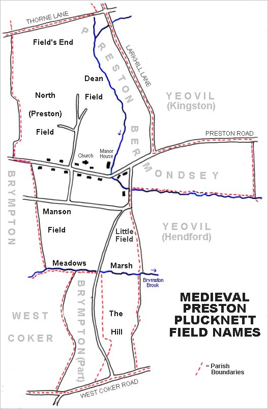
The main post-medieval fields of Preston Plucknett. The original large medieval field called Field's End is at top left.
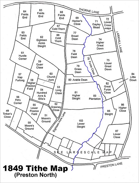
Map based on the 1849 Tithe Map showing Gayley Mead (Parcel 71) at top right.
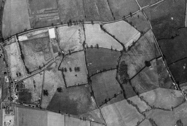
This is a 1946 aerial photograph showing Thorne Lane running across the top and Larkhill Lane (today's Larkhill Road) running diagonally across the top right quadrant. Gayley Mead is the light coloured field to the right of the triangular-shaped light coloured field, right of top centre.
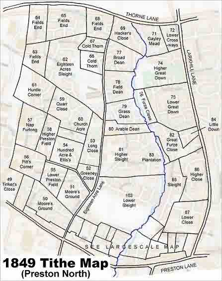
The 1849 Tithe Map superimposed over the modern Ordnance Survey map.