Preston Plucknett
Preston Plucknett
Now part of Yeovil
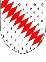 Sir
Alan Plugenet
(or Ploknet) who
gave Preston
Plucknett his
name, was
excommunicated
in 1315 for
having refused
to bury his
mother according
to her wishes
and also for
assaulting the
Rural Dean and
forcing him to
eat the deed of
citation.
The arms of Plugenet were ermine, a bend fusilly gules (on a field of the fur ermine, a red diagonal stripe made of lozenge shapes).
In 1856 Vickery wrote "Preston is a considerable parish one mile northwest from Yeovil, in the turnpike-road to Taunton. It is divided into two tithings, viz. 1. Preston-Plucknet, containing forty houses, with the church, 2. Preston-Bermondsey, containing fourteen houses. The whole number is fifty-four, and of inhabitants two hundred and eighty. There are about ten farms ; the rest are mostly cottages, but better than in many other parishes. The soil is a rich light sandy loam, and stone-rush, with good blue marle under it, and the situation very pleasant. It is highly cultivated, well watered by springs, and ornamented, but not encumbered with wood."
For centuries the parish of Preston lay between Brympton and Yeovil, the greater part of it being the Manor of Preston Plucknett. For its early history click here.
Although mostly incorporated within Yeovil in 1928 (small parts being absorbed by the adjacent parishes of Brympton and West Coker), Preston Plucknett retained a rural village charm with its many thatched roadside cottages (many of which are shown in the Gallery below) until the 1960s when the majority of the cottages on either side of Preston Road were demolished for road widening and straightening.
Buildings of note in Preston Plucknett include -
-
Glencote (The Old House, 16th century)
-
Knapp House (17th century)
-
Preston Great Farm (Abbey Farm)
-
Preston House (Plucknett Hotel)
-
Preston Park House (Preston Lower Farm)
. . . . and gone but not forgotten
Map
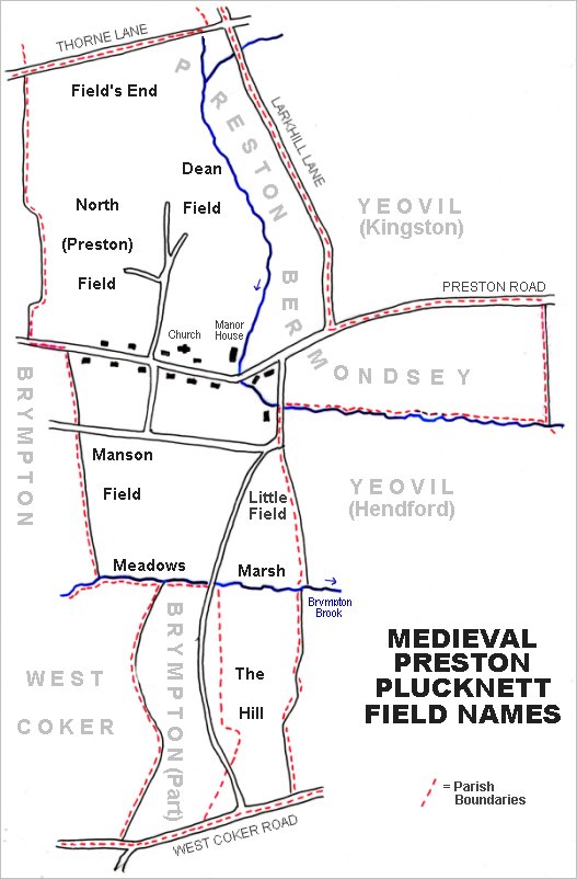
The main medieval fields of Preston Plucknett.
Snippets from the past
General Sessions of the Publique Peace 1609-10 - A warrant signed and sealed by Edw[ard] White, Clerk of the Peace, for apprehension of John Bristowe, late of Preston in the county of Somerset. Dated at the Epiphany Sessions at Wells, 6 James I.
Sessions of the Peace held at Wells the 13th, 14th, 15th and 16th days of January 21 James [1623-4] - On information that Thomas Wyatt of Preston is become a very lewd and dangerous person not fitting to live at liberty for fear of doing hurt and injury to the King's subjects. For the preventing of such mischiefs the said Wyatt is to be forthwith conveyed with this order to the House of Correction for this county, there to be safely kept and set on work until further order be taken; and the said parish is to allow him maintenance if his labour is not sufficient to relieve him.
Sessions Roll 90, 80, 81 - Three men of Preston Plucknett, being demanded by George Sampson JP in 1655, if they were married and to whom, gave the names of their wives and number of children, and stated that they were married at Babcary or Keinton Mandeville by a wandering person whose name they do not know and have no certificate to show.
General Sessions of the Publique Peace att the Castle of Taunton, 12July 1653 - For that this Court is informed by diverse of the inhabitants of Preston Plucknett that the house of one John Wills of Preston aforesaid now licensed to sell ale is a most unfit place due to the same in regard of its neereness to the town of Yeovill. This court doth hereupon order that the sd Alehouse shalbe actually suppressed, any licence formerly graunted to the contrary notwithstanding.
gallery
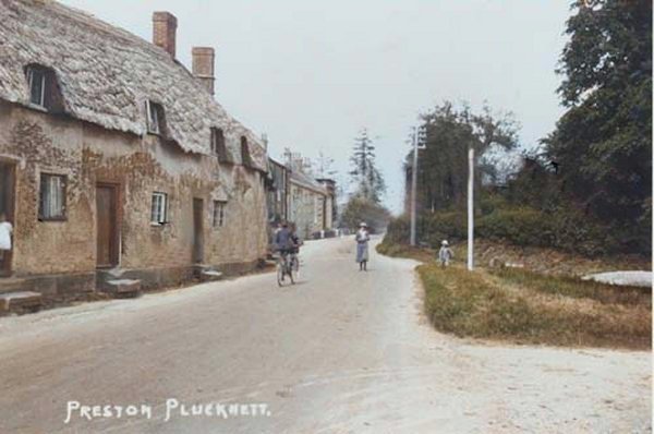
This photograph
features in my
book "A-Z
of Yeovil"
Jubilee Cottages, opposite the Jubilee Tree junction. From a colourised postcard of the early 1930s.

From my
collection.
This
photograph
features in my
book "Lost Yeovil"
The old Bell Inn, in a colourised photograph of around 1920. At far right are seen two thatched cottages; the first was at one time the village post office but was later the home of the Beale family. The other cottage was occupied by the Saunders family. Both the Bell Inn and the cottages were demolished for road widening.
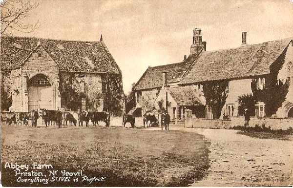
From my
collection
A postcard of Preston Great Farm (erroneously called 'Abbey Farm'), produced around 1907 and used by Aplin & Barrett as an advertisement for their St Ivel range.

St James, in a colourised photograph of around 1880, when most of Preston Plucknett was thatched.
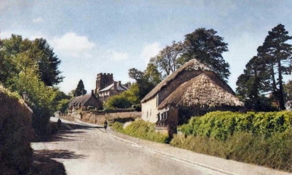
A colourised postcard of 1954 of Preston Plucknett, looking west to St James church.
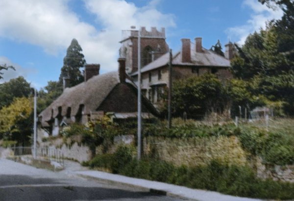
This colourised photograph of 1956, looks west along Preston Road, but a little closer to the cottages. The thatched cottages were soon demolished. The large house behind the cottages was Sutherland House, home to Yeovil poet and author Walter Raymond from around 1892 to 1905.
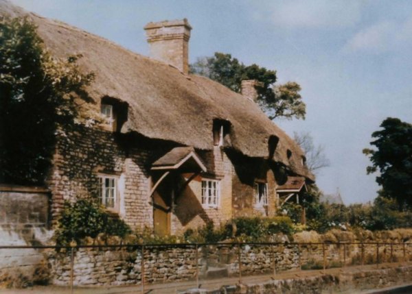
A colourised photograph of the thatched cottages of the previous photograph (Nos 214 and 216 Preston Road).
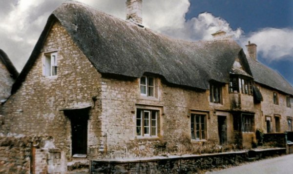
This
colourised photograph
features in my
book "Lost Yeovil"
No 253 Preston Road, photographed around 1965 and demolished shortly thereafter.
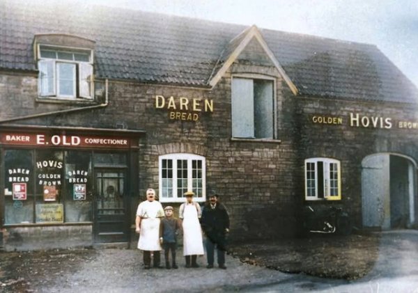
Old's bakery, opposite St James' church, photographed (colourised) around the 1920s.
From my
collection
-
This
colourised
postcard features in my
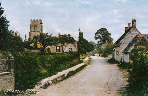
book 'Yeovil From Old Photographs'.
The tower of St James church, Preston & Brympton Elementary School (opened 1875) and roadside cottages in an unused postcard, probably dating to about 1920, published by Whitby of Yeovil. The cottages were demolished for road widening.
This
colourised image
features in my
book 'Yeovil
- The Postcard
Collection'.
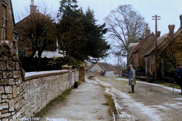
Looking east along the western end of Preston Plucknett during the 1920s.