Great Lyde
Great Lyde
A field within the great manorial East Field
Great Lyde (Parcel 929) was a large field originally within the great East Field of the Manor of Kingston. Although not shown on Philip Byles map of Lyde of 1653 it is most likely that, being immediately to the south, it was included within the Domesday Manor of Lyde and may have been instrumental in the original name since the two tributaries at the head of Lyde brook (now piped underground) joined at its northwest corner and the conjoined stream ran along the northern border of the field. The route of the brook, forming Lyde Gurl, was lowest part of the northern flank of Hather Mead Hill.
In his will of 1828 William Row stated ".... my Close of Pasture Ground called Great Lyde bought of the Earl of Egremont [Note: George Francis Wyndham, 4th Earl of Egremont (30 August 1786 – 2 April 1845) of Orchard Wyndham, Somerset] containing about twelve acres....". At the time of the 1846 Tithe Apportionment Great Lyde was owned by John Tanner Whiteley Pitcher (Pitcher was the 'natural' son of William Row and lived at East Chelborough, Dorset) and let to John Brook the Younger. It was used as pasture for grazing livestock and was measured at 8a 2r 35p.
Bordered by the Lyde stream to the north, it was bounded to the west by Harbin's Ground (Parcel 930), to the south by Cox's Close (Parcel 926) and Genge's Ground (Parcel 924) which also wrapped around Great Lyde to form its eastern boundary.
By the time of the 1946 aerial photograph seen below, Great Lyde remained an open field. Today Great Lyde contains houses and gardens of St John's Road and Chatsworth Gardens in its southern half and Birchfield County Primary School in the northern half.
For details on historic land measurement (ie acres, roods and perches) click here.
maps

This map, based on the descriptions in the 1589 Terrier and the 1846 Tithe Map of Yeovil shows the approximate boundaries of the Manors of Kingston and Hendford as well as the manorial three-field system used in Kingston.

A map of the great medieval East Field of Kingston Manor showing conjectured locations of several fields based on descriptions in the 1589 Terrier.
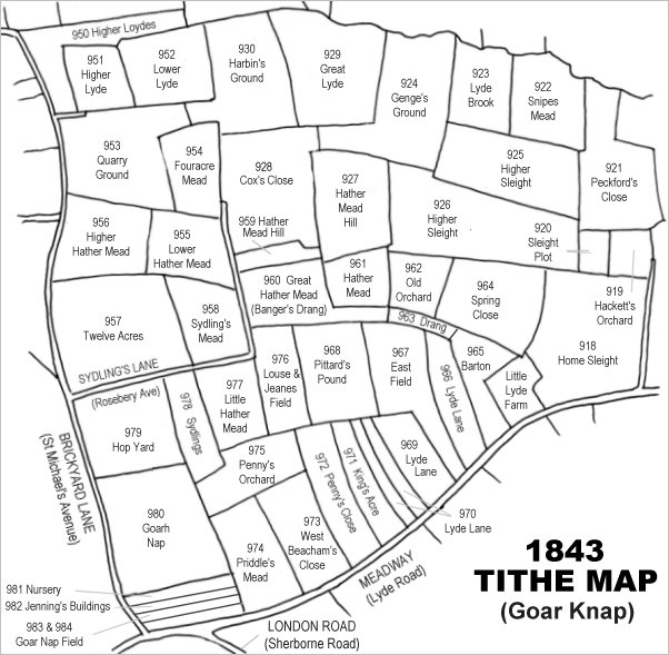
Drawn from the 1846 Tithe Map with field names added from the 1846 Tithe Apportionment, with Great Lyde (Parcel 929) at centre top.
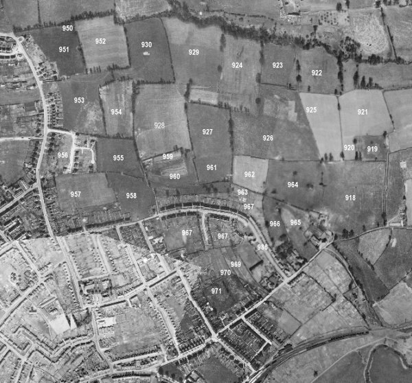
The 1946 aerial survey photograph (somewhat mis-aligned at bottom left) with parcel numbers of 1846 plotted on.
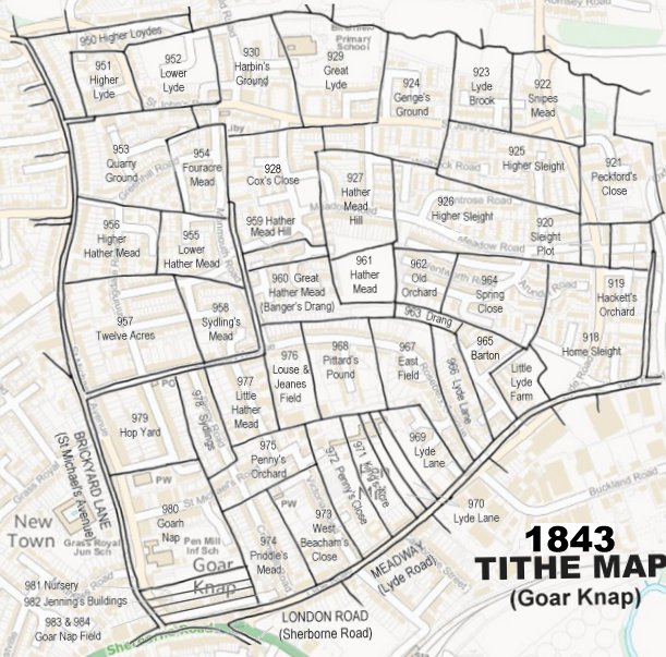
The 1843 Tithe Map overlaid onto a modern map of the area.
Gallery
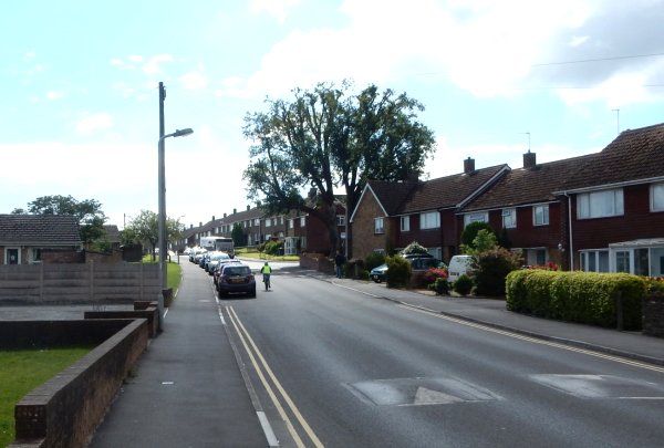
Photographed in 2016 from outside the Yellow Wagtail and looking west along St John's Road. The top of the hill (the houses to the right of the bus) was the highest point of Hather Mead Hill. The road and to the left were along the northern edge of Great Lyde (Parcel 929) and the houses to the right of the road were built in the spur of Genge's Ground (Parcel 924). Photographed in 2016.
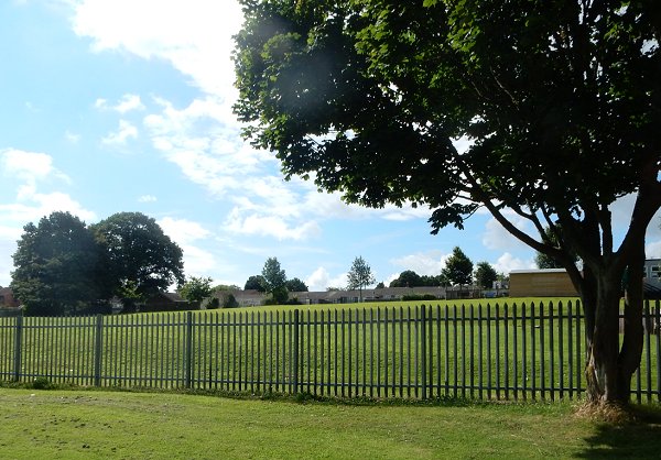
Seen from Birchfield Park and looking north, this was (roughly) the southern border of Great Lyde. The bungalows at centre are in Chatsworth Road and at right is Birchfield County Primary School. Of course, much of the foreground is made up ground at this northern end of what had been an open refuse tip in the 1970s. Photographed in 2016.