victoria bridge
victoria bridge
Addlewell Lane
Victoria Bridge was built in the 1860's to carry the spur of Addlewell Lane over the newly-built railway line to give continued road access to Victoria Buildings.
Victoria Buildings was a long row of cheap housing named for Queen Victoria and probably built around the time of her accession in 1837 at the bottom of the western slope of Summerhouse Hill. Indeed in the 1841 census Victoria Buildings was referred to as 'New Walk' as well as its other local name of 'Heaven' by which the area was known for decades.
Built
close to several
leather and
gloving
factories shown
on the map
below, it was
intended for
workers in these
factories and,
when listed in the
1841 census, was
almost
exclusively
lived in by
glovers and
their families.
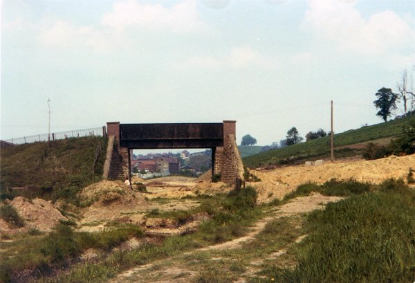
When the railway was built along the southern and western flanks of Pen Hill in the 1860's, road access to Victoria Buildings was cut and necessitated to building of the bridge. It was a steel box-girder construction with enclosed sides, the existing road being heightened on both sides of the railway and the revetments to each side being constructed in stone.
Victoria Buildings were demolished in 1965 and the bridge was removed later, around 1977, and the road restored to its original level..
map
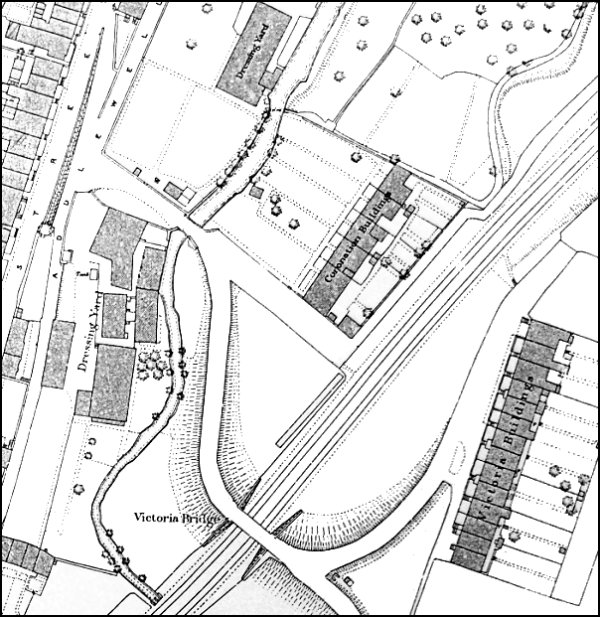
Map based on the 1886 Ordnance Survey shows Victoria Bridge, centre bottom, carrying the spur of Addlewell Lane over the railway tracks to Victoria Buildings.
gallery
From my
collection
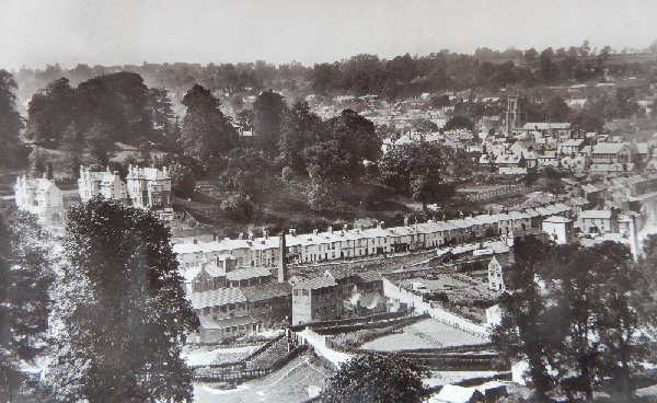
The view across to Pen Hill (top left quadrant), Park Street (running across the centre) and Victoria Bridge (bottom centre). From a postcard of 1911.

This colourised photograph, taken in 1950 from the western slopes of Summerhouse Hill, looks down on Victoria Bridge with glove factories beyond and the houses of Park Street at the back.
Courtesy of
Roger Froude
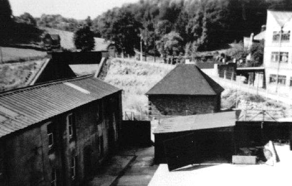
Victoria Bridge, at top left, with the Addlewell Lane approach running up from centre right. At bottom left is the former Coronation Buildings but at the time of this late 1950's photograph the glove factory of Parker, Brooks & Long.
From the Cave
Collection
(colourised),
Courtesy of South Somerset Heritage Collection
This photograph, taken in 1963 from Park Street, looks across to the terrace of cheap housing known as Victoria Buildings. Right of centre is Victoria Bridge crossing the railway and clearly showing how Addlewell Lane was raised up either side of the railway.
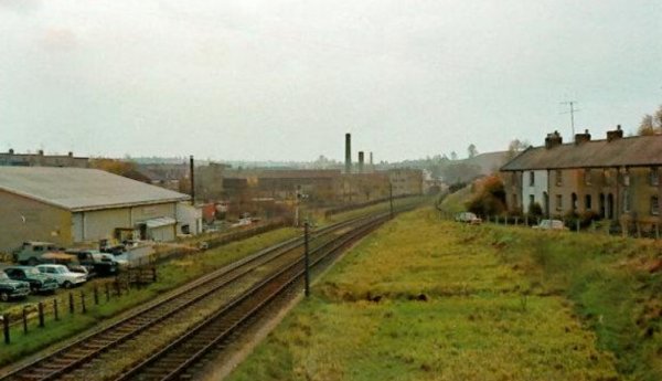
The view from Victoria Bridge, again taken in 1963, looks east along the railway tracks towards the town station with Victoria Buildings to the right and Wyndham Hill in the distance beyond.
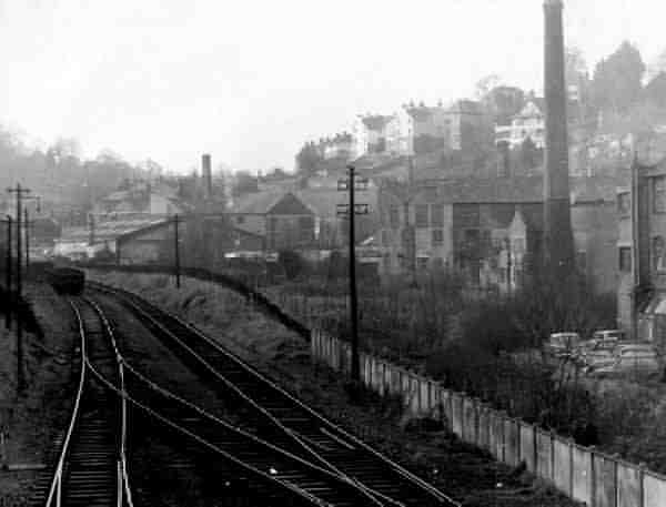
... and looking west from Victoria Bridge around the same time.
Courtesy of John
Penny
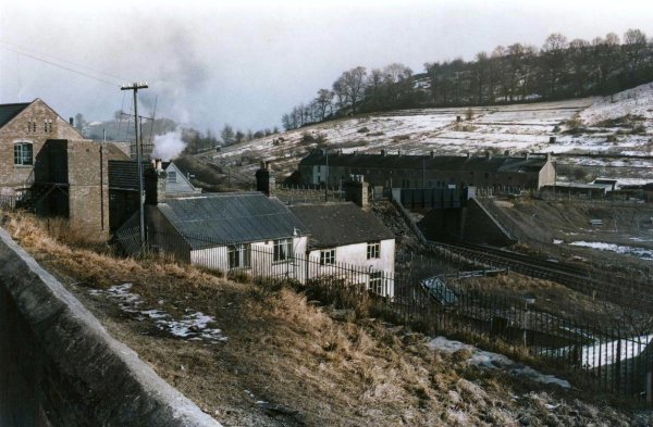
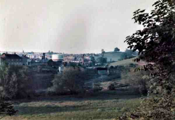
The view from Ninesprings, including Victoria Bridge, photographed around 1970.
Courtesy of
Allan Harding. This
photograph
features in my
book "Lost Yeovil"