Cold Thorn
Cold Thorn
A northern field of in Preston Plucknett
The 1763 survey of the Manor of Preston showed Cold Thorne (the name infers 'bleak') as a field situated between the two medieval fields of Field's End and Dean Field. It was shown as two separate fields, both called Cold Thorne in the 1763 survey of the Manor of Preston, but each field had different owners.
The 1846 Preston Tithe Map still showed it as two separate fields with Cold Thorn (Parcel 67) to the north of Cold Thorn (Parcel 66). This double field was bounded to the north by Field's End (Parcel 68) and, to the west and south by Eighteen Acres Sleight (Parcel 62). To the east it was bounded by the field access track known as Eighteen Acre Lane, the other side of which was Broad Dean (Parcel 77).
The Preston Plucknett Tithe Apportionment of 1848 noted that both parcels of Cold Thorn were owned by Lady Georgiana Fane of Brympton d'Evercy and the tenant was Thomas Hawkins (who was a tenant of over 200 acres in over 40 parcels in the parish). Parcel 66 measured 2 acres, 2 roods, 30 perches, while Parcel 67 measured 3 acres, 3 roods, 30 perches. Both were used as pasture for grazing livestock.
The 1946 aerial photograph (see below) shows the field as apparently joined into one larger field albeit retaining some trees along the former boundary. It disappeared when the Abbey Manor estate was built in the 1980s and the site is now occupied by the houses and gardens of Merevale Way, Stourton Way and the field that is now the northeast section of Abbey Manor park.
For details on historic land measurement (ie acres, roods and perches) click here.
maps & Aerial photograph
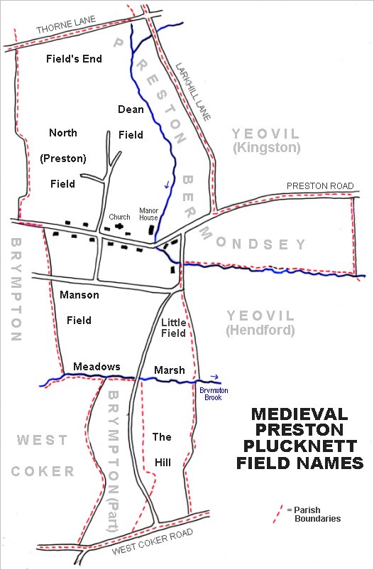
The main post-medieval fields of Preston Plucknett. The original large medieval field called Field's End is at top left with Dean Field to its southeast.
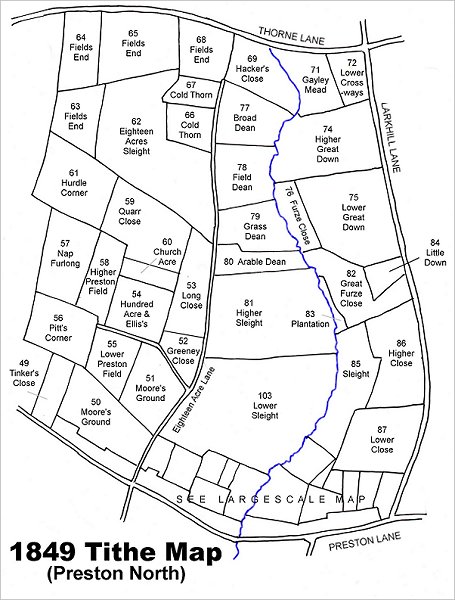
Map based on the 1849 Tithe Map showing Cold Thorn (Parcels 66 and 67) towards top centre.
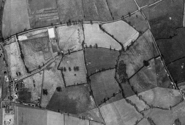
This is a 1946 aerial photograph showing Thorne Lane running across the top and Larkhill Lane (today's Larkhill Road) running diagonally across the top right quadrant. Cold Thorn is seen, left of centre, as a rectangular field with a small projection to the west and several trees running along the old boundary between the two parcels.
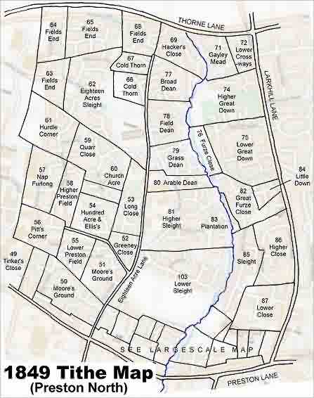
The 1849 Tithe Map superimposed over the modern Ordnance Survey map.