Grove
Grove
A field on the gentle lower southern slope of Newton Hill
Grove (Parcel 827), was a large field on the lower southern slope of Newton Hill (although today we tend to call it Summerhouse Hill), running down towards the River Yeo. The name 'Grove' derives from the Old English grāf meaning land by a tree plantation.
At the time of the 1846 Tithe Apportionment, Grove was owned by George Harbin and let to William Pope as part of Newton Farm. It was recorded as pasture for grazing livestock and measured 16a 1r 14p.
Grove (Parcel 827) was bordered on the west by Newton Road, to the north by Little Middle Hills (Parcel 826), and to the east by Cowleaze (Parcel 837) and Horse Leaze (Parcel 830). To the south it was bounded by Hanging Sleight (Parcel 828) and Barwick parish.
For details on historic land measurement (ie acres, roods and perches) click here.
maps

This map, based on the descriptions in the 1589 Terrier and the 1846 Tithe Map of Yeovil shows the approximate boundaries of the Manors of Kingston and Hendford as well as the manorial three-field system used in Kingston.
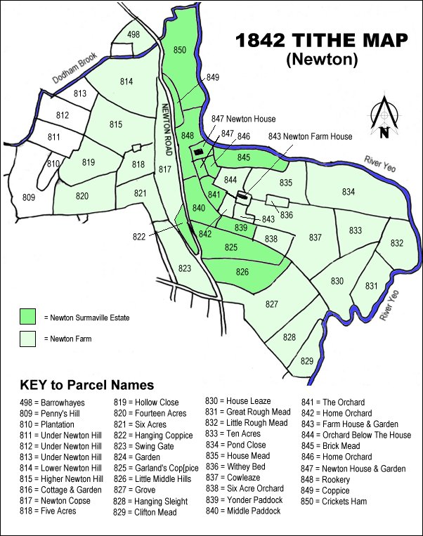
TThe 1842 Tithe Map showing the Newton Surmaville Estate shaded mid-green and the parcels of Newton Farm shaded light green. Grove (Parcel 827) is to the right at centre bottom.