Lower Parcroft
Lower Parcroft
A former part of the great West Field of Kingston Manor
Originally a part of the great medieval West Field of Kingston Manor, an ancient deed from the time of Richard II (reigned 1483-1485) refers to a parcel of land called Percrofte and Perecroft, meaning Pear Tree Croft (as with a similarly named field in Yeovil Marsh). Clearly, through time, this has become today's Parcroft.
Lower Parcroft (Parcel 1438) was a rectangular field on the southern side and halfway along the field access track known as Lower Larkhill Lane (today the eastern end of Stiby Road).
The 1846 Tithe Apportionment noted Lower Parcroft measured 2a 3r 8p and was used as pasture for grazing livestock. The Apportionment noted that the owner was John Glyde, a Yeovil linen draper, and the tenant was William Harrison. It was part of Marl Close Farm.
Lower Parcroft was bounded on the north by Parcroft Orchard (Parcel 1438 - also owned by Glyde and tenanted by Harrison), on the west by Middle Marle Close (Parcel 1440a), to the south by an un-named field (Parcel 1459) behind Grove Cottage and by Grove House and its orchard (Parcels 1460 and 1461) and to the east by Long Ground (Parcel 1436).
Today the former Lower Parcroft is occupied by the houses and gardens of Westfield Road and the southern section of Westfield Crescent.
For details on historic land measurement (ie acres, roods and perches) click here.
maps & Aerial Photographs

This map, based on the descriptions in the 1589 Terrier and the 1846 Tithe Map of Yeovil shows the approximate boundaries of the Manors of Kingston and Hendford as well as the manorial three-field system used in Kingston.
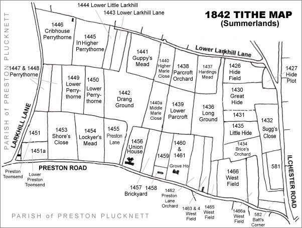
The Larkhill area reproduced from the 1842 Tithe Map. Lower Parcroft is right of centre.
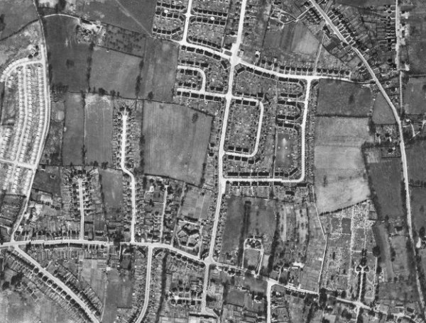
The 1946 aerial photograph - the southern section of Westfield Crescent was built on the former Lower Parcroft, right of centre of this photograph.
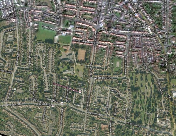
The same area today 'borrowed' from Google maps.
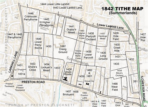
The 1842 Tithe Map superimposed (only very slightly out at the bottom) over a modern map.