Long Ground
Long Ground
A former part of the great West Field of Kingston Manor
The term 'ground' was generally applied to large areas of grassland lying at a distance from a farm. In Yeovil 47 parcels of land incorporated the word 'ground'.
Long Ground was a large rectangular field halfway between Preston Road and the field access track called Lower Larkhill Lane that would become today's Stiby Road (to which a spur of the field ran north to access the track). A similar spur had run south to Preston Road at one time but the southern portion of this had been sold off prior to 1846.
The 1846 Tithe Apportionment noted Long Ground as 7a 0r 36p and used as pasture for grazing livestock. The Apportionment noted that the owner was George Mayo and the tenant was William Buck.
Long Ground was bounded on the north by the field access track called Lower Larkhill Lane, on the west by Harding's Mead (Parcel 1437) and Lower Parcroft (Parcel 1439), to the south by Preston Lane Orchard (Parcel 1462) and West Field (Parcels 1463, 1464, 1465 and 1466) and to the east by Hide Field (Parcel 1426), Great Hide (Parcels 1430 and 1431), Little Hide (Parcel 1435) and Brice's Orchard (Parcel 1434).
Today the former northern spur of Long Ground is occupied by the houses and gardens on the eastern side of Westfield Grove while the bulk of the former field is occupied by the houses and gardens of the southern half of Westfield Grove and the southern half of Westfield Crescent.
For details on historic land measurement (ie acres, roods and perches) click here.
maps & Aerial Photographs
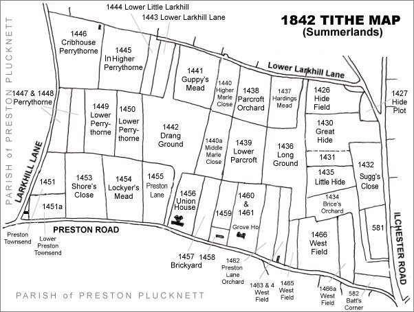
The Larkhill area reproduced from the 1842 Tithe Map. Long Ground is at right centre.
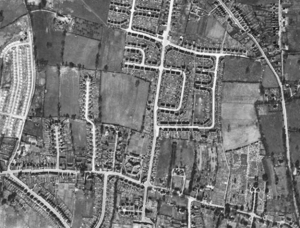
The 1946 aerial photograph - the former northern spur of Long Ground is occupied by the houses and gardens on the eastern side of Westfield Grove while the bulk of the former field is occupied by the houses and gardens of the southern half of Westfield Grove and the southern half of Westfield Crescent.
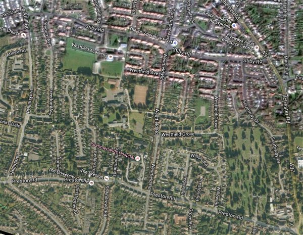
The same area today 'borrowed' from Google maps.
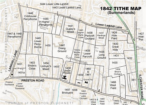
The 1842 Tithe Map superimposed (only very slightly out at the bottom) over a modern map.