Mary Street
Mary Street
A Victorian cul-de-sac
Mary Street is a short cul-de-sac on the north side of Reckleford Hill (today's Reckleford), halfway between The Avenue and Goldcroft. On the east side are several small Victorian houses while the west side is dominated by the large St Gildas' school building.
In earlier times there had been a couple of cottages at right angles to Reckleford Hill, but no road on the long, narrow site. It was bounded on the north by a large field called Cheeseman's Close (shown on the map below as Parcel 569). The site of what would become Mary Street was shown as parcel 546 on the 1842 Tithe Map (see below). In the 1846 Tithe Apportionment it was recorded that Parcel 546, 'Houses and Gardens', was owned by William Jones Prowse (the Lord of Kingston Manor) and the tenant was glove manufacturer William Bide who almost certainly sub-let the cottages to his workers.
Exactly when Mary Street was built is unknown, but it was certainly by 1875 and it is first shown on the Ordnance Survey map of 1886. At this time there was a terrace of four houses on the east side (later replaced by the St Gildas' school buildings). On the east side was a single house set back from the road, a terrace of eight houses and a final terrace of five houses. All the houses on the east side of Mary Street remain today. The northern terrace, unusually, has gardens in front of the houses instead of continuing the road. At the junction of Mary Street with Reckleford were a pair of semi-detached houses on either corner. These were demolished in the 1960s (see Gallery) in preparation for the widening of Reckleford.
Collins' Directory of 1907 listed 22 residents in Mary Street.
maps & Aerial photograph
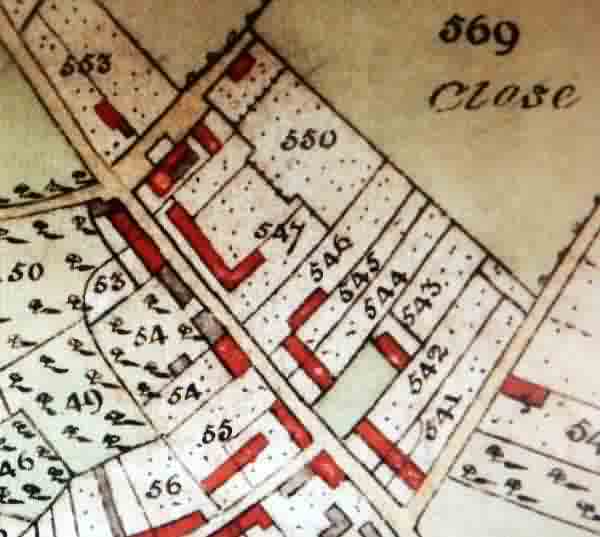
An extract from the 1842 Tithe Map of Yeovil by Edward Watts with Reckleford Hill running from top left towards bottom right. Mary Street was to be built on the parcel numbered 546. The cottages, shown as red, were probably occupied by the workers who worked for William Bide.
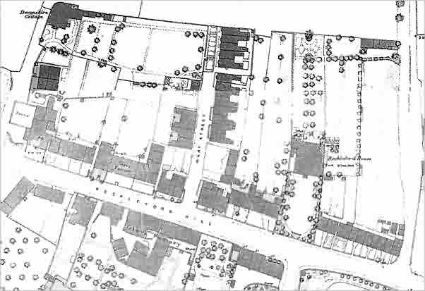
An extract from the 1886 Ordnance Survey map showing Mary Street at centre and running north from Reckleford Hill (today's Reckleford). At extreme left is the track leading to Devonshire Cottage (later rebuilt as The Avenue) and at extreme right the nascent Goldcroft.
 "
"
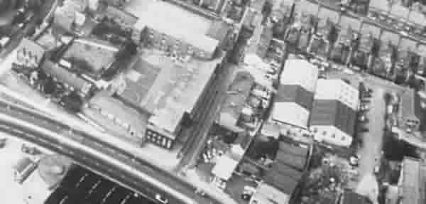
An aerial photograph of Mary Street (at centre) of around 1980.
gallery
From the Cave
Collection
(colourised),
Courtesy of South Somerset Heritage Collection
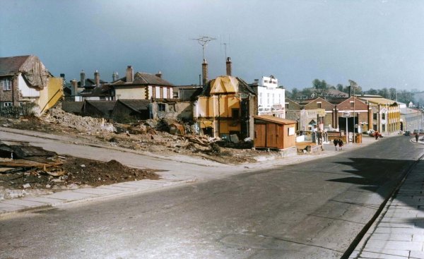
Demolition works in readiness to convert Reckleford to dual carriageway in the early 1960s. At left houses at the end of Mary Street have gone.
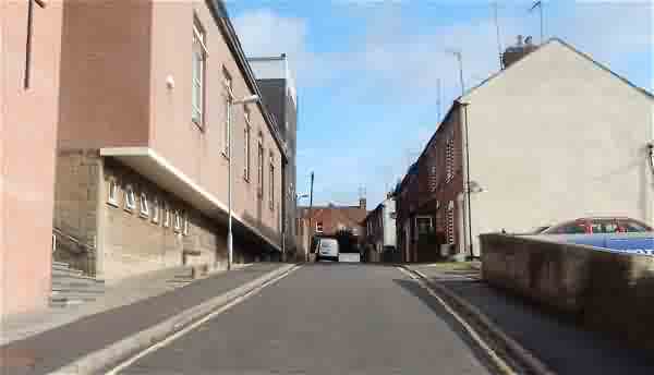
Mary Street seen from Reckleford with St Gildas at left. Photographed in 2016.
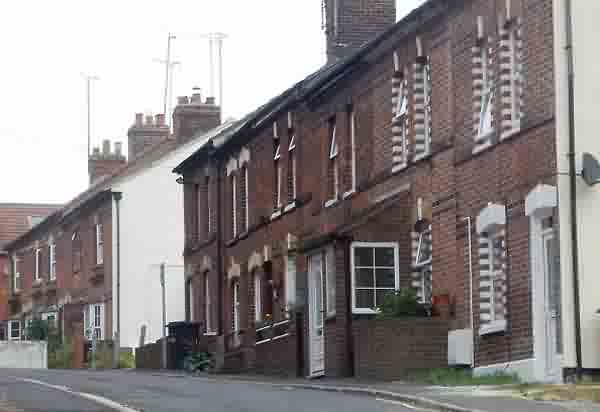
The surviving Victorian terraces in Mary Street. Photographed in 2016.