reckleford
reckleford
Once a quiet country lane, now a busy dual carriageway
At one time a small brook called the Rackel or Rackle, little more than an open sewer, had crossed the road close to the Pall Tavern and was shallow enough to be forded, hence the early name of Market Street for hundreds of years was Rackleford, or Reckleford - not to be confused with today's Reckleford. Indeed, even as late as the 1871 census the enumerator still listed today's Market Street as 'Reckleford formerly called Rotten Row'.
Reckleford originally started at the junction with Higher Kingston at the crossroads with Court Ash Terrace and what would become The Avenue in the west. From here it was known as Reckleford Hill as far as Goldcroft, beyond which it was known as Lower Reckleford, later just Reckleford, until it joined with Sherborne Road close to Sun House. The area around the junction of today's Reckleford and Market Street was known as Reckleford Cross after a wayside cross that had existed into the early nineteenth century.
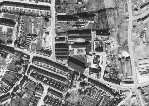
At the junction with Market Street, the area was known as Reckleford Cross because in earlier times a wayside cross had stood there. In Victorian times Reckleford Hill was built up on both sides, with a couple of large glove factories on the south side. On the north side were small houses all the way from the Black Horse to Goldcroft and then just fields as far as Eastland Road, then known as Kiddles Lane, until William Bide built his leather factory in 1850 - seen on the map below as 'Dressing Yard' - with cottages for his workers on Reckleford. In 1876 the Reckleford Board School opened - marked 'School' on the map. On the south side of Lower Reckleford was a large space occupied by orchards and later occupied by Salisbury Terrace, then a terrace of houses, Reckleford Terrace, that reached as far as the Glovers Arms.
In 1913 the Nautilus Works were completed on the north side of Reckleford, while on the south side Salisbury Terrace had been built in the 1890s.
Reckleford as we know it today has changed out of all recognition in the past fifty years or so. In the 1970s, with the building of the new District Hospital and the 'improvement' of Reckleford to dual carriageway standard, plus its extension to the new Hospital Roundabout, meant the destruction of much of this area of Yeovil. Bide's Gardens were lost to both the hospital and the Reckleford extension. Much of the north side of Reckleford remained although Bide's cottages near Eastland Road were sacrificed, as was Salisbury Terrace, for the widening of Reckleford. On the south side of Reckleford Hill, everything was demolished for the widening of Reckleford including the glove factories and the Nag's Head Inn. The terrace of houses close to the Glovers Arms were demolished for the new ambulance and fire stations.
map
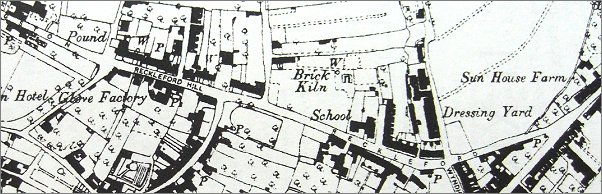
This 1890 Ordnance Survey map shows the entire length of Reckleford at the time - from its junction with Higher Kingston at the crossroads with Court Ash Terrace and what would become The Avenue in the west, to its junction with Sherborne Road in the east.

A street map of Yeovil dating to the early 1970s, at which time Reckleford joined Higher Kingston at the junction with the Avenue. Reckleford did not follow its current route through to Kingston until it was made dual carriageway in 1974-5.
gallery
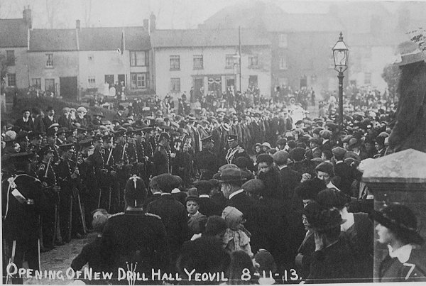
This photograph shows the ceremony of opening the new Drill Hall in Southville on 8 November 1913 photographed from Southville looking across to Reckleford. This makes it the only photograph I know that shows the houses on the south side of Reckleford seen here in the background. These were demolished and the area had a single large house, seen in the following photograph, built on it. The area is now the triangular pedestrian area / flower beds at the junction of Sherborne Road, Reckleford and Townsend.
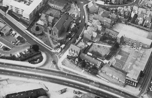
This interesting aerial photograph, probably taken during the early 1960s, shows the junction of Reckleford and Sherborne Road at lower left, the house at the junction (now a pedestrian / flowerbed area), the Duke of Wellington at lower right and the industrial units between the Sherborne Road houses and Wyndham Hill at top right.
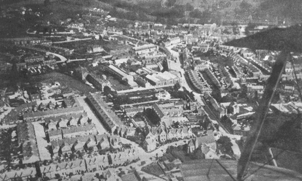
A 1919 aerial photograph taken from a biplane - its wing-tips and strut are seen at right. At the end of the lower wing-tip is the Church of the Holy Ghost and running across the bottom of the photograph is The Avenue. Running from the lower wing-tip towards the top of the photograph is Reckleford with the Nautilus Works at centre and Salisbury Terrace opposite.
An aerial photograph dating to 1975 shows the Black Horse at the centre with the three dormers on the junction of The Avenue running to top centre. Reckleford, newly made into a dual carriageway, snakes across the lower half of the photograph while Higher Kingston comes down from the top left, past the Catholic Church of the Holy Ghost. Originally at this point Higher Kingston ended and Reckleford Hill started, its original course marked by the line of remaining buildings starting with the Black Horse.
An aerial view taken in 1928 showing the Nag's Head Inn (white building at centre) facing Reckleford with Court Ash Terrace just visible at the right hand edge of the photo. Note the two glove factories of Thring & Luffman to the left of the Nag's Head - now all roughly where the Reckleford central reservation is, just in front of the large vacant plot that was the cattle market.
From the Cave
Collection
(colourised),
Courtesy of South Somerset Heritage Collection
This photograph, taken in the early 1960's looks down Reckleford Hill from the Avenue / Court Ash Terrace crossroads. The entrance to the Avenue is at left with the sign of the Black Horse evident on the corner. At right is the entrance to Court Ash Terrace - this section of Court Ash was closed a short while after this photograph was taken and the whole area including the top section of Court Ash Terrace as well as all the buildings to the Nags Head was redeveloped as part of the widening of Reckleford.
From the Cave
collection (colourised). Courtesy of South Somerset Heritage Collection
This photograph, of the early 1960s, was taken from the entrance to the Avenue with Reckleford running across the photograph. The houses are the cottages at the northeast corner of Court Ash Terrace. At right, the tree is in Bide's Gardens.
From the Cave
Collection
(colourised),
Courtesy of South Somerset Heritage Collection
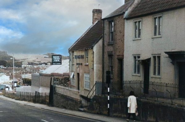
Another 1960's photograph giving a bit more of the view of Reckleford Hill. Immediately beyond the Nags Head Inn are the buildings of the animal market.
From the Cave
Collection
(colourised),
Courtesy of South Somerset Heritage Collection
A little further on, and Reckleford is seen from alongside the animal market at right.

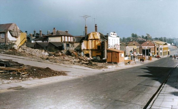
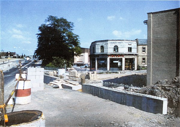
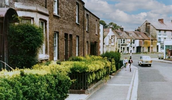
This colourised photograph dates to the early 1960s and shows the junction of Market Street, at left, with Reckleford, as the buildings shown were being prepared for demolition. This whole area was known as Reckleford Cross since at one time a wayside cross stood in the middle of the road at this point.
From the Cave
Collection
(colourised),
Courtesy of South Somerset Heritage Collection
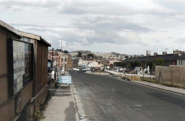
This view of Reckleford, of around 1963, is taken from near the cattle market and looks east. On the right, Reckleford Terrace has been demolished for the new ambulance and fire stations, exposing Ceil Street which, until this time had been hidden away as a back street.
From the Cave
Collection
(colourised),
Courtesy of South Somerset Heritage Collection
Photograph of the 1960s, showing the construction of the new fire and ambulance stations on Reckleford. The houses of Salisbury Terrace, at the right, would soon be demolished for the widening of Reckleford. That the widening is already planned at this time is evidenced by the dwarf wall built outside the fire station which, today, is just a path-width away from the dual carriageway.
From the Cave
Collection
(colourised),
Courtesy of South Somerset Heritage Collection
Again, photographed in the 1960s, the construction of the new fire and ambulance stations near completion.
From the Cave
Collection,
Courtesy of South Somerset Heritage Collection
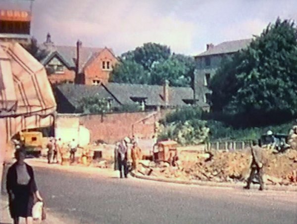
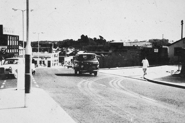
Demolition works in readiness to convert Reckleford to dual carriageway in the early 1960s. At left houses at the end of Mary Street have gone. Reckleford House (at this time the offices of the Ministry or National Insurance) left of centre, will soon be demolished.
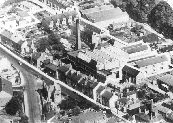
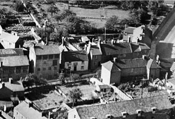
A 1946 aerial view of the Nautilus Works at centre, sandwiched between Goldcroft at left of centre, Dampier Street at right of centre and Reckleford running across the photograph. Notice how narrow Reckleford is.
This
photograph
features in my
book "Lost Yeovil"
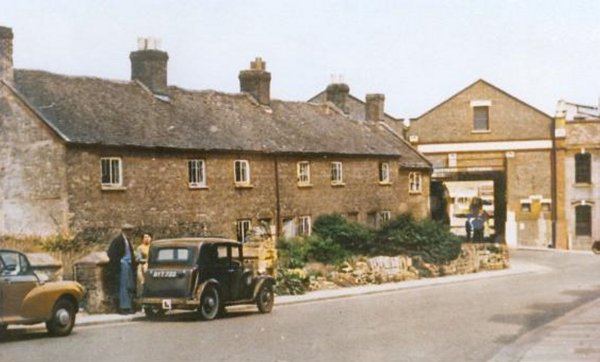
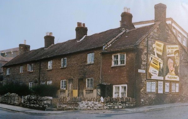
Cottages on Reckleford by Goldcroft. Photographed in the early 1960s. These were demolished soon after this photograph was taken. In the 1840s all the cottages were owned by bright smith (silver smith) George Rendell, who rented them out. One of them (not sure which) was later the grocery and bakery of Henry C Tomkins.
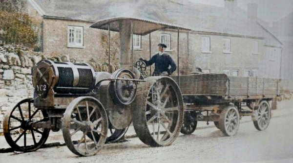
A colourised photograph of a Petter oil traction engine, posing for the camera outside the cottages of the previous photograph in 1911. The signwriting on the trailer reads "WH Snook, Hauling Contractor, Yeovil".
.... and the same cottages seen from the other direction.
From the Cave
Collection
(colourised),
Courtesy of South Somerset Heritage Collection
Looking down Reckleford in the early 1960's with Goldcroft and the Nautilus Works at left and Salisbury Terrace at right. Salisbury Terrace would soon be demolished for the widening of Reckleford to dual carriageway. As seen by the wide expanse of footpath at lower left, the cottages of the previous photograph have already gone.

Reckleford seen from the hospital in a colourised photograph of around 1970.
Courtesy of the
Western Gazette
The construction of the Princes Street pedestrian underpass in 1975.
Courtesy of the
Western Gazette
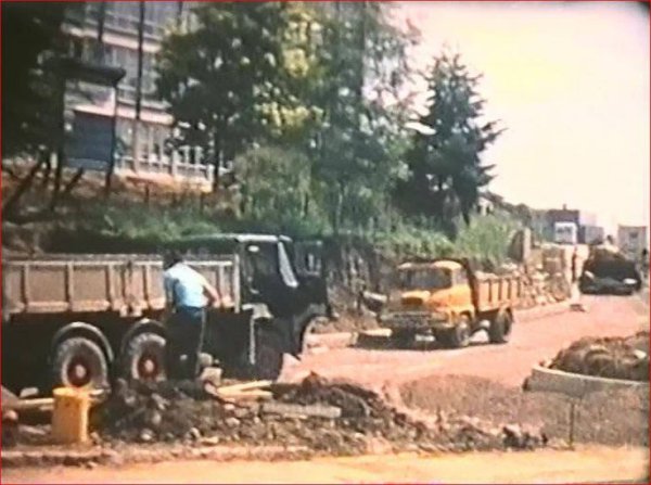
The construction of Reckleford at the end of Princes Street in 1975.
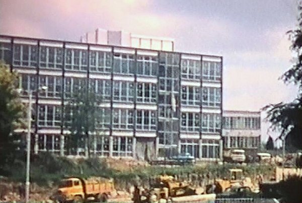
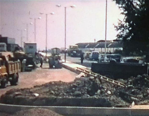
Constructing Reckleford as dual carriageway in front of the maternity unit.
Constructing Reckleford as dual carriageway near the junction with Kingston with the maternity unit in the background.
Constructing Reckleford as dual carriageway with the maternity unit in the background.
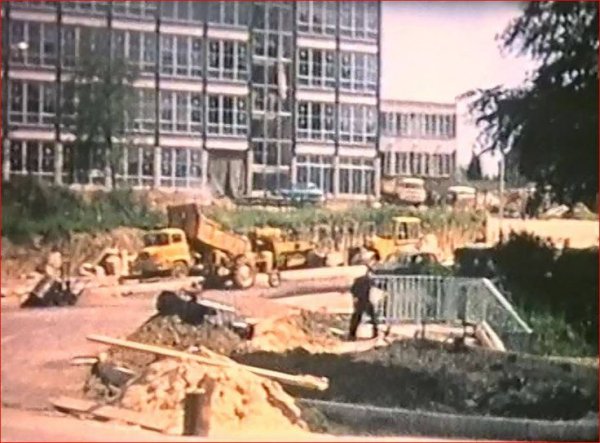
Constructing Reckleford as dual carriageway with the market buildings in the background.
Constructing the hospital - this shows Kingston and the site of the recently demolished Red Lion.
Courtesy of
Chris White
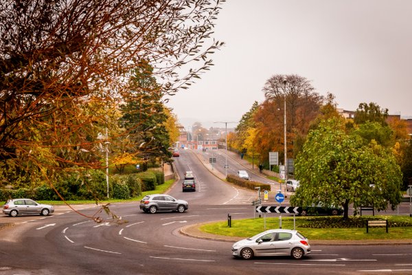
The Hospital Roundabout, photographed in 2013.
Courtesy of
Chris White
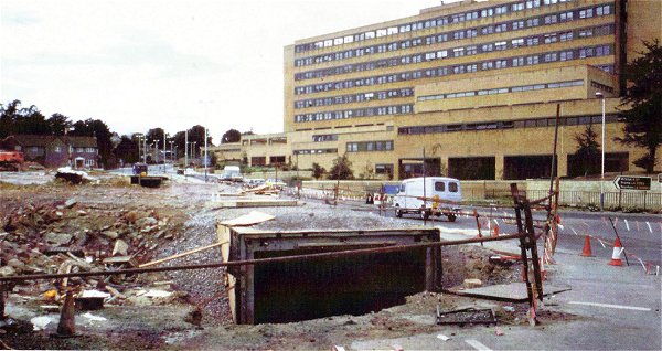
The Hospital Roundabout, photographed in January 2016 before the 'improvements'.
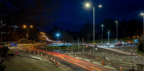
Courtesy of
Chris White
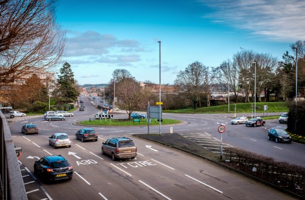
The Hospital Roundabout, photographed in March 2016 during the alterations.

Photograph
(colourised) by
Geoff Bowler,
courtesy of Sue
Bowler
Looking down Reckleford towards the Nautilus Works with Wyndham Hill in the background left of centre. Photographed in 1969.

Photograph
(colourised) by
Geoff Bowler,
courtesy of Sue
Bowler
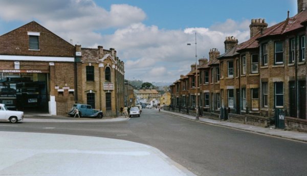
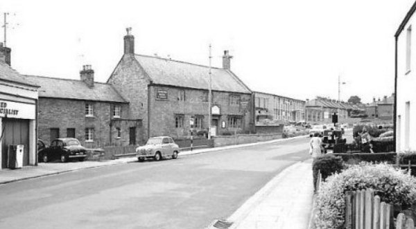
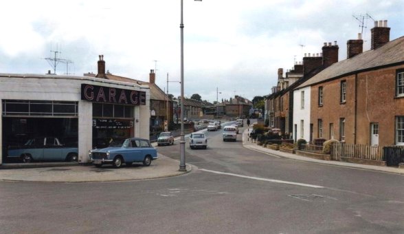
Further down Reckleford, by the junction of Market Street. Photographed in 1969. What a brilliant mini ice cream van.

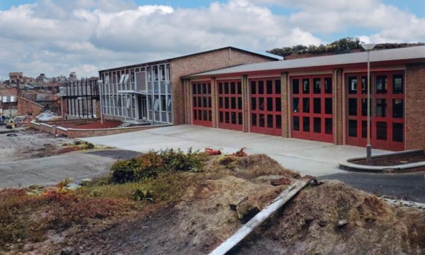
The Reckleford fire station in a colourised photograph of 1984.
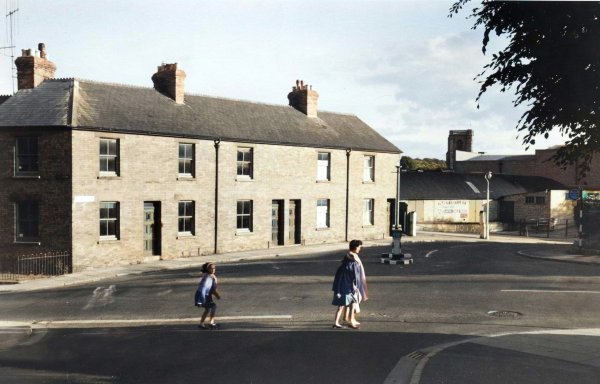
This colourised photograph, taken in 1960, shows Reckleford Terrace (immediately right of the Glovers Arms) that was demolished for the widening of Reckleford and the construction of the ambulance and fire stations that opened in 1962. In the distance, Salisbury Terrace was demolished shortly thereafter for the Reckleford widening as were the cottages at right – built around 1850 by William Bide to house workers in his glove factory.
This photograph was taken in the mid 1960's. Reckleford was obviously a little wider than is apparent in the photograph above but was about to become much wider as the cottages at right in this photograph were demolished so that Reckleford could be widened even further into the dual carriageway it is today. Note too that Salisbury Terrace and the terrace next to the Glovers Arms, seen in the previous photograph, have now gone.
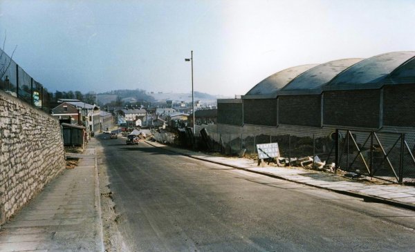
Single carriageway Reckleford photographed in the early 1960s.
From the Cave
Collection
(colourised),
Courtesy of South Somerset Heritage Collection
A colourised photograph of around 1960. The cottages at left were demolished for the widening of Reckleford.
From the Cave
Collection
(colourised),
Courtesy of South Somerset Heritage Collection
Single-carriageway Reckleford in the 1960s, seen from Wyndham Street.

From the Cave
Collection
(colourised),
Courtesy of South Somerset Heritage Collection
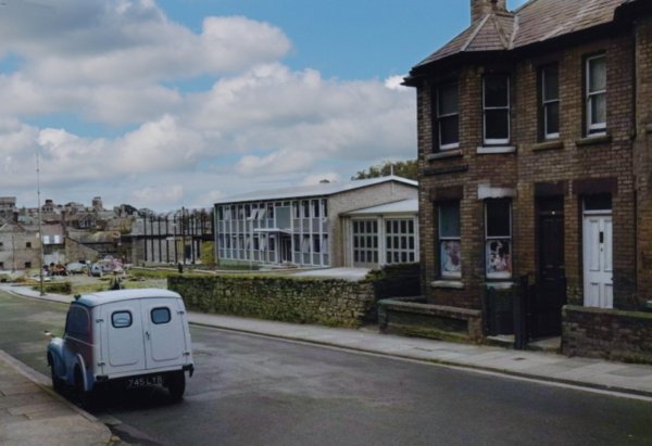
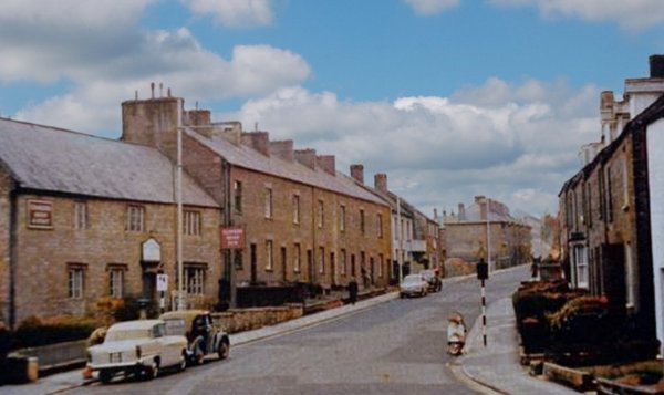
Reckleford at the junction with Eastland Road. Within the decade the house at the left was demolished for the widening of Reckleford to dual carriageway standard. Reckleford School, seen at the right, remains today. Photographed in the 1960s.

This
colourised
image
features in my
book 'Yeovil
- The Postcard
Collection'.
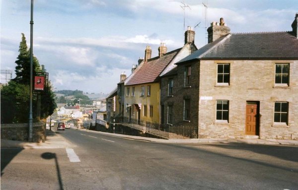
The junction of Reckleford and Wyndham Street (at right) seen in a postcard sent in 1969.
Courtesy of Mark
Rowe
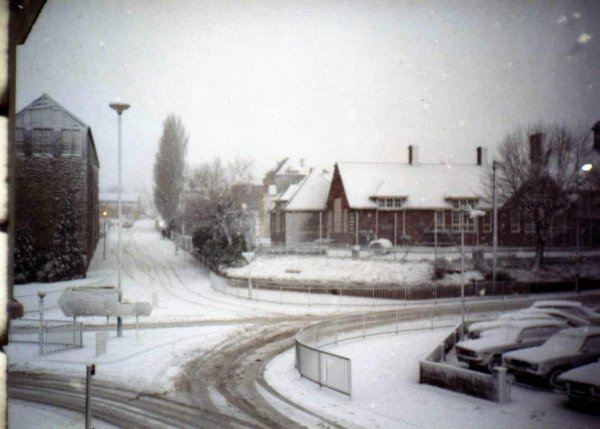
The junction of Eastland Road, Reckleford and Wyndham Street during winter 1982.
Courtesy of
Chris Rendell
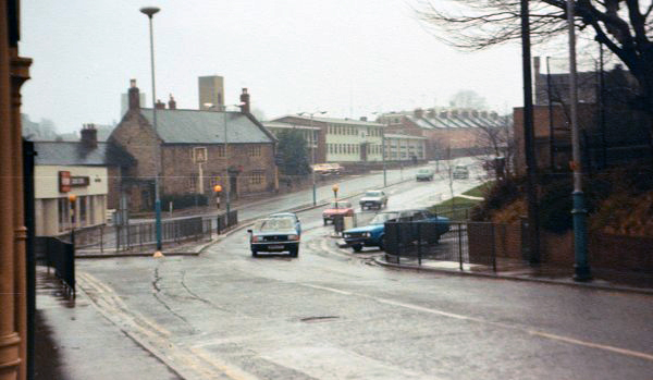
The dual carriageway, less central reservation barriers, photographed in 1983.
Courtesy of Mark
Fraser
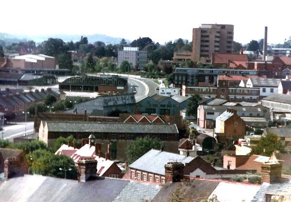
Reckleford, at the centre of this 1983 photograph, is seen from the top of Wyndham Hill.
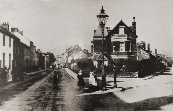
This is probably the earliest photograph of Reckleford and dates to about 1890. It is taken from Sherborne Road with that part of the old London Road, known as Townsend, running off to the left and Reckleford runs off to the right. This view is completely unrecogniseable today with the large house on the corner now the site of gardens, pedestrian walkways and traffic lights, (and seen in the first aerial photograph above) while the row of houses at left were demolished in the 1970s. Note the single, large Sugg lamp.