PArk WAY
Park WAY
Footpath joining Kingston and Park Road
Originally known
as Thomas' Yard,
Park Way was
essentially a
footpath entered
from
Kingston
via a
porte-cochere
two doors from
the
White Lion
public house.
There was a
dog-leg lit by a
lamp post when
it met the rear
gardens of
villas in
Park Road
whence it
continued, via a
smaller
porte-cochere,
as a narrow
alleyway to Park
Road close to
the
Armoury.
It was named as
"late Thomas'
Yard" in the
1861, 1871 and
1881 census and
as
“Thomas’s Yard
(now known as
Park Way)” in
the 1891 census.
Park Way
disappeared with
the widening of
Kingston and the
construction of
Queensway
in 1976.
MAP
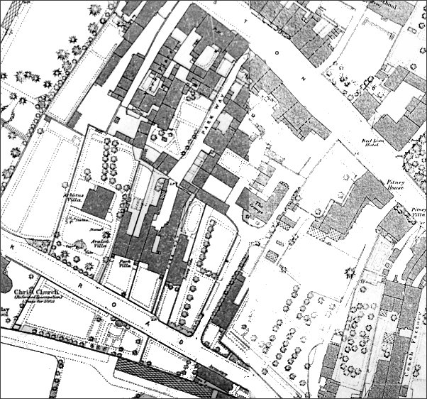
This map, based on the 1886 Ordnance Survey, shows Park Way at top centre, running south from Kingsway via a porte-cochere, then turning 90° at the lamp post (just visible as 'LP'), through another porte-cochere before turning 90° again, through a third porte-cochere then running as a narrow footpath between buildings and entering Park Road at bottom centre (by the 'A' in 'ROAD').
Gallery
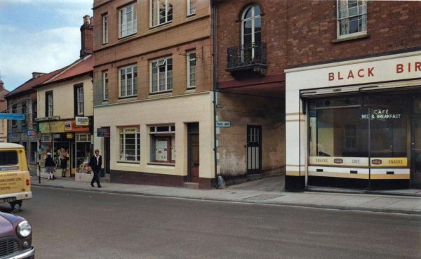
From the
Cave
Collection
(colourised).
Courtesy of South Somerset Heritage Collection
At centre is the Kingston entrance to Park Way (it even has a street nameplate) - through the porte-cochere next to the Black Bird Café. Photographed in the mid-1960s.