Pittard's Ground
Pittard's GRound
A field within the great manorial East Field
Pittard's Ground (Parcel 968) was a five-acre field, rising steadily from north to south, originally within the great East Field of the Manor of Kingston.
This was possibly land owned by William Pyttarde, recorded in the 1548 Return of Chantries as the occupant of a tenement at 'Estlambroke, a property of the Chantry of the Holy Cross within St John's parish church.
At the time of the 1846 Tithe Apportionment, Pittard's Ground was owned by John Tanner Whiteley Pitcher (Pitcher was the 'natural' son of William Row and lived at East Chelborough, Dorset) and let to John Brook the Younger. Pittard's Ground was used as pasture for grazing livestock. It measured 5a 1r 19p.
Pittard's Ground was bounded on the north by Great Hather Mead (Parcel 960), on the west by Louse & Jeanes Field (Parcel 976), on the south by Penny's Orchard (Parcel 975) and Penny's Close (Parcel 972) and on the east by East Field (Parcel 967).
Today the former Pittard's Ground is occupied by a short distance of the houses and gardens of both sides of Rosebery Avenue, as well as the entirety of Sydling Road.
For details on historic land measurement (ie acres, roods and perches) click here.
maps

This map, based on the descriptions in the 1589 Terrier and the 1846 Tithe Map of Yeovil shows the approximate boundaries of the Manors of Kingston and Hendford as well as the manorial three-field system used in Kingston.

A map of the great medieval East Field of Kingston Manor showing conjectured locations of several fields based on descriptions in the 1589 Terrier.
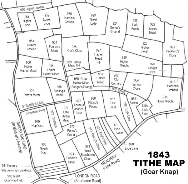
Drawn from the 1846 Tithe Map with field names added from the 1846 Tithe Apportionment, with Pittard's Ground just below the centre (yes, I know I spelt it Pittard's Pound on the map).
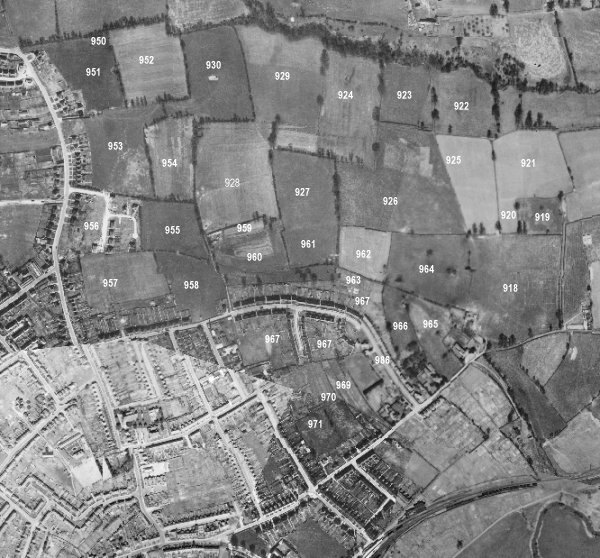
The 1946 aerial survey photograph (somewhat mis-aligned at bottom left) with parcel numbers of 1846 plotted on. By this time, however, Sydling Road had been built and completely occupied the former Pittard's Ground.
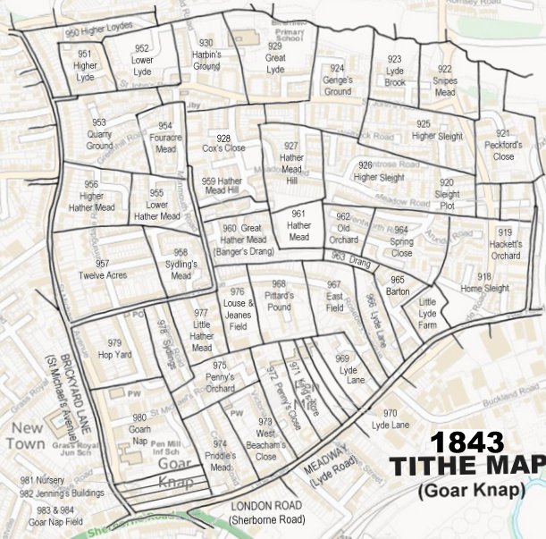
The 1843 Tithe Map overlaid onto a modern map of the area.
gallery
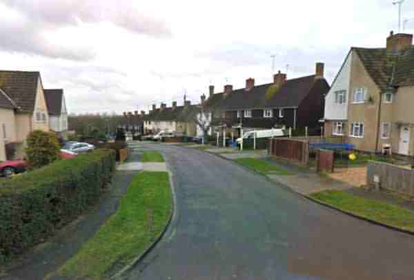
Sydling Road seen from Rosebery Avenue - the road, together with the houses and gardens both sides, occupy almost all of the former Pittard's Ground.