salisbury Terrace
salisbury terrace
Built for glove-trade workers
 Salisbury
Terrace, on
Reckleford, was
built by
William Tucker
in the 1890s on
waste land
lying between
Reckleford and
Vicarage Street
as shown on the
maps below.
John Neal's
rope works
were in Reckleford
and a rope walk
is shown running
parallel to
Reckleford Hill
on Watt’s map of
1831. It was on
the south side
of today's
Reckleford,
opposite
Goldcroft, but
in 1848 his rope
factory was
destroyed by
fire. Salisbury
Terrace, built
on the site of
the old rope
works, fronted
onto Reckleford
but had
Cecil Street
immediately
behind it. Both
Cecil Street and
Salisbury
Terrace were
named after the
Prime Minister
of the time,
Lord Salisbury,
whose family
name was Cecil.
Salisbury
Terrace, on
Reckleford, was
built by
William Tucker
in the 1890s on
waste land
lying between
Reckleford and
Vicarage Street
as shown on the
maps below.
John Neal's
rope works
were in Reckleford
and a rope walk
is shown running
parallel to
Reckleford Hill
on Watt’s map of
1831. It was on
the south side
of today's
Reckleford,
opposite
Goldcroft, but
in 1848 his rope
factory was
destroyed by
fire. Salisbury
Terrace, built
on the site of
the old rope
works, fronted
onto Reckleford
but had
Cecil Street
immediately
behind it. Both
Cecil Street and
Salisbury
Terrace were
named after the
Prime Minister
of the time,
Lord Salisbury,
whose family
name was Cecil.
William Tucker was a glover who ran the Glovers Arms from at least 1871 until his death at the turn of the century. However he was an entrepreneur with wide interests and he expanded into glove manufacturing, having invested in the business of F Blake & Co just a few doors along in Reckleford.
When William began investing in town development and providing housing for glove workers, he named two of the roads he built after members of his family; Earle Street after his son and Vincent Street, as well as Vincent Place, after his wife's maiden name. The rest of the development were Cecil Street and Salisbury Terrace in Reckleford.
Other developments William initiated, which were continued and expanded after his death in 1899 by his son, William Earle Tucker, included Victoria Road, St Michael's Road, and Lyde Road.
Salisbury Terrace was demolished in the early 1960s for the widening of Reckleford.
MAPs
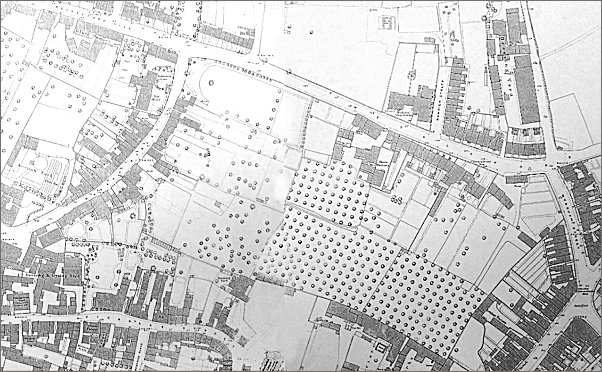
Map based on the 1886 Ordnance Survey showing the undeveloped area between Reckleford, seen running across the top of the map, and Vicarage Street in the lower left corner.
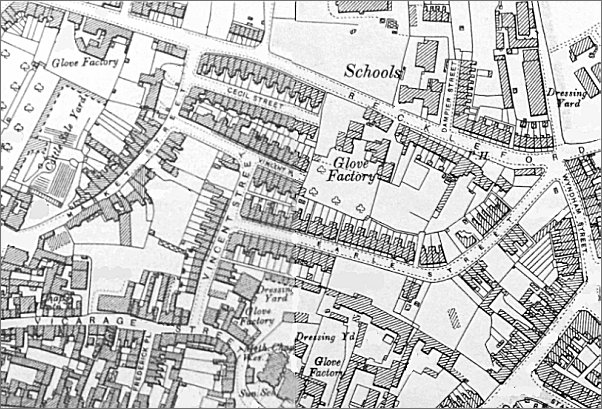
Map based on the 1901 Ordnance Survey showing the same area developed with Earle Street, Vincent Street, Vincent Place and Cecil Street. Salisbury Terrace is to the north of Cecil Street.
gallery
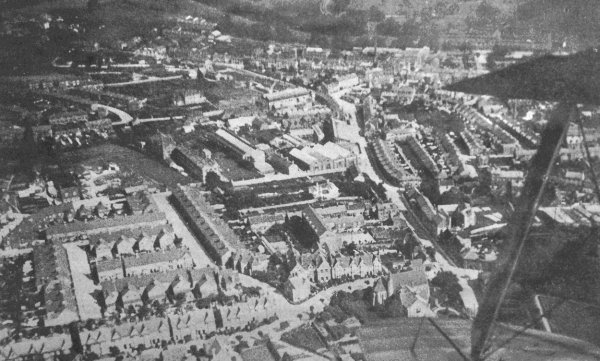
A 1919 aerial photograph taken from a biplane - its wing-tips and strut are seen at right. At the end of the lower wing-tip is the Church of the Holy Ghost and running across the bottom of the photograph is The Avenue. Running from the lower wing-tip towards the top of the photograph is Reckleford with the Nautilus Works at centre and Salisbury Terrace opposite.

From my
collection
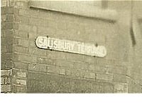
A colourised postcard, probably taken during the 1930s, of a house in Salisbury Terrace - note the street nameplate affixed to the wall of the house. Note too the iron railings surmounting the garden wall; most properties had such railings which were removed during the Second World War for the war effort and today many streets have the remnants of railings.
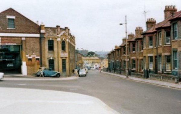
Looking down Reckleford in the early 1960's with Goldcroft and the Nautilus Works at left and Salisbury Terrace at right. Salisbury Terrace would soon be demolished for the widening of Reckleford to dual carriageway.
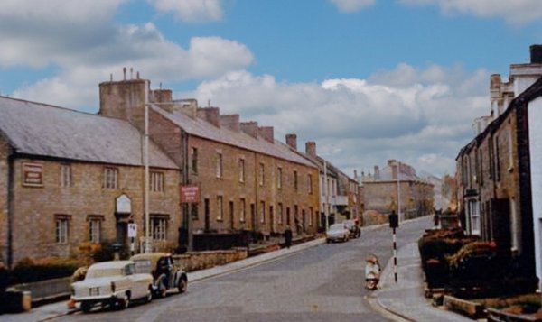
This photograph, taken in 1960, shows the terrace of houses that were demolished for the widening of Reckleford and the construction of the ambulance and fire stations that opened in 1962. In the distance, Salisbury Terrace was demolished shortly thereafter for the Reckleford widening as were the cottages at right – built around 1850 by William Bide to house workers in his glove factory.
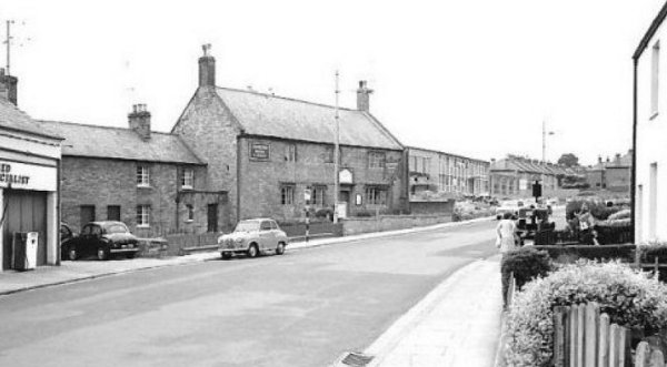
This photograph was taken in the mid 1960's. Reckleford was obviously a little wider than is apparent in the photograph above but was about to become much wider as the cottages at right in this photograph were demolished so that Reckleford could be widened even further into the dual carriageway it is today. Note too that Salisbury Terrace, seen in the previous photograph, has now gone.