Spring Close
Spring Close
A field within the great manorial East Field
Spring Close (Parcel 964) was a very steep six-acre field on the southern flank of the hill known as The Down.
At the time of the 1846 Tithe Apportionment, Spring Close (Parcel 964) was owned by Sarah Rose and let to Charles Marsh. It was used as pasture for grazing livestock. It measured 6a 1r 37p.
Spring Close was bounded on the south by Drang (Parcel 963) and Barton (Parcel 965), on the east by Home Sleight (Parcel 918), on the north by Lower Sleight (Parcel 926) and on the west it was bounded by Old Orchard (Parcel 962).
Today the former Spring Close is occupied by the houses and gardens at the eastern ends of Woburn Road, Wentworth Road and Marlborough Road, together with the western half of Arundel Road.
For details on historic land measurement (ie acres, roods and perches) click here.
maps

This map, based on the descriptions in the 1589 Terrier and the 1846 Tithe Map of Yeovil shows the approximate boundaries of the Manors of Kingston and Hendford as well as the manorial three-field system used in Kingston.

A map of the great medieval East Field of Kingston Manor showing conjectured locations of several fields based on descriptions in the 1589 Terrier.
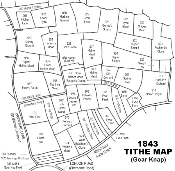
Drawn from the 1846 Tithe Map with field names added from the 1846 Tithe Apportionment, with Spring Close at centre right.
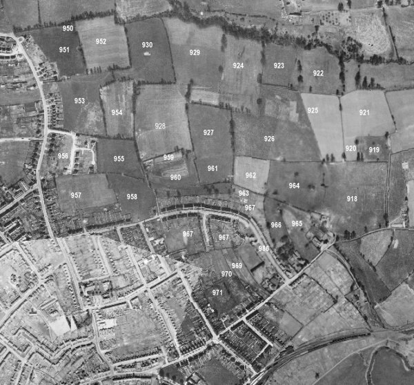
The 1946 aerial survey photograph (somewhat mis-aligned at bottom left) with parcel numbers of 1846 plotted on. At this time, Spring Close (marked with '964' on this photograph) remained as an open field.
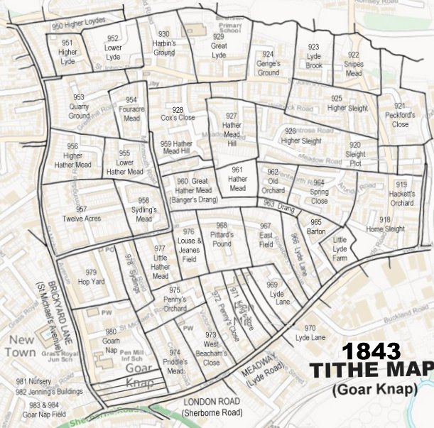
The 1843 Tithe Map overlaid onto a modern map of the area.
Gallery
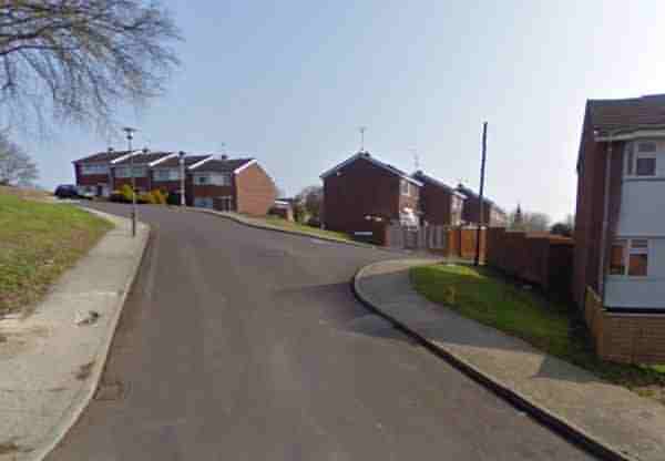
Woburn Road seen from its junction with Marlborough Road - at the left are seen the rear of the houses in Wentworth Road. This would have been the north-eastern corner of Spring Close and, together with the following photograph, gives an indication of how steep the area is. All the houses in this photograph are three storeys tall on their southern elevations, but two storeys high on their northern aspect.
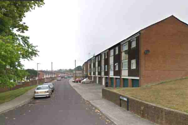
Wentworth Road, at the right, seen from its junction with Marlborough Road. Again, this photograph gives an indication of how steep the area is. This would have been the centre of the former Spring Close.
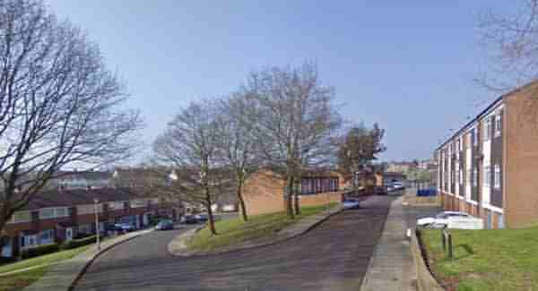
Seen from Marlborough Road and looking north towards its junction with Meadow Road (just off-photo at extreme left), this image shows the junction with Arundel Road at the centre. This would have been from the centre of Spring Close and looking towards its eastern half.