stoney lake
stoney lake
Part of the three-field system in the Manor of Kingston
The 'stoney' part of the name is self-evident, whereas the 'lake' part of the name comes from the Old English lacu, meaning a slow-flowing stream and in this case referring to the Lyde brook.
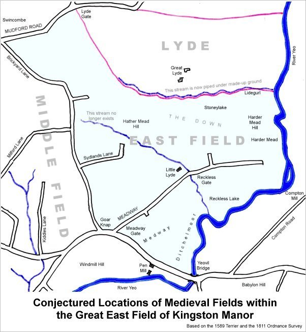
The 1589 Terrier indicates the three great fields - west, middle and east - as shown on the map below, and Stoney Lake or Stone Lake was described as being in East Field - ".... before the Meadway (the southern part of today's Lyde Road) by the river towards Yeo. Bridge and upwards to the lower part of the Harde Mead and from thence upward between the lands of Thos. Phelps the east side of the lands of Francis Beacham on the west side to the bounding of Stonylake and from Stonylake down by Lidegurl to the great River and so upwards from the great river to Compton Mill aforesaid being the rest of the Down and Harder Mead Hill bounding upon Lide.... "
Stoney Lake is thought to have been later subdivided into Lyde Brook (Parcel 923), Snipe's Mead (Parcel 922) and the northern part of Peckford's Close (Parcel 921).
map

This map, based on the descriptions in the 1589 Terrier and the 1846 Tithe Map of Yeovil shows the approximate boundaries of the Manors of Kingston and Hendford as well as the manorial three-field system used in Kingston.

A map of the great medieval East Field of Kingston Manor showing conjectured locations of several fields based on descriptions in the 1589 Terrier.