Peckford's close
Peckford's Close
A field within the great manorial East Field
Peckford's Close (Parcel 921) was a large field originally within the great East Field of the Manor of Kingston.
The northern part of Peckford's Close, together with Lyde Brook (Parcel 923) and Snipe's Mead (Parcel 922) are thought to have originally been the area known as Stoneylake which the 1589 Terrier refers to "the bounding of Stonylake and from Stonylake down by Lidegurl". The 'stoney' part of the name is self-evident, whereas the 'lake' part of the name comes from the Old English lacu, meaning a slow-flowing stream and in this case referring to the Lyde brook, or Lyde Gurl.
It was, presumably, a detached field of Little Lyde Farm since the farm was referred to as Peckford's Farm in the 1743 Terrier.
At the time of the 1846 Tithe Apportionment Peckford's Close was owned by John Tanner Whiteley Pitcher and let to John Green. It measured at 6a 3r 5p and was used as pasture for grazing livestock with a northern spur running to the Lyde brook giving access to water.
It was bounded on the west by Snipe's Mead (Parcel 922) and Higher Sleight (Parcel 925), to the south by Sleight Plot (Parcel 920), Hackett's Orchard (Parcel 919) and Kiln (Parcel 913) and to the east by Hanging Ground (Parcel 909) and On Down (Parcels 912 and 912a).
By the time of the 1946 aerial photograph seen below, Peckford's Close remained an open field.
I surveyed the field in 1975 prior to designing the houses built on it and at this time it was just waste ground and Lyde Road had already been built through its southwest corner. Today it contains houses and gardens of the eastern side of Lyde Road - almost from Pembroke Close and running north to just before the new roundabout.
For details on historic land measurement (ie acres, roods and perches) click here.
maps

This map, based on the descriptions in the 1589 Terrier and the 1846 Tithe Map of Yeovil shows the approximate boundaries of the Manors of Kingston and Hendford as well as the manorial three-field system used in Kingston.

A map of the great medieval East Field of Kingston Manor showing conjectured locations of several fields based on descriptions in the 1589 Terrier.
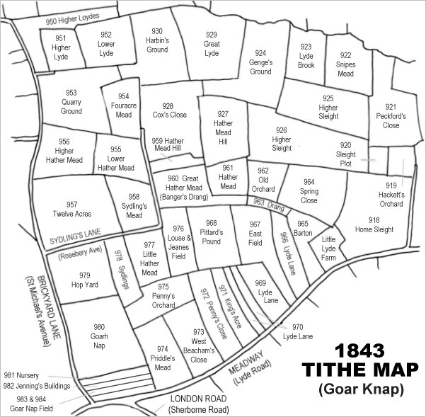
Drawn from the 1846 Tithe Map with field names added from the 1846 Tithe Apportionment, with Peckford's Close (Parcel 921) at top right.
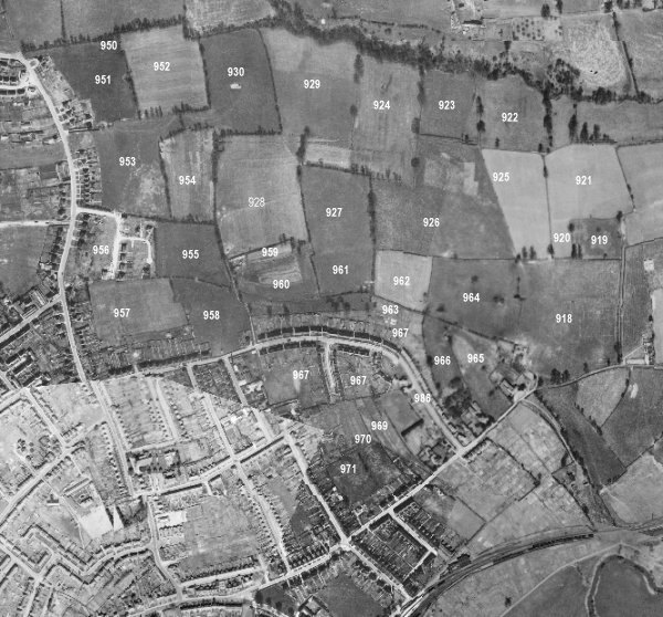
The 1946 aerial survey photograph (somewhat mis-aligned at bottom left) with parcel numbers of 1846 plotted on.
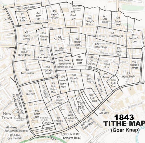
The 1843 Tithe Map overlaid onto a modern map of the area.