sunhouse Orchard
sunhouse Orchard
The 'home' orchard of Sun House Farm
The 1743 Terrier records Sun Orchard as half an acre, being the home orchard of Sun House Farm, later the Sun House Inn (see which for early owners/occupiers, etc.). The lands occupied by Sun House Farm were quite extensive, extending to as far as St Michael's Avenue in the east and probably beyond almost to the River Yeo. As well as this 'home' orchard, the farm also had Rowe's Orchard and Hill Orchard. The Turnpike Minutes 1753-1810 refer to the distance "Kingston Gate to Sunhouse 5 furlongs". (Note: 5 furlongs = 1,100 yards or 1,005.8m).
The 1846 Tithe Apportionment recorded Sunhouse Orchard as Parcel 523, with the house, gardens, etc. as Parcel 524. The Apportionment noted that both Parcels 523 and 524 were owned by John Tanner Whiteley Pitcher ('natural' son of William Row) and the tenant was John Brook the Younger. Parcel 523 was described as pasture, measuring 1a 2r 0p, the house and garden measured 0a 2r 10p.
Sunhouse Orchard was bounded on the east by Thomas' Cross (989) and on the north by Shen's Lower Ryalls (994).
Sunhouse Orchard was still an orchard in 1912 as shown by the map below, but today the former Sunhouse Orchard is occupied by houses and gardens of Sherborne Road and Eastville and the rear car park of the Elim church.
maps

This map, based on the descriptions in the 1589 Terrier and the 1846 Tithe Map of Yeovil shows the approximate boundaries of the Manors of Kingston and Hendford as well as the manorial three-field system used in Kingston.
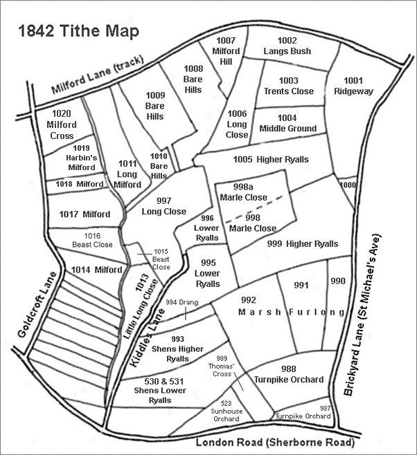
This map is based on the 1842 Tithe Map with field names added from the 1846 Tithe Award.
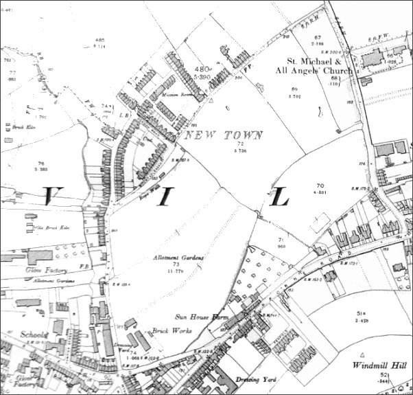
The 1912 Ordnance Survey showing the fledgling New Town surrounded by fields.
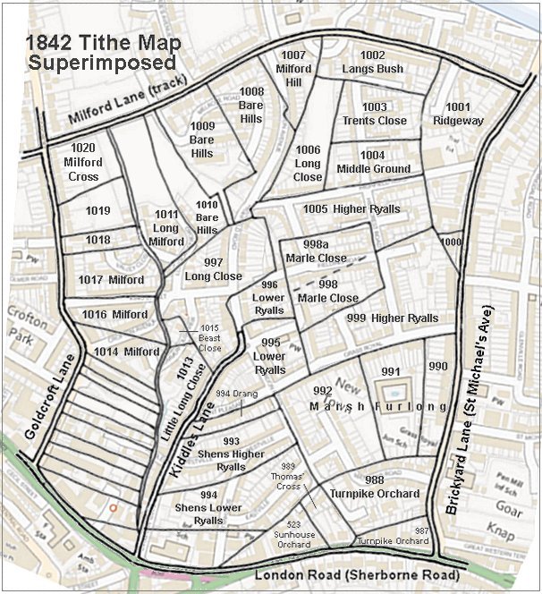
The 1842 Tithe Map superimposed (roughly) over a modern street map showing where several modern roads, for example Gordon Road, Grass Royal and Highfield Road, follow former field boundaries.
gallery

Sun House Farm in London Road (Sherborne Road) near its junction with Reckleford, the later Sun House Inn.