yeovil bridge turnpike house
yeovil bridge turnpike house
Built in 1856 for £250
In 1753, Turnpike Commissioners were appointed for "repairing and widening the roads" of Yeovil. At the first meeting of the Yeovil Turnpike Trust on 12 June 1753, they ordered that "three capital gates be erected" at Hendford Bridge (by today's Railway Tavern) and also known as Hendford Gate, Goar Knap (spanning Sherborne Road on the town side of the junction of St Michael's Avenue - later replaced by Yeovil Bridge Turnpike House) and the "Head of Kingston". There was also the Pen Style Stop Gate near the entrance leading from Pen Style to Newton, later replaced by Pen Style Turnpike House. Other gates at various times being Watercombe Side Gate, Combe Street Lane "Hutt Gate" - later replaced by Mudford Road Turnpike House, Milford Lane Side Gate (today's Goldcroft) and Jernegan's Hut Side Gate at Vagg.
Collectors at each of these gates received a salary of six shillings per week or "eight shillings until the toll houses are completed".
The Goar Knap Gate was later moved to Yeovil Bridge and a toll house was built alongside the bridge (on the 'wrong' side of the bridge, so technically in Dorset) in 1856, for the princely sum of £250 (about £35,000 at today's value). The Yeovil Bridge Turnpike House was designed by Robert Howard Shout, architect of Yeovil and London. A datestone commemorates its erection (photograph below) but fortunately a very detailed specification was recorded in the Turnpike Trust Minute Book as follows -
Yeovil Bridge, 1856. Contract £250
Walls - Footings rough Yeovil stone. Front, side, and back walls rough hammer-dressed Yeovil stone laid in horizontal courses in random range work. Ham stone dressings to windows, doors, mullions, gables, chimney and cap. Quoins of Halfway House stone, hammer-dressed. Living room and staircase walls lined with brick. Flues and fireplaces brick properly cored and pargetted. Dressings around fireplaces and mantel shelf Ham stone, stop chamfered round opening. Ground floor paved with Keinton stone, back hearths Ham stone.
Roof - Tiles secured to oak laths and laid in mortar.
Timber - Fir timber externally - Memel or Riga deals. Inside work - Christiana or Archangel, American red pine.
The upstairs is referred to as 'Chamber Floor'.
Yeovil Bridge Turnpike House is Grade II Listed.
gallery
Courtesy of Tim
Conner
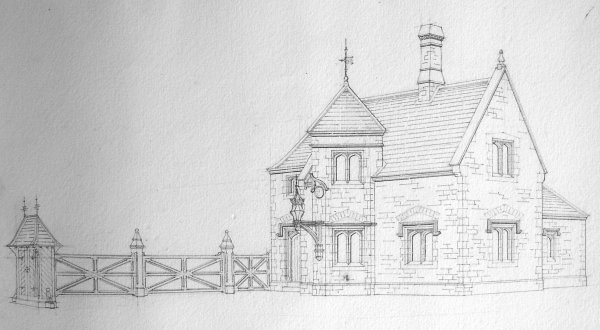
An original sketch by architect Robert Shout of the Yeovil Bridge Toll House, including the Toll Gates that had originally been sited at Goar Knap (roughly near the junction of today's St Michael's Avenue and Sherborne Road).
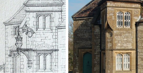
From Shout's sketch, at left, it appears that a clock was to be installed in the circular space provided on the edge of the projecting triangular viewing area that gave a view of approaching traffic from both directions. Whether or not a clock was actually installed is unknown. Damage to the string course at window head height suggests that the projecting lantern had originally been installed, but later removed. Note that the window above the door in the sketch does not appear to have been installed. For a close-up of the datestone and the circular 'clock' space, see the final photograph below.
From the Stiby
Collection
(colourised),
Courtesy of South Somerset Heritage Collection
The original of
this photograph
features in my
book 'Yeovil
From Old
Photographs'
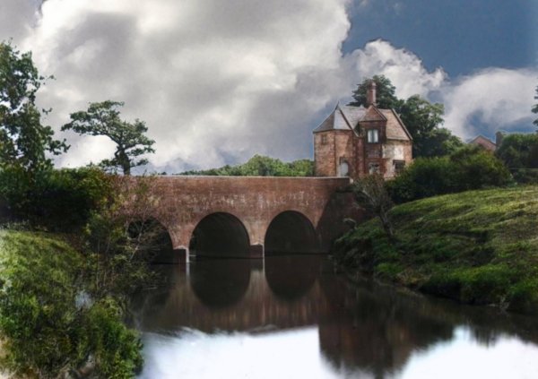
A photograph by Henry Stiby, dating to the 1880s, showing Yeovil Bridge and the toll house. The River Yeo is the boundary between Somerset and Dorset and is the eastern end of Sherborne Road before becoming the dual carriageway of Babylon Hill.
From the Cave
Collection
(colourised),
Courtesy of South Somerset Heritage Collection
The single carriageway A30 leaving Yeovil for Sherborne in the 1960s. The car is passing over Yeovil Bridge, with the Toll House to the left.
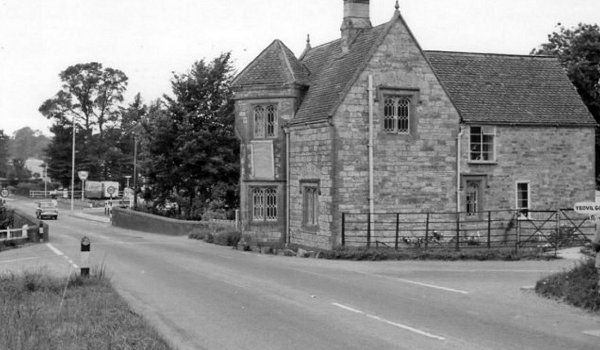
A photograph of the 1960s looking towards Yeovil along the Sherborne Road with Yeovil Bridge at left and the toll house at right.
From the Cave
Collection
(colourised),
Courtesy of South Somerset Heritage Collection
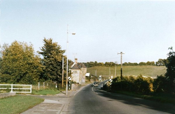
Yeovil Bridge Tollhouse photographed in the 1960s, long before today's dual carriageway and roundabout was even thought of.
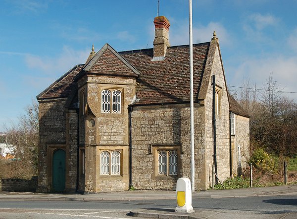
The toll house elevation to Sherborne Road. Photographed in 2013.
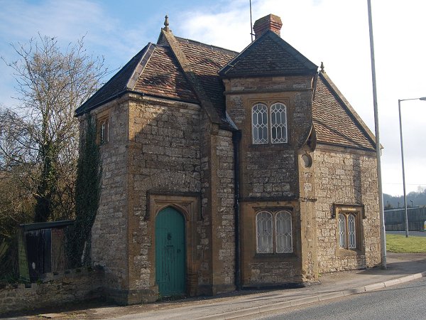
The west elevation, seen from Yeovil Bridge. Photographed in 2013.
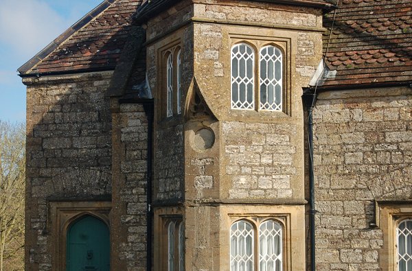
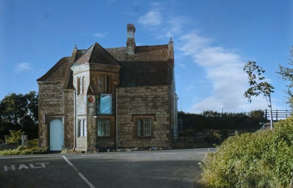
The central, angled section built to allow the toll keeper to watch for traffic coming from either direction. At centre is the datestone. Photographed in 2013.
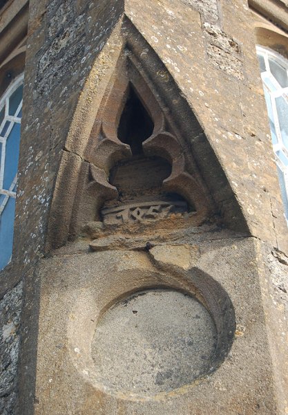
The datestone showing a worn '1856'. The circular area below the datestone was intended for a clock, It is not known if a clock was ever installed. Photographed in 2013.