Hendford
Hendford
Known by a variety of names
Taking its name from the Manor of Hendford through which it passes, as early as the 14th century Hendford was referred to as Hineford or Hyneford. Until the 19th century it was also known as Henford, Henford Street and Hendford Road. There have been occasions in the past where, for obvious reasons, its northern end was known as Hog Market.
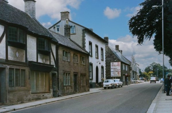
Today we readily accept that Hendford runs from the bottom of Hendford Hill, where it crosses Dodham Brook by the Railway Tavern, as far as "Denner's Corner" - its junction with High Street. Unfortunately the story of this northern end of Hendford is far more complex. Like many of Yeovil’s streets, Princes Street hasn’t always been named as such. Indeed it was actually less straightforward than that, simply because of former ancient boundaries which meant that various parts of the street fell within the three ancient manors of Yeovil Borough, Hendford and Kingston. Even though it had lain within the ancient Manor of Yeovil Borough the eastern side of what is now Princes Street, from High Street to Church Street, was called Hendford. On its eastern side from Church Street to North Lane, having once been in the Manor of Kingston, the street was called Kingston and continued as such to Fiveways. The western side however, from Westminster Street all the way to Park Road, had also once been in the Manor of Hendford and consequently the road here was considered to be Hendford. So, when it was built in 1730, Old Sarum House was actually the last house in Hendford.
The photographs
in the gallery
below relate to
that part of
Hendford from
High Street as
far as Hendford
Hill. For
photographs of
that part of
Hendford which
is now Princes
Street -
see here.
gallery

This
colourised photograph
features in my
book 'Secret Yeovil'.
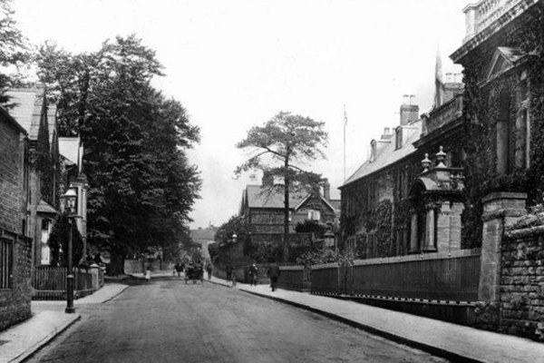
This photograph, one half of a stereoscopic pair, was taken around 1870 and looks down Hendford with High Street and the shop of Lindsay Denner at extreme left. Next to Denner's is the home of clock maker Robert Dobel but by the time of this photograph the home, workshop and shop premises of his son Frederick Dobel. The impressive building at right is Stuckey's Bank, facing High Street, and demolished in 1918. At centre, the three-storey building in the distance is the Three Choughs Hotel and the two-storey building to its immediate left was Boucher & Porter's premises which also served as the first premises of Yeovil's first Savings Bank of which John Totterdell Boucher was its first Actuary and William Porter became its second Actuary after the departure of Boucher to Burnham.
From my
collection.
This
colourised image
features in my
book 'Yeovil
- The Postcard
Collection'.
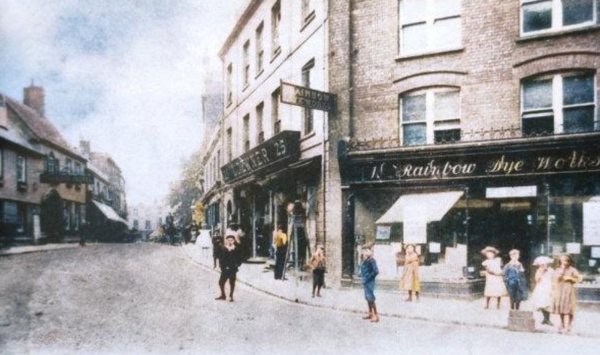
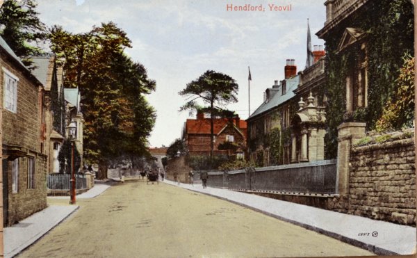
This postcard of the northern end of Hendford, postally unused, I'd guess dates to about 1900. At extreme left is just seen the edge of Denner's shop and next to it are the remaining shops before he took them over. The two men at centre are standing outside Stuckey's Bank (demolished before 1918) and between the bank building and Genge's shop is the narrow entrance to Porter's Lane (later widened to become today's Westminster Street).
From my
collection
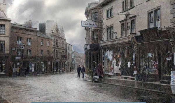
A colourised view of the High Street - Hendford junction about 1905. Denner's shop is at centre with the Rainbow Dye Works next door - another building eventually to be absorbed into Denner's store.
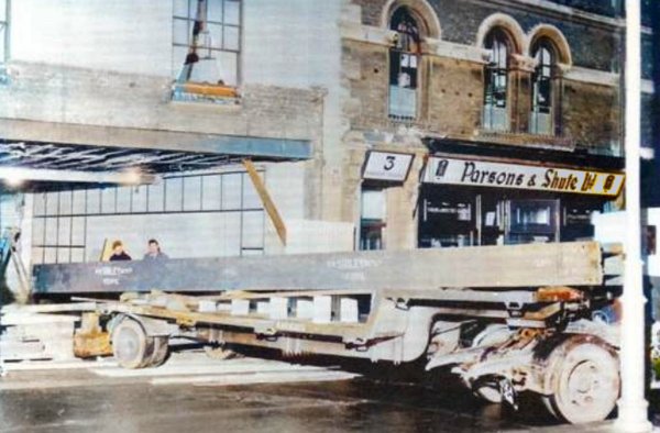
A colourised photograph of 1934 showing strengthening works to Denner's newly-acquired neighbouring property in Hendford (this was next door to the Rainbow Dye Works premises of the previous photograph). Here, a massive RSJ is slowly maneuvered into position through the removed shop front.
From my
collection
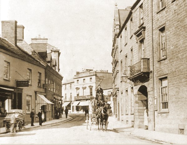
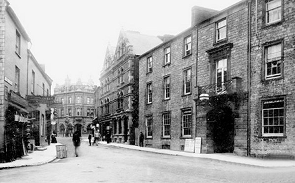
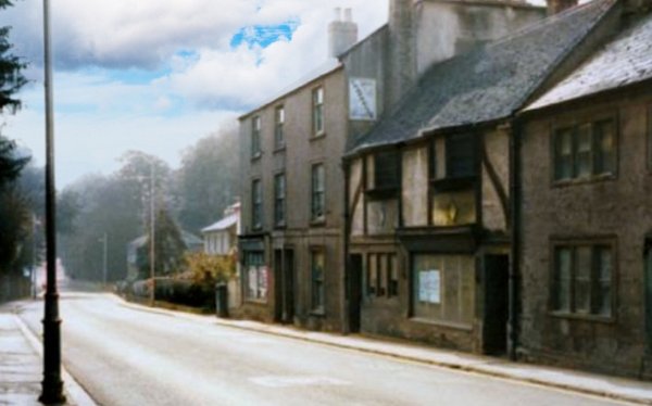
Looking along the along the 'top' of Hendford, a horse-drawn omnibus, used to transport guests to and from the railway stations, waits outside the Three Choughs Hotel in this sepia-toned photograph of about 1890. The driver sits on a wicker storage box. In the background the fine three-storey building to the left of the driver still stands today with the upper two storeys occupied by the High Street Dental Practice while the two-storey building behind the driver (the furniture shop of Henry White) was replaced by the Capital & Counties Bank building in 1897.
Almost the same view as the previous photograph, but this colourised photograph dates to around 1955.

From the Cave
Collection
(colourised),
Courtesy of South Somerset Heritage Collection
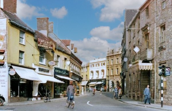
The junction of Hendford, Princes Street and High Street shown in the 1950 Yeovil Guide.

A colourised postcard of Hendford dating to about 1908, by which time the Three Choughs is proudly announcing its 'Motor Accommodation' that was housed in its former stables at the junction of Hendford and West Hendford - see below.
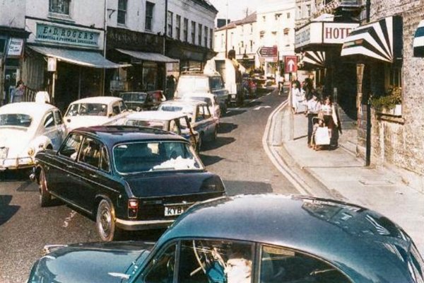
This photograph dates to 1905 and is a general view along the 'top' of Hendford towards the High Street / Princes Street / Hendford junction. The Three Choughs Hotel is at right. At extreme left the two-storey building next to the three-story building with a fine display of buckets was the ironmongery of Henry James Sercombe.
At the far end of the street, on the corner of Princes Street and High Street stands the building mentioned in the text of the photograph above as replacing the two-storey building. This edifice was built for the Capital and Counties Bank and opened in 1897.
From my
collection.
This
image
features in my
book 'Yeovil
- The Postcard
Collection'.
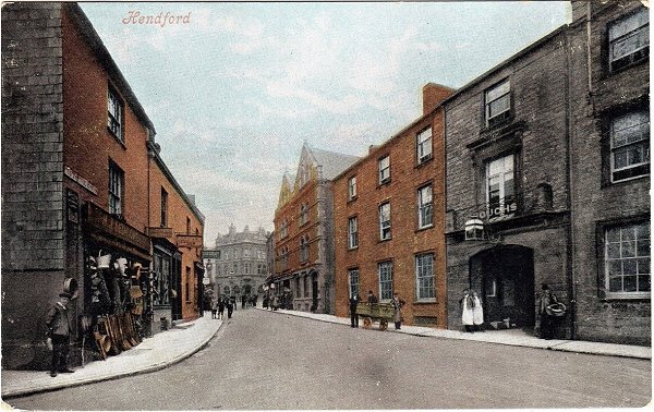
A hand-coloured postcard of the same view of the northern end of Hendford dating to about 1905. At right is the Three Choughs Hotel and at left is the ironmonger's shop of Henry James Sercombe who was listed as a 'tinman' in trade directories between 1903 and 1923.
Courtesy of South Somerset Heritage Collection
No 14 Hendford (next door to the Cottage Cafe), photographed in the 1960s.
... and what a difference the development of transport has made in the past hundred years - as witness by this colourised photograph of 1970.
Courtesy of Jack
Sweet
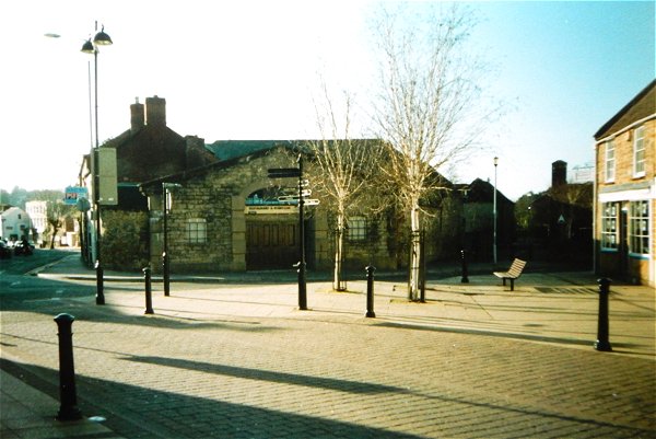
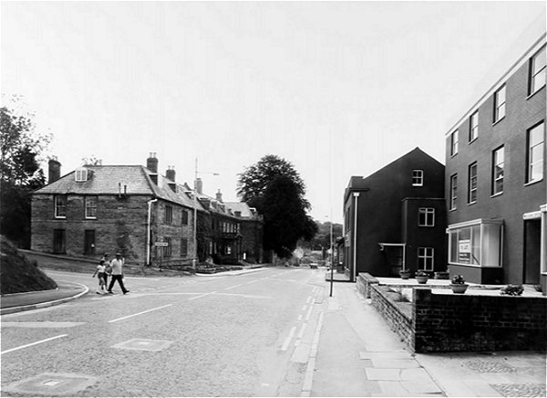
The northern end of Hendford photographed in 1993. Although partly pedestrianised, the trees have yet to be planted.
This photograph, taken around 1960, looks across Hendford and shows the very narrow entrance to West Hendford running alongside the Oxford Inn.

The Three Coughs Hotel (at extreme left) had a garage for patrons. This was the former livery stables of the Three Choughs Hotel.
Courtesy of
Garth Baker
Taken a few years later, in the 1960s, after the Oxford Inn had been demolished and its site used as a temporary car park.
Courtesy of
Colin Haine
By the time of this 1984 photograph the former stables and garage had been converted to a nightclub - initially called the Camelot Suite in the early 1970s, then Oliver's in the late 1970s and the Electric Studios, or simply the Studios, in the early 1980s. By its final closing in 2003 it was called Arena - see below.
Courtesy of
Vivien and John
Cornelius. This
photograph
features in my
book "Lost Yeovil"
Photographed in 2003, when the nightclub finally closed as Arena.
Courtesy of
Vivien and John
Cornelius
With the Arena sign between the windows above the door, the building is finally sold and the land intended for development. Photographed in 2003.
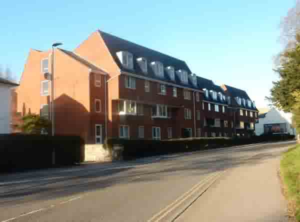
The residential development that replaced the nightclub, photographed in 2015.
.... and seen from the end of South Street. Photographed in 2015.

Courtesy of Rob
Baker
These were the photographic studios of John Chaffin & Sons from 1862 until 1919. This colourised photograph of the early 1920s shows that it next became a garage.
This
colourised photograph
features in my
book "Lost Yeovil"
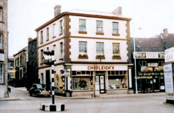
This photograph, probably taken in the 1960's, shows how narrow South Street (with the car driving out of it) was at the time. The Three Choughs Hotel is at left. Chudleigh's Seed Merchants was demolished in the 1960's to widen South Street. It is most likely that this was Charles Dodge's premises when he was listed as 'Corn & General Merchants of Hendford' in Collins' Yeovil Directory of 1907. The building next to it (with the BSA signs) had earlier been the photographic studios of John Chaffin and then his son between 1862 and 1919. In the 1920s it was the Motor Mart garage (see previous photograph). At the time of this photograph it was occupied by Yeovil Motor Cycle Mart. Note at extreme right, on the corner of Hendford and West Hendford, the Three Choughs Hotel had its own car park for the use of patrons only on the site of its former livery stables.
Courtesy of
Colin Haine.
This
photograph
features in my
book "Lost Yeovil"
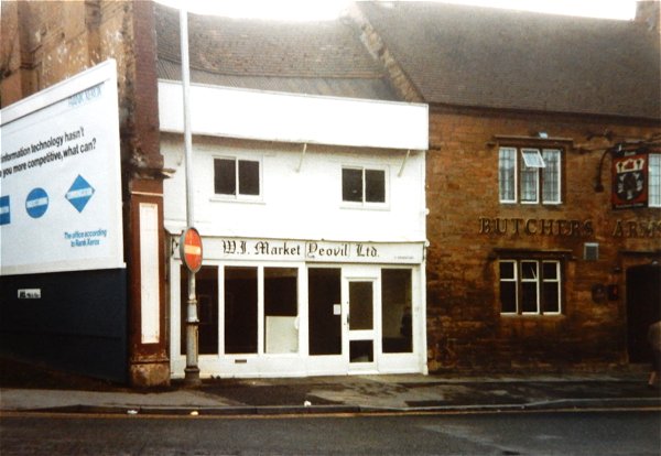
By the time of this 1984 photograph John Chaffin's photographic studio was occupied by the Yeovil branch of the Women's Institute. Chudleigh's premises from the previous photograph had been demolished by this time and Chaffin's former premises were to follow shortly after this photograph.
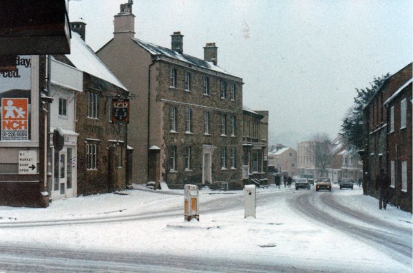
The 'top' of Hendford, seen during the snow of February 1987.
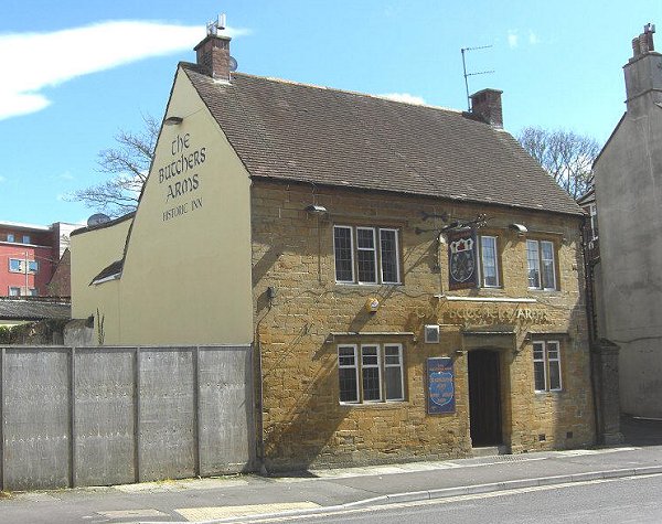
The Butchers Arms, less Chaffin's old premises next door. Photographed in 2012.
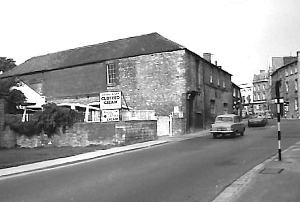
Moving down Hendford a bit, the Three Choughs is at extreme right. The bulk of the building at centre was the groom's accommodation for the Chough's livery stables, later garage mentioned in the previous photograph. I can remember buying clotted cream at Adams' Dairy on the first week I moved to Yeovil in September 1973, to send to mum and dad back in North London as a 'typical' present from Yeovil and the West Country. (I also got through a fair bit myself!).
Courtesy of
Chris Shoemark
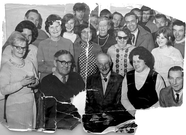
A somewhat dog-eared photo of staff of Adams Dairy - do you recognise anyone? can you put a date to this photograph?
From the Cave
Collection
(colourised),
Courtesy of South Somerset Heritage Collection
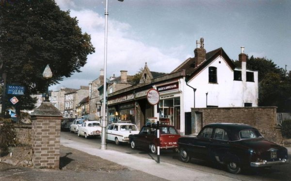
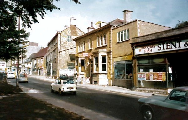
Taken from just a little further along Hendford and outside the Manor Hotel, this photograph of about 1960 looks back to the shops beyond those in the previous photograph. Stent's fish shop is at centre and Dibben's cake shop was next to it. This short parade of shops had earlier been known as 'The Rink' and was Henry White's Furnishing Warehouse.
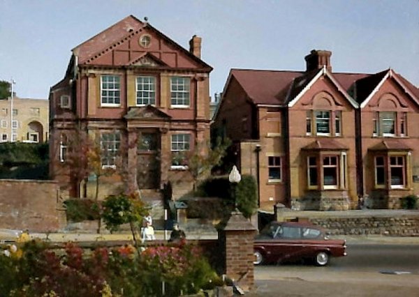
In almost the same view as the previous photograph, this colourised photograph of Hendford, was taken in the early 1970s. The site of Stent's fish shop (formerly Sawyer's) at right, is now occupied by Dolphin House (see next photo), but all of the other buildings, including Ayr House at centre and Flower's House next to it, remain today up to, and including, the Butcher's Arms seen between the two cars.
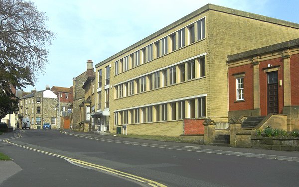
This photograph of Hendford, taken in 2014, is almost the same view as the previous photograph towards the Butcher's Arms. Stent's fish shop (formerly Sawyer's) at right has gone, its site now occupied by Dolphin House, but all of the other buildings, including Ayr House at centre and Flower's House next to it, remain today up to, and including, the Butcher's Arms seen between the two cars.
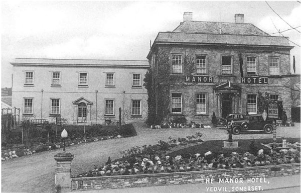
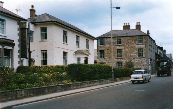
The Manor Hotel as seen in a postcard from the 1930s. The Manor Hotel, on the western side of Hendford, with its fine Georgian five-bay Ham stone elevation and recessed five-bay stable block, was built in 1776 and was originally the private house, known as Hendford House, of local glover John Daniell the elder.
The Masonic Hall seen in a colourised photograph of the 1960s, across Hendford from the Manor Hotel. At extreme left, in the background, is glimpsed the Law Courts in Petter's Way before the Masonic Hall had its extension on the side. The two houses at right are still there but are now offices; the house next to the Masonic Hall was the photographic studio of J Bell, later taken over by Jarratt Beckett.
Looking southwest along Hendford in 1975 with Hendford manor at left.
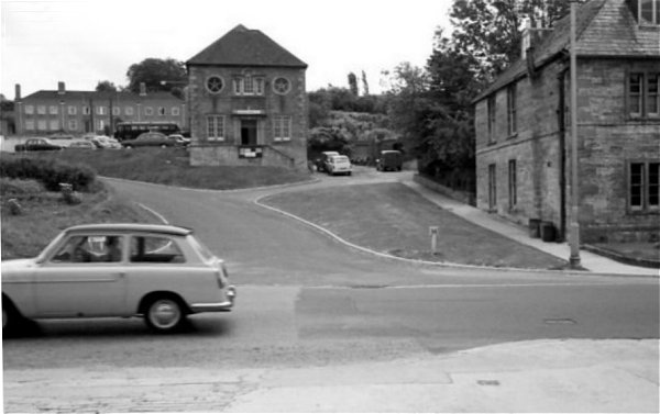
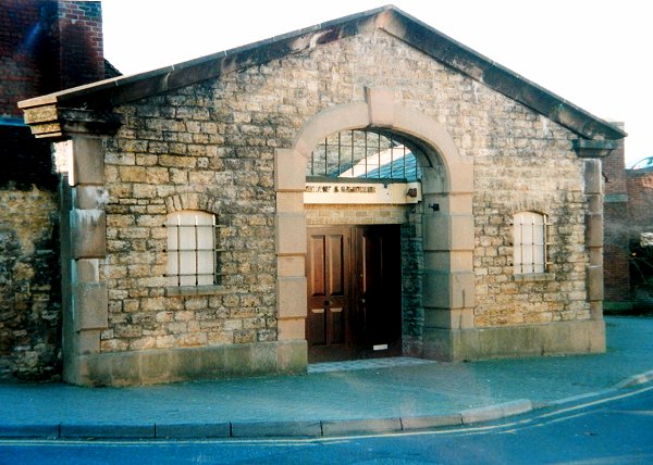
....and a little further still is the newly-made entrance to the car park in Petters Way. At centre stands the Hendford Manor Coach House, which later housed Yeovil Museum, and at extreme right is the edge of Hendford manor itself. Photographed in the 1960s.
From the Cave
Collection
(colourised),
Courtesy of South Somerset Heritage Collection
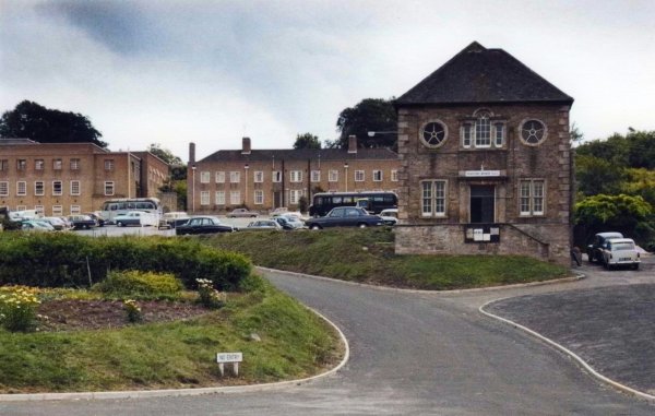
... and yet another view, also from the 1960s, before Federated House (the Job Centre) was built, obscuring the left half of this photograph.

Hendford Manor at left, photographed in 1912. Hendford Manor was originally built about 1740 for James Hooper, a Yeovil solicitor. Is it me or does it seem that Hendford was far more attractive in those days?
.... see what I mean? Photographed in 2014.
This photograph
features in my
book 'Yeovil From Old Photographs'.
A delightful hand-coloured postcard of about 1914 looking north towards the town centre, with Hendford Manor at right.
Courtesy of the
Western Gazette
.... and the 1912 photograph the above postcard was taken from.
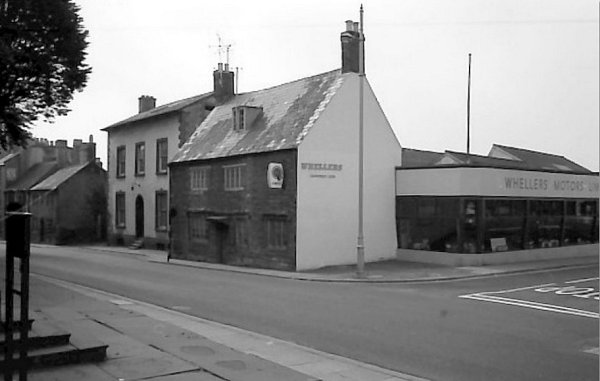
Opposite Hendford Manor is Manor Road with Whellers Motors Ltd. This corner is now occupied by the Homeville House Complex.
From the Cave
Collection
(colourised),
Courtesy of South Somerset Heritage Collection
This photograph, looking south along Hendford, dates to about 1965, the London Inn is at centre but boarded up and awaiting demolition. Chappell's bakery is the large three-storey building at left. The tree in the photograph at left was in the grounds of Hendford Manor, which is behind the photographer. The site of these are also now occupied by the Homeville House Complex.
From the Cave
Collection
(colourised),
Courtesy of South Somerset Heritage Collection
The same scene, but a little closer.
From the Cave
Collection
(colourised),
Courtesy of South Somerset Heritage Collection
... and looking back towards town.
The same stretch of road (but looking north) as the previous photograph. This is Homeville House. Photographed in 2016.
From the Cave
Collection
(colourised),
Courtesy of South Somerset Heritage Collection
This photograph
features in my
book 'Secret
Yeovil'
The large white house at left is 66 Hendford and is still there today. Photographed in the 1960s, looking along Hendford towards town with the boundary wall of Hendford Manor just glimpsed at extreme right. Chappell's bakery, formerly Dibben's Bakery and before that, the bakery of Henry Pulman, is the large three-storey building at centre. Before that it was the bakery of John Strong, followed in turn by his son William Strong and then his grandson Henry Strong.
66 Hendford's well-proportioned elevation, displaying its fine Regency-style marginal lights to all windows, including the porch. Photographed in 2013.
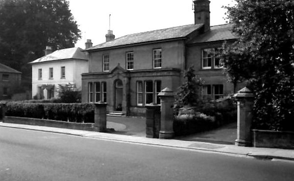
Hendford Vicarage, 70 Hendford, photographed in the 1960s. The four Regency residences on the western side of Hendford, all of which survive, stood opposite Hendford Terrace seen below.
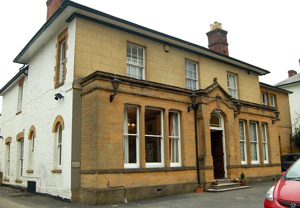
The former Hendford Vicarage with its Victorian extension running the full width of the ground floor elevation and, to my mind, somewhat spoiling the original lines of the building. Photographed in 2013.
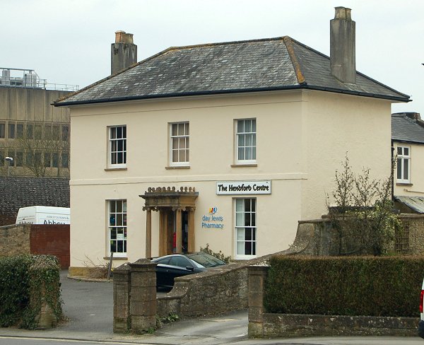
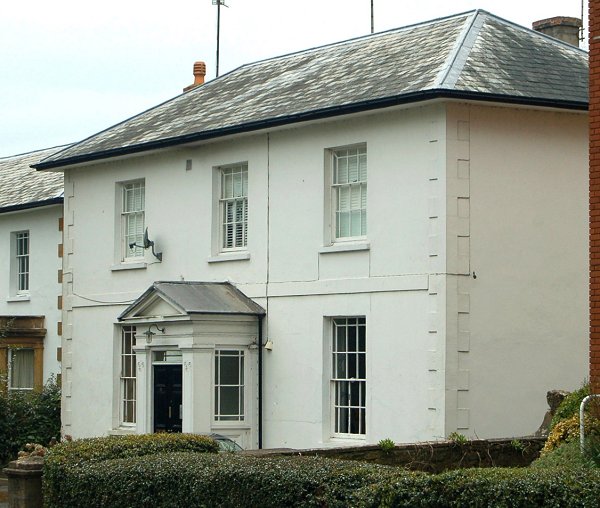
Once a fine residence in typical, if simple, Regency style, No 72 Hendford is now a pharmacy. Photographed in 2013.

From the Cave
Collection
(colourised),
Courtesy of South Somerset Heritage Collection
Photographed in the 1960s, this photo looks north along Hendford with Hendford Terrace at right. The trees beyond the terrace were in the grounds of Hendford Manor and hidden away behind the trees was Hendford Manor Lodge.
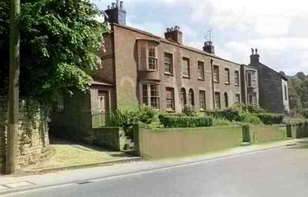
This (colourised) photograph dates to about 1960 and shows Hendford Terrace in Hendford. The wall at the bottom left corner is the boundary wall of Hendford Manor and next to it is the entrance to Chant's Path - its street nameplate is on the end wall of the first house.
Courtesy of the
Western Gazette
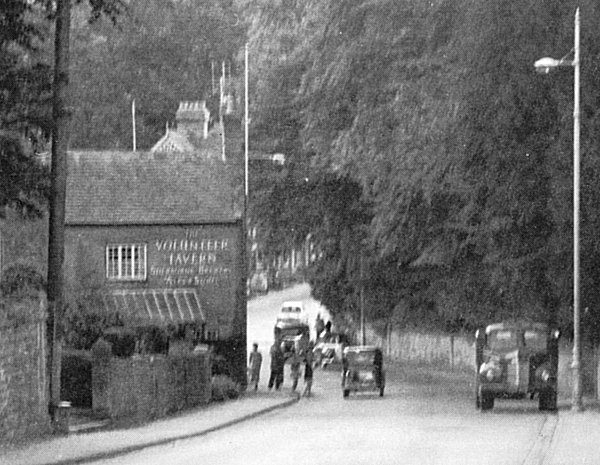
Looking down a very rural-looking Hendford towards the junction with Horsey Lane in 1956 with the Volunteer Tavern on the corner of Brunswick Street at left.
Courtesy of the
Western Gazette
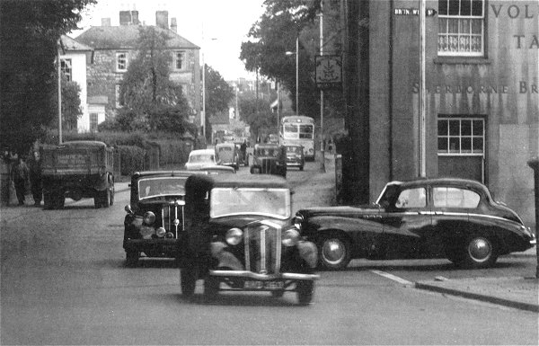
Looking north along a very busy Hendford from the junction with Brunswick Street at right. Photographed in 1956.
From the Cave
Collection
(colourised),
Courtesy of South Somerset Heritage Collection
The Volunteer Inn is seen at right angles with Hendford. This photograph was taken at the beginning of demolition in 1965 and the terrace of housing seen at left, Hendford Terrace, was to follow shortly thereafter.
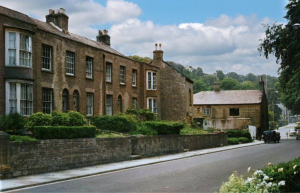
.... and the same spot in 2014.
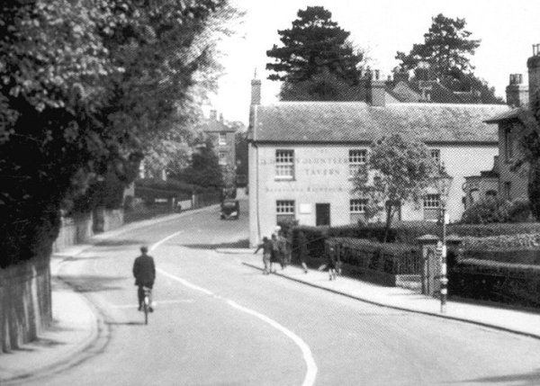
Looking north along Hendford with the Volunteer, on the corner of Brunswick Street, photographed about 1955 - a tranquil scene before Hendford was straightened out.
This is the junction of Horsey Lane (at left) and Hendford (at right) with the wall of Hendford Lodge being demolished.
Courtesy of
Daniel Dicks
Brunswick Street (with the car) at the junction with Hendford, photographed in the 1970s.
Courtesy of the
Western Gazette
Hendford and Brunswick Street photographed around 1975. At right is the Nichols' leather dressing factory, later the Hendford and today called Cooper's Mill.
Courtesy of the
Western Gazette
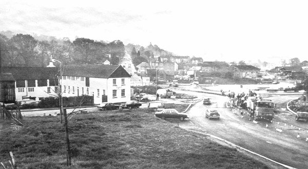
The southern end of Hendford being modified in 1977 when the new police station roundabout was being built. The large white building at left is LH Nichols Ltd's lambskin dressing factory, later converted to Coopers Mill.
Courtesy of the
Western Gazette
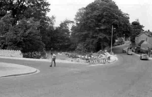
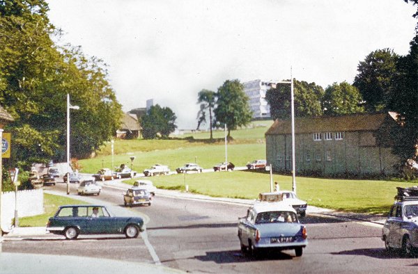
The new road layout nears completion in this photograph of later 1977, seen from the bottom of Hendford Hill.
Courtesy of
Chris Rendell
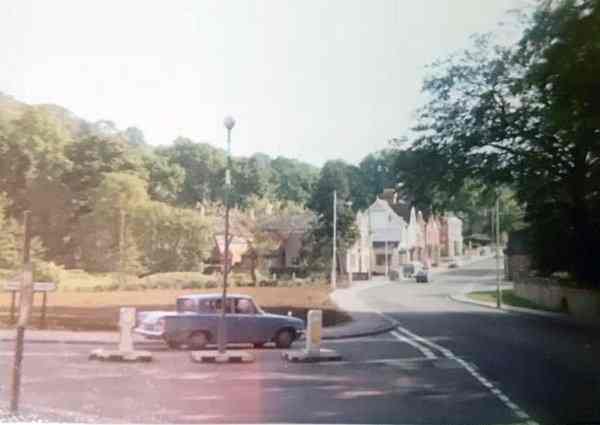
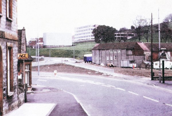
The southwestern end of Hendford photographed in 1985 - Brunswick Street runs off to the right just off photo. Note that today's Octagon Theatre was still called the Johnson Hall at this time.
Courtesy of
Chris White
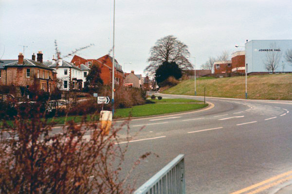
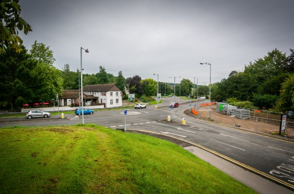
The Coopers Mill roundabout photographed in 2015 at the start of works to turn this into a light controlled junction. Brunswick Street runs across from left to right of centre, while Hendford runs in from the bottom right.
From my
collection
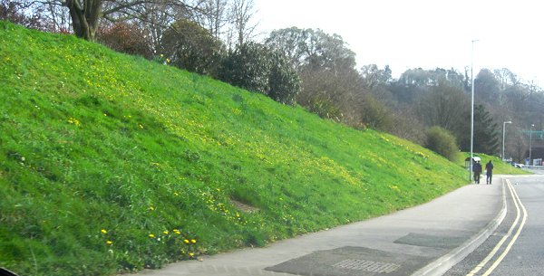
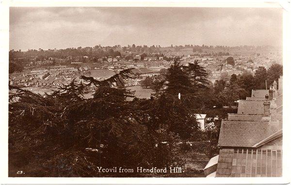
This postcard of 1934 shows that there's a good view across Yeovil from Hendford Hill - unusual for a Yeovil postcard which normally show the view from Summerhouse Hill.