back Street / south street
back Street / south street
An original street of the medieval Borough
 Back
Street or Back
Lane, the
later South
Street, has been
a street within
the medieval
town probably
since Saxon
times. In
medieval times
it was the
southern
boundary of the
Borough,
Back
Street or Back
Lane, the
later South
Street, has been
a street within
the medieval
town probably
since Saxon
times. In
medieval times
it was the
southern
boundary of the
Borough,
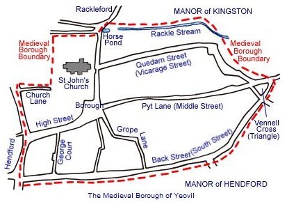
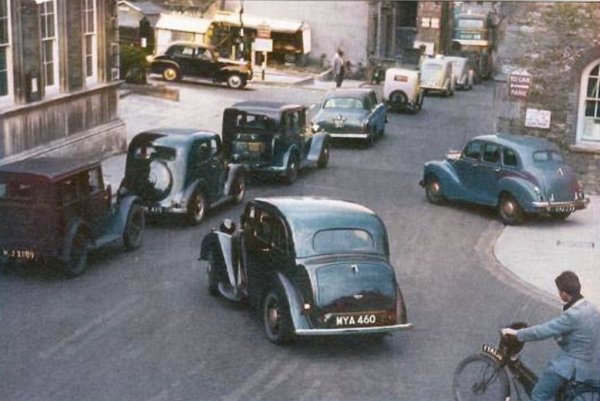
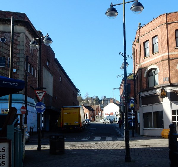
South Street, running from Hendford in the west to Vennell's Cross (now the Triangle) in the east, formed the southern boundary of the ancient Borough of Yeovil. It has always been known as South Street although for a few hundred years it went by the name of Back Street later reverting to South Street.
It was called South Street in a Woborn muniments deed of 1335 and in the Close Rolls of 1398 but in the Churchwarden’s Accounts of 1542 it was referred to as “South Street now called Back Street” and a lease dated 1589 refers to “South Street commonly called Back Street”. It was referred to as 'Backstrete' in William Hayne's will of 1551 and as Back Street in the 1589 Terrier. The Portreeve's Accounts refer to South Street up to 1800 but in 1813 it was referred to in the Accounts as 'now Back Street' and John Martin's map of Corporation Properties, also of 1813, labels it as Back Street.
It is named on Watt’s map of 1806 as South Street but is named as Back Street on his map of 1831. Interestingly, on Day's map of 1831 he calls it South Street from Hendford to Bond Street and then labels it Back Street from Bond Street to the Triangle. The 1841 Census refers to it as Back Street while the 1851 and subsequent Census Returns call it South Street, so it was clearly going through the reversion process to South Street during the early 19th century.
As a sidenote - it appears that traffic wardens have been the bane of Yeovilian's lives at least since the nineteenth century as reported in the Sherborne Mercury of 12 November 1850 "Thomas Hodges, of Yeovil, for having suffered a waggon to continue standing in South Street, longer than was necessary, was fined 2s 6d (about £12 at today's value) and costs."
map
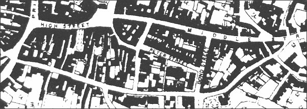
A map based on the 1890 Ordnance Survey of South Street, running across the bottom of the map from Hendford at extreme left to The Triangle at right.
gallery
This
colourised photograph
features in my
book "Lost Yeovil"
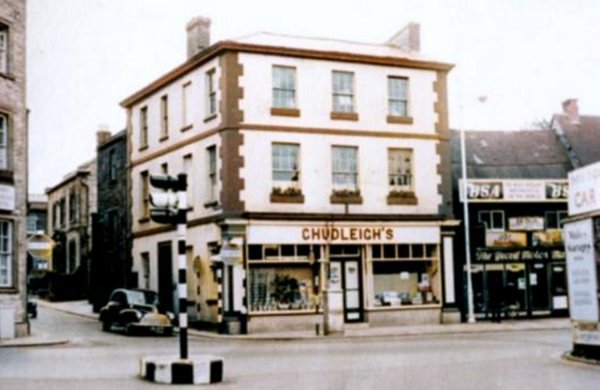
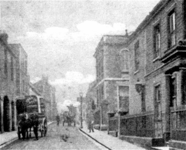
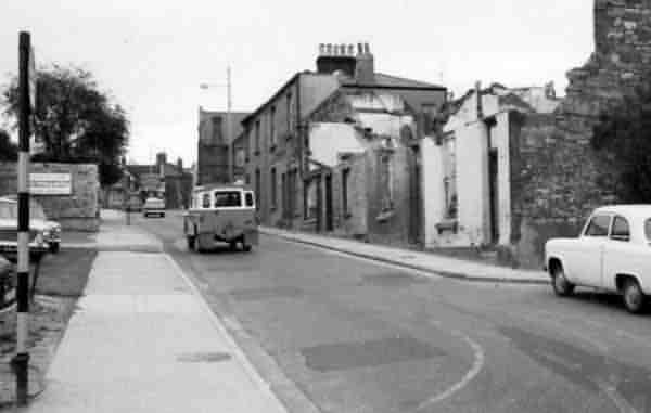
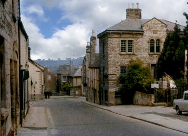
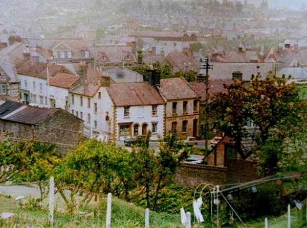
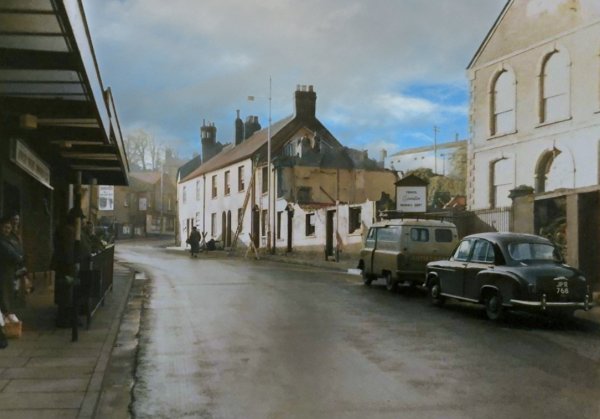
This colourised photograph, taken from Hendford in the 1960's, shows how narrow South Street (with the car driving out of it) was at the time. The Three Choughs Hotel is at left. Chudleigh's Seed Merchants was demolished in the 1960's to widen South Street.
Traffic congestion in South Street at the junction with Hendford, seen in a colourised photograph of 1958.
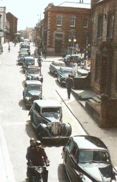
... and the traffic backs up beyond Petters Way - another colourised photograph of 1958.
Traffic congestion in South Street, added to from King George Street, in a colourised photograph of 1955.
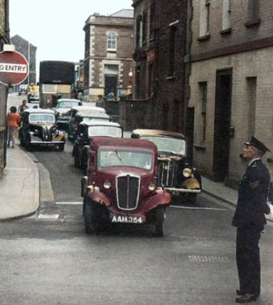
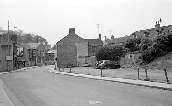
Looking back to Hendford this photograph shows just how narrow South Street was at its junction with Hendford before Moffat Marine and Chudleigh's Seed Merchant on the corner opposite the Choughs were demolished - and it's even two-way traffic! The Oxford Inn is seen straight ahead with the Three Choughs Hotel at right.
Dr Ptolemy Colmer's house and surgery at 79 South Street. The site is now occupied by the entrance to Petters Way and the Petters Way car park adjoining South Street. The railings at left belong to the Baptist Church and at the time of this photograph a narrow lane ran between Dr Colmer's house and the church, leading originally to extensive orchards.
Courtesy of the
Western Gazette
South Street looking east around 1914. At centre is the Newnam Hall and Schools and at right is South Street House.
This
colourised photograph
features in my
books 'Yeovil
From Old
Photographs'
and
"Yeovil
In 50 Buildings"
A photograph of the Baptist Chapel before 1867. Dr Colmer's house from the previous photograph is at extreme right.

This
colourised photograph
features in my
book "Lost Yeovil"
South Street seen from the Petters Way market, now the car park, photographed in the 1950s. At extreme left is the end wall of the Three Choughs, the white house right of centre was the market toll collector's house owned by the Corporation and at right is the old Cheese Market, by this time used as the town fire station. The domed turret at for right is on the roof of the municipal offices - there's a good view from there albeit very dusty getting to it through the roofspace of the offices.

From the Cave
Collection
(colourised),
Courtesy of South Somerset Heritage Collection
Market stalls left in-situ in what is now the Petters Way car park after the demolition of the toll collector's house. Photographed in the 1960's from Petters Way looking towards South Street.

From the Cave
Collection
(colourised),
Courtesy of South Somerset Heritage Collection
South Street Fire Station at the time of its demolition in May 1961, seen from Petters Way.

From the Cave
Collection
(colourised),
Courtesy of South Somerset Heritage Collection
This photograph, taken in May 1961, shows the Globe and Crown at extreme left and at centre the demolition of the Fire Station, formerly the old Cheese Market in South Street.

Courtesy of
David Perry
(colourised)
Once the old Fire Station was removed the space created become extra parking for council officials. South Street is off-photo to the left and at the right is seen the edge of the municipal offices. Most of this space is now occupied by the library.
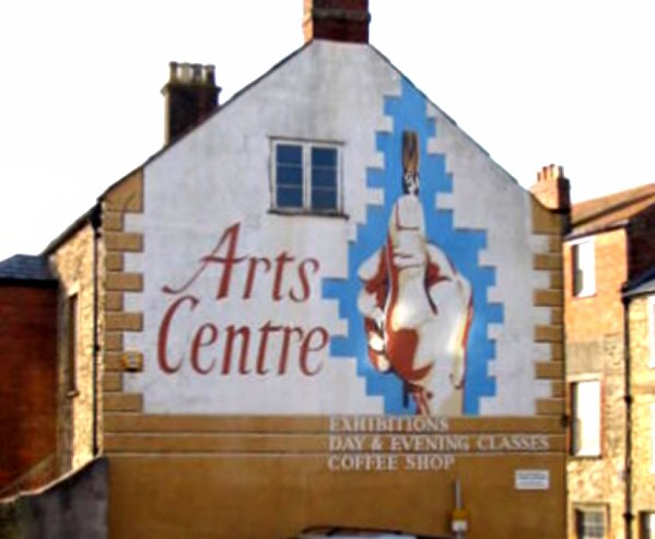
From 1988 until 2005, the Yeovil Community Arts Association managed and ran 80 South Street (seen at the centre of the previous photograph) as a small arts centre and café.
This colourised photograph
features in my
book 'Yeovil From Old Photographs'.
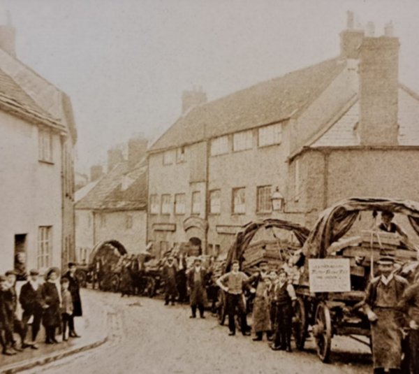
This colourised photograph of about 1910 shows the opposite side of the road to the previous photograph and roughly where King George Street is today. The Market House Inn is the three-storied building to left of centre. The two-storied building to its left is the Cheese Market building with its three arches at ground floor level. Between the two buildings is the entrance to George Court. To the right of the Market Street Inn was 5 South Street which had been an un-named beerhouse, but by 1870 was the home and workplace of cabinet maker George Holley. At far left the three- and two-storey buildings are the Three Choughs Hotel and next to it the King's Arms 2.

This colourised photograph
features in my
book 'Yeovil
From Old
Photographs'
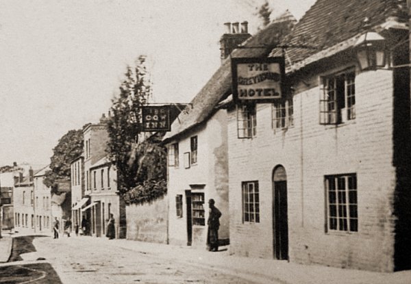
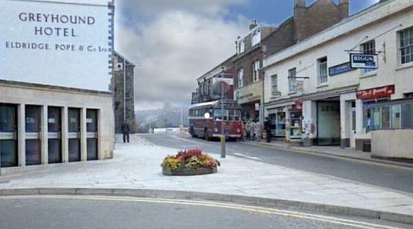
Moving along South Street just a few yards to the east and taken before 1879, this photograph by Adam Gosney shows the Greyhound Hotel at extreme right (before being rebuilt in its present form), the Cow Inn next door, the Globe and Crown opposite and the Three Choughs Hotel in the far distance at the end of South Street. Between the Cow Inn and the Choughs was the two-storey King's Arms (2) in the far distance as well as a couple of un-named beerhouses. Then the three-storey Market House Inn and then another un-named beerhouse. Just think, what an ideal pub crawl. Note the horse-drawn omnibus parked outside the Greyhound.
This photograph
features in my
book 'Yeovil
From Old
Photographs'
Another photograph of South Street taken around 1880 showing the Cow Inn and the Greyhound Hotel. The man is standing at the entrance to Greyhound Yard, a small 'court' of low quality housing.
From my
collection
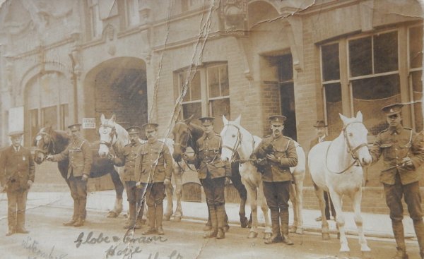
A postcard of soldiers and horses outside of the Globe and Crown, South Street, Yeovil, possibly West Somerset Yeomanry billeted in the stable at the rear of the Globe and Crown whilst mustering for war service August 1914.

The Yeovil Sanitary Laundry Co. Ltd. was established in 1877 in South Street, at the rear of the Globe and Crown with its steam laundry and extensive drying grounds behind the pub. It was enlarged in 1897-8 and in 1903 a new manager's house fronting South Street was built which also contained an office and receiving room - seen in this colourised photograph of around 1910. At the same time the Globe and Crown was rebuilt. This building later became the Yeoman Cleaners of the following photograph.
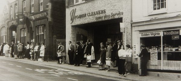
Waiting for the bus outside the Globe & Crown and Yeoman Cleaners around 1970.
Courtesy of Alan
Jackson
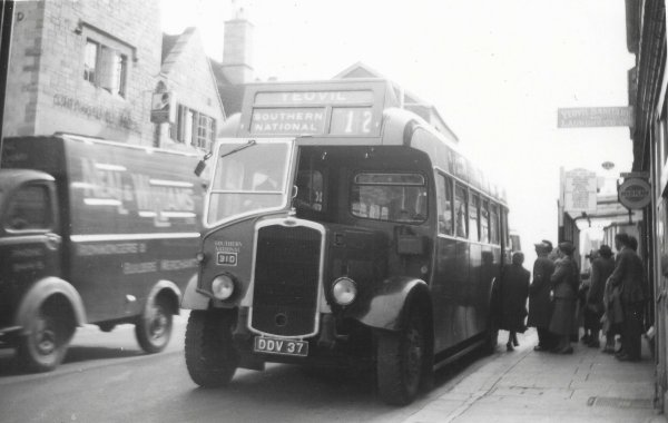
... and the bus arrives. Photographed in the late 1950s or 1960. Thanks to Michael Russell for explaining that the bus is "a Bristol L5G with a Beadle B36R body at the time which had been converted earlier. Fleet number 310 was withdrawn at Exeter in 1961."
This colourised photograph looks east along South Street in the 1960's, when King George Street still had traffic and the telephone kiosks are shown - it wasn't until my son asked what they were that I realised they had gone and it's just a plain wall again.
From the Cave
Collection
(colourised),
Courtesy of South Somerset Heritage Collection
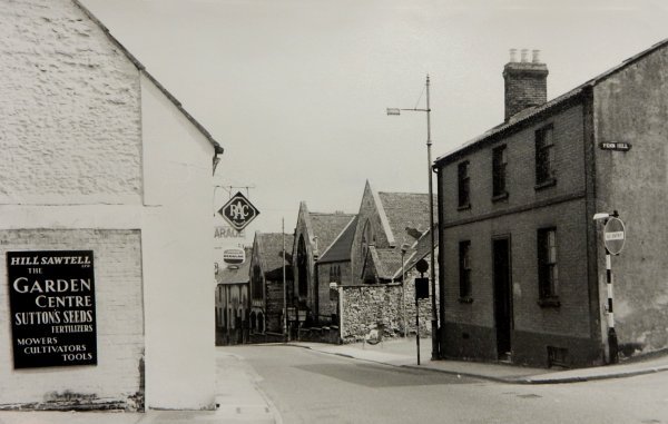
South Street photographed from Penn Hill. The building at left survives today, but at the time of this 1960's photograph was the Public Library Reading Room. Previously the glove factory of Boyd & Fooks, the three-storey Hill Sawtell building at the centre was demolished and is now car parking, while the two-storey Hill Sawtell building to its right is now the Penn Hill Pharmacy. The white cottage at the right (also seen end-on in the photograph below) was demolished and is now the forecourt of Kwikfit.
A view east along South Street from the junction with Penn Hill (at right). At centre is South Street School. Photographed around 1960.
From the Cave
Collection
(colourised),
Courtesy of South Somerset Heritage Collection
A photograph from the 1960s looking east. At right is South Street School, opposite the junction with Union Street seen at left.
Courtesy of
Roger McElliott
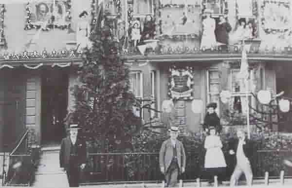
62 South Street (see next photo) decked out with flags and bunting for the Coronation of Edward VII, 9 August 1902.
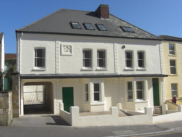
A pair of houses built by Samuel Cridland in South Street in 1887 - his home perhaps? Photographed in 2014.
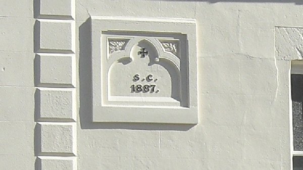
The 1887 datestone with Samuel Cridland's initials on the above South Street property.
From the Cave
Collection
(colourised),
Courtesy of South Somerset Heritage Collection
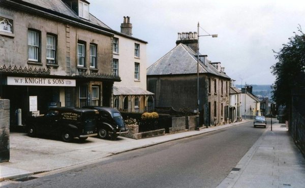
The houses just a little further east than those above, built in 1887 by Samuel Cridland.
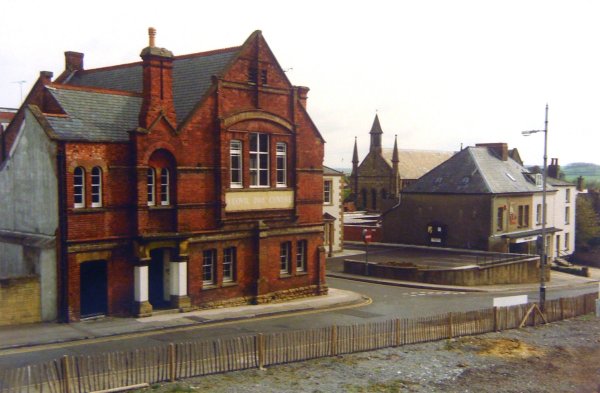
The demolition of the cottages behind Holy Trinity church around 1960. This had earlier been the site of the Black Cock.
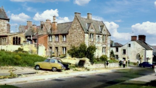
A sight not seen today - the back of Woborn Almshouse on the corner of Bond Street, viewed from South Street, This colourised photograph was taken around 1960, shortly after Woborn Terrace was demolished.
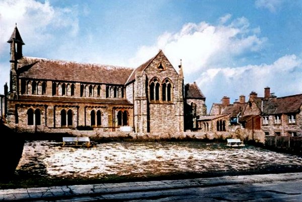
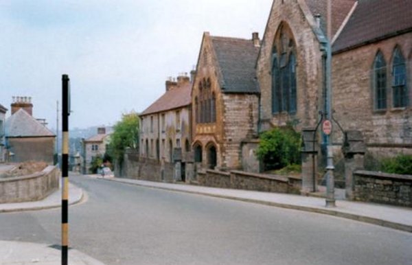
The south elevation of Holy Trinity church facing South Street, in a colourised photograph, probably during the 1960s.
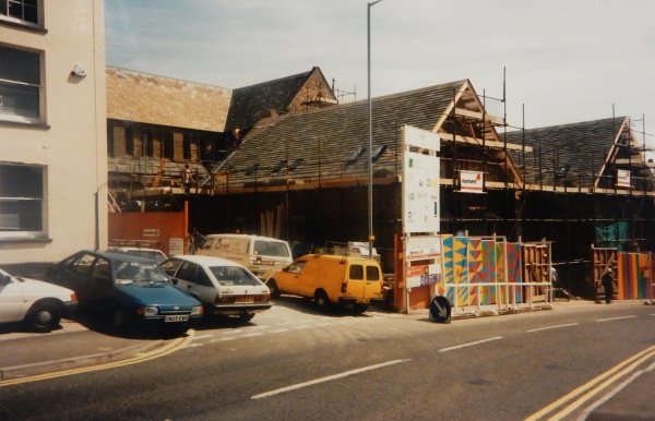
Yeovil Trinity Foyer under construction during 1996, part of the conversion of Holy Trinity church.
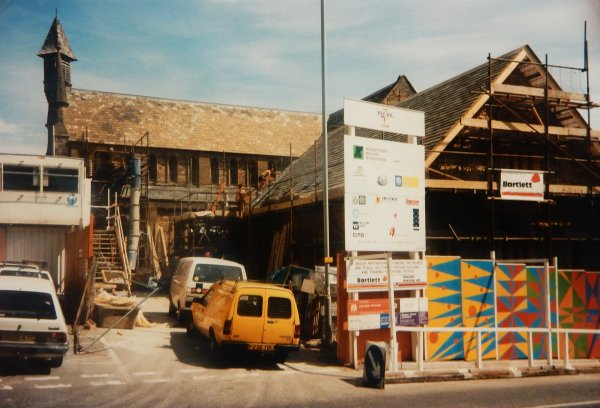
.... and a slightly different view, taken at the same time as the previous 1996 photograph but this offering a better view of Holy Trinity church.
Courtesy of
Colin Haine.
This photograph
features in my
book 'Now
That's What I
Call Yeovil'
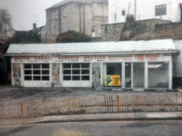
The South Street garage, opposite Bond Street. The site is now flats.
Courtesy of
Vivien and John
Cornelius
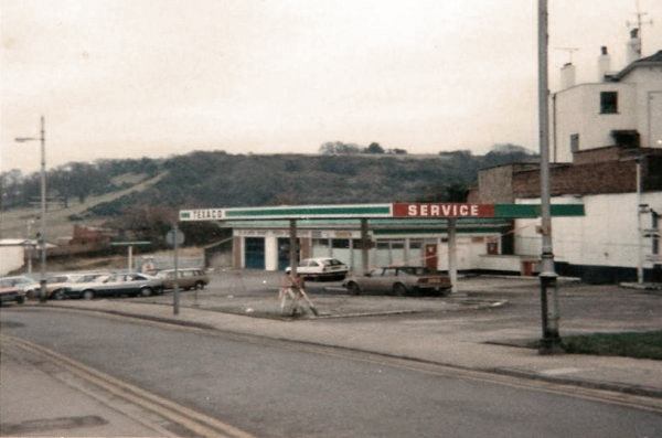
The South Yeovil Service Station in South Street, photographed in 1992 just before demolition. The site is now flats.

From the Cave
Collection
(colourised),
Courtesy of South Somerset Heritage Collection
The former Victoria Temperance Hall (now the South Street Centre) photographed in the 1960s from the forecourt of the South Yeovil Service Station. The white buildings at the left, including the shop premises of JT Lowe, were demolished shortly after this photograph was taken.
The fence in front of the South Yeovil Service Station (earlier photo) is now in the foreground but looking across to the Day Centre (the former Victoria Temperance Hall) and Union Street.
This
colourised photograph
features in my
book "Lost Yeovil"
A 1960s photograph looking east along South Street shows Thomas Fooks' house at right. The white building at left with two people outside is on the corner of Bond Street while opposite is just seen the junction with Park Street. The house seen on the corner of South Street and Park Street was Park Street House, the home of Fooks' son, William.
From the Cave
Collection
(colourised),
Courtesy of South Somerset Heritage Collection
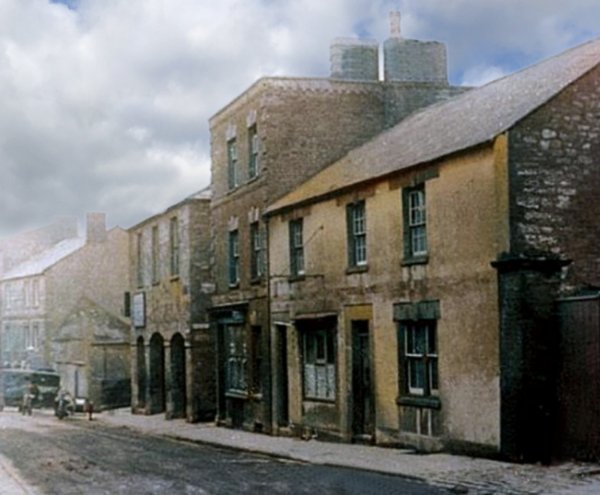
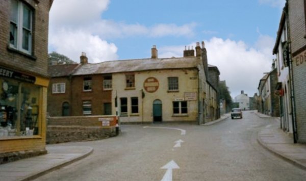
Dating to about 1955, this colourised photograph looks west along South Street, just past the junction with Bond Street on the right. By this time the Globe Inn, at centre, had closed and was awaiting demolition. Note how the main A30 traffic is directed around in front of the Globe Inn, down Park Street. Today this section of Park Street is the only part surviving at its original level and is now a small car park. At left, beyond Sam McCreery's shop, is Addlewell Lane, now the main route through to the modern Park Street.
From the Cave
Collection
(colourised),
Courtesy of South Somerset Heritage Collection
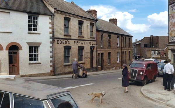
Eden's Fish & Chips (now a Chinese takeaway) around 1960. the houses at left were demolished to improve the junction of Bond Street.
Photographed by
Doug Keyse,
courtesy of Andy
Keyse
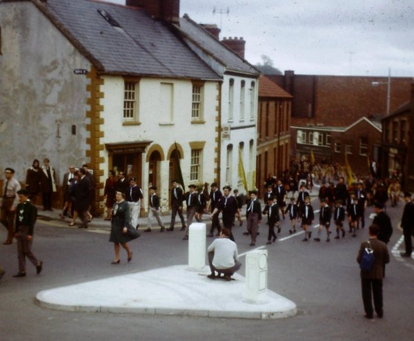
The St George's Day parade of 1968 passes Bond Street at left. Shortly after this photograph Mr Head's small corner shop was demolished, along with the house next to it, in order to improve vehicle access to Bond Street.
This colourised photograph of the 1960s, looks down on Eden's Fish & Chip shop and the shop on the corner of Bond Street and South Street seen from Penn Hill.
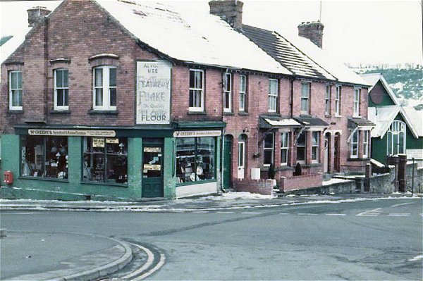
Sam McCreery's junk shop seen in the snow of 1985.
Courtesy of
Wendy Leach
This photograph of South Street dates to about 1880 or 1890. The three-storey building at centre was William Fooks' glove factory. The two-storey building at right was the Park Street House gardener's cottage.

From the Cave
Collection
(colourised),
Courtesy of South Somerset Heritage Collection
This
photograph
features in my
book "Lost Yeovil"
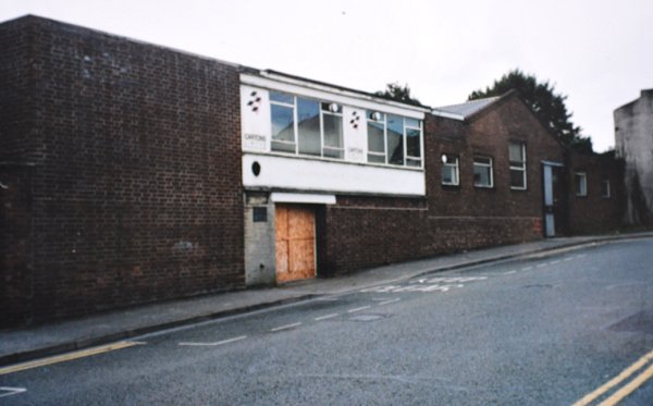
This photograph of South Street dates to about 1920. The three-storey white building at centre was William Fooks' glove factory while the garden wall at extreme right was the South Street entrance to Park Street House. It later became a box-making factory and, later still, the site was cleared and it was occupied by the Somerset & Dorset Box Co Ltd. The site is now the car park behind the old Gaumont cinema.
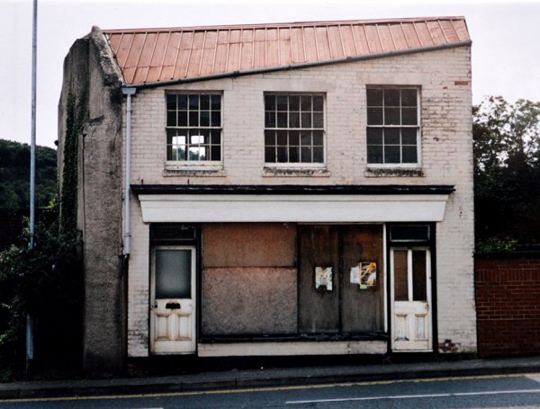
I believe that the building at right, with a shop-front and the Pitman's School sign, replaced the Park Street House gardener's cottage in the earlier photograph above. This later building was demolished in 2001. See also next photo.
Courtesy of
Vivien and John
Cornelius.
This photograph
features in my
book 'Now
That's What I
Call Yeovil'
The Park Street House gardener's cottage, later the Pitman's School of the previous photograph, hung on until its demolition in 2001 - just after this photograph was taken. Latterly it was a hairdresser's salon.
From the Cave
Collection
(colourised),
Courtesy of South Somerset Heritage Collection
Demolition of old cottages at the eastern end of South Street to make a car park (see next photo) opposite the Gaumont Cinema in the 1960s.
This photograph of the 1960s now looks back towards the junction with Park Street in the distance. The building at extreme left is the same as the building with the Pitman's sign in the previous photograph. The scene has hardly changed in the past 50 years - click here for a 'Then & Now' comparison.
Looking east again, the car park seen in the photograph above on the left with the Primitive Methodist chapel, somewhat hastily demolished I seem to remember, and the box factory on the right with the Gaumont cinema behind it. In the far distance is the Triangle where South Street terminates. To the right is the box factory (see also below).
The eastern end of South Street photographed around 1995. The Primitive Methodist chapel has scaffolding and will shortly partly fall down and partly be demolished. At the right all the box factory buildings would soon be demolished. Today, the area is mostly car parks.
Courtesy of
Vivien and John
Cornelius.
This
photograph
features in my
book "Lost Yeovil"
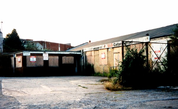
The box factory, at one time the Somerset & Dorset Box Factory and latterly simply S&D. Demolished for a car park and photographed in 2001 shortly before demolition.
From my
collection
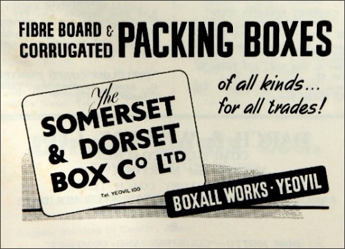
The Somerset & Dorset Box Co Ltd's advertisement in Foord's Directory of 1964-5.
Courtesy of
Vivien and John
Cornelius.
This photograph
features in my
book 'Now
That's What I
Call Yeovil'
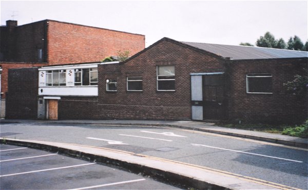
The box factory seen from the car park on the north side of South Street. Photographed in 2001 with the rear of the Gaumont cinema at top left.
Courtesy of
Vivien and John
Cornelius
.... and for those of you interested enough to care - the back of the box factory. Closed in 2001.
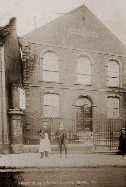
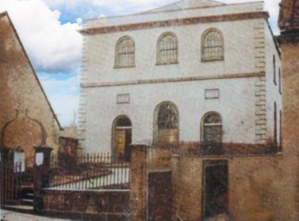
Back to South Street - this postcard dates to around 1910 and is of the Primitive Methodist Chapel in South Street, seen above. The site is now a private car park.
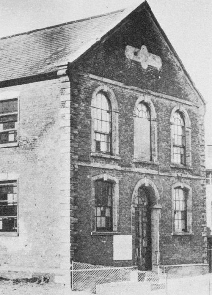
A later photograph of the of the Primitive Methodist Chapel in South Street - note that the building to the left in the previous photograph has been demolished and the nice railings in front of the chapel have gone which probably dates this photograph to after the Second World War when the railings would have been requisitioned for the war effort.
From my
collection.
This
image
features in my
book 'Yeovil
- The Postcard
Collection'.
The eastern end of South Street, seen from the Triangle. Detail from a postcard sent in 1914.
Courtesy of
Chris Rendell
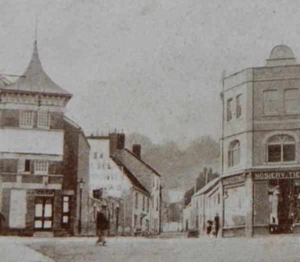
The eastern end of South Street as it meets the Triangle with Stars Lane at far left. Photographed in 1985 at which time the Gaumont had stopped showing films and was now a bingo hall and the old Co-op building at far right was now Harris' carpet showroom.
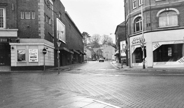
South Street 2015 - going back the other way
This first shot is almost unchanged from the 1985 photo above.
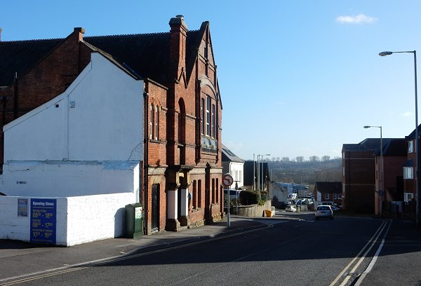
Looking back towards the Triangle. The Primitive Methodist Chapel once stood just off camera to the left.
The site of the Primitive Methodist Chapel photographed in 2015 - now a tatty private car park next to the council's not-much-smarter car park at far left both substantially contributing to the down-and-out look of this part of Yeovil. If only both car parks used about a meter-wide strip at the rear for some decent screen planting it would look far more attractive. However this might slightly reduce the number of parking spaces and since car parking fees and fines are the council's largest source of income, the chances of that happening are pretty remote. Rant over.
Once upon a time there was a box factory where that wall is now.
Looking back to where the box factory once stood. The old Gaumont cinema at extreme left. Again, a large area devoid of any planting to soften the appearance of the area - shame.
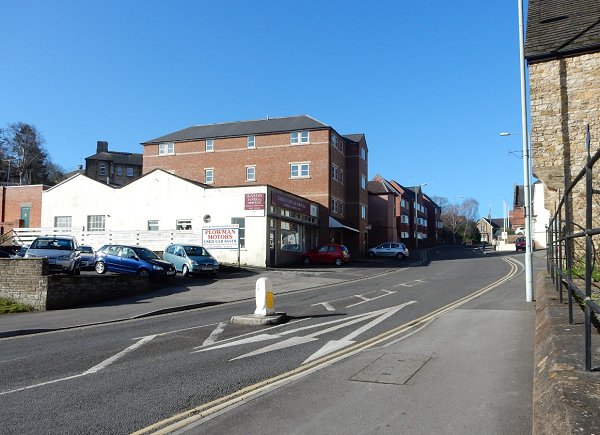
Looking west towards the junction with Park Street and Bond Street. The hairdressers on the corner was, at one time, Sam McCreery's junk shop.
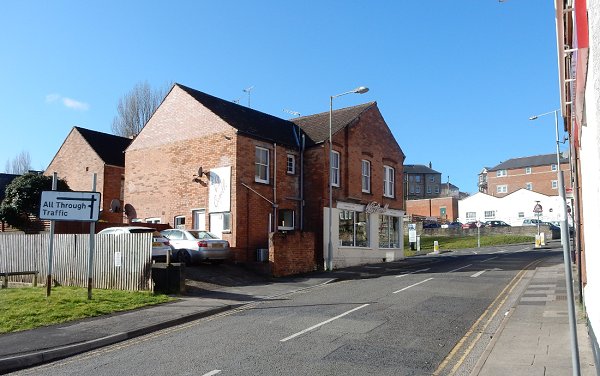
South Street now stops and starts at this centre point where once was Addlewell Lane at left and Park Street at right. Photographed from the end of Bond Street. South Street runs across the photograph.
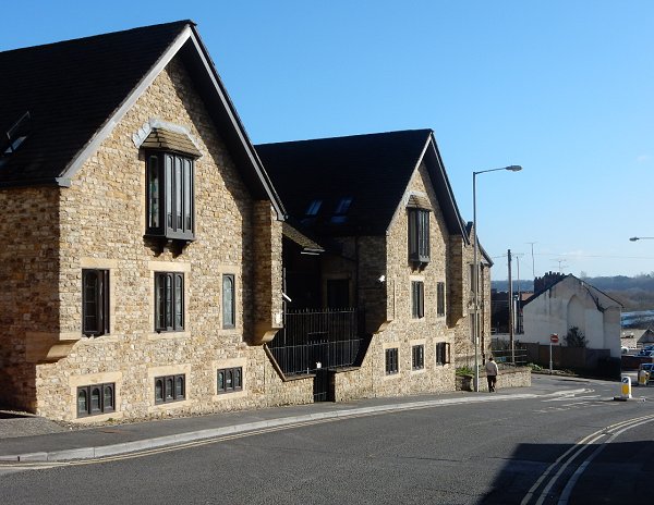
This photograph, with the garden wall of Woborn Almshouse at extreme right, looks west. Where once stood South Street School and the South Yeovil Service Station opposite the Victoria Temperance Hall (now the Day Centre) massive blocks of flats now stand.
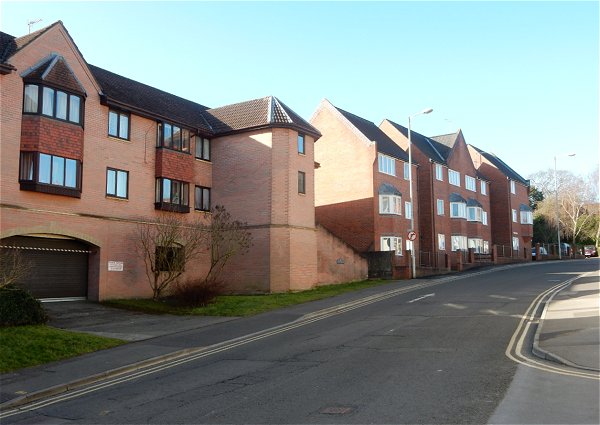
.... said massive blocks of flats.
Still looking west, massive blocks of flats at left, the Victoria Temperance Hall (now the Day Centre) at centre and at right, in a whiteout caused by the sun that my camera couldn't cope with, are the houses built by Samuel Cridland in 1887.
Looking back to Yeovil Trinity Foyer, built onto the rear of redundant Holy Trinity church in 1996 to provide accommodation and training to young people aged between 16 and 24 years old. Just beyond, the chap is walking past Woborn Almshouse which, in turn, is next to the junction with Bond Street.
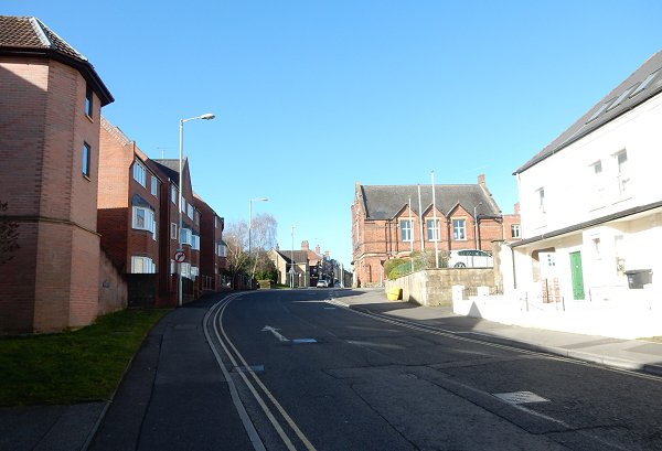
Looking back east with the Victoria Temperance Hall (now the Day Centre) at left and the massive blocks of flats at right.
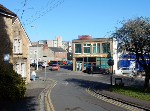
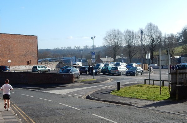
South Street running across the photograph, seen from Penn Hill.
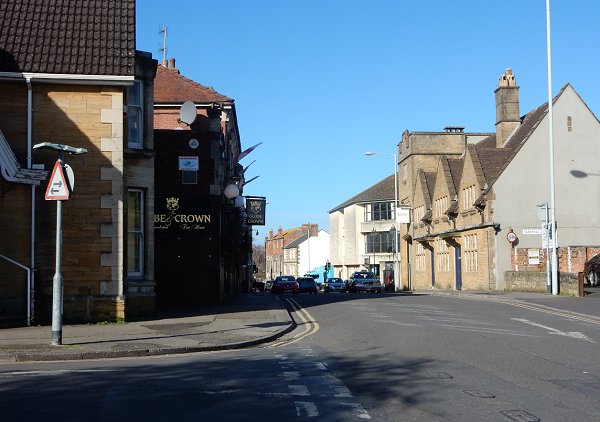
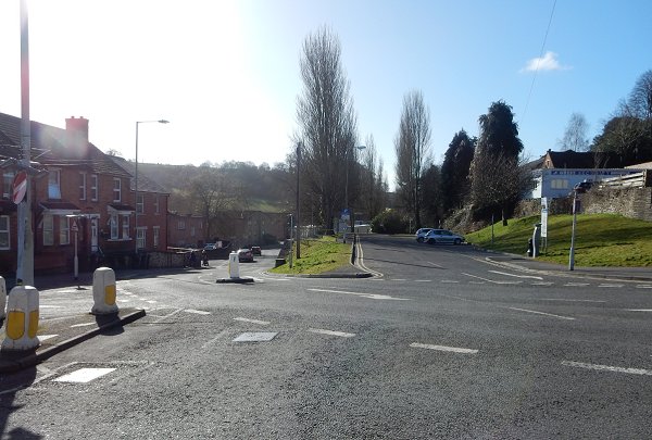
.... and the final stretch of South Street, seen from Penn Hill and looking towards the old Three Choughs Hotel at centre.