Old Brickyard
Old Brickyard
A small field used as a brickyard within the great manorial East Field
Old Brickyard (Parcel 948), was originally a small field in the great medieval East Field of Kingston Manor but later, as suggested by its name, was used as a brickyard.
The 1846 Tithe Apportionment noted that (Parcel 948) was described as 'Old Brickyard' - inferring it was no longer in use. The owner at this time was William Edwards and the tenant was George Ricketts (although it is not suggested that either were brickmakers). The Apportionment went on to describe Parcel 948 as being 3a 1r 10p and used as pasture - confirming that it was no longer used as a brick yard.
Old Brickyard was bounded on the west by Brickyard Lane (today's St Michael's Avenue), on the north by Long Close (Parcel 945), on the east by Spring Close (Parcel 947) and to the south by Cribhouse Ground (Parcel 949).
By the time of the 1946 aerial photograph, seen below, Old Brickyard was a small open field. Its location now lies under the Bucklers Mead Astro-Turf football pitch.
For details on historic land measurement (ie acres, roods and perches) click here.
maps

This map, based on the descriptions in the 1589 Terrier and the 1846 Tithe Map of Yeovil shows the approximate boundaries of the Manors of Kingston and Hendford as well as the manorial three-field system used in Kingston.

A map of the great medieval East Field of Kingston Manor showing conjectured locations of several fields based on descriptions in the 1589 Terrier.
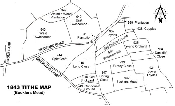
Drawn from the 1846 Tithe Map with field names added from the 1846 Tithe Apportionment, with Old Brickyard (Parcel 948) towards centre bottom.
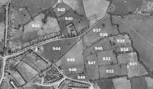
The 1946 aerial survey photograph with parcel numbers of 1846 plotted on.
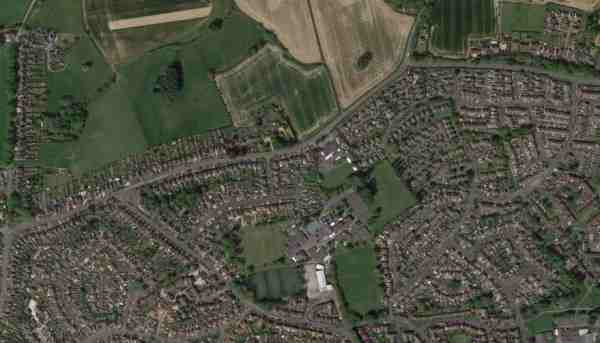
An aerial view (courtesy of Mr Google) of the area today.
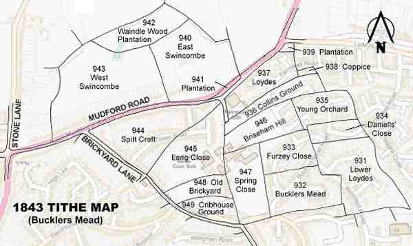
The 1843 Tithe Map overlaid onto a modern map of the area.