Penny's Mead
Penny's Mead
A field within the Manor of Hendford
Penny's Mead (Parcel 783) was originally a field within the Manor of Hendford and was, for generations, part of Aldon Farm. The name Aldon was known before Aldon house was built since Watt's map of 1806 shows a footpath "To Aldon Farm, etc."
The Penny family were, during the seventeenth and eighteenth centuries, glove manufacturers who tended to invest in parcels of land. It is assumed that Penny's Mead is one such parcel.
At the time of the 1846 Tithe Apportionment, Penny's Mead was owned by John Batten Snr and let to John Brook the Elder (from c1810 to 1846) followed by John Brook the Younger (from 1847 to 1854). It was recorded as a meadow for growing hay and measured 2a 0r 10p. For other tenant farmers, see Aldon Farm.
Penny's Mead (Parcel 783) was bordered on the north by Dodham Brook, to the west by Nursery (Parcel 782), to the south by Tucker's Mead (Parcel 787) and Orchard (Parcels 785 and 786) and to the east New Pond (Parcel 784).
Today, the former Penny's Mead is mostly occupied by Goldenstones Leisure Centre and the remains of the parcel forms a part of the Yeovil Country Park.
For details on historic land measurement (ie acres, roods and perches) click here.
maps

This map, based on the descriptions in the 1589 Terrier and the 1846 Tithe Map of Yeovil shows the approximate boundaries of the Manors of Kingston and Hendford as well as the manorial three-field system used in Kingston.
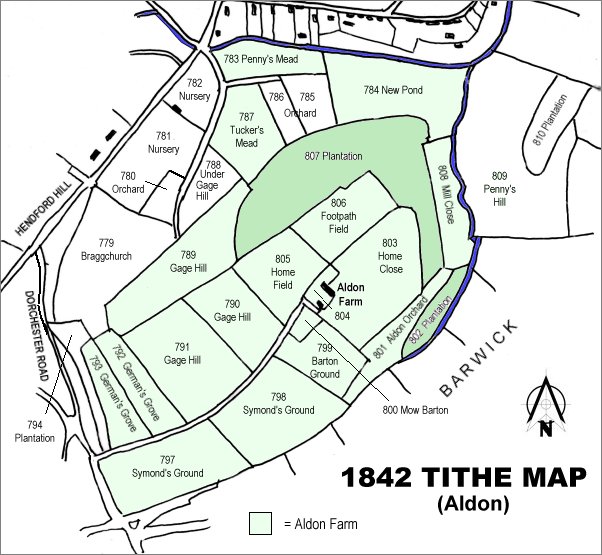
The 1842 Tithe Map showing the Aldon area and the parcels of Aldon Farm shaded light green. New Pond (Parcel 784) is at the top right.
Gallery
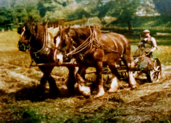
Penny's Mead, later to be the site of Goldenstones, in a colourised photograph of August 1940.
Courtesy of John
Penny
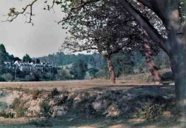
Penny's Mead - photographed around 1970 by John Penny (a different branch of the Penny family).