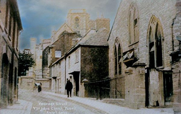
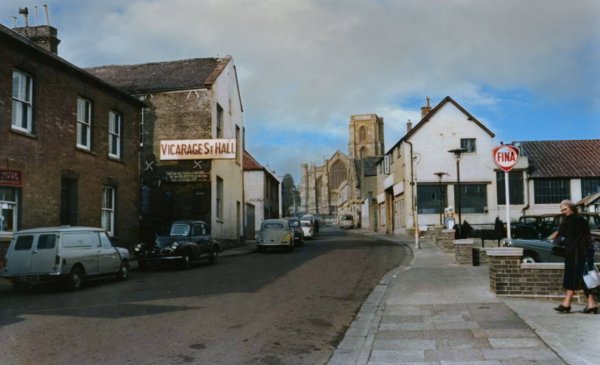
Quedam Street / vicarage street
Quedam Street / vicarage street
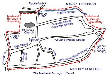
An original street of the medieval Borough
 Quedam
Street, the
later Vicarage
Street, has been
a street within
the medieval
town probably
since Saxon
times. In
medieval times
much of the
northern
boundary of the
Borough was a
small stream or
brook called the
Rackel, or
Rackle, which
ran along the
rear of
properties on
the northern
side of Quedam
Street,
Quedam
Street, the
later Vicarage
Street, has been
a street within
the medieval
town probably
since Saxon
times. In
medieval times
much of the
northern
boundary of the
Borough was a
small stream or
brook called the
Rackel, or
Rackle, which
ran along the
rear of
properties on
the northern
side of Quedam
Street,
The street itself ran eastwards from Silver Street, opposite St John's church, before veering southeast and joining Middle Street at Vennell's Cross, now the Triangle.
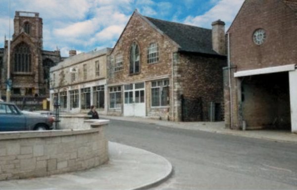
Vicarage Street was formerly known as Quedam Street or Quidham Street and according to Leslie Brooke in several of his esteemed publications he says the word Quedam was a corruption of the Latin word quedum meaning a ‘certain street’ or place of uncertain name. However I have in my collection a lease, dated 4 September 1794, in which Mr John Rossiter, a carpenter, leased a burgage and garden from John King, bookseller, “in a certain Street there called Quedam Street” inferring that it was actually the name of the street rather than meaning a place of uncertain name.
In his will of 24 August 1580, woollen draper Gyles Hayne wrote "... Also my saide Mother shall have use and Enioye for tearme of her lief the Rentes Dewe of the Tenementes w[hi]ch Thomas Wills and others dwell in, in Quedin streete sometyme S[i]r William Carants Landes,".
In a thirteenth century document from the reign of Henry III (reigned 1216-1272) refers to it as Quedamstreete. The name Vicarage Street, which appears to have happily existed alongside the name Quedam Street for several centuries, was named after the vicarage of St John's church that was established there in 1377. An earlier vicarage existed since in 1192 the church of St John (not the present church) was rated at 63½ marks and the vicarage at 7½ marks, but whether or not it was located in Vicarage Street is unknown. In 1546 the vicarage was noted as the ‘parsonage’ in a bill of payments “for repairs of the parsonage and tenements of Yevyll from Michaelmas 37 Hen. VIII to Michaelmas following, viz., for carpenters, thatchers, &c. Four items of payments to the Bishop of Bath and to the dean and chapter and archdeacon of Wellys are noted in the margin. Total £7 8s 1½d”.
In 1729 a charge of one pound for the Window Tax was levied on the Vicarage indicating that it was one of the largest properties in the Borough of Yeovil with more than thirty windows.
In 1856 Vickery wrote "There is a Vicarage-house belonging to the church, situate in Vicarage-street, but its locality is so bad, that it is at present unoccupied."
The name Quedam Street fell into disuse and the name Vicarage Street became firmly established during the nineteenth century and was named as such from the 1841 census onwards. In 1856 Vickery referred to "Quedam-street (now Vicarage Street)".
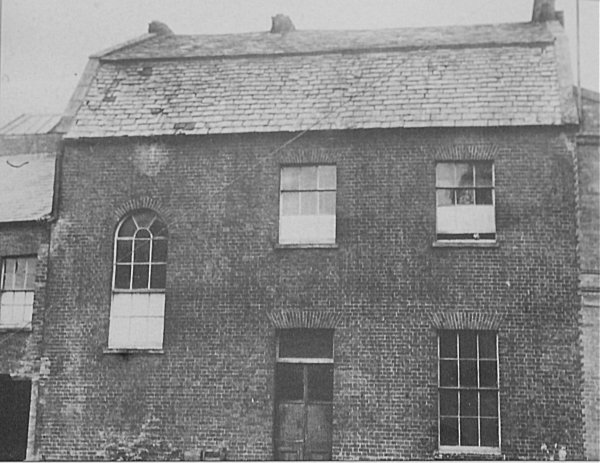
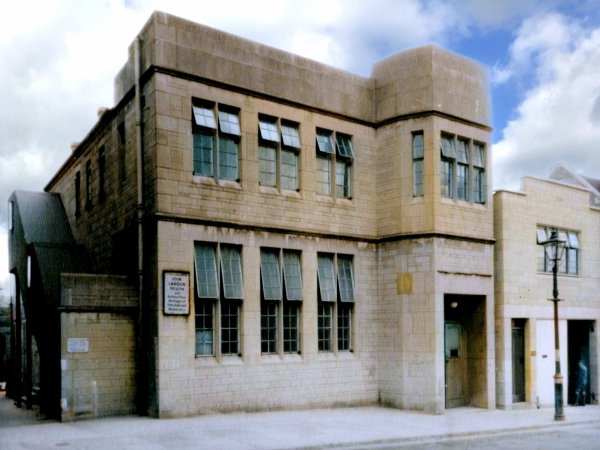
In medieval times the Chantry of the Blessed Virgin Mary Without the Church was supposedly built in Vicarage Street although, since the chantry was actually attached to the church, it is more likely that this was simply a property owned by the chantry which provided some income in the form of rents. The site was later built on and became the Unitarian chapel, photographed below, itself rebuilt in 1809.
In the eighteenth century a workhouse was established in Vicarage Street but later moved to a site now at the rear of the Liberal Club in Middle Street. In 1837 it moved again to the new Union Workhouse in Preston Road.
In 1818 the Corporation build a Sunday School in Vicarage Street, later to become the Vicarage Street Hall - photographed below. Referring to the building in 1856, Vickery wrote "This place of worship is situate in Vicarage-street, and was purchased for £200, about the year 1850, of the Town Commissioners. It had formerly been part of the property of the Portreeve and Burgesses, by whom it had been built as a Church Sunday School for the town. Mr. William B. Dyer usually ministers at the place. A Sunday and a Day School are attached to the building."
In 1852, at the enquiry of the General Board of Health following a cholera epidemic in 1848-49, Dr. Tomkyns' evidence upon the sanitary condition of the town stated that "Epidemics are not of very frequent occurrence, and then chiefly in the lower parts of the town, such as Reckleford, Vicarage-street, Belmont, &c". At the enquiry it was stated that outbreaks of typhoid fever were common in the town, especially in the poorer parts of the town, including Vicarage Street. It was stated that frequently privvies were built so close to the wells that the drinking water became contaminated as was cited at Jennings Court off Vicarage Street.
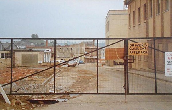
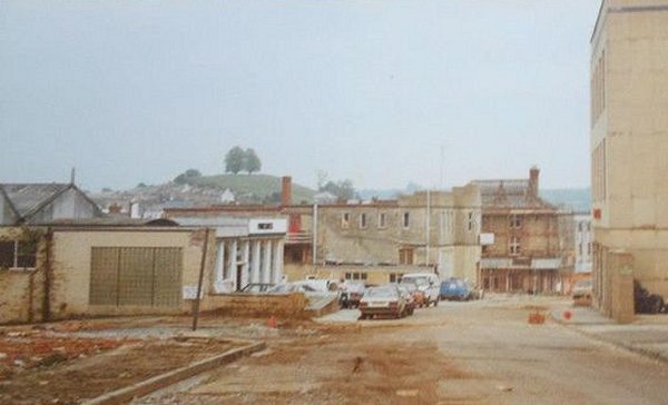
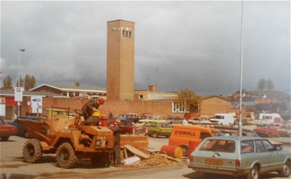
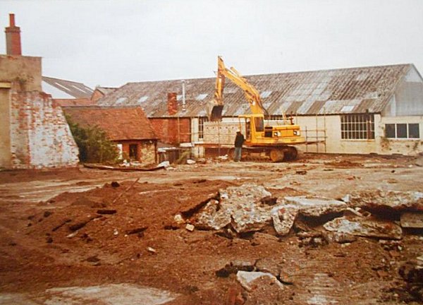
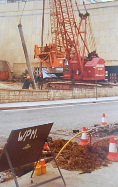
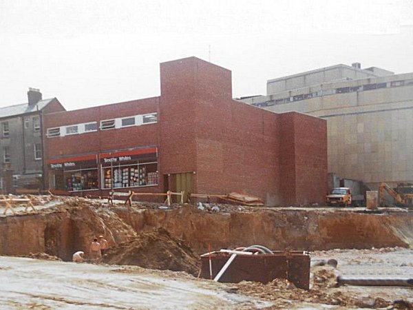
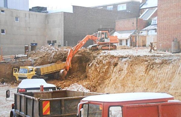
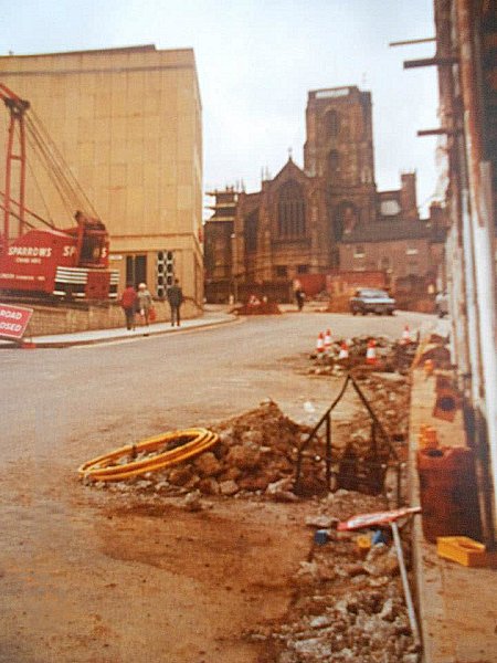
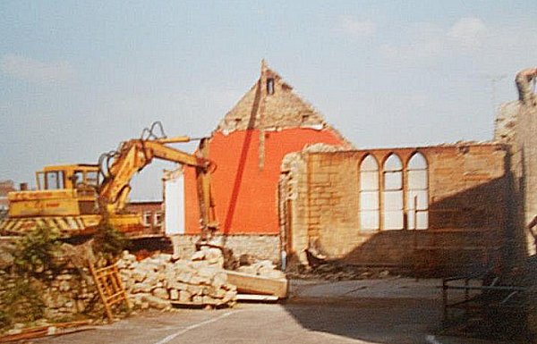
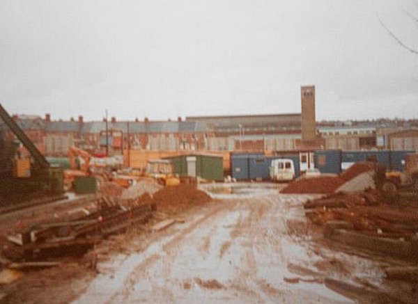
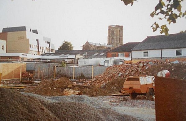
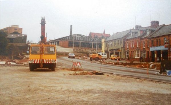
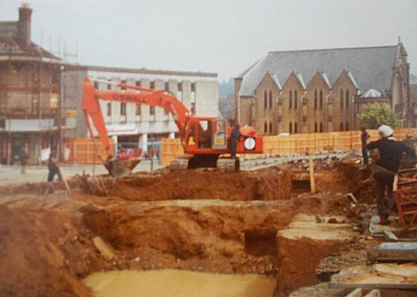
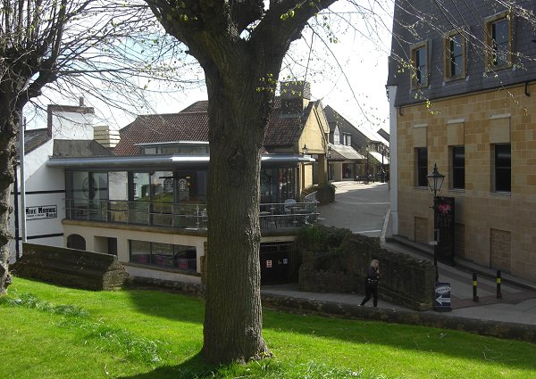
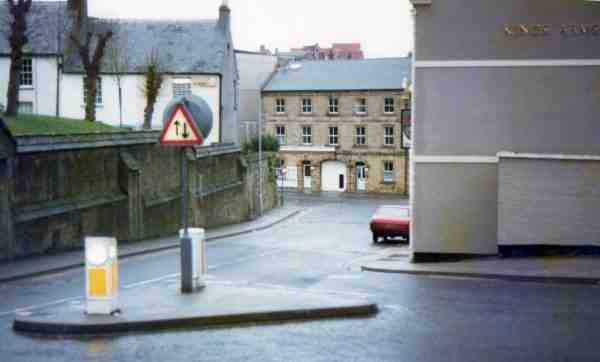
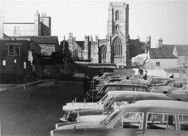
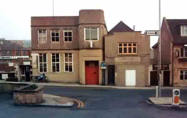
Vicarage Street was all but obliterated when the Quedam project really got under way in 1983 - see the series of photographs at the bottom of this page. Apart from a couple of shops close to the Triangle, the Methodist church is the only Vicarage Street building to survive.
map
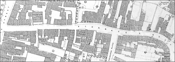
A map based on the 1886 Ordnance Survey of Vicarage Street with Silver Street at extreme left. Quidham Place is just left of centre with its entrance just below the 'V' of Vicarage Street.
Courtesy of Rob
Baker
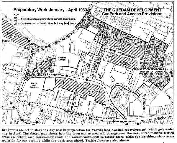
A map published in the 21 January 1983 edition of the Western Gazette showing the size and scope of the new Quedam shopping precinct development that heralded the demise of Vicarage Street.
gallery
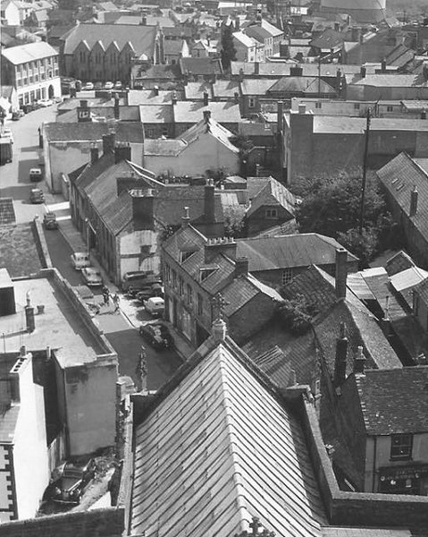
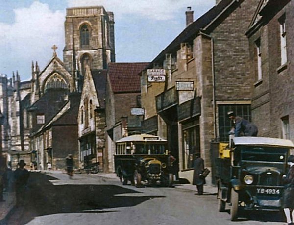
The whole of Vicarage Street as seen from the tower of St John's church in the early 1960s. Vicarage Street runs from its junction with Silver Street (obscured by St John's chancel roof at centre bottom) up to the premises occupied by Neal and Williams (later with a new front elevation) before veering right, in front of the Methodist church, and joining Middle Street at the Triangle at top right.

This
colourised photograph
features in my
book "Lost Yeovil"
The western end of Vicarage Street photographed from Silver Street, c1920. The Parker family's butcher's shop is at left. This had earlier been the premises of William Bodenham (from the 1830s), then his son George Bodenham. By the time of his death in 1883, George Bodenham also owned the property at right - later the Denning Brothers' butchers - together with the slaughterhouse behind it. His wife Emily ran the family butchery until her death in 1894.

Courtesy of
Colin Haine
-
This colourised photograph
features in my
book 'Yeovil
From Old
Photographs'.
Vicarage Street seen from St John's churchyard, probably during the 1950s. The triangular, single storey building at centre was for many years a fire engine house - it later became part of Dening Brothers butchers shop and provisions merchants in Silver Street. Dening's had their own slaughterhouse behind the shop. These premises, and the slaughterhouse, were also earlier owned by George Bodenham and, after his death, by his wife Emily.
The western end of Vicarage Street viewed from St John's churchyard in the mid-1960s. The 1930s building at centre was Percy Winsor's Engineering and agricultural implements business. Beyond that is the former Unitarian church taken over by Winsor as an extension to his store.
Courtesy of the
Western Gazette
Again, the western end of Vicarage Street photographed from St John's churchyard in the 1970s, with Silver Street running across the bottom of the photograph.
Courtesy of Toby
Newcombe, photo
by Simon
Newcombe
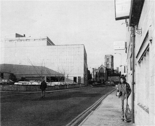
Pretty much the same scene, again photographed from the churchtard in the early 1980s.
.... and almost the same view in 2013 (sorry about the tree).
Courtesy of Toby
Newcombe, photo
by Simon
Newcombe
The lower end of Silver Street, photographed in the 1980s from the junction with Vicarage Street.

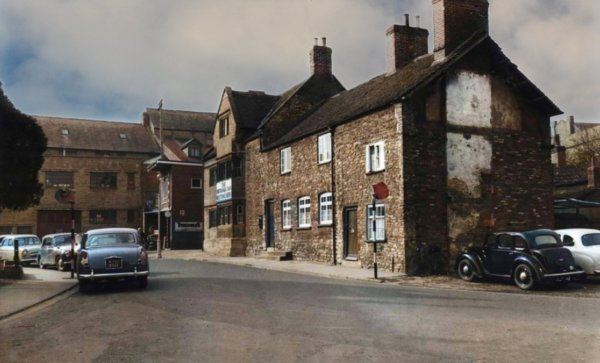
A colourised photograph dating to around 1900, of the western end of Vicarage Street looking towards Silver Street. The buildings at centre predating Percy Winsor's building of the first photograph. The Unitarian church, rebuilt in 1809, was in use at this time. This was built on the site of the medieval Chantry of the Blessed Virgin Mary. The canopy casting a deep shadow on the house next to the church is the passageway that led through to Mead's Court. In 1881 and 1891 this small house was known as the Tinman's Shop and was occupied by 'Tinman & Brazier' Alfred White, his wife Lucy née Gale, their five sons and a servant.
This colourised
postcard
features in my
book 'Yeovil
From Old
Photographs'
A slightly later photograph, probably dating to around 1910, of the same scene with the man walking past the passageway, with its canopy, leading to Mead's Court. The archway at extreme left gave access to Parker's slaughterhouse - many thanks to Ron Hilborne for that snippet of info - Ron remembers "My bedroom overlooked the slaughter yard at the back so by the time I was about six I knew how to slaughter almost anything."
This
colourised
postcard
features in my
book 'Yeovil From Old Photographs'.
From the Cave
Collection
(colourised),
Courtesy of South Somerset Heritage Collection
This photograph of the 1960s is of the western end of Vicarage Street, seen from close to Silver Street. The temporary car park would later be surfaced and a boundary wall constructed as glimpsed in the following photograph.
From the Cave
Collection
(colourised),
Courtesy of South Somerset Heritage Collection
Another photograph of the late 1960s looking back to the west end of Vicarage Street with St John's church at extreme left. Note that by this time the old Unitarian church had been acquired by Winsor who adapted it for his use, including changing two of the upper windows and the whole of the ground floor frontage.
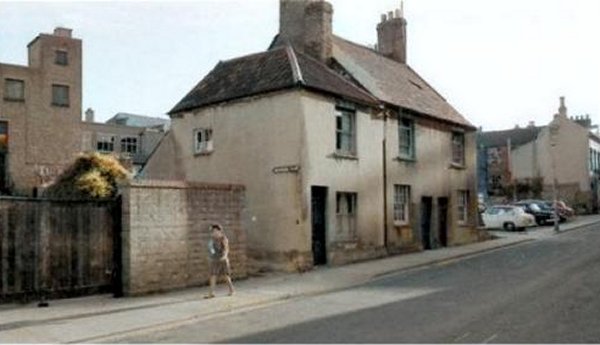
The Vicarage Street house of Cuthbert Raymond in which Walter Raymond was born. This house was next door to the Anchor Inn at the western end of Vicarage Street and was demolished in the late 1950s.
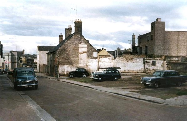
Vicarage Street car park, photographed in 1969.
From the Cave
Collection
(colourised),
Courtesy of South Somerset Heritage Collection
This
photograph
(colourised)
features in my
book "Lost Yeovil"
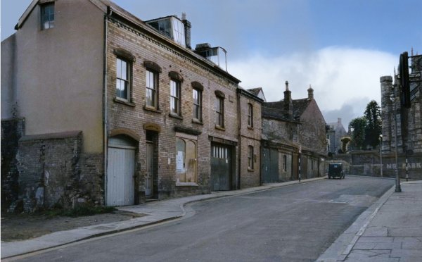
Again from the mid-1960s, this photograph shows the buildings facing Winsor's business. At the far end, the single storey building was for many years a fire engine house - it later became part of Denning Brothers butchers shop in Silver Street (demolished in the first photograph of this series). The large two-storey building dominating this photograph was former premises of the small Engineering company Harbour & Hobbs.
From the Cave
Collection
(colourised),
Courtesy of South Somerset Heritage Collection
This colourised photograph dates to about 1960 and shows the entrance to Quidham Place at centre. Vicarage Street runs diagonally across the photograph. At far right is the Harbour & Hobbs building featured in the previous photograph.
From the Cave
Collection
(colourised),
Courtesy of South Somerset Heritage Collection
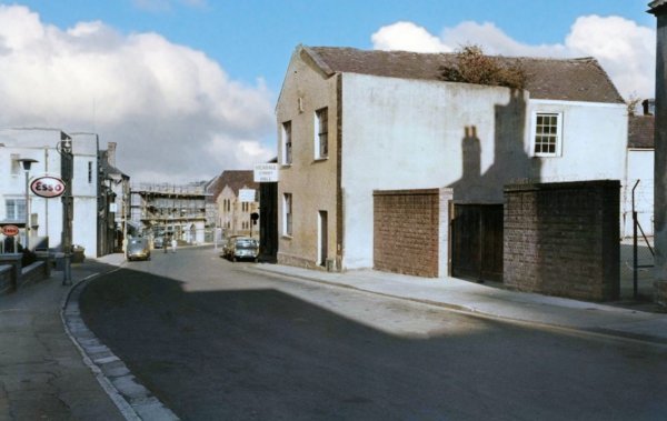
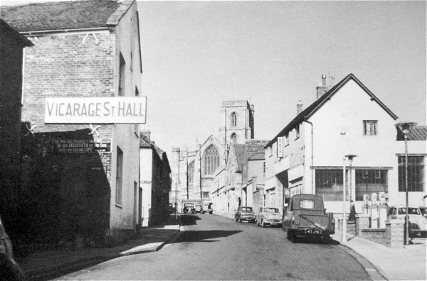
Moving further down Vicarage Street, this 1960s photograph shows the Vicarage Street Hall. At left is Vincent's garage.
From the Cave
Collection
(colourised),
Courtesy of South Somerset Heritage Collection
... and looking west at the Vicarage Street Hall, from the other direction.
.... and seen from a slightly different angle in 1960.
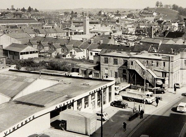
A few years later - this is the view from the roof of the Marks & Spencer building looking down to Vicarage Street with Vincent's garage and the Labour Club at right. Running across the photo are the rooftops of Vincent Street.
From the Cave
Collection
(colourised),
Courtesy of South Somerset Heritage Collection
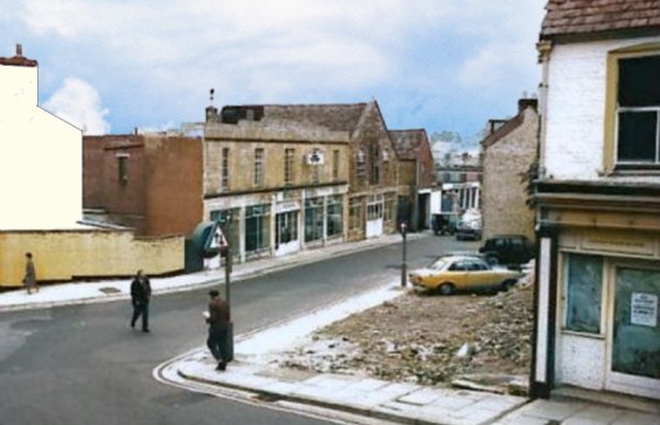
.... and moving just a bit further along Vicarage Street, this photograph shows the entrance to Frederick Place. On the corner of Frederick Place where the mini is parked was the general grocery and sweet shop of Nat Robins. On the opposite corner, with the sign, was Pearce's sweet factory, where herbal sweets were made.

This
colourised photograph
features in my
book "Lost Yeovil"
A photograph of 1958 showing Vicarage Street houses, opposite the junction with Vincent Street and near the bend in the road towards the eastern end of Vicarage Street. These were demolished shortly thereafter and the site was cleared for a car park.
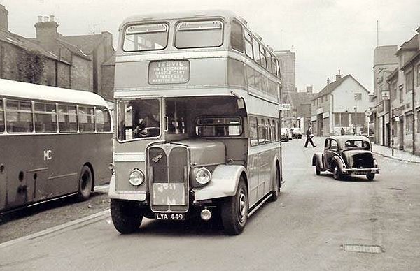
A double-decker bust travelling along Vicarage Street during the 1950s. At extreme right are the Albion Inn and the Labour Club.
From my
collection
Built in the 1930s (I'm guessing, based on the style of architecture), the Labour Club in Vicarage Street. This colourised photograph, by H Harvey of Yeovil, dates to between the mid-1940s and the mid-1950s.
Courtesy of
Chris Rendell
The Labour Club (T&GWU offices) at left, the Albion Inn, the entrance to Vincent Street then the old Army & Navy Stores building and the premises of Neal & Williams builders merchants.. Photographed from Vicarage Street shortly before demolition in 1983.
Courtesy of
Colin Haine.
This photo
features in my
book 'Now
That's What I
Call Yeovil'
The Labour Club seen from the car park opposite, which lay at the end of Frederick Place.
Courtesy of
Helen Angel
Extance
Pretty much the same view. Photographed from Vicarage Street in 1983.
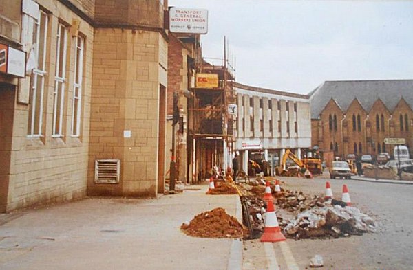
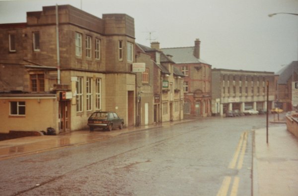
Looking eastwards towards the bend in Vicarage Street in the late 1970s. At extreme left is the Albion Inn, then the junction of Vincent Street, on the opposite corner was the building that had been the Army & Navy Stores. The modern building at centre had been Neal & Williams Ltd which, during the Second World War, had been the venue for the Yeovil War Workers Club. Next was the entrance to the Council's Town Yard and finally, at right, the Methodist church - the only building in this scene that remains today.

From the Cave
Collection
(colourised),
Courtesy of South Somerset Heritage Collection
Looking down Vincent Street from Vicarage Street with the Albion Inn on the western corner and the Army & Navy Stores on the eastern corner. Photographed in the mid-1960s.
Courtesy of Rob
Baker
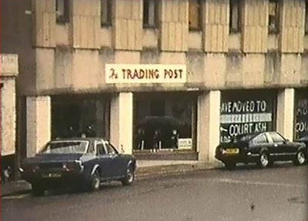
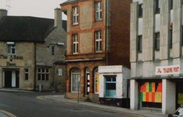
The junction of Vincent Street with Vicarage Street seen from the east. At left is the Albion and on the other corner is the old Army & Navy stores. The black and white door had been a cheese shop. The small building was Thoroughgood's (I think was a shoe repairer) and then the Trading Post which had been Neal & Williams' premises. Photographed around 1980.
Courtesy of Rob
Baker
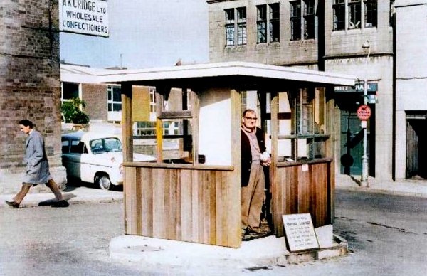
This colourised photograph of 1970 shows the ticket office of the South Street car park (with Unity Hall in the background at right), before the introduction of ticket machines shortly thereafter.
Courtesy of Rob
Baker. This
photograph
features in my
book "Lost Yeovil"
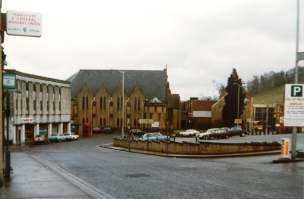
.... and looking the other way across to the Methodist church and the Vicarage Street car park. At extreme left the T&WU office was in the Labour Club next door to the Albion Inn.
Courtesy of the
Western Gazette
This photograph of the 1970s looks west towards St John's church. At left is the entrance to the Vicarage Street car park that aligned with Frederick Place. The man at right is passing by the Labour Club (T&GWU offices) and the Albion.

Another colourised photograph of 1958, showing Vicarage Street houses on the bend in the road towards its eastern end. These are boarded up and awaiting demolition before the site was cleared for a car park (see next photo).
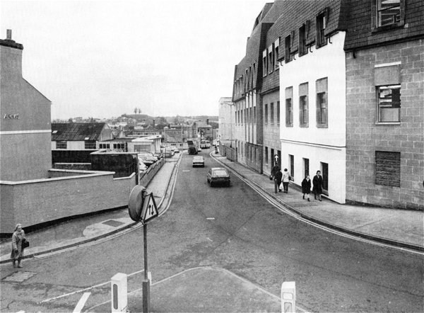
Looking down Middle Street with the Albion Inn, right of centre, scaffolded and awaiting demolition in 1982. To the immediate right of the Albion Inn was Vincent Street. The car park at left was built on the site of the houses of the previous three photographs. In 1967 charges for the Vicarage Street car park (which had spaces for 120 cars) was 6d for two hours (the same as Middle Street) while all other car parks were 6d for all day parking.

From the Cave
Collection
(colourised),
Courtesy of South Somerset Heritage Collection
Taken around 1960, this photograph looks east towards the Methodist church - about the only building that survives today from this whole series of photographs. Note that the wall around the car park has yet to be built.
From the Cave
Collection
(colourised),
Courtesy of South Somerset Heritage Collection
Turning right, round the bend of the previous photograph, the view takes in this short stretch of Vicarage Street with the Britannia Inn and the cottages alongside, before bearing left at the end around the Methodist church and heading towards the Triangle.

From the Cave
Collection
(colourised),
Courtesy of South Somerset Heritage Collection
Looking back to the double-bend towards the eastern end of Vicarage Street, this photograph shows the Britannia Inn, originally a seventeenth century house, and adjoining cottages taken about 1968. Off-photo to the right is the Methodist church.
Courtesy of Rob
Baker
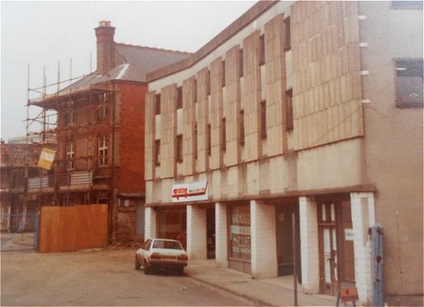
After the Britannia Inn and adjoining cottages were demolished in 1969, the area was made into a car park. EH Hamilton's tyre shop (established in 1928) at left survived until the destruction of Vicarage Street. Before 1928 it had been the horse-shoe stores of Neal & Williams and owned by one 'Minty' who, apparently, was a pig farmer of Yeovil Marsh with an alcoholic wife.
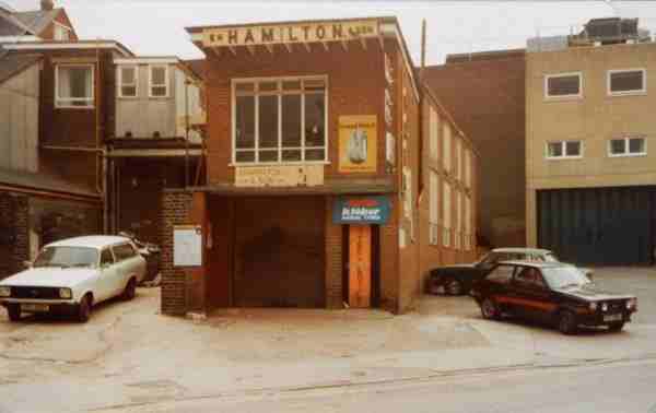
Courtesy of
Colin Haine
Hamilton Tyres photographed in the very early 1980s shortly before demolition.
Courtesy of the
Western Gazette
Almost the same view as the previous photographs. Although the Western Gazette's caption dated this photograph to 1956, they are a couple of decades out since the Britannia Inn wasn't demolished until 1969 to create the car park seen at centre.
From the Cave
Collection
(colourised),
Courtesy of South Somerset Heritage Collection
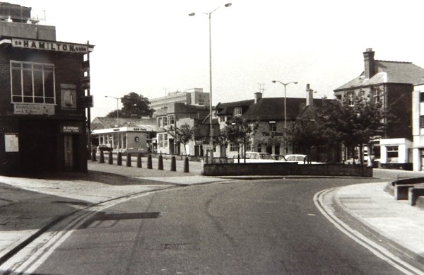
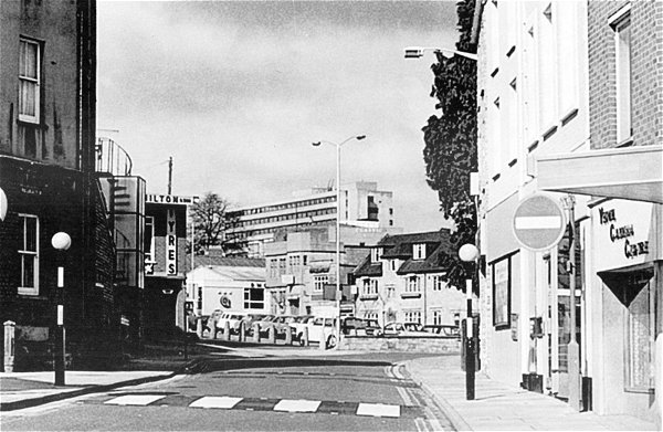
This photograph, taken about 1968 from the Triangle, shows the entrance to Vicarage Street at centre and the building with the white rectangle is the Britannia Inn of the previous photograph. At left is the old Co-Operative store and offices (later Porter Blacks) next is the entrance to Middle Street, Britons shop was earlier Belben's Bazaar, later the Woolwich Building Society and is now a bookmakers. To the right are buildings still existing and now occupied by the Abbey Building Society, at far right is the Coronation Hotel & Vaults in front of which are the underground toilets, now the location of the bandstand.
Courtesy of
Chris Rendell.
This photo
features in my
book 'Now
That's What I
Call Yeovil'
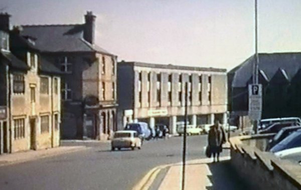
Vicarage Street photographed from its junction with Middle Street in 1983. In the distance are seen the Albion Inn, the entrance to Vincent Street, the old Army and Navy building and the premises of Neal & Williams.
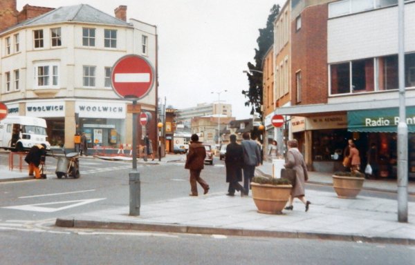
Photo by Trevor
Wallbridge.
Courtesy of South Somerset Heritage Collection
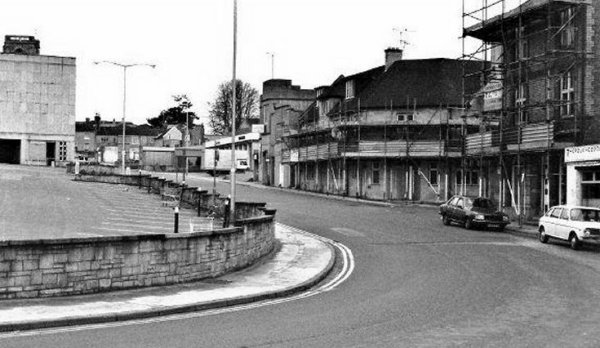
Pretty much the same view but photographed from a little further back into the Triangle. Photographed on 11 April 1983.

Courtesy of Toby
Newcombe, photo
by Simon
Newcombe
Pretty much the same scene, again photographed from the Triangle in the early 1980s.
The obliteration of Vicarage Street, 1983
Courtesy of Mark
Fraser
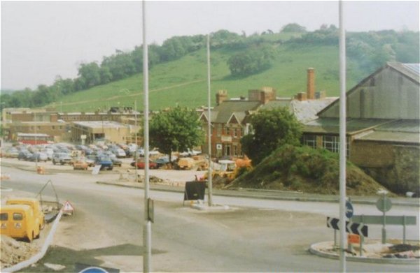
An unusual view of Vicarage Street in 1983 which appears to have been taken from the roof of the Nautilus Works in Reckleford.
Courtesy of Mark
Fraser
Taken at the same time as the previous photograph, this image is taken from further east.
Courtesy of
Roger Key. This
photo features
in my book 'Now
That's What I
Call Yeovil'
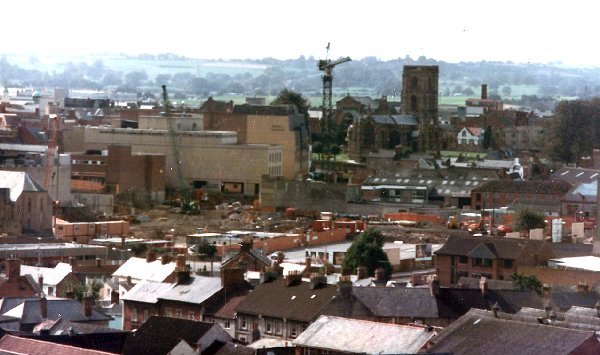
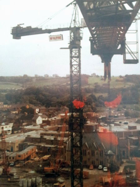
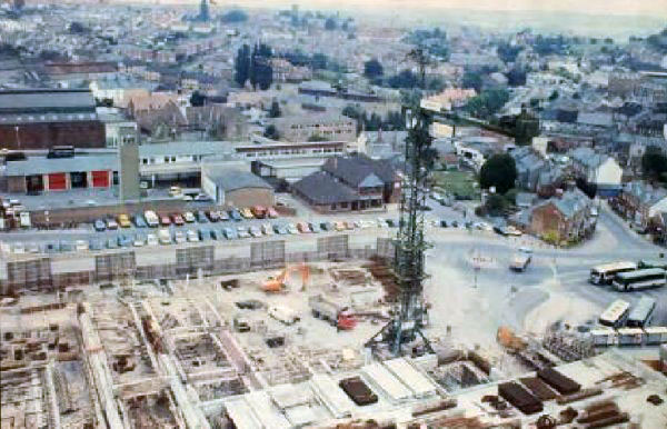
In 1983 Roger Key was one of the tower crane operators and took this and the following two photographs. Seen at bottom right is the Vicarage Street Methodist Church.

Courtesy of
Roger Key
Again seen from the tower crane, the new Quedam centre takes shape. Running off to the left towards the top are seen the rear of the shops in Middle Street while Summerhouse Hill dominates the top right of the photograph.
Courtesy of
Roger Key
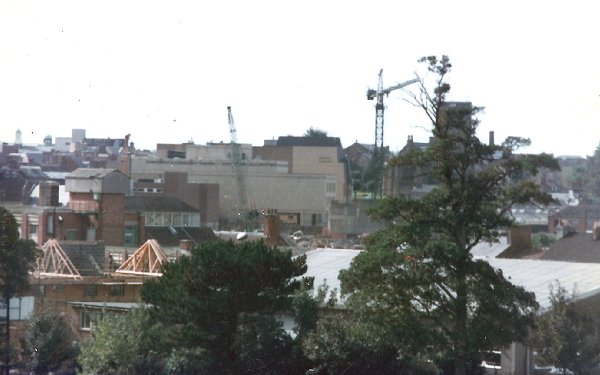
Also seen from the tower crane, the bus station is at lower right with the remains of Earle Street at centre right. The Labour Club is at centre with the ambulance station behind it and the fire station to its left.
![]()
All the following photographs are courtesy of Helen Extance.