the borough
the borough
Yeovil's original market square
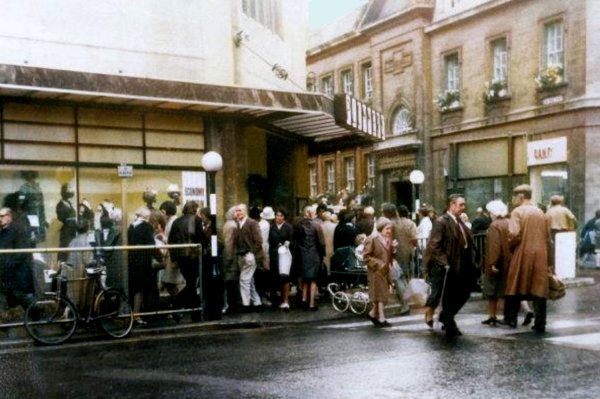
The traditional market place and heart of Yeovil simply known as ‘The Borough’ is little more than a widening of High Street and, indeed, officially the Borough doesn’t exist being technically High Street.
It was, from medieval times, the site of the weekly Friday market which dealt in locally-grown produce brought into the town from nearby villages and farms to sell. In early times this had included livestock as well as meat and meat produce, dairy produce, fruit and vegetables, corn and other grains and so forth but quite soon, as the town grew, the market began to expand into other nearby parts of the town – hence the earlier names of some of the nearby streets such as Cattle Market (Princes Street), Hog Market (Hendford), Corn Market (Silver Street) and Sheep Lane (North Lane).
In addition flax and hemp were bought and sold in the Borough market, being the raw materials for the substantial textile industry that was the mainstay of the town before gloving and leather production came to prominence.
In the centre of the Borough were two permanent market buildings; the Shambles (rebuilt 1803) used primarily by butchers and the Market House (built 1740) used by other stallholders. To the north of the Borough stood the Tolle Hall that contained the town's lock-up. The Market House also contained the town's stocks. On its southeast corner, at the junction with Wine Street, an old house called The Bow stood until the middle of the nineteenth century.
In 1856 Daniel Vickery recorded “Several old butchers' shops and shambles, which stood at the entrance of the old Market-house, were purchased and removed. Perhaps, however, no part of the borough has undergone more changes in appearance and reality, - dwellings and dwellers - than what is popularly called "The Borough." Not long since the site of Mr Dingley's shop was covered by one of the old wood and plaster buildings, and that of the Wilts and Dorset Bank by a block of low mean dwellings.”
|
Yeovilians
remember... ".... a Mr Whittle who, on Saturday nights, used to dispense delightful and mouth-watering confections of his own manufacture in the market place under the glare of naphtha flares, and to whom I paid willing tribute from my penny or tuppence weekly pocket money." |
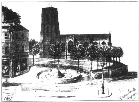
And finally, the long debate that continues to this day on Facebook about demolishing the buildings in front of St John's church in order to open up the view is nothing new. It was frequently discussed during Victorian times and the following article is from the Western Gazette's edition of 26 May 1911.
Suggested
Yeovil
Town
Improvement
|
MAPs
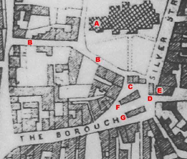
Day's map of
1831 showing the
Borough, plus a
few associated
features;
A = The
Chantry in
original
position,
B =
Church Lane /
Street, C =
Tolle Hall,
D = Bow,
E =
London House,
F = The
Butchers'
Shambles, G
=
Market House.
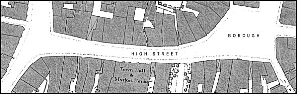
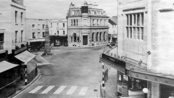
The 1901 Ordnance Survey showing High Street and the Borough, technically all High Street.
gallery
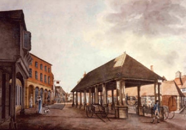
This painting
features in my
book 'Secret
Yeovil'
A painting made in 1810 of the Borough looking towards High Street which runs to the distance at left. The building at centre was the Market House, built in 1740, and behind it to the right was the butcher's Shambles, built in 1803. The Tolle Hall is seen at right, surmounted by its clock or 'horolitch'. At left, the building with the arched ground floor is the only building surviving today in the Borough and originally the ironmongery shop of William Edwards (who built it in 1790), then Josiah Hannam followed by James Bazeley Petter and then Hill & Sawtell. Today it is 15 High Street, occupied by Superdrug and is seen in the final photograph of this page. At extreme left is the ancient building, called Under Bow (see next image) on the corner of today's Wine Street.
Courtesy of Mrs
M J Rogers
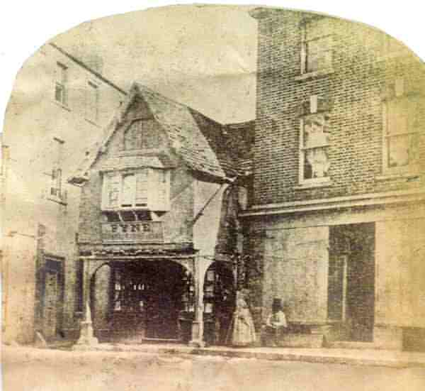
Under Bow, in the Borough on the corner of Grope Lane, photographed in 1861 by artist and photographer Frederick Treble. Under Bow was destroyed by fire in December 1861.
This photograph
features in my
book "A-Z
of Yeovil"
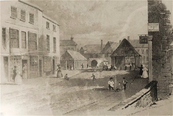
This sketch, made by GE Madeley to illustrate his map of 1831, shows the Borough seen from High Street - roughly the view seen today from the north end of King George Street. The Shambles is to the left and the Market House is to the right. The buildings at far left still stand today, that to the left is Clement White's shop, today's 8 High Street, at this time occupied by draper Benjamin Ryall whose name appears above the door. Behind the hanging sign at right is the Medical Hall which at this time was occupied by George Wellington, druggist and chemist.

... and a comparison photograph of May 2024.
This
photograph
features in my
book "Lost Yeovil"
A very early photograph by William Barrett (half of a stereoscopic pair), dating to about 1863, looking across the Borough to High Street.

From my
collection. This
colourised photograph
features in my
book "Lost Yeovil"
The Borough seen from High Street in an early photograph dating to about 1865 by W Barratt of Bridport. Note the buildings either side of Middle Street - London House to the left and the Medical Hall to the right.
This colourised photograph
features in my
book 'Yeovil From Old Photographs'.
This photograph was taken by Yeovil Photographer Jarratt Beckett and published in his 1897 book "Somerset viewed through a Camera".
Another photograph of the Borough by Jarratt Beckett and published in his 1897 book "Somerset viewed through a Camera".
Judging by the size of the tree in the front garden of the Bell, this colourised postcard dates to about 1900. This is AI-colourised from a monochrome postcard, as opposed to the hand-coloured version below.
From my
collection.
This
image
features in my
book 'Yeovil
- The Postcard
Collection'.
The same postcard as in the above, but this hand-coloured version was posted in 1907.
From my
collection
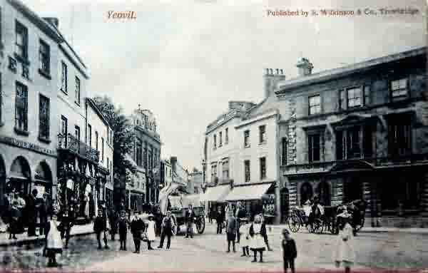
The Borough from a postcard of around 1902. Check out the lady in her carriage with her uniformed driver outside the bank (enlarged below) - that's the way to make a cash withdrawal.
From my
collection
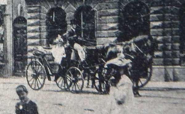
The enlargement of the lady in her carriage from the previous photograph.
From my
collection
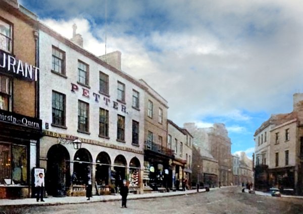
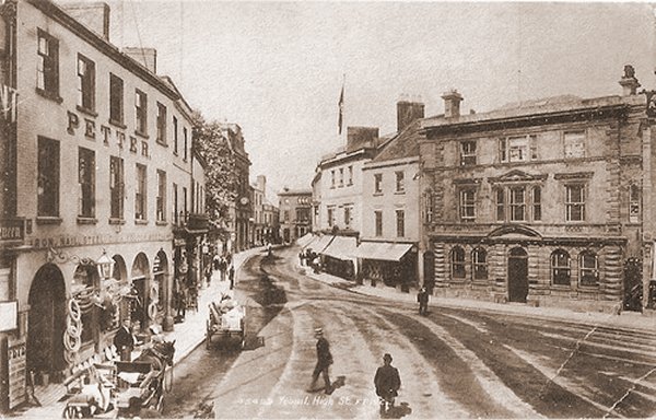
The same view but taken around 1905, by which time Harry Hill and John Sawtell had taken over today's Superdrug building (at extreme left) that had previously been the premises of HB & H Petter (sons of James Bazeley Petter).
From my
collection
Again using the same photograph, this hand-coloured postcard with an integral frame was part of a series of Yeovil postcards produced around 1910. This example was posted in 1911.
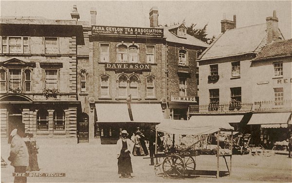
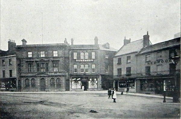
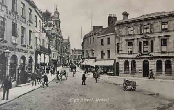
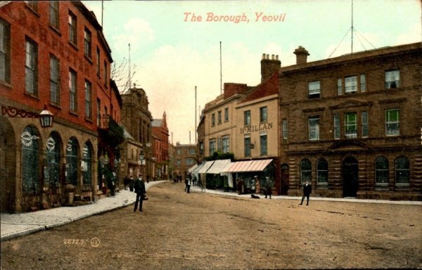
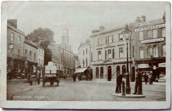
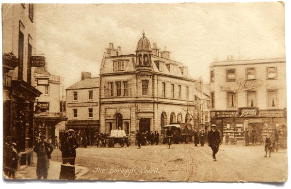
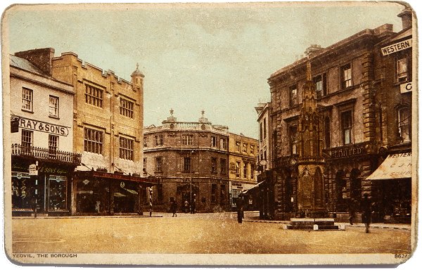
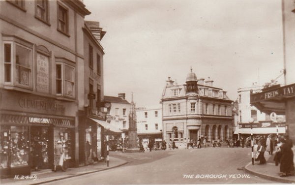
This postcard is dated 1906 and shows the Wilts & Dorset Bank (now Lloyds TSB) at left, then grocer and tea dealer JH Dawe & Son who were in the Borough from the mid-1870s to 1907 (later Shirley & Somerville) and at right is the clothiers, hatters and outfitters the Redwood Brothers who were located in the Borough from around 1890 until the 1930s.
This
colourised photograph
features in my
book 'Secret Yeovil'.
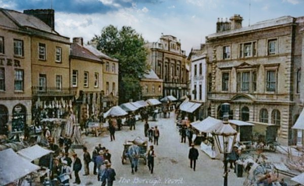
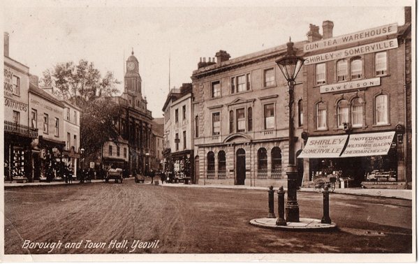
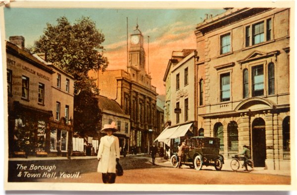
A postcard of about 1905 (this one was posted in 1911) showing the Town Hall beyond the weekly market in the Borough.
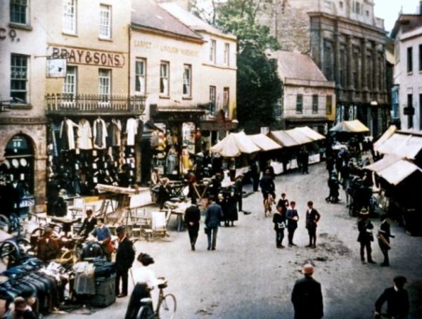
The weekly market in the Borough in a colourised photographed of about 1912. Notice that, although the signage of the three shops at left have changed, the stalls in High Street look identical to those in 1905.
This
colourised photograph
features in my
book "Lost Yeovil"
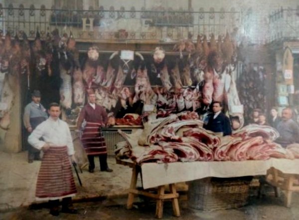
This photograph, taken around 1910, is of John Coombs Hayne's butcher's shop in the Borough (literally) - the shop was in the white building seen behind the handcart in the previous photograph. Hayne's moved to their current premises at the very northern end of Princes Street in 1939.
This postcard, dated 1905, looks from the first floor of the Medical Hall along High Street to Stuckey's Bank in Hendford. At left is James Bazeley Petter's ironmongery store - he later opened another branch, just a few doors along in High Street, located between the tree and the Town Hall.
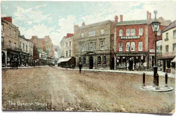
A heavily hand-tinted postcard of the Borough and High Street dating to about 1907.
From my
collection
This postcard of the Borough by Henry Thomas Balls was posted in 1907.
From my
collection.
This
image
features in my
book 'Yeovil
- The Postcard
Collection'.
This postcard of 1909 has been so heavily touched-up and hand-coloured in the studio that it now looks like a water colour painting.
From my
collection
A postcard of the Borough, sent in 1918.
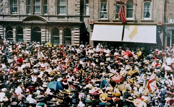
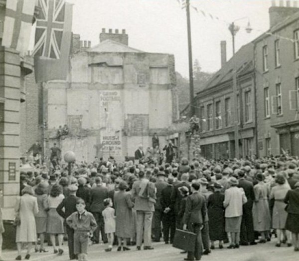
Crowds gather in the Borough to celebrate Empire Day in a colourised photograph of 1909.
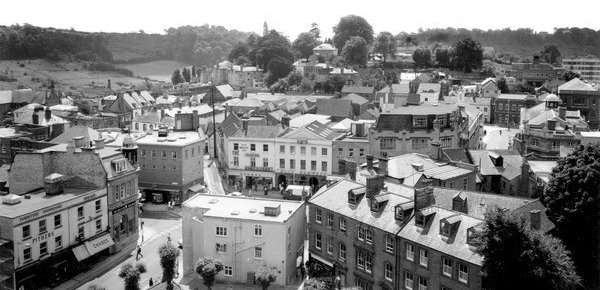
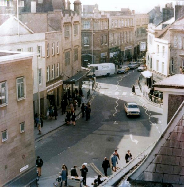
The Borough as seen from the top of St John's tower and photographed in the mid-1960s. At bottom left is the top of Silver Street, along the bottom is the eastern end of Church Street.

Crowds in the Borough and High Street awaiting the declaration of the election from the Town Hall in 1910.
Courtesy of Jack
Sweet
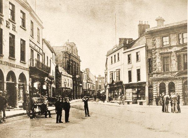
High Street and the Borough, photographed in 1910.

This colourised
image
features in my
book 'Yeovil
- The Postcard
Collection'.
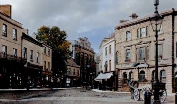
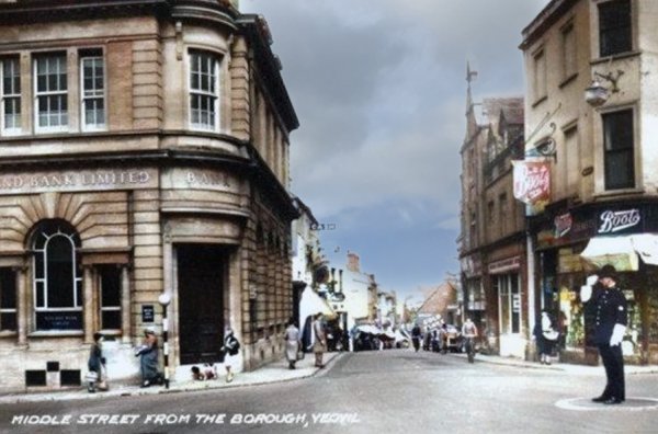
This photograph was taken around 1900 from the Borough, looking towards the junction of Silver Street at left and Middle Street at right. The large building on the corner was London House which belonged to Thomas Thorne, a Draper. It was demolished and replaced with the current bank building, Going down Silver Street was a boot stores, a greengrocer and then the Half Moon Hotel.

From my
collection.
This photograph
features in my
book 'Yeovil From Old Photographs'.
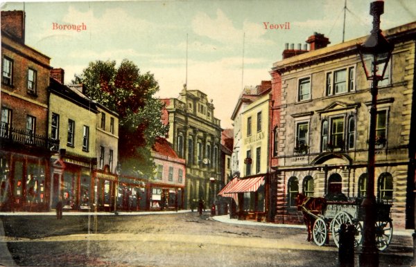
The Borough seen in a postcard dated 1906 by E Whitby & Son of Yeovil. At the centre is London House with Silver Street to its left and Middle Street to its right. At right is the Medical Hall with Wine Street off to is right.
William Redwood had the Silver Street building (retaining the name Singleton's Boot Stores) next to London House as his footwear department and the premises in the Borough with his name as his outfitters department. He would eventually acquire the adjoining building (at this time occupied by Hayne the butcher).
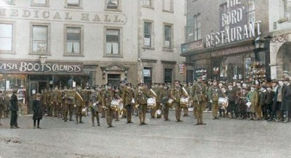
Troops parade in the Borough in a colourised photograph of 1914 (there's always one who has to turn around!). The Medical Hall at left and Maynard's Borough Restaurant at right flanking Wine Street.
From my
collection
This postcard, with the new bank building heavily touched up in the studio, was sent in 1922 but the photograph was clearly taken before July 1921 as the War memorial is missing.
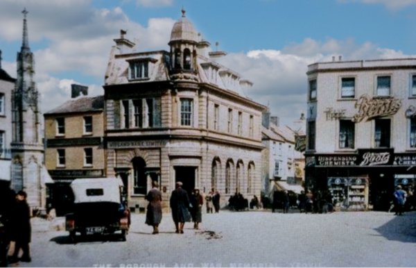
This colourised postcard is dated 1925 and is almost the same view as two postcards above. The new War Memorial stands to the left and at this time you could drive your car either side of it. At centre the Midland Bank building has replaced London House but the Medical Hall, now Boots the Chemist, remains.
From my
collection
-
This photograph
features in my
book 'Yeovil
From Old
Photographs'
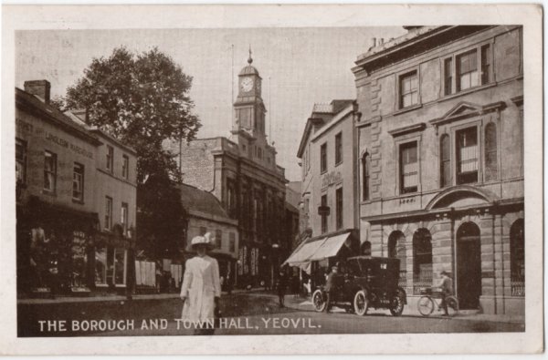
A postcard looking towards the Town Hall from the Borough. This card was posted in 1918. Note that the town hall now has its clock,
This
image
features in my
book 'Yeovil
- The Postcard
Collection'.
A hand-coloured postcard (usually seen in monochrome as the previous) showing the Town Hall seen from the Borough around 1918.
From my
collection
A colourised postcard dated 1929 looking across the Borough towards King George Street. King George Street has opened and Frederick Taylor's store (seen behind the car) is only two storeys high.
From my
collection
An almost identical view in a postcard of 1932.
How to cross the road in the Borough in the late 1920s. I wonder who won - the pedestrian or the cars?

From my
collection. This
photograph
features in my
book "Lost Yeovil"
A hand-coloured postcard showing market stalls setting up in the Borough, circa 1930.

...and the flags were flying from the Town Hall in this photograph of 1933. Frederick Taylor's store is still only two storeys high.
From my
collection.
This
image
features in my
book 'Yeovil
- The Postcard
Collection'.
But in an almost identical postcard dating to after 1935, the town hall has disappeared, being destroyed by fire. Frederick Taylor's store is now three storeys high.
From my
collection.
This
colourised
postcard
features in my
book 'Yeovil
- The Postcard
Collection'.
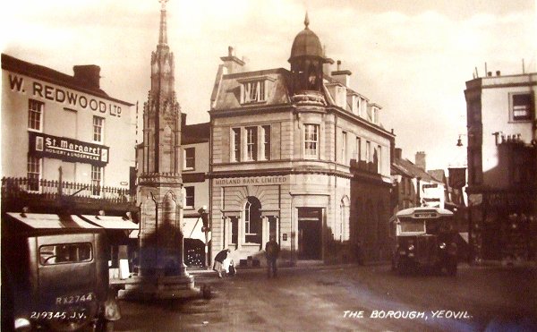
A postcard of the War Memorial in the Borough, apparently guarded by a policemen. This card was sent in 1940 even though the photograph must have been taken before 1935 when the Town Hall, seen in the background, burnt down.
From my
collection.
This photograph
features in my
book "A-Z
of Yeovil"
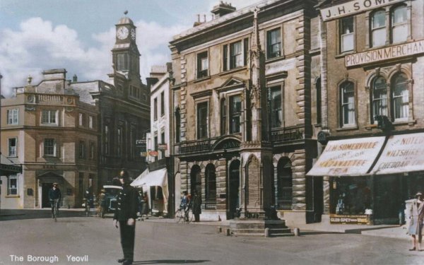
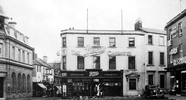
Looking east across the Borough, circa 1940. Hayne the butcher left his Borough premises in 1939 to move to the northern end of Princes Street and was acquired by Redwood's. From this time Redwood's had three shops at this stage; two in the Borough (at left) and one in Silver Street next to the bank - which, at this time, still had a pitched roof (compare with later photos).
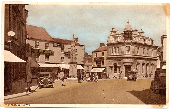
A postcard of 1936 showing that there was still no definite edge to the road in the Borough and you could still drive behind the War Memorial. Nice bus.
From my
collection
A late 1930s postcard albeit posted in 1943 (the Medical Hall is still there although it was destroyed by bombing in 1941) looking across the Borough with the shop of Clement White at left. Photographed from King George Street.
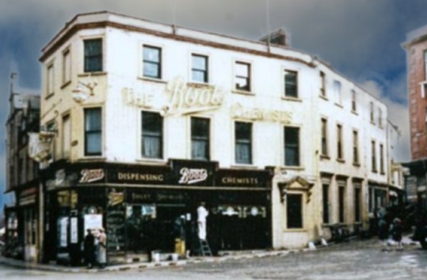
A colourised photograph of the mid-1930's looking across the Borough to Middle Street at left, Boots the Chemist in the old Medical Hall, Wine Street and the Borough Restaurant at right, formerly the shop of William Maynard who created the "Prize Medal Royal Yeovil Sausages" enjoyed so much by Queen Victoria. The Medical Hall was destroyed during an air raid in the Second World War.
A colourised postcard of the late 1930s looking down Middle Street from the Borough. Note the policeman on traffic duty outside the Medical Hall, standing in a specially-painted circle.
Probably one of the last photographs ever taken of the old Medical Hall around 1939 before it was destroyed by enemy bombing on Good Friday 11 April 1941.
Courtesy of Jack
Sweet
A crowd gathers in the Borough to listen to speeches on 15 August 1945. The crowd was noticeably smaller that that which celebrated VE Day. This is the site of the bombed Medical Hall and the buildings at right are in Wine Street.
Courtesy of Jack
Sweet
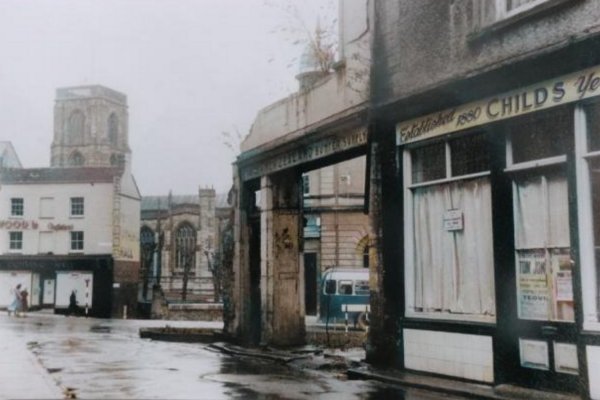
The view (colourised) from Wine Street to the Borough with the ruins of the Medical Hall at the right. This is dated from the poster in Childs' window - 'Tom Jones' was Yeovil Operatic Society's production of 1951.
Courtesy of Jean
Mellings née
Spilsbury
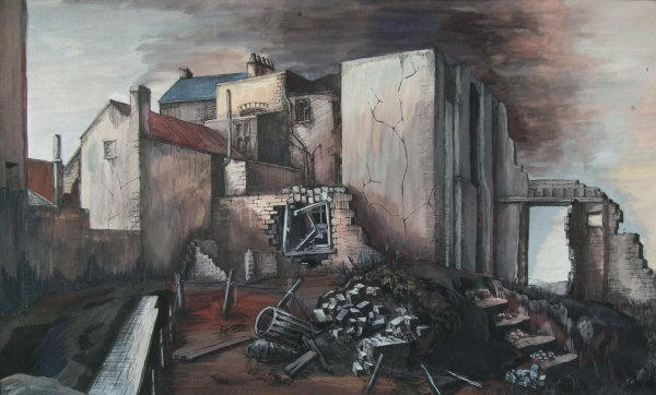
While at Yeovil School of Art in 1951, 18-year-old Jean Spilsbury painted this scene of the bombed Medical Hall.
The bombsite that had been the Medical Hall photographed around 1945. The site has only been partially cleared and this was long before the garden was laid out.

After the war, the site that had been the Medical Hall was converted into a temporary garden planted with tulips donated to the town by Dutch children who had been evacuated to Yeovil during the war. It was later landscaped as seen in the following photos.

Photo
(colourised) by Leonard
Marshall,
courtesy of
Carol McStravick
The garden seen from the Borough, looking to Middle Street.

From my
collection.
This
colourised image
features in my
book 'Yeovil
- The Postcard
Collection'.
This postcard dates to 1947 (albeit posted in 1953) and shows an unusual view of the Borough. Wine Street runs off to the left, High Street is at top left and Middle Street runs to the bottom right corner. The gardens at bottom left mark the site of the bombed Medical Hall.
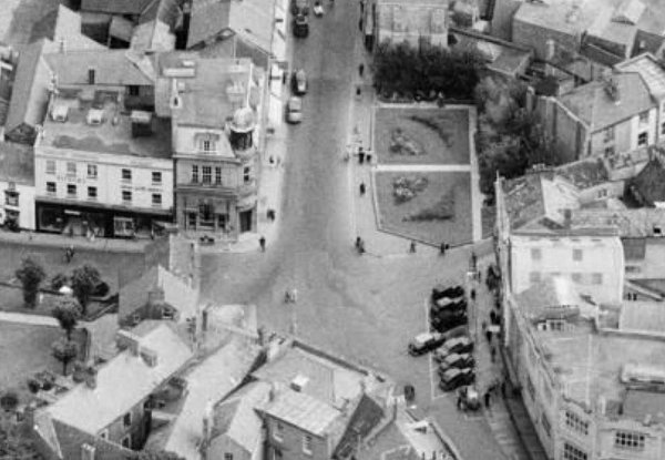
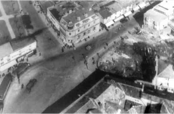
A 1953 aerial photograph of the Borough featuring the garden on the site of the bombed Medical Hall.
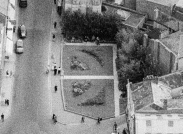
An enlargement of the previous aerial photograph showing the garden in more detail.
View of the Borough - and a double-decker bus - as seen from the gardens. Photographed in the early 1950s.
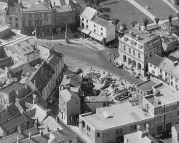
In this aerial photograph of about 1955 the garden has been removed and the site is being prepared for the construction of the new Boots building.

From my
collection.
This
image
features in my
book 'Yeovil
- The Postcard
Collection'.
A postcard from the early-1950's (this one was posted in 1955) sowing Redwood's "Borough Clothing Hall" in front of St John's church. It was built on the site of the old Tolle Hall.
Courtesy of Rob
Baker
A colourised photograph of the Borough in 1958, when the bus stops were behind the War Memorial.
From my
collection
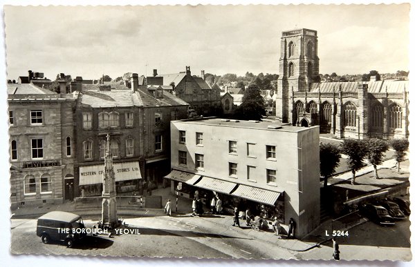
A postcard from the late-1950's (this one was posted in 1962) looking across the Borough towards St John's church. The white building at centre was at this time occupied by Finlay's the tobacconists and you could still drive either side of the War Memorial.
From my
collection
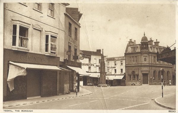
A postcard of the Borough dated 1953 and clearly taken on a Sunday morning, with Clement White's shop at 8 High Street at left.
From my
collection
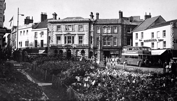
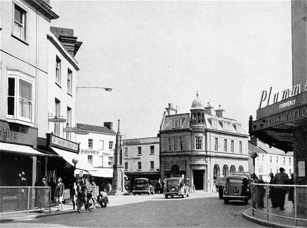
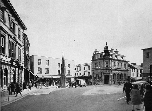
The Borough photographed from King George Street and featured in the 1950 Yeovil Guide. Note that Frederick Taylor's store (at right) is now Plummer's. Note that the building to the immediate left of the War Memorial has a pitched roof in this photo but not in the next.
Busy shoppers in High Street move past Plummer's store (formerly Frederick Taylor's), on the corner of High Street and King George Street, in the colourised photograph of the 1960s.
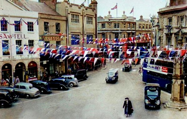
A colourised photograph of the Borough decorated in 1953 for Queen Elizabeth II's coronation.
Courtesy of the
Western Gazette
Looking east across the Borough, circa 1960. The building to the immediate left of the War Memorial now has a flat roof.
From my
collection
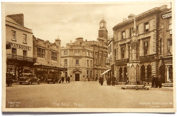
The Borough - as seen in the 1962 Yeovil Guide.
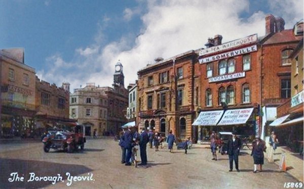
A colourised photograph of the 1960s, looking across the Borough and High Street.
From my
collection
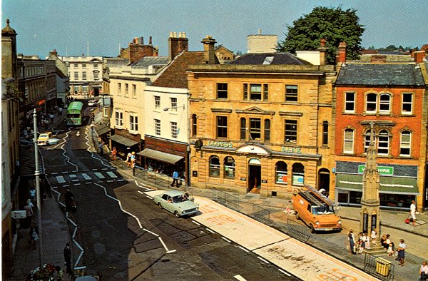
This postcard of the Borough (I'm guessing) dates to the late 1970s.
Courtesy of
Chris Rendell
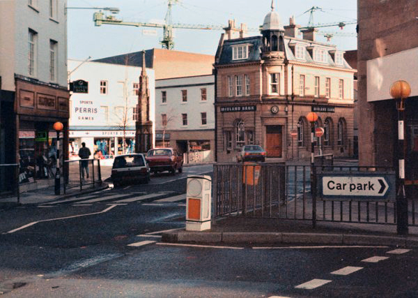
Almost the same scene from King George Street, photographed in 1985. The cranes in the background were employed during the construction of the Quedam.
From my
collection.
This
image
features in my
book 'Yeovil
- The Postcard
Collection'.
A hand-tinted postcard of the Borough postmarked 1961. Note Frederick Taylor's store at right, on the corner of King George Street.

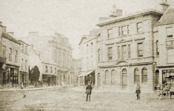
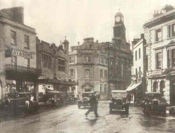
The Borough photographed in the mid-1960's. It has changed very little since then. Note that Frederick Taylor's store is now three storeys high, with a fourth floor added in the new Mansard roof. At left, in the building next to Taylor's, is the Yeovil branch of Martins Bank Ltd.
From my
collection.
This
image
features in my
book 'Yeovil
- The Postcard
Collection'.
A postcard of the Borough dating to the 1970s.
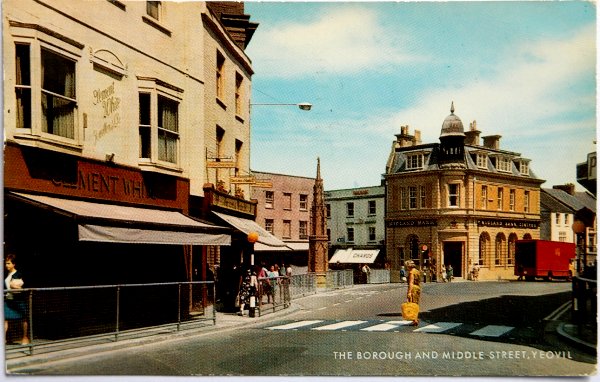
From my
collection
Another postcard, dated 1967, looking to the junction with Silver Street and Middle Street.
From my
collection.
This
image
features in my
book 'Yeovil
- The Postcard
Collection'.
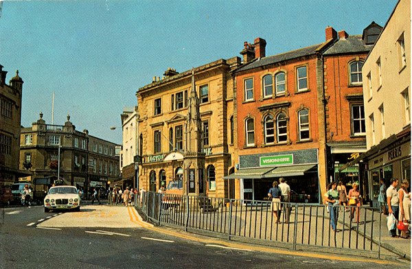
Another postcard from the late 1970s, although this one was posted in 1983.
Courtesy of
Colin Haine
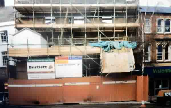
In the mid-1980s the Lloyds Bank building was completely demolished (apart from the front wall facing the Borough) and rebuilt to modern bank security standards. During the works the bank temporarily relocated to the old Douglas Seaton showrooms on the corner of Huish and Clarence Street.
Many thanks to Roger McElliott for the following " I worked on this site for over a year 1987/88/89. This is an early photo of the rebuilding of Lloyds Bank from late 1987 early '88. The demolition has taken place behind the facade of the front, the augered piling has taken place around the perimeter of the site behind, and the excavation is under way. All the excavated soil was dug by hand and thrown onto conveyor belts that went up and out of the first floor window and down a chute (into a lorry) that can be seen in the photo. All the materials went in or out of the door or windows except for the steel work that was craned in on Sundays."
A postcard of the Borough dated 1985.
Courtesy of
Chris Rendell
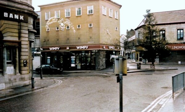
Middle Street joins the Borough, in a colourised photographed of 1985. Wimpy has taken over the old Boots building but I can't remember what type of shop Collingwood's (at right) was.
Photograph by
Trevor Hussey,
courtesy of Mrs
Anne Hussey
.... and seen in the early 1990s.
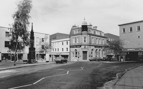
Looking across the Borough to the War Memorial. Photographed 2013.
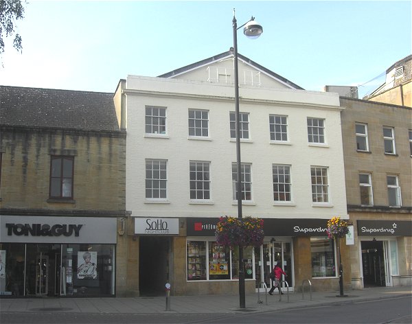
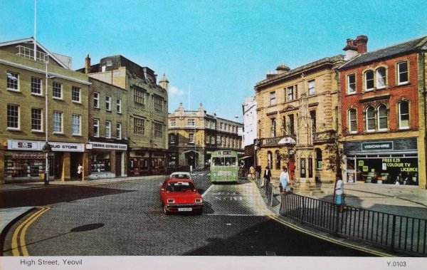
The oldest surviving building in the Borough, appearing in the first image above. It was built originally as the ironmongery shop of William Edwards (in 1790), replacing the premises of ironmonger and cutler Benjamin Dymond who sold up in 1758, then Josiah Hannam, followed by James Bazeley Petter and then Hill & Sawtell - in fact it was in continuous use as an ironmongery from 1790 until the 1970s, which must be some kind of record. Today it is Superdrug. Photographed in 2013.