wyndham street
wyndham street
The 'New Cut' between Reckleford and Sherborne Road
Wyndham Street had not been built by the time E Watts drew his map of Yeovil in 1806 (see below) but was built by the time he produced his 1831 map although there were no houses. At this time it was known as 'New Cut' - indeed it was still called New Cut on the 1858 map of Yeovil.
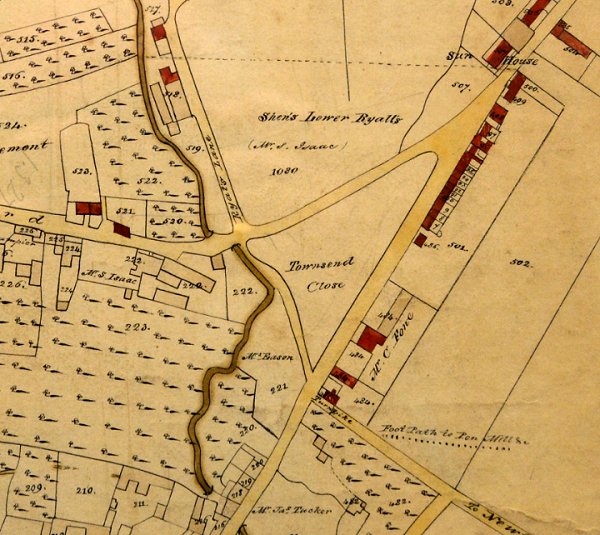
Bidder's map of 1843 shows that only a few houses on the eastern side, at the northern end, had been built at this time - the four cottages shown in the first photograph below. The land on the western side, Parcel 74 in the 1846 Tithe Apportionment, was owned by Rebecca Eason at this time and leased to Charles Pittard.
It was called 'New Cut' in the 1861 census since it was a cut between Reckleford Hill and London Road, today's Reckleford and Sherborne Road. As seen from the map below, the eastern side was built up within twenty years but only the southern half of the western side. The western side was finally completed in the twentieth century.
As a side-note, one of my first jobs in the Borough Architect's department of Yeovil Borough Council, when I moved to Yeovil in 1973, was to supervise a contract to re-roof one of the eastern buildings. It transpired that the architect before me had started the re-roofing on the wrong house! That became interesting.
map
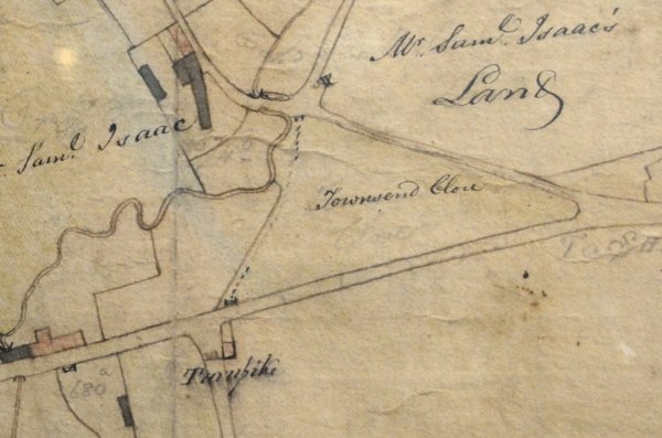
E Watt's map of 1806 shows the field called Townsend Close at the junction of Reckleford Hill and London Road - now Reckleford and Sherborne Road. At this time the field was owned by Mr P Francis. In the top left quadrant, the dark-shaded building is the farmhouse of Samuel Isaac and surrounded by his land. The farmhouse later became the Glovers Arms. Note the dotted line representing a footpath running along the western boundary of Townsend Close, with a gate at either end. This footpath is the line of the later Wyndham Street.
Showing the same area as above, Watt's map of 1831 shows that Wyndham Street, at this time known as 'New Cut', has been newly-built and houses have been built along the southeastern side of London Road.
Part of Bidder's map of Yeovil of 1843 with the newly-built New Cut, or Wyndham Street, seen towards top right. The buildings seen at the northeast corner of the road are shown in the photograph below and were demolished around 1960.
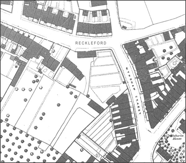
This map, based
on the 1886
Ordnance Survey,
shows Wyndham
Street right of
centre, running
between
Reckleford and
Sherborne Road.
gallery
This
colourised
postcard
features in my
book 'Yeovil
- The Postcard
Collection'.
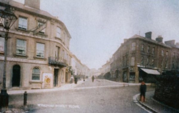
Wyndham Street seen from the junction of Newton Road with Lower Middle Street around 1900. Note the Sugg lamp at extreme left and at extreme right the stone wall where the boy is standing is now the old Western Gazette offices, built in 1906. The scene is dominated at left by the Elephant and Castle.

From the Cave
Collection
(colourised),
Courtesy of South Somerset Heritage Collection
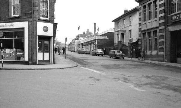
After Frank Clement's death in 1962, the shop on the corner of Wyndham Street and Sherborne Road was sold and became a launderette as seen in this photograph of the mid-1960s.
The southern end of Wyndham Street at its junction with Lower Middle Street in the mid-1960s. The photographer had his back to the Elephant and Castle. Osborne House is right of centre next to the Western Gazette building, in this streetscape of the mid-1960s.
The northeast corner of Wyndham Street in a colourised photograph of 1961. This row of cottages, the original cottages shown on Bidder's map of 1843, was demolished as part of the widening of Reckleford.
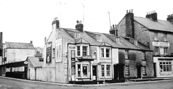
.... and seen
again around 1965. The
Anchor
fish restaurant
at far right
remains today as
Domino's
takeaway.
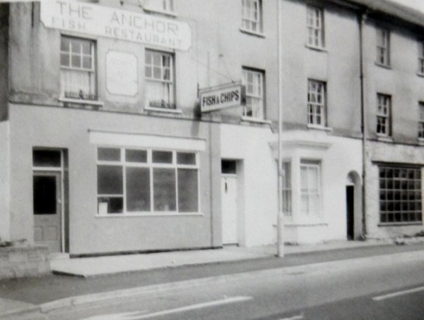
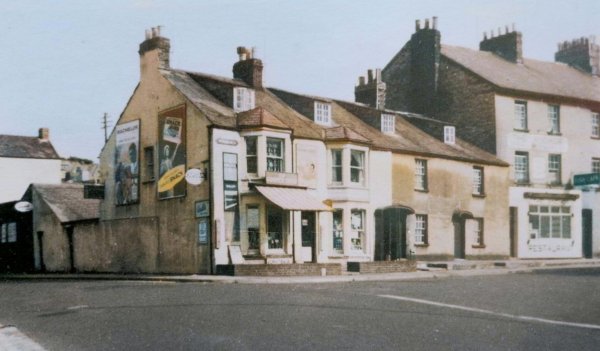
The Anchor Fish Restaurant photographed in the 1960s. The building next door appears unaltered today.

From the Cave
Collection
(colourised),
Courtesy of South Somerset Heritage Collection
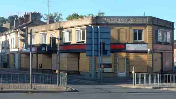
Wyndham Street seen from Reckleford, circa 1960. At right is Grimsby Corner but the parapet is shorter today - check it out next time you pass.
From the Cave
Collection
(colourised),
Courtesy of South Somerset Heritage Collection
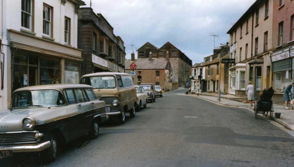
Wyndham Street seen from Sherborne Road, again circa 1960. Note that the leather factory in Eastland Road still has its wooden top floor and the leather workers' cottages in front of it still survive at this time.

Photographed in the early 1960s when it was a bit unkempt, this building is now the Chinese takeaway.
From the Cave
Collection
(colourised),
Courtesy of South Somerset Heritage Collection
The very last houses and shops on the northeast corner of Wyndham Street. The houses at centre and right would be demolished before 1969 (see next photo). The group of ladies at far left are standing on the corner of Eastland Road and Reckleford.

This
colourised
image
features in my
book 'Yeovil
- The Postcard
Collection'.
The junction of Reckleford and Wyndham Street (at right) seen in a postcard sent in 1969.
Courtesy of Mark
Rowe
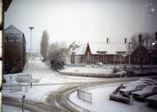
The junction of Eastland Road, Reckleford and Wyndham Street during winter 1982.
Courtesy of
Colin Haine
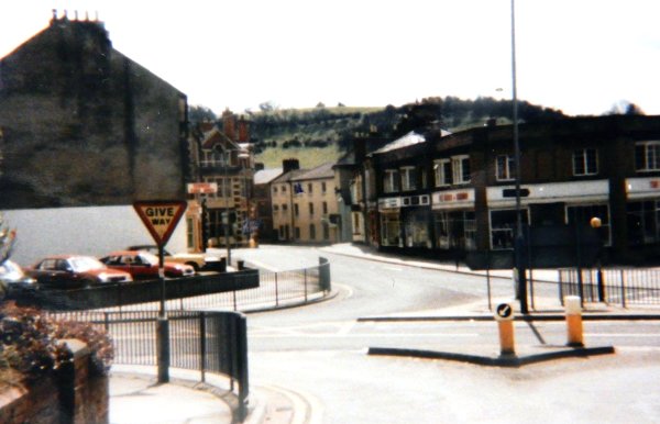
Seen here in 1986 the junction of Wyndham Street and Reckleford lacks the present array of traffic lights. It didn't seem to hold the traffic up then - or did it?
Courtesy of
Chris Rendell
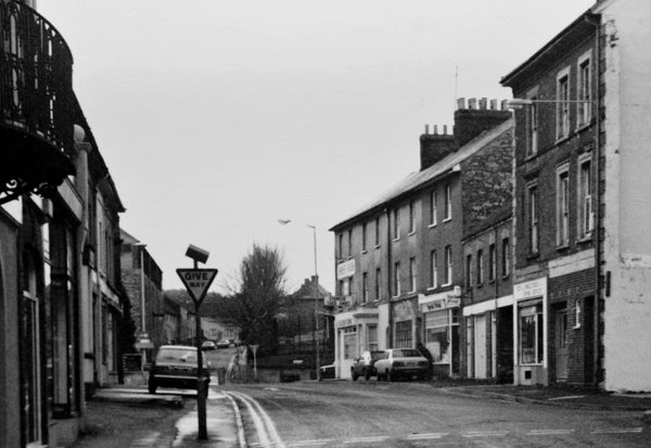
Wyndham Street photographed from outside the Elephant & Castle in 1985.
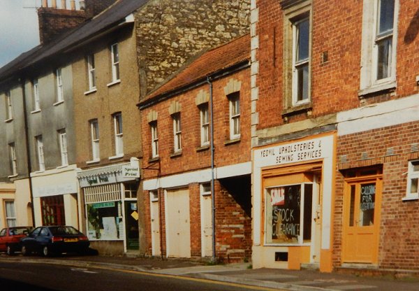
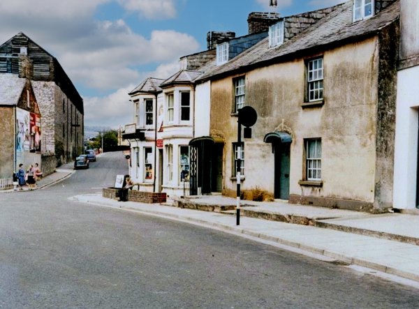
Photographed around 1990, Sprint Print is now the Polish deli, the two storey building is now three storeys and the premises occupied by Yeovil Upholsterers and Sewing Services is now converted to flats.
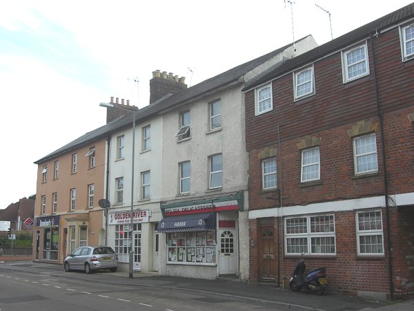
Wyndham Street east side, photographed in 2013.
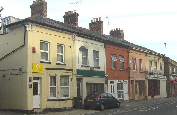
Wyndham Street west side, photographed in 2013. This is the southern half of the western side and these buildings were built between 1860 and 1886. The ground floor elevations of all have been altered in one way or another.
Photographed in August 2020 - we didn't think it would be long (although it was still like this until August 2024 - see below) before the west side of Wyndham Street disappears.
... and then

12 August 2024 - demolition begins.

... and basically grinds to a halt.
The view to Wyndham Street, sans Grimsby Corner, seen from the southern end of Eastland Road as it joins Reckleford. Photographed on 17 August 2024.

Still to be demolished? Photographed on 17 August 2024.