Brice's Orchard
Brice's Orchard
A former part of the great West Field of Kingston Manor
Originally what became Brice's Orchard had most likely been part of West Field - itself a subfield, most likely a common field, within the great medieval West Field of Kingston Manor.
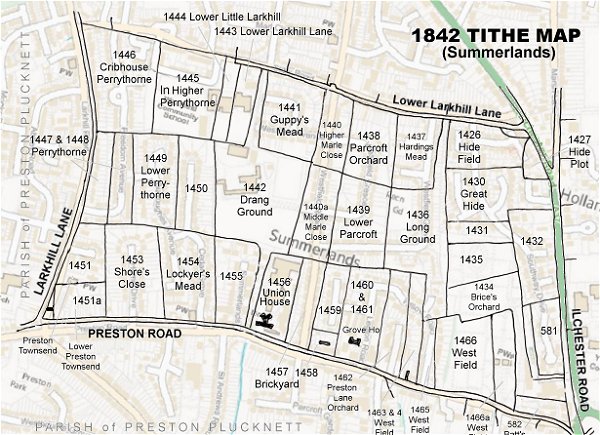
Brice's Orchard (Parcel 1434) was a strangely-shaped field just west of Ilchester Road and lying halfway between Lower Larkhill Lane (today's Stiby Road) to the north and Preston Lane (today's Preston Road) to the south. It had a long dog-leg extension off its southeastern corner which gave direct access to Ilchester Road (roughly where the access is today for the County Council's Fiveways Resource Centre).
The 1846 Tithe Apportionment recorded that Brice's Orchard measured 3a 3r 0p and was used as an orchard. It was owned and occupied by Elizabeth Duffett (1793-1868) at this time. Elizabeth was the youngest daughter of glove manufacturer Henry Collins of Court Ash House and the widow of glove manufacturer Samuel Duffett who had died two years previously.
Brice's Orchard was bounded on the north by Little Hide (Parcel 1435), on the west by Long Ground (Parcel 1436), to the south by West Field (Parcels 1466 and 1466a) and to the east by Sugg's Close (Parcel 1432).
In 1928 Brice's Orchard was purchased by the Town Council in order to extend Yeovil Cemetery northwards. Today the former Brice's Orchard forms part of Yeovil Cemetery.
For details on historic land measurement (ie acres, roods and perches) click here.
maps & Aerial Photographs

This map, based on the descriptions in the 1589 Terrier and the 1846 Tithe Map of Yeovil shows the approximate boundaries of the Manors of Kingston and Hendford as well as the manorial three-field system used in Kingston.
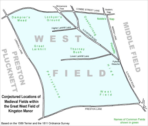
A conjectural map of the great West Field of Kingston Manor showing ancient sub-fields, most likely common fields, within the overall bounds of West Field.
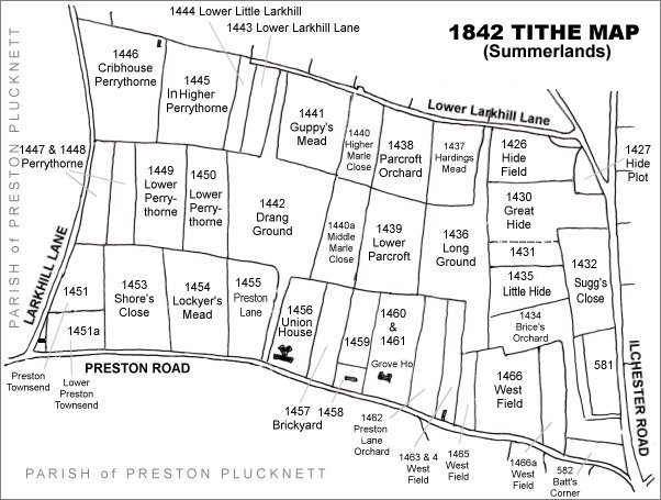
The Larkhill area reproduced from the 1842 Tithe Map. Brice's Orchard is in the lower right quadrant.
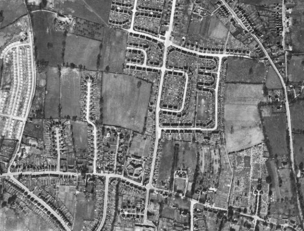
The 1946 aerial photograph - at this time, the former Brice's Orchard formed part of Yeovil Cemetery.
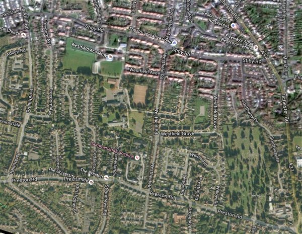
The same area today 'borrowed' from Google maps.
The 1842 Tithe Map superimposed (only very slightly out at the bottom) over a modern map.