petters way
petters way
Celebrating the Yeovil family of ironmongers, Engineers, etc.
On the 1901 Ordnance Survey what would become Petters Way was still little more than a track off South Street, between the Baptist Chapel and South Street House, leading to extensive orchards covering the area of today's Petters Way and the car park.
On 22 September 1935 the Town Hall in High Street was destroyed by fire and, although the recently-built municipal offices in King George Street were available, the council decided that a new civic centre was called for. The following year the council purchased Hendford Manor and its extensive grounds with the intention of using the site for the proposed new civic complex (see sketch below). At this time South Street House, the former home and surgery of Dr Ptolemy Colmer, was demolished and Petters Way was constructed.
The Yeovil Law Courts was first of the new municipal buildings to be constructed and this opened in 1938. The start of the Second World War the following year brought an abrupt halt to the civic centre project and it wasn't until the construction of Maltravers House in 1969, to house County Council and government departments, that any further building work was carried out on the site.
In 1948 a fund for Yeovil's civic hall was started. It was designed by Richard Hare of Salisbury in 1961 but building didn't finally start until 1972 and the Johnson Hall opened in 1974 as a multi-purpose civic hall at a cost of £150,000. In 1985 it was re-named as the Octagon Theatre.
In 1987 the old toilets in Petters Way were demolished and Petters House was built.
map / aerial photographs
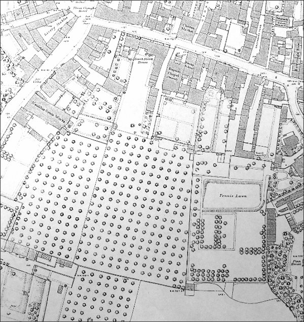
The 1886 Ordnance Survey map shows the extensive orchards now covered by Petters Way and the car park. At this time access was via a narrow track between South Street House and the Baptist chapel.
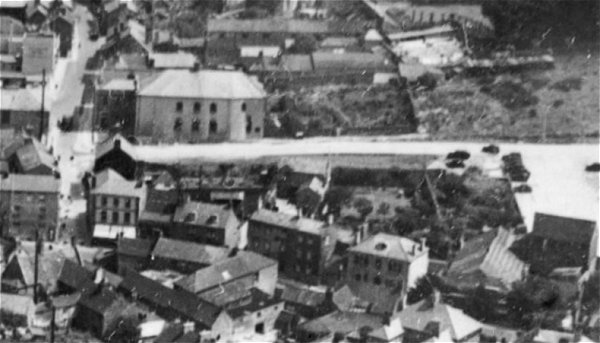
This aerial photograph dates to 1935 and shows Petters Way running across the photograph from South Street, at left, to the car park at right. Buildings of note are - the Greyhound Inn at very top left, the Baptist church at top left, the Three Choughs Hotel at centre left edge with the junction of South Street with Hendford to its right. On the opposite corner the buildings running along the east side of Hendford (with their street elevations facing us) are Chudleigh's seed merchants, the small shop that had been John Chaffey's photographic studio (later the WI Market), next to the Butcher's Arms. Next is Flower's House and then Ayr Villa. Note that in the top right hand corner is the field that the Yeovil Law Courts and Police Station would be built on three years later, in 1938.
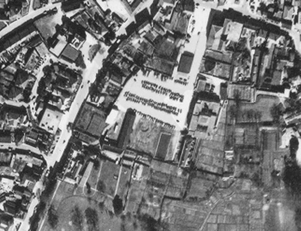
The 1946 aerial photograph shows Petters Way and its car park at centre. In 1950 car park charges were 6d per day or 12/6 per quarter (which rose to 15 shillings per quarter by 1962). The car park is much smaller than it is today and the law court buildings are seen at right of the car park. South Street runs across the top right corner and Hendford runs diagonally down the left side. The dark rectangle at top right of the car park, next to Petters Way, is the old public toilet block that was demolished when Petters House was built in 1987.
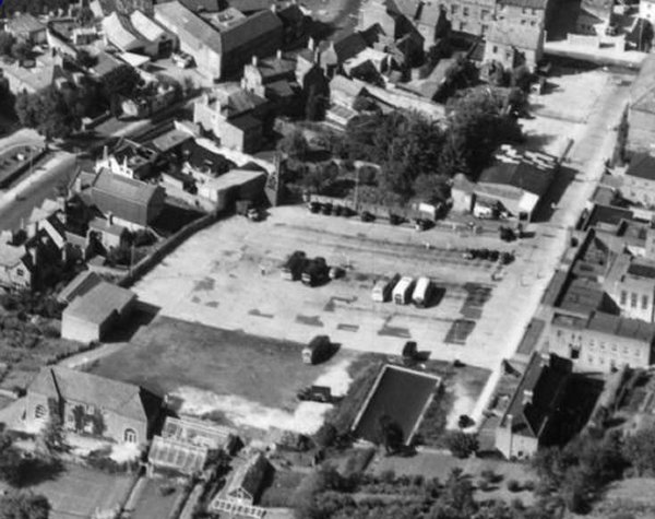
An aerial view of the car park, with Petters Way at right, photographed in 1953.
gallery
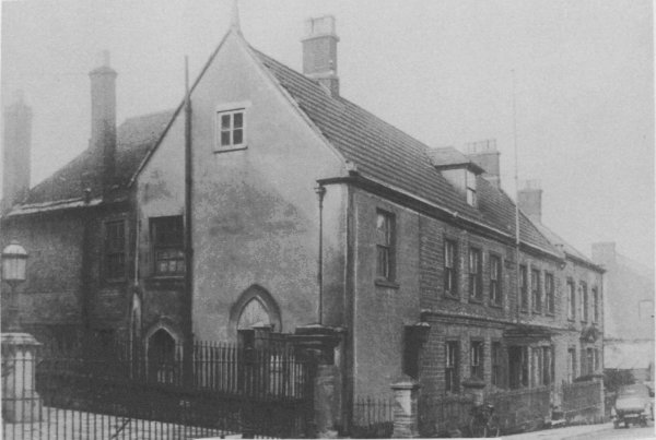
The
Newnam Hall
and Schools and
the
Baptist
Church in South
Street before
the construction
of Petters Way
alongside. The
man is standing
by the entrance
to the track
that led to
orchards.
Photographed
about 1912.
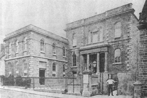
South Street House - the former home of glove manufacturer William Hooper Masters and later Dr Ptolemy Colmer's house and surgery at 79 South Street. The site is now occupied by the entrance to Petters Way and the Petters Way car park adjoining South Street. The railings at left belong to the Baptist Church and at the time of this photograph a narrow lane ran between Dr Colmer's house and the church, leading originally to extensive orchards.
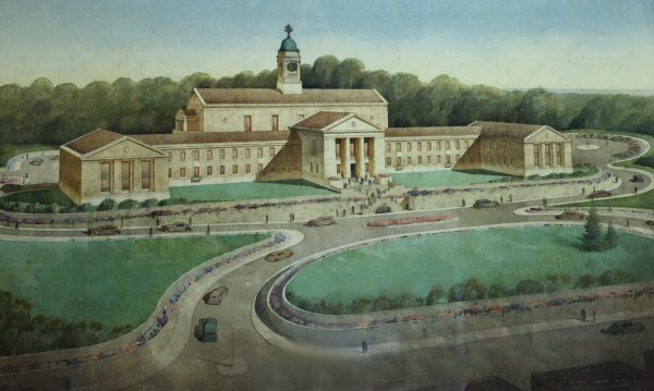
The design for Yeovil's new 1930's Civic Centre by Mr R Cecil Howitt of Mansfield, Notts., from a watercolour by Cyril Fairy. It would appear that Hendford runs along the bottom of the painting and Flowers House, Hendford Manor and all the buildings in between were to be demolished to create the open greenspace in front of the imposing civic centre.
From my
collection
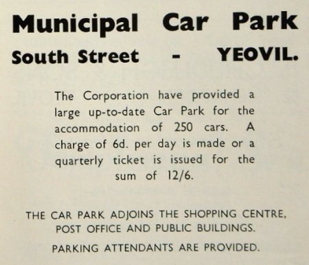
South Street Car Park charges as advertised in the 1950 Yeovil Guide. 6d per day is about 75p at today's value.
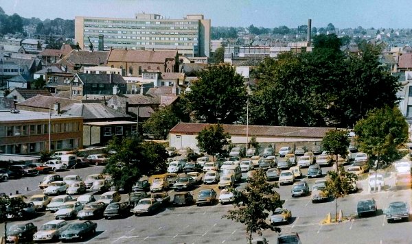
A colourised photograph of Petters Way car park, probably taken in the 1980s.
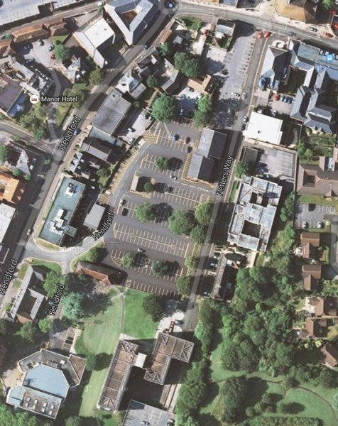
A current aerial image, 'borrowed' from Google, shows the extended car park with its access off Hendford at centre left. Petters House is seen at top right of the car park, the old law courts are off to the right, Maltravers House is at bottom centre and the Octagon is at bottom left.
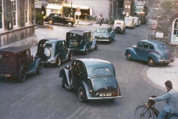
Traffic congestion in South Street, added to from King George Street, in a colourised photograph of 1955. Notice the market stalls temporarily in the car park.

From the Cave
Collection
(colourised),
Courtesy of South Somerset Heritage Collection
Market stalls left in-situ in what is now the Petters Way car park. Photographed in the 1960's from Petters Way looking towards South Street. South Street House would originally have stretched right across this photograph.
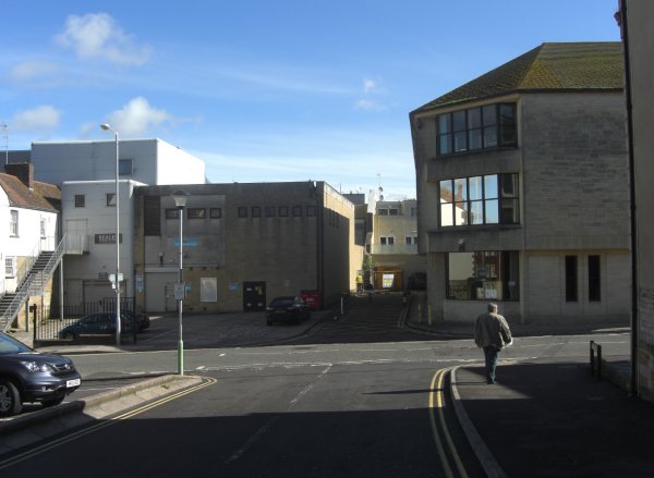
... and the same view photographed on 29 May 2013.

Courtesy of
Paul Pickford
(colourised)
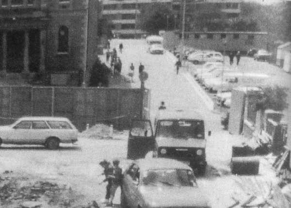
This photograph dates to 1952 (when the film "Red Skies of Montana" was released). Paul noted "This is the additional building the Fire Brigade used near the car park in Petters Way. The building was situated at the bottom of the market site at the top of Petters Way facing out onto South Street. It was most likely constructed during the Second World War by members of the National Fire Service (NFS) to house the additional appliances that were stationed at Yeovil at the time. The appliance on the left is a Dennis F7 and was one of the first new Fire Engines delivered to the newly formed brigade. The one on the right is a wartime Austin 60Ft hand operated Turntable Ladder which remained in Service at Yeovil until 1971."
Courtesy of
Colin Haine
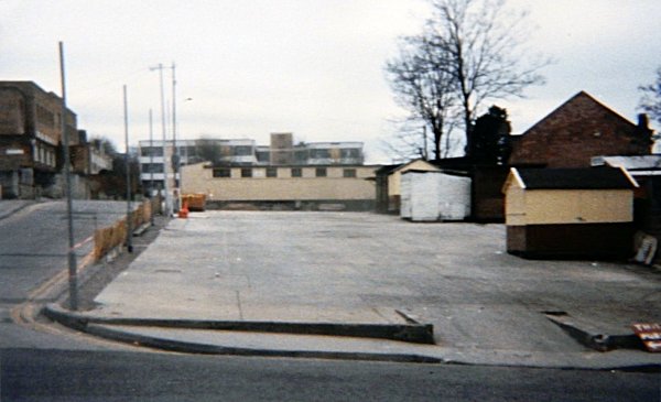
Looking at the Petters Way market site from South Street in 1985.
Courtesy of
Colin Haine
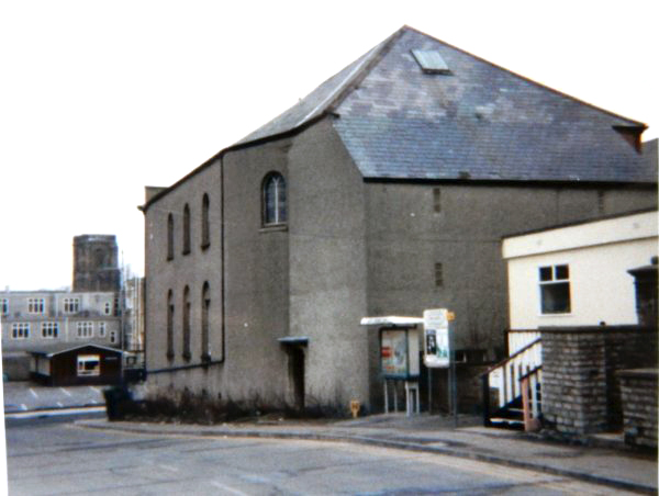
An interesting shot of the rear of the Baptist Chapel photographed in 1983 from the end of Petters Way. At extreme right the wooden shed, approached up a short flight of wooden steps, was a town centre presence office of the Council's Housing Department. At far left is seen the 'shed' in the car park behind the municipal buildings of King George Street. At the end closest to the photographer was the Children's Library and at the far end, next to Borough Arcade, was my office for several years in the 1980s.
Courtesy of
Colin Haine
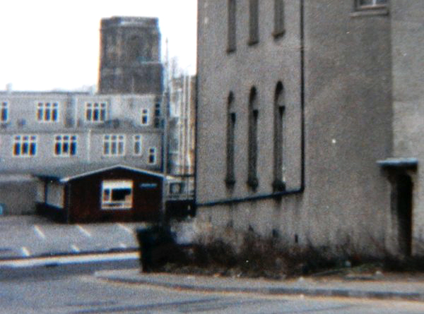
An enlargement from the previous photo showing the 'shed' that held the Children's Library at one end and my office at the other.
Petters Way in 1985 during the groundworks for the new library in the foreground. At top right the block of public toilets would be shortly demolished (see next photo) for the Petters House development and the market stall sheds, seen at extreme top right, would disappear when the market was moved to Middle Street.
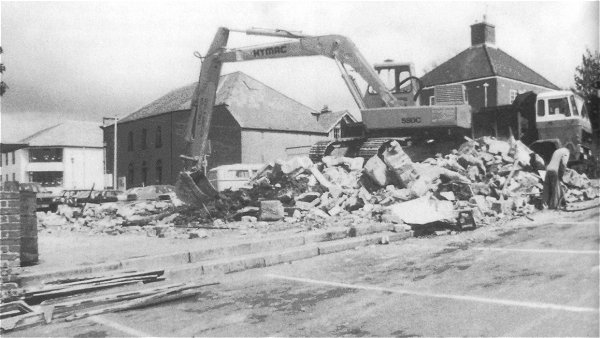
The demolition of the public toilets in 1987 seen from the main Petters Way car park. At extreme left is the new library building and behind the digger arm is the Baptist chapel.
Courtesy of
Vivien and John
Cornelius
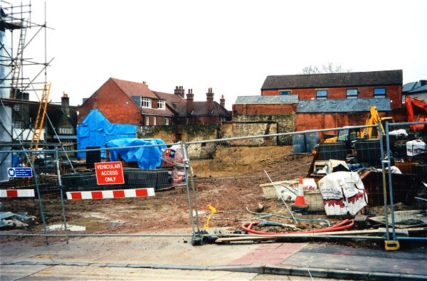
The site at the rear of the Baptist chapel being cleared ready for residential redevelopment and the partial rebuilding of the chapel itself. Photographed from Petters Way in 2002.
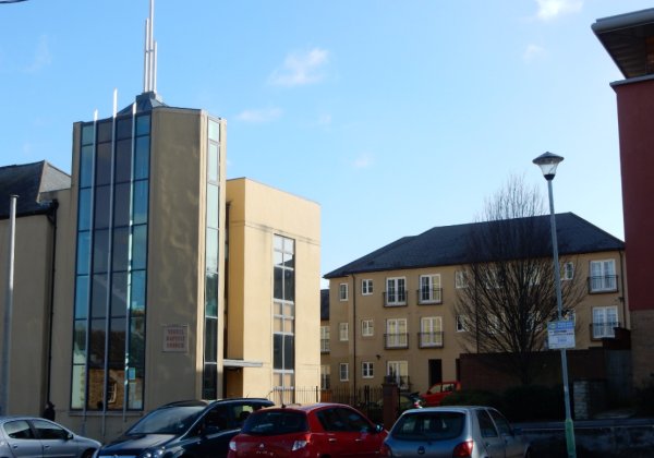
The new sheltered housing scheme, Pegasus Court, built on the site of the previous photograph, seen in 2015.
Courtesy of
Vivien and John
Cornelius. This
photograph
features in my
book "Lost Yeovil"
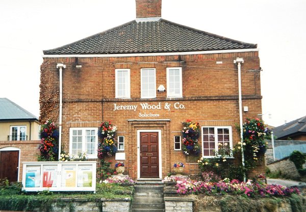
Fielding House, Jeremy Wood & Co's offices in Petters Way. Photographed in 2003. This building stood between the Baptist chapel and the Law Courts and faced the car park. It was demolished and the site is now, unsurprisingly, flats.
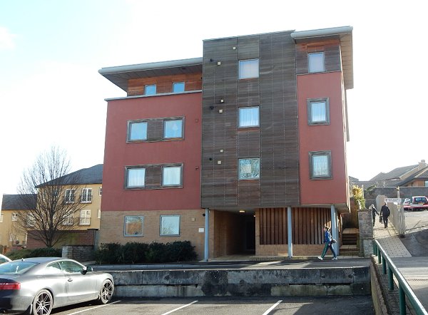
.... and now, instead of the lovely Fielding House, we have this. Photographed in 2015.
Courtesy of Rob
Baker
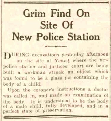
A brief article from the Western Gazette's edition of 17 November 1936.
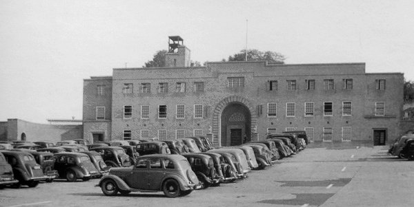
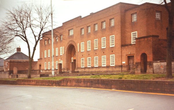
The Yeovil Law Courts and Police Station in Petters Way opened in 1938. This photograph was taken in 1955 and the air raid siren housing still surmounts the building.
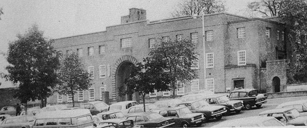
Pretty much the same view in 1965 although this photograph does emphasise the slope of the car park built on the former orchards. Note also that the air raid siren housing had been removed by this time.
Courtesy of
Chris Rendell
- This
colourised photograph
features in my
book 'Yeovil
From Old
Photographs'
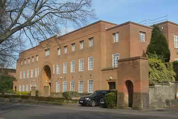
The Yeovil Law Courts in Petters Way photographed in 1983.
This photograph
features in my
book "Yeovil
In 50 Buildings"
.... and photographed in 2017.
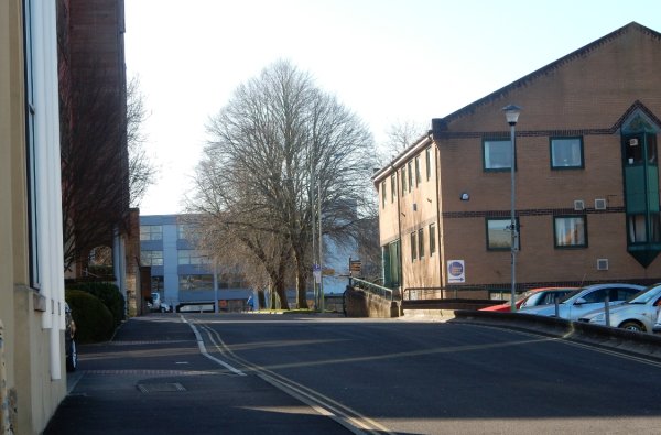
Looking along Petters Way towards Maltravers House. Photographed on 27 February 2017.
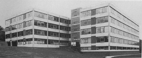
Maltravers House, built in 1969 and photographed here in the early 1970s.
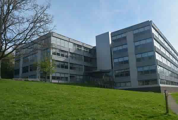
.... and photographed in 2017.
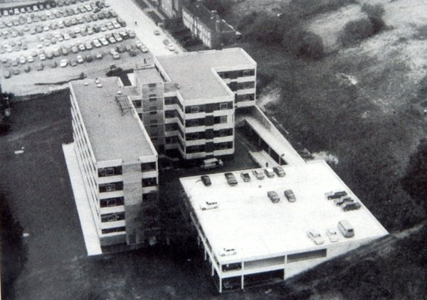
.... and seen from the air in 1970.
Courtesy of
Butch Bishop
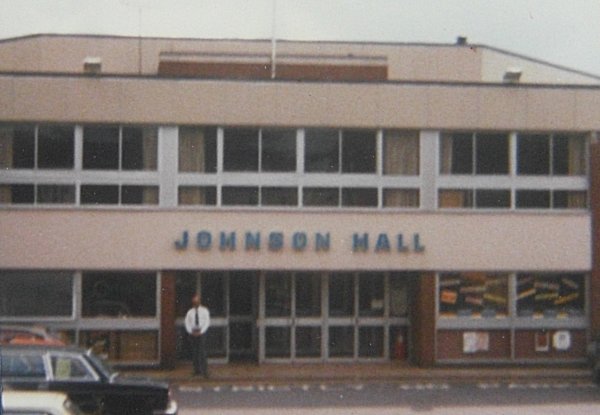
Johnson Hall, today's Octagon Theatre, opened in 1974. Photographed in the late 1970s.
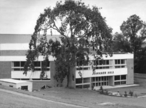
.... and seen from the grass bank by the car park around the same time.