Preston Road
Preston Road
The ancient lane connecting Yeovil and Preston Plucknett
In 1856 Vickery wrote "Preston is a considerable parish one mile northwest from Yeovil, in the turnpike-road to Taunton." Today's Preston Road was originally called Preston Lane and, as seen in the map below, there were no buildings between Yeovil and Preston Plucknett. Until the boundary changes of 1928, the parish of Yeovil ended at Larkhill Road where the parish of Preston Plucknett began.
Over time, as with most roads of this nature, houses and other buildings have been added to Preston Road. However, especially in more recent times, Preston Road has been straightened and widened in places, often causing the loss of old buildings.
The photographs in the Gallery below, illustrate Preston Road for its entire length. They begin at Fiveways and end at Preston Plucknett - albeit not in chronological order. Most photos have links in the accompanying text leading to further information and photographs.
map
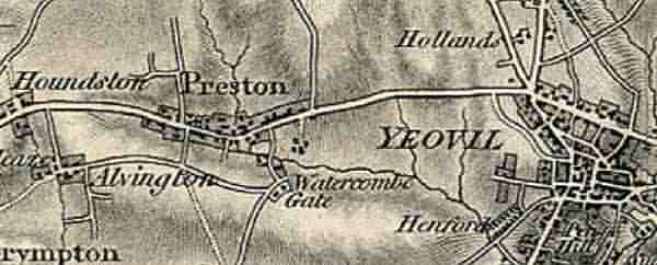
Part of the 1811 Ordnance Survey map showing the completely unpopulated Preston Lane flanked by open fields and running from Fiveways, at the right, to the village of Preston Plucknett at the left, and beyond. At the centre, running north from Preston Road, is Larkhill Road - at the time called Down Lane.
gallery
This
colourised photograph
features in my
book 'Yeovil From Old Photographs'.
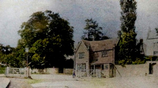
The second (at least) Kingston Turnpike House photographed about 1860 by Henry Goodfellow (before the Fiveways hospital was built). The eastern end of Preston Road was at the very left edge of this photograph. Notice the toll gates which would close until tolls had been paid.
From my
collection
-
This photograph
features in my
book 'Yeovil
From Old
Photographs'.
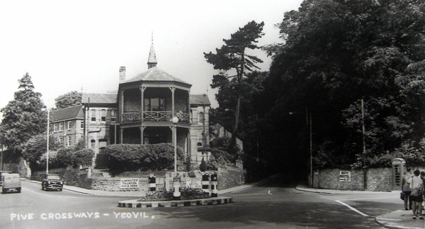
Fiveways photographed in the early 1950s by HA 'Jack' Cooper, when the roundabout still had its black and white markings - painted on during the war so that it was easier to see in the blackout. Preston Road is at the left with two cars. Replacing the Yeovil General Dispensary, Fiveways hospital opened in January 1872 just as an outbreak of smallpox hit Yeovil. Fiveways Hospital was demolished in 1969 and the site was lost as the new, massive Fiveways roundabout was developed.
From the
Cave
Collection
(colourised),
Courtesy of South Somerset Heritage Collection
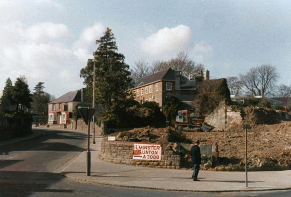
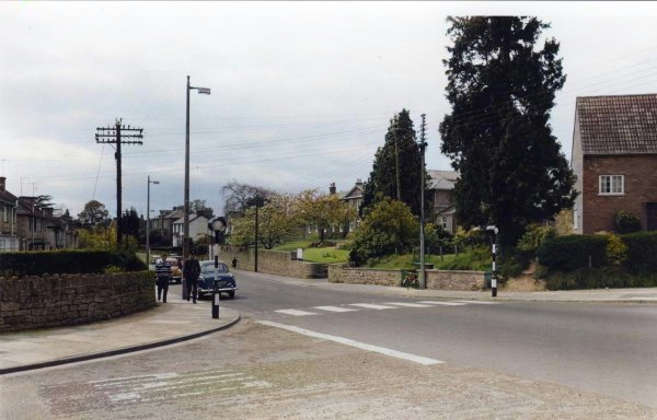
A 1969 photograph taken from Fiveways Crossroads and looking down Preston Road towards the Somerset Inn, facing the bend in the road after the demolition of the hospital.
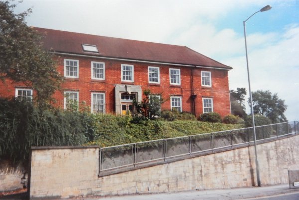
Photo by Jack
Sweet. Courtesy of South Somerset Heritage Collection
The Health Clinic, including the former School Dentistry Unit, was built in the 1930s - seen right of centre in the previous photograph. This photograph taken in 1993.
Courtesy of
Chris Rendell
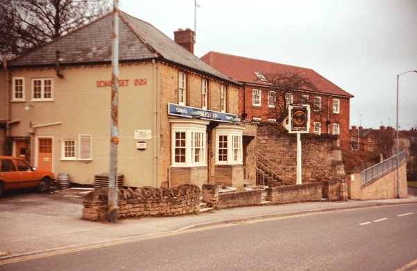
The Somerset Inn photographed in 1984.
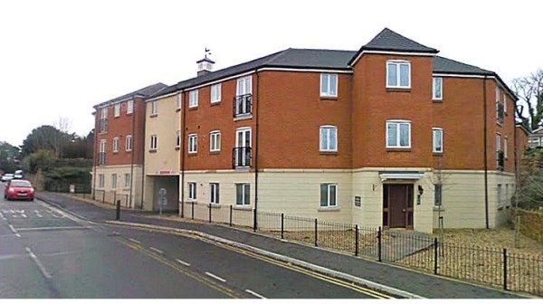
Somerset Court on the site of the Somerset Inn, photograph taken in 2009.
This photograph
features in my
book "A-Z
of Yeovil"
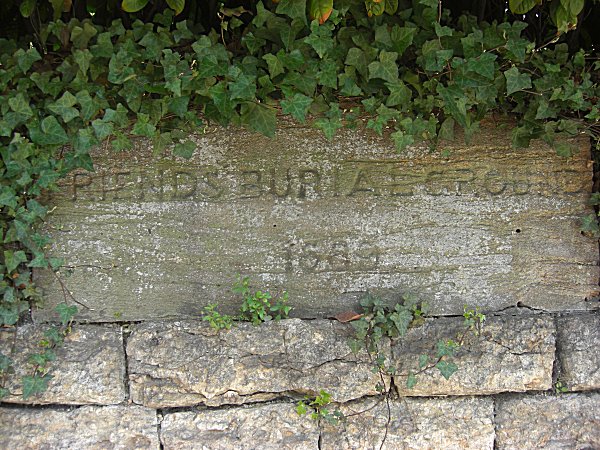
Moving just a few yards further west, this is he stone set into the Quaker, or Friends, burial ground's boundary wall, facing Preston Road. It is inscribed "Friends' Burial Ground 1689". Photographed in 2013.

This
colourised image
features in my
book 'Yeovil
- The Postcard
Collection'.
A photograph of the entrance to, and the lodge of, Yeovil cemetery, adjacent to the Friends' burial ground, taken around 1900 from The Park. The entrance and lodge are unchanged today.
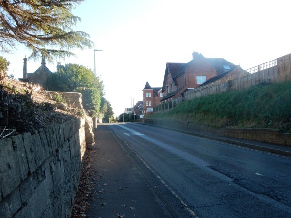
Looking east along Preston Road, towards the summit of Cemetery Hill. Photographed on 4 November 2021.
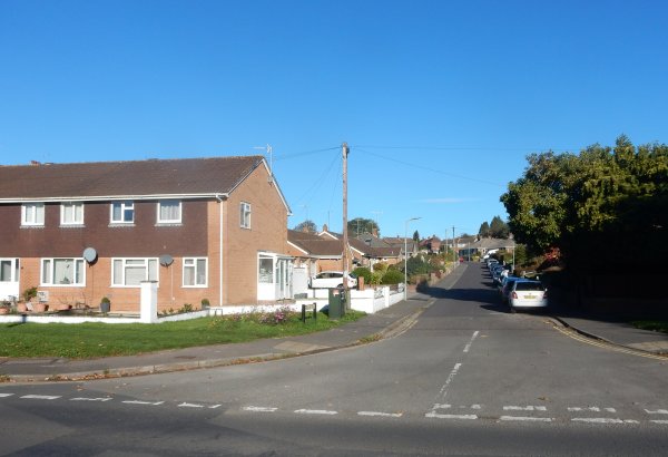
Willow Road seen from Preston Road. The houses at the left are built on the site of Providence Cottage. Photographed on 4 November 2021.
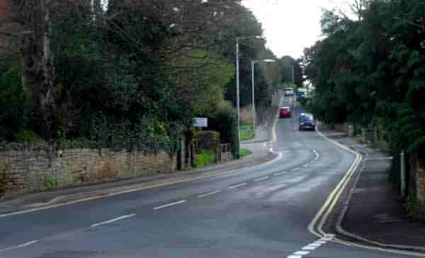
Looking east along Preston Road to Cemetery Hill from Grove Avenue. The entrance to Willow Road, site of the former Newis' Mills, is seen at the centre between the two street lights.
From the Cave
Collection
(colourised),
Courtesy of South Somerset Heritage Collection
The original of
this
photograph
features in my
book "Lost Yeovil"
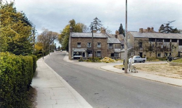
This colourised photograph was taken in the 1960s and looks west along Preston Road and the road running off to the right is Willow Road. The three-bay house end-on to Preston Road with a corner shop in its left-hand side is Providence Cottage. The building at right was originally a leather tannery but converted into a flour mill known as Newis' Mills. Both cottage and mills were demolished shortly after this photograph was taken.
From the Cave
Collection
(colourised),
Courtesy of South Somerset Heritage Collection
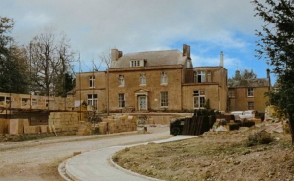
Grove House, photographed in the 1960s from Preston Road. The new road being constructed in the foreground is today's Legion Road and, at the time, Grove House was about to be demolished.
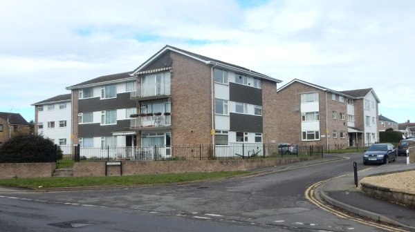
Flats in Legion Road, built on the site of the former Grove House. Photographed in 2016.
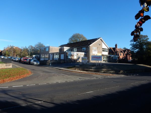
The eastern side of the entrance to Legion Road and the YESS Club (Yeovil Ex Service & Social Club, formerly Yeovil branch of the British Legion) seen from Preston Road. Photographed 4 November 2021.
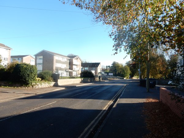
Preston Road, looking east towards Legion Road. Photographed 4 November 2021.
Just before the junction with Westfield Road stands Grovecote, built in 1830 as the manse for the minister of Yeovil's Unitarian Chapel in Vicarage Street. Photographed in 2013.
From the Cave
Collection
(colourised),
Courtesy of South Somerset Heritage Collection
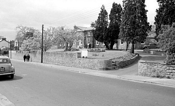
An early 1960s photograph of the old workhouse building, seen from the junction of Preston Road and Summerleaze Park
From the Cave
Collection,
Courtesy of South Somerset Heritage Collection
An early 1960s photograph of the old workhouse building, seen from Preston Road.
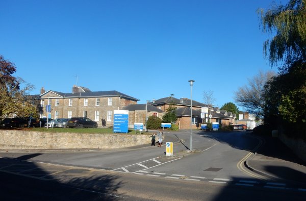
The old workhouse building now forms part of Summerlands Health Park, seen here with its much-widened entrance from Preston Road. Photographed on 4 November 2021.
This photograph
features in my
book "Yeovil
In 50 Buildings"
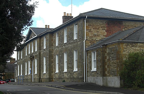
To the west of Westfield Road, is the main Preston Road elevation of the former Yeovil Union Workhouse, photographed in 2017. Today, only the administration block, seen here, survives.
Taken before 1932, when they were demolished, these cottages stood on what is now the corner of St Andrew's Road. At the left is Preston Road and at the left edge is seen the retaining wall in front of the old workhouse building of the previous photograph.
Presumably taken at the same time as the previous photograph, this looks west along Preston Road from the other side of the cottage above.
Courtesy of
Chris Rendell
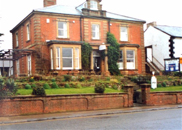
Opposite St Andrew's Road, stands the Preston Hotel photographed in 1989.
... and photographed on 4 November 2021.
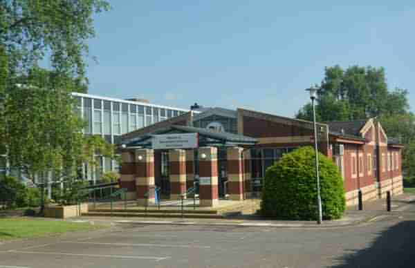
To the immediate west of St Andrew's Road, on the south side of Preston Road, are the former council offices, now Bournemouth University's Yeovil campus. Photographed in 2018.
This
photograph
features in my
book 'Yeovil From Old Photographs'.
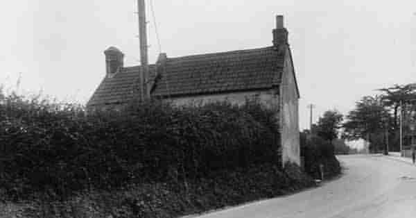
The southern end of Larkhill Road seen from Preston Road, probably photographed in the 1930s. At right is Ivy Cottage which is shown on the 1886 Ordnance Survey (indeed, it was also shown on the 1842 Tithe Map as the only house in Down Lane). It was demolished in the 1960s. The Larkhill Road houses at left (built in 1906) were actually in the parish of Preston Plucknett until the 1928 boundary changes.
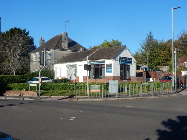
The former Post Office on the corner of Preston Road and Larkhill Road. Photographed on 4 November 2021.
This photograph
features in my
book "Yeovil
In 50 Buildings"
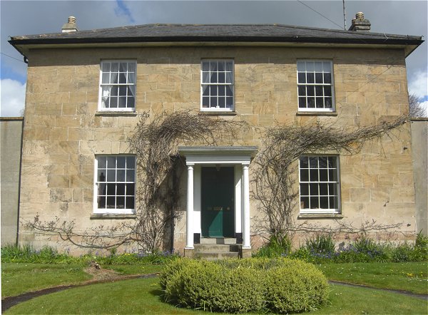
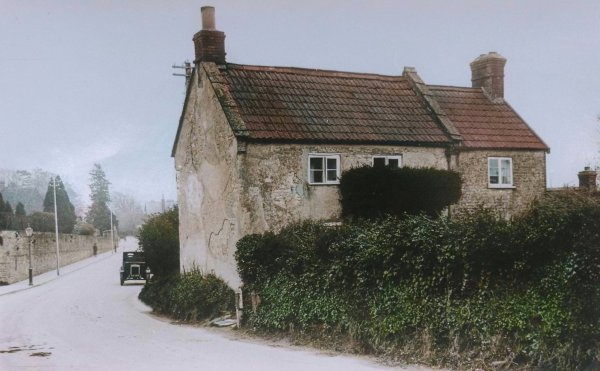
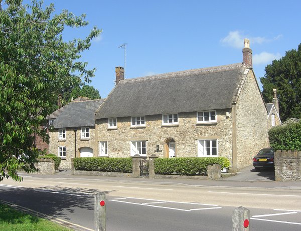
Just beyond Larkhill Road is Glencote, on the north side of Preston Road, now known as the Old House. Photographed in 2014. Glencote is a rare survivor of what was once typical of the domestic houses of Yeovil. It is thought to have sixteenth century origins albeit with major alterations during the seventeenth century.
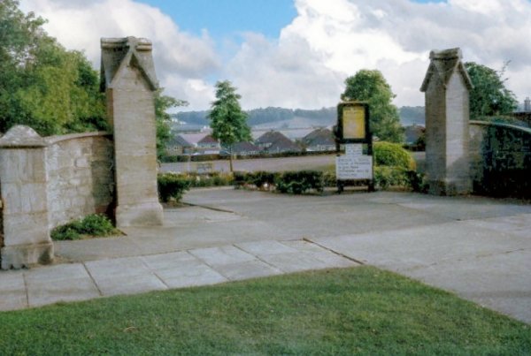
A colourised photograph of the entrance to Preston Park (carved from the land of Preston Lower Farm in the late 1920s), opposite Glencote (above). Judging by the lack of trees, this photograph is probably from the 1960s.
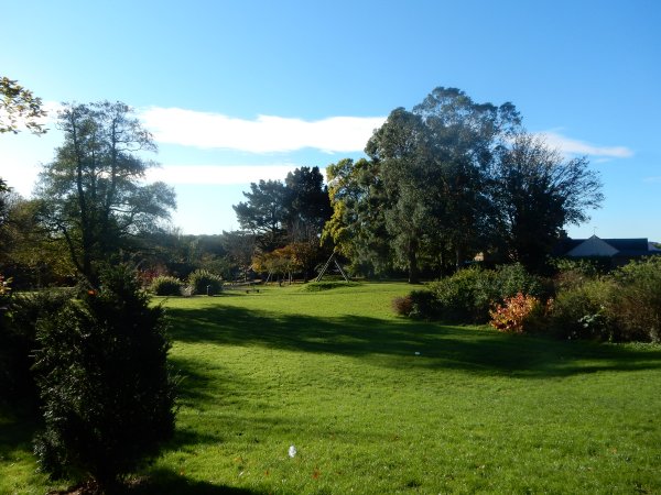
Preston Park viewed from Preston Road. Photographed 4 November 2021.
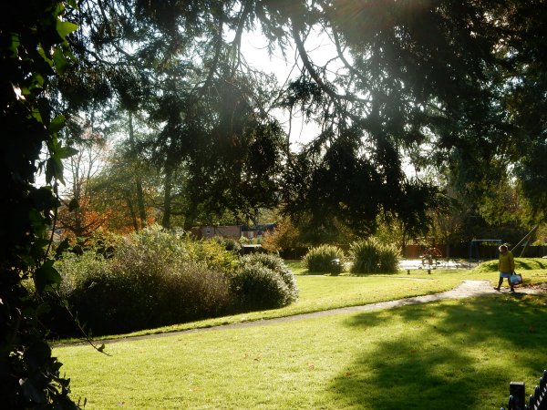
Preston Park seen from just inside the entrance. Photographed 4 November 2021.

Photo
(colourised)
courtesy of Bob
March
Her Majesty Queen Elizabeth passes the Plucknett during a visit in the 1960s.
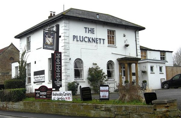
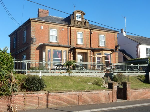
The Plucknett, photographed in 2009. Originally built as a private residence, it was recorded as Preston House on early maps. Being turned into a hotel during the mid 20th century, the Plucknett closed in 2015.
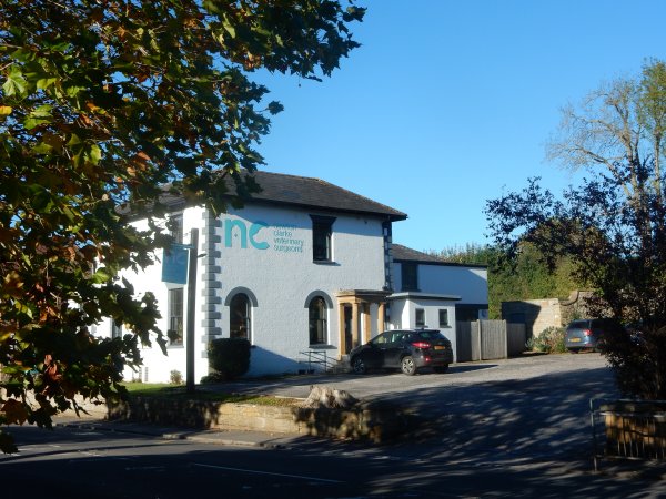
The former Plucknett is now a vet's practice. Photographed 4 November 2021.
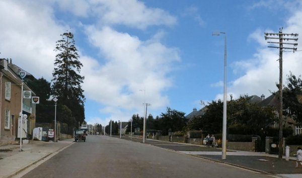
Courtesy of South Somerset Heritage Collection
(colourised)
Preston Road looking east. Photographed in the early 1950s.
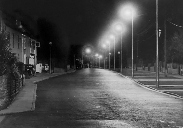
Courtesy of South Somerset Heritage Collection
The same scene at night, again photographed in the early 1950s.
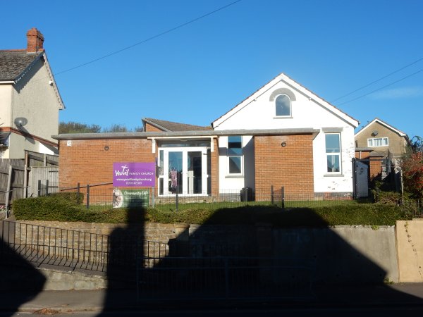
Yeovil Family Church, nearly opposite Watercombe Lane. Photographed 4 November 2021.
This
(colourised) photograph
features in my
book 'Yeovil
From Old
Photographs'
Jubilee Cottages, opposite the 'Jubilee Tree junction' with Watercombe Lane, photographed in 1931. The cottages were demolished in 1938.
A slightly different view of Jubilee Cottages in a colourised photograph of around 1930.
Courtesy of South Somerset Heritage Collection
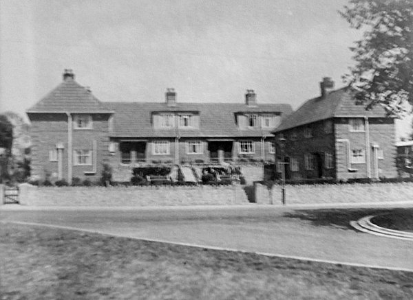
Jubilee Place, seen here in the 1950s, was built on the site of Jubilee Cottages, but slightly further away from the road.
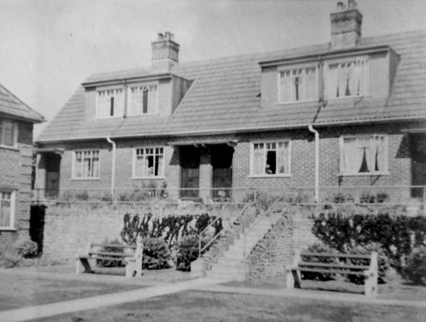
Courtesy of South Somerset Heritage Collection
The central section of Jubilee Place, again photographed in the early 1950s.
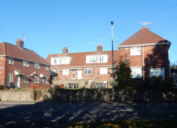
Jubilee Place photographed on 4 November 2021.

Photo
(colourised) courtesy of
Carol Parmiter
The Preston Plucknett Post Office, probably photographed in the 1950s.
Carol said "I have been asking my mother, who is now 90 years old, about the Post Office. Apparently, my great-grandmother Mrs Elizabeth Sloggett lived in the house connected to the Post Office and ran the PO for a while [probably in the 1920s]. Her husband Edwin Sloggett worked in the bacon factory, which was located nearby (possibly behind the PO). When Elizabeth became ill, her daughter Olive (my grandmother) took over the running of the PO. My mother is sure they only rented the house, and thinks it was owned by a Mr Haynes [this would probably be Hedley Haynes, or his son Arthur, owners of the bacon factory]." - notes in square brackets are mine.
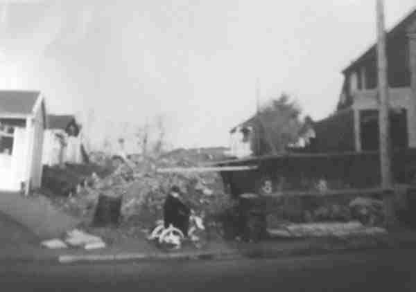
Courtesy of
Carol Parmiter
This photograph probably dates to the 1950s. Carol continues; "it shows the entrance to where Stratford Road was planned to be built and the existing house along Preston Road. The houses in Stratford Road were built in the early 1960’s, as my parents bought a brand new property there in 1965."

From my
collection.
This
photograph
features in my
book "Lost Yeovil"
The old Bell Inn, in a colourised photograph of around 1920. At far right are seen two thatched cottages; the first was at one time the village post office but was later the home of the Beale family. The other cottage was occupied by the Saunders family. Both the Bell Inn and the cottages were demolished for road widening - the Bell Inn was rebuilt, the cottages were not.

Photograph
(colourised) courtesy of Mrs
Barbara Harper
The petrol pumps at the front of the first Bell Inn on this site. Just visible at top right is the inn sign (which, apparently, squeaked loudly when it was windy) on the stone-built L-shaped building.
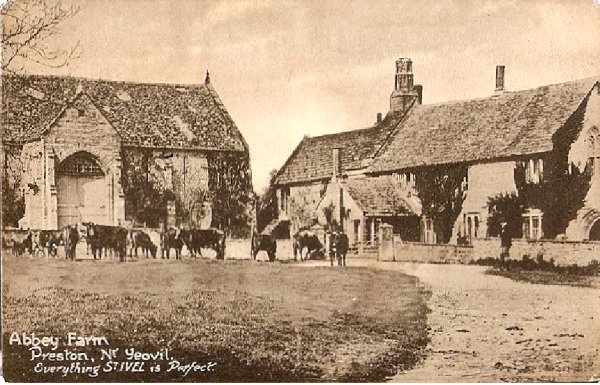
From my
collection
A postcard of Preston Great Farm (erroneously called 'Abbey Farm'), produced around 1907 and used by Aplin & Barrett as an advertisement for their St Ivel range.
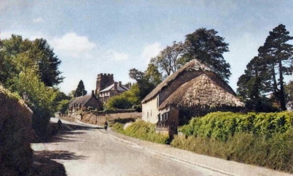
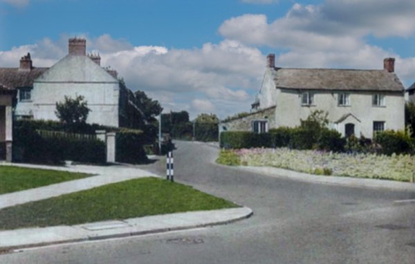
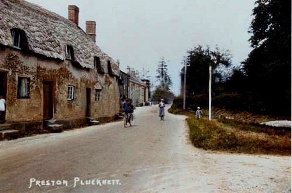
A colourised postcard of 1954 of Preston Plucknett, looking west to St James church.
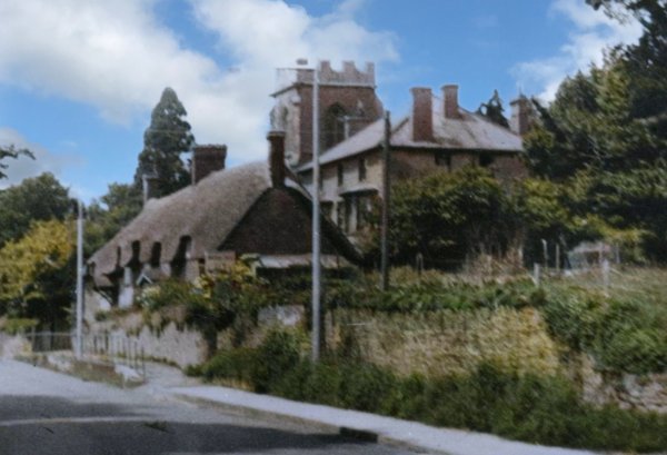
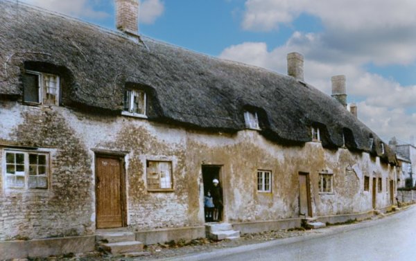
This colourised photograph of 1956, looks west along Preston Road. The thatched cottages were soon demolished. The large house behind the cottages was Sutherland House, home to Yeovil poet and author Walter Raymond from around 1892 to 1905.
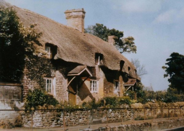
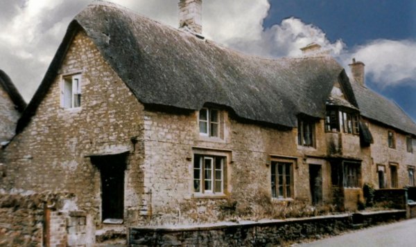
A colourised photograph of the thatched cottages of the previous photograph (Nos 214 and 216 Preston Road).
This
colourised photograph
features in my
book "Lost Yeovil"
No 253 Preston Road, photographed in 1957 and demolished shortly thereafter.
From my
collection
-
This
photograph
features in my
book 'Yeovil From Old Photographs'.
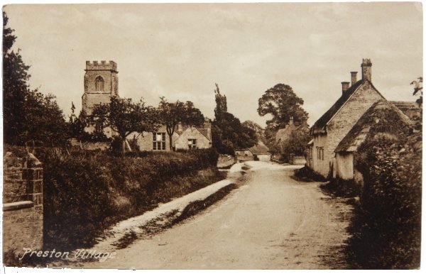
The tower of St James church, Preston & Brympton Elementary School (opened 1875) and roadside cottages in an unused postcard, probably dating to about 1920, published by Whitby of Yeovil. The cottages were demolished for road widening.
This
colourised image
features in my
book 'Yeovil
- The Postcard
Collection'.
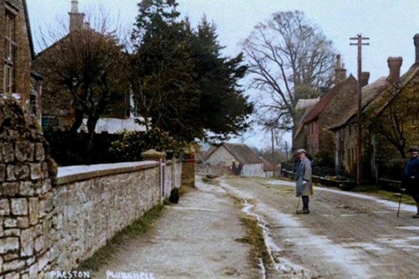
Looking east along Preston Road from the western end of Preston Plucknett during the 1920s.